compass rose
advertisement
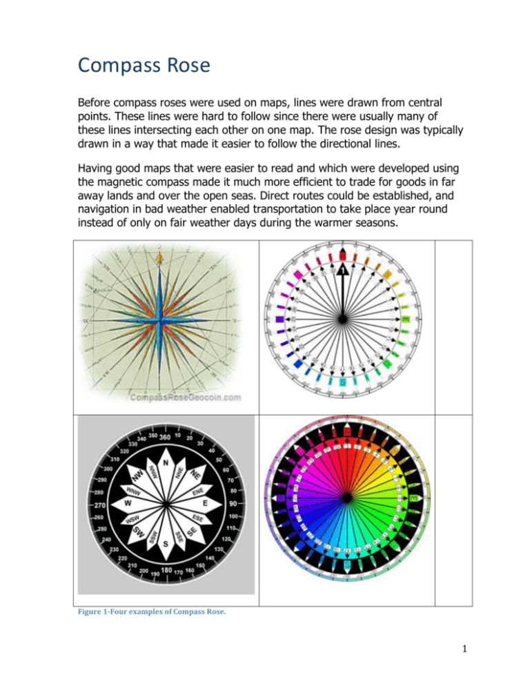
Compass Rose Before compass roses were used on maps, lines were drawn from central points. These lines were hard to follow since there were usually many of these lines intersecting each other on one map. The rose design was typically drawn in a way that made it easier to follow the directional lines. Having good maps that were easier to read and which were developed using the magnetic compass made it much more efficient to trade for goods in far away lands and over the open seas. Direct routes could be established, and navigation in bad weather enabled transportation to take place year round instead of only on fair weather days during the warmer seasons. Figure 1-Four examples of Compass Rose. 1 About its design The four main points (cardinal directions) of the compass were derived from the wind rose: North, East, South, and West. This is also where the four half points originated (ordinal directions). Later, more points were developed to gain more precise bearings, until finally 32 points in total were used. Reciting all 32 points of the compass is called "boxing the compass". Red, blue, black, and green were the most common colors used in the compass rose. For the times, these colors were the easiest to distinguish in low light situations when using oil lamps. Naming all 32 points on the rose is called boxing the compass. Boxing the compass is the action of naming all thirty-two principal points of the compass in clockwise order. Such names, formed by the initials of the cardinal directions and their intermediate ordinal directions, are accepted internationally, even though they have their origin in the English language, and are very handy to refer to a heading (or course or azimuth) in a general fashion, without having to resort to computing or recalling degrees. The set of 32 named points can be increased by another 32 directions using half-points. These are constructed by taking the more important of the two directions it lies between and adding a half-point deviation toward a cardinal point. For instance, the direction between numbers 1 (North) and 2 (North by East) is "North-half-East"; that between numbers 3 (North-Northeast) and 4 (Northeast by North) is "North-Northeast-half-East", and so on. The set of directions can be increased yet again to a set of 128 named directions using quarter-points,[1] although for communicating heading these fractional points have been superseded by degrees measured clockwise from North. # Compass point Abbr. Traditional wind point N Tramontana Lowest Middle Highest 0.00° 5.62° 1 North 2 North by east NbE 5.63° 11.25° 16.87° 3 North-northeast NNE 16.88° 22.50° 28.12° 4 Northeast by north NEbN 28.13° 33.75° 39.37° 5 Northeast 39.38° 45.00° 50.62° 6 Northeast by east 50.63° 56.25° 61.87° NE NEbE Greco or Bora 2 7 East-northeast ENE 61.88° 67.50° 73.12° 8 East by north EbN 73.13° 78.75° 84.37° 9 East 84.38° 90.00° 95.62° E Levante 10 East by south EbS 95.63° 101.25 ° 106.87° 11 East-southeast ESE 106.88° 112.50 ° 118.12° 12 Southeast by east SEbE 118.13° 123.75 ° 129.37° 129.38° 135.00 ° 140.62° SEbS 140.63° 146.25 ° 151.87° 15 South-southeast SSE 151.88° 157.50 ° 163.12° 16 South by east SbE 163.13° 168.75 ° 174.37° 174.38° 180.00 ° 185.62° 13 Southeast 14 Southeast by south 17 South SE S Sirocco Ostro 18 South by west SbW 185.63° 191.25 ° 196.87° 19 South-southwest SSW 196.88° 202.50 ° 208.12° SWbS 208.13° 213.75 ° 219.37° 219.38° 225.00 ° 230.62° 20 Southwest by south 21 Southwest SW Libeccio 22 Southwest by west SWbW 230.63° 236.25 ° 241.87° 23 West-southwest WSW 241.88° 247.50 ° 253.12° 24 West by south WbS 253.13° 258.75 ° 264.37° 264.38° 270.00 275.62° 25 West W Poniente or 3 Zephyrus ° 26 West by north WbN 275.63° 281.25 ° 286.87° 27 West-northwest WNW 286.88° 292.50 ° 298.12° 28 Northwest by west NWbW 298.13° 303.75 ° 309.37° 309.38° 315.00 ° 320.62° 29 Northwest NW Mistral 30 Northwest by north NWbN 320.63° 326.25 ° 331.87° 31 North-northwest NNW 331.88° 337.50 ° 343.12° 32 North by west NbW 343.13° 348.75 ° 354.37° 354.38° 360.00 ° 1 North N Tramontana 4
