Submitted by El Salvador
advertisement
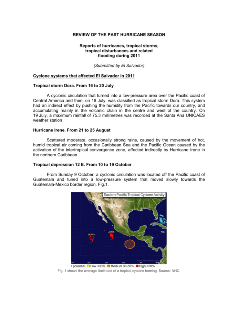
REVIEW OF THE PAST HURRICANE SEASON Reports of hurricanes, tropical storms, tropical disturbances and related flooding during 2011 (Submitted by El Salvador) Cyclone systems that affected El Salvador in 2011 Tropical storm Dora. From 16 to 20 July A cyclonic circulation that turned into a low-pressure area over the Pacific coast of Central America and then, on 18 July, was classified as tropical storm Dora. This system had an indirect effect by pushing the humidity from the Pacific towards our country, and accumulating mainly in the volcanic chain in the centre and west of the country. On 19 July, a maximum rainfall of 75.3 millimetres was recorded at the Santa Ana UNICAES weather station Hurricane Irene. From 21 to 25 August Scattered moderate, occasionally strong rains, caused by the movement of hot, humid tropical air coming from the Caribbean Sea and the Pacific Ocean caused by the activation of the intertropical convergence zone, affected indirectly by Hurricane Irene in the northern Caribbean. Tropical depression 12 E. From 10 to 19 October From Sunday 9 October, a cyclonic circulation was located off the Pacific coast of Guatemala and tuned into a low-pressure system that moved slowly towards the Guatemala-Mexico border region. Fig.1. Fig. 1 shows the average likelihood of a tropical cyclone forming. Source: NHC. On Wednesday 12th, the low-pressure system over the Pacific Ocean off southwest Mexico turned into tropical depression 12E (Fig. 2), and made landfall in Mexico close to the Tehuantepec isthmus on the afternoon of Wednesday 12th. Fig. 2 shows Tropical Depression No. 12E near Tehuantepec. Source: RAMSDIS ON LINE. On Saturday 15 October, the remnants of the Tropical Depression formed an extensive depression field over Central America, forming two low-pressure areas, one in the Gulf of Honduras, which moved slowly towards the Yucatan Peninsula; and another on the Pacific coast south of Guatemala – El Salvador, maintaining storm-type intermittent and continuous moderate to heavy rains throughout the country, falling mainly on the coastal area and the central volcanic chain, due to the lower level south-westerly winds flowing from the troposphere at a speed of 10 to 15 knots. The highest rainfall occurred in the volcanic chain in the west (Valle de los Naranjos), centre (Cordillera del Bálsamo) and east (Cordillera Tecapa-Chinameca) of the country. Huizúcar recorded the highest rainfall of the storm, with a total of 1,513 mm (Fig. 3). Los Naranjos recorded cumulative rainfall of 1,344 mm during the 10 days that the storm lasted. The opposite occurred in the northern part of the western, paracentral and eastern area of the country, where the impact was somewhat less, with cumulative rainfall of less than 250 mm over the 10 days. The stations concerned include Guija, with 210.8 mm, Santa Rosa de Lima, with 216 mm and Cerrón Grande, with 242.3 mm. Tropical depression DT12E and low-pressure system in El Salvador Cumulative rainfall in mm from 10 to 19 October 2011 Fig. 3 shows the maximum rainfall recorded during the 240 hours of the storm, with the highest rainfall of 1,513 mm in Huizúcar 2011 was the second wettest year on record in El Salvador, with 2,378 mm of rainfall. The wettest year of all time was 2010, which recorded annual rainfall of 2,549 mm. The historical average annual precipitation in the country is 1,800 mm. October 2011 was also a record month for precipitation. The constant rain in the country led to saturation of the soil from the central valley to the coast, contributing to the increase in level and subsequent overflowing of most of the rivers and streams that drain from the volcanic chain to the coast. The departments affected were: Ahuachapán, Sonsonate, La Libertad, La Paz, San Vicente, Usulután and San Miguel, where damage was caused to houses, crops, livestock and roads. The precipitation kept the soil oversaturated from the central valley of the country down to the southern coastal strip. There were also a number of landslides which cost the lives of 34 people. ___________
