Quantifying water cycle variability in the classroom
advertisement
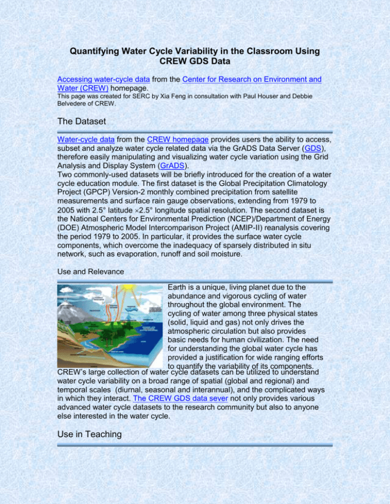
Quantifying Water Cycle Variability in the Classroom Using CREW GDS Data Accessing water-cycle data from the Center for Research on Environment and Water (CREW) homepage. This page was created for SERC by Xia Feng in consultation with Paul Houser and Debbie Belvedere of CREW. The Dataset Water-cycle data from the CREW homepage provides users the ability to access, subset and analyze water cycle related data via the GrADS Data Server (GDS), therefore easily manipulating and visualizing water cycle variation using the Grid Analysis and Display System (GrADS). Two commonly-used datasets will be briefly introduced for the creation of a water cycle education module. The first dataset is the Global Precipitation Climatology Project (GPCP) Version-2 monthly combined precipitation from satellite measurements and surface rain gauge observations, extending from 1979 to 2005 with 2.5° latitude 2.5° longitude spatial resolution. The second dataset is the National Centers for Environmental Prediction (NCEP)/Department of Energy (DOE) Atmospheric Model Intercomparison Project (AMIP-II) reanalysis covering the period 1979 to 2005. In particular, it provides the surface water cycle components, which overcome the inadequacy of sparsely distributed in situ network, such as evaporation, runoff and soil moisture. Use and Relevance Earth is a unique, living planet due to the abundance and vigorous cycling of water throughout the global environment. The cycling of water among three physical states (solid, liquid and gas) not only drives the atmospheric circulation but also provides basic needs for human civilization. The need for understanding the global water cycle has provided a justification for wide ranging efforts to quantify the variability of its components. CREW’s large collection of water cycle datasets can be utilized to understand water cycle variability on a broad range of spatial (global and regional) and temporal scales (diurnal, seasonal and interannual), and the complicated ways in which they interact. The CREW GDS data sever not only provides various advanced water cycle datasets to the research community but also to anyone else interested in the water cycle. Use in Teaching The datasets can be used in teaching the following topics and skills in atmospheric science, meteorology, climate, and hydrology. Teaching Topics Quantify water cycle variation on multiple spatial and temporal scales. Solve water balance equation and understand water cycle. Classify anomalous dry and wet periods. Identify the impact of El Niño-Southern Oscillation (ENSO) on water cycle variability. Investigate the effect of nature’s activity, such as Mt. Pinatubo volcanic eruption on the variation of water cycle. Relate the global warming to water cycle changes by detecting trends in GPCP and NCEP/DOE reanalysis datasets. Teaching Skills Using data to make images of temporal changes of water cycle data. Using data to make spatial plots of water cycle data. Using linear regression to determine the trend of water cycle components. Interpreting water cycle variation from graphs. Exploring the Data Data Type and Presentation GPCP and NCEP/DOE AMIP-II reanalysis have been provided for the period 1979-2005. Data are available in Binary format. Accessing Data Raw data can be accessed via the CREW GDS sever. The GDS versatile capability allows users to remotely gain access to the desired dataset and subset specified temporal and spatial subdomain without downloading a large dataset for further analysis. Manipulating Data and Creating Visualizations Students can process the data to create graphs from raw data using GrADS. Graphs can then be used to visualize water cycle data spatially and temporally and to display the water cycle variation. Tools for Data Manipulation Users can access the raw data provided from the CREW GDS sever and use GrADS software to manipulate and visualize the dataset. A tutorial for using GrADS is helpful to learn its basic features. The GrADS scripts provide examples of displaying the monthly, seasonal and annual water cycle variation on global and regional scales. About the Data Collection Methods GPCP combines precipitation estimates from low-orbit satellite microwave data, geosynchronous-orbit satellite infrared data, and surface rain gauge observations. This merged analysis utilizes the strengths of each data type and removes biases based on hierarchical relations in the stepwise approach. NCEP/DOE AMIP-II reanalysis aims to fix the known processing errors in NCEP/National Center for Atmospheric Research (NCAR) using an improved forecast model and updated data assimilation system. When compared with NCEP/NCAR reanalysis, significant improvements were made in NCEP/DOE AMIP II reanalysis, such as land surface hydrology and land-ocean fluxes. Limitations and Sources of Error GPCP precipitation uncertainty is due to the algorithm and sampling error. Reanalysis data are subject to the bias in uncertainty of model parameterization. References and Resources Scientific References that Describe these Datasets The Version-2 Global Precipitation Climatology Project (GPCP) Monthly Precipitation Analysis (1979-present): Research article illustrates the features of GPCP precipitation (from Journal of Hydrometeorology). NCEP-DEO AMIP-II Reanalysis (R-2): This research article presents characteristics of reanalysis-2 dataset (from Bulletin of the American Meteorological Society). Other Related Scientific References Contemporary Changes of the Hydrological Cycle over the Contiguous United States: Trends Derived from In Situ Observations: A research article describes the changes of water cycle components over the contiguous United States during the twentieth century (from Journal of Hydrometeorology). Assessing a Satellite-Era Perspective of the Global Water Cycle: This research article assesses the capability of a global data compilation to depict the global water cycle’s mean state and variability. Other Related Scientific Educational Resources Introduction to the Atmosphere: Students will build a model to simulate parts of the water cycle. The Hydrological Cycle Online Meteorology Guide: Online module illustrates the water cycle components. Related Links CREW resources provide information on global precipitation data (including GPCP) and numerous links on water cycle educational resources. The NCEP/DOE AMIP-II reanalysis complete archive is available at the NOAA/NCEP website.
