File - Tessa Fritzsche
advertisement
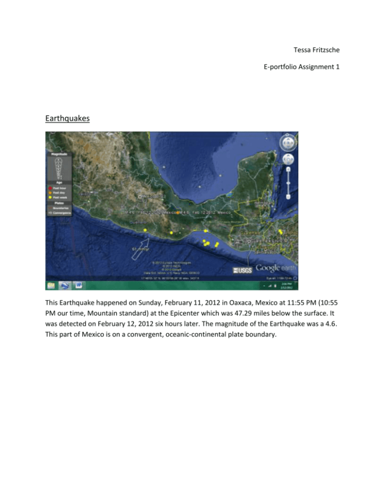
Tessa Fritzsche E-portfolio Assignment 1 Earthquakes This Earthquake happened on Sunday, February 11, 2012 in Oaxaca, Mexico at 11:55 PM (10:55 PM our time, Mountain standard) at the Epicenter which was 47.29 miles below the surface. It was detected on February 12, 2012 six hours later. The magnitude of the Earthquake was a 4.6. This part of Mexico is on a convergent, oceanic-continental plate boundary. s This 4.6 magnitude earthquake happened on the Alaskan Peninsula February 9 th, 2012. It happened at 6:26 AM, 9 hours after it started at the epicenter the evening before, 51.82 miles below the surface. This earthquake happened at a convergent, subduction zone. This earthquake happened in the Kuril Islands which are north of Japan. It was a 4.7 magnitude earthquake that occurred on February 11th, 2012 at 7:52 PM at the epicenter and 8:52 when detected. This earthquake is on a convergent, oceanic-oceanic plate boundary. This 5.1 magnitude earthquake happened in Uttaranchal, India on February 9 th, 2012 7:17 PM. According to the picture, it shows a continental-continental plate boundary with the southern one as a convergent plate. The earthquakes epicenter was 15.84 miles below the surface. This earthquake happened in the Gulf of Aden which is east of the coast of Ethiopia and south of Saudi Arabia on February 7th, 2012 at 11:31 AM at the epicenter and 8:31 when it was detected. It was a 4.9 magnitude earthquake. This earthquake was on two faults. One was an oceanic spreading rift, and the other was an oceanic transform fault. This 5.9 magnitude earthquake happened in the Fiji Region at 1:47 PM February 10th, 2012. Fiji is on a few oceanic-oceanic plate boundaries and this earthquake happened from oceanic spreading rifts. Its depth was 357.60 miles below the ocean surface. Volcanoes Mount Waialeale, the volcano that is Kauai, Hawaii. Mount Waialeale is a shield volcano on the Pacific plate boundary. This volcano is part of the Fuerteventura Canary Islands. This volcano is a cinder cone volcano. These islands are on an oceanic transform fault boundary. Loihi is the volcano that will soon be the newest island in the Hawaiian Islands. It is a hot spot, just like the other Hawaiian volcanoes. This volcano is on the pacific plate boundary. Garove is one of the biggest volcanic islands in the Witu Islands of the New Guinea coast. It is a composite volcano, or Stratovolcano. There are many different kinds of plate boundaries out in this area, but Garove is on an ocean transform fault boundary. Assignment Reflection Volcanoes and Earthquakes occur because of the plate boundaries. If we didn’t have the plates that are constantly moving, the plates wouldn’t slip causing an Earthquake. The plates shift and open up the asthenosphere and the lithosphere sending material into the mantle. If this didn’t happen, there wouldn’t be added material causing pressure to shoot up out of the crust and become a volcano. If you see where volcanoes and earthquakes are, there will be some kind of plate boundary around it or right where they lie because they are directly correlated to each other. Before taking this course, I didn’t realize how certain natural disasters can effect or even cause another one. I found it so interesting looking at where all the earthquakes were located and the volcanoes. I knew of the ring of fire, but it didn’t occur to me that earthquakes had a lot to do with the plate boundaries as well. I want to be able to well-prepare for the earthquake we are going to have here in Utah, and this class has helped me so far to know what to expect and know what kind of research I need to do.


