1 How rivers erode How rivers transport River Basin
advertisement
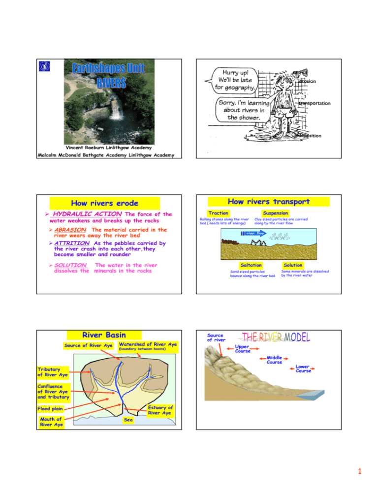
Vincent Raeburn Linlithgow Academy Malcolm McDonald Bathgate Academy Linlithgow Academy How rivers transport How rivers erode HYDRAULIC ACTION The force of the water weakens and breaks up the rocks Traction Suspension Rolling stones along the river bed.( needs lots of energy) ABRASION The material carried in the river wears away the river bed Clay sized particles are carried along by the river flow river flow ATTRITION As the pebbles carried by the river crash into each other,they become smaller and rounder SOLUTION The water in the river dissolves the minerals in the rocks River Basin Source of River Aye Watershed of River Aye (boundary between basins) Saltation Solution Sand sized particles bounce along the river bed Some minerals are dissolved by the river water Source of river Upper Course Middle Course Tributary of River Aye Lower Course Confluence of River Aye and tributary Estuary of River Aye Flood plain Mouth of River Aye Sea 1 Formation of a waterfall FEATURES OF THE UPPER COURSE V-SHAPED VALLEYS WITH INTERLOCKING SPURS Waterfall Retreats upstream Hard rock WATERFALLS AND RAPIDS Soft rock POT HOLES ON RIVER BED Steep sides ( gorge ) Undercutting The The overhang process erodes the Eventually Vertical erosion starts again softer rock collapses Forms plunge pool forming an overhang Eroded rock WATERFALL RETREATS . UPSTREAM . . . The River Avon has smoothed off parts of this hard igneous rock. . . OVERHANG PLUNGE POOL UNDERCUTTING OF SOFT ROCK What is this process called? MEANDERS Meanders MEANDERS Meanders Possible break through point Most erosion on the outside of the bend .. Fastest flow Flood plain Flood plain © Used with the permission of the Geological Survey of Canada © Used with the permission of the Geological Survey of Canada Available at Available at http://sts.gsc.nrcan.gc.ca/clf/landscapes.asp Possible ox-bow lake http://sts.gsc.nrcan.gc.ca/clf/landscapes.asp 2 River bend Fastest current Formation of an ox-bow lake slowest current Bank will collapse The Some river Eventually now follows during the a period new route ofMost erosion bends get closer Theheavy meanders shapethrough river change flow it cuts and closer Most deposition through time Small river (Slip off slope) cliff is formed Small river cliff Outer bank Is undercut Deepest part of the river Slip off slope ( river beach ) Deposition of Sand and shingle The bends migrate At the bends the Sideways leaving river flows faster The neck gets narrower The old meander deposits on the inside at the outside The erosion the andasnarrower Is left a small lake Of the makes bend (OX - BOW lake) Meanders more pronounced Want to see that again ? Want to see that again ? Want to see that again ? Want to see that again ? 3 Want to see that again ? NARROW MEANDER NECK FUTURE OX-BOW LAKE Gentle valley sides River is actually flowing above The floodplain !! Levees is often artificially strengthened Flat floodplain Layers of silt Deposited during floods Coarse material Forms natural levees Characteristics Slope Middle Course Lower Course quite steep gentle Width narrow quite wide Depth shallow quite deep Straightness winding Load little meandering Type of load large/small angular medium/small rounded Main work Valley width tributaries Upper Course usually steep some wide deep big meanders lots small+ rounded erosion Transportation transportation transportation deposition narrow quite wide wide V shaped valley Steep Valley sides meander ox-bow lake Flood plain Reproduced with the permission of the Controller of HMSO © Crown Copyright NC/02/15232 4
