Inventory of Activities pro-forma
advertisement
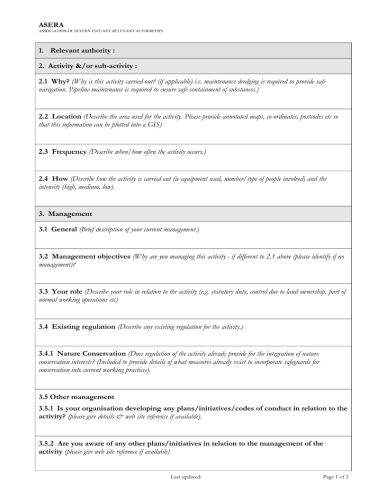
ASERA ASSOCIATION OF SEVERN ESTUARY RELEVANT AUTHORITIES 1. Relevant authority : 2. Activity &/or sub-activity : 2.1 Why? (Why is this activity carried out? (if applicable) i.e. maintenance dredging is required to provide safe navigation. Pipeline maintenance is required to ensure safe containment of substances.) 2.2 Location (Describe the area used for the activity. Please provide annotated maps, co-ordinates, postcodes etc so that this information can be plotted into a GIS) 2.3 Frequency (Describe when/how often the activity occurs.) 2.4 How (Describe how the activity is carried out (ie equipment used, number/type of people involved) and the intensity (high, medium, low). 3. Management 3.1 General (Brief description of your current management.) 3.2 Management objectives (Why are you managing this activity - if different to 2.1 above (please identify if no management)? 3.3 Your role (Describe your role in relation to the activity (e.g. statutory duty, control due to land ownership, part of normal working operations etc) 3.4 Existing regulation (Describe any existing regulation for the activity.) 3.4.1 Nature Conservation (Does regulation of the activity already provide for the integration of nature conservation interests? (Included to provide details of what measures already exist to incorporate safeguards for conservation into current working practices). 3.5 Other management 3.5.1 Is your organisation developing any plans/initiatives/codes of conduct in relation to the activity? (please give details & web site reference if available). 3.5.2 Are you aware of any other plans/initiatives in relation to the management of the activity (please give web site reference if available) Last updated: Page 1 of 2 ASERA ASSOCIATION OF SEVERN ESTUARY RELEVANT AUTHORITIES 3.5.3 Outline any other known management of the activity (e.g. recreational clubs, voluntary groups). 4. Current information 4.1 Monitoring/research (Are you undertaking any current monitoring/research of the activity?) 4.2 Why is it carried out? 4.3 Please list any research/monitoring reports and their format (e.g. paper, GIS, please give web site reference if available) 4.4 Are you aware of anyone else who carries out monitoring/research of the activity? 5. Assessment of impact on the features/sub-features (Please attempt to provide information where possible. Any information provided will help sector groups, other RAs , Natural England and the Countryside Council for Wales understand the nature of activity impacts at different areas of the site and identify possible solutions. ) 5.1 Nature of impact/effect. What is the nature of the possible effect of the activity on the feature/sub-feature? (Please use the separate sheet as a guide.) 5.2 Other factors. Do other factors (natural processes, indirect effect from other management measures) also affect the features/sub-features in a comparable way? Does this need to be taken into account in prescribing management? 5.3 Outside site boundary. If the activity is outside the boundary of the site, is it also likely to affect the feature/sub-features? 5.4 Beneficial activities. Does the activity contribute to the favourable condition of the site? Please describe how. Last updated: Page 2 of 2
