Conservation Areas Metadata
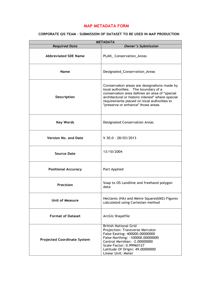
MAP METADATA FORM
CORPORATE GIS TEAM – SUBMISSION OF DATASET TO BE USED IN MAP PRODUCTION
METADATA
Required Data Owner’s Submission
Abbreviated SDE Name PLAN_ Conservation_Areas
Name
Description
Key Words
Designated_Conservation_Areas
Conservation areas are designations made by local authorities. The boundary of a conservation area defines an area of "special architectural or historic interest" where special requirements placed on local authorities to
"preserve or enhance" those areas.
Designated Conservation Areas
Version No. and Date
Source Date
Positional Accuracy
Precision
Unit of Measure
Format of Dataset
Projected Coordinate System
V 30.0 - 28/03/2013
13/10/2004
Part Applied
Snap to OS Landline and freehand polygon data
Hectares (HA) and Metre Squared(M2) Figures calculated using Cartesian method
ArcGis Shapefile
British National Grid
Projection: Transverse Mercator
False Easting: 400000.00000000
False Northing: -100000.00000000
Central Meridian: -2.00000000
Scale Factor: 0.99960127
Latitude Of Origin: 49.00000000
Linear Unit: Meter
Extent
Source
Frequency of Update
Name of Submitter
Name contact Detail of
Owner/Custodian
Access Constraint
Viewing Constraint
Leeds MD
Top:
Right:
Bottom:
Left:
439850.437500 m
444175.981165 m
426564.173026 m
420953.250000 m
OS Landline and MasterMap, Development
Directorate - SDU
Adhoc
Usman Umar –
Spatial Data Manager (GIS)
City Development Directorate
Tel:(0113) 2478121
Phil Ward
Conservation Officer
Strategy & Policy
City Development Directorate
Tel: 247 6390 intellectual property rights
Unrestricted
Associated Documents Revised UDP Volume 1 19/07/2006
Acceptance of Data Limitations
Corporate GIS Team, do not make any guarantee, expressed or implied, nor assume any legal liability or responsibility for the accuracy, completeness, or usefulness of any information or data provided on any maps produced. Metadata which is provided for data used in map production may not be as comprehensive as datasets held Corporately. Datasets are used with the knowledge that there may be limitations to the data, which could include technical inaccuracies or typographical errors. Datasets which are submitted with satisfactory metadata may be placed on the Corporate architecture subject to agreement and if requested.
SIGNED: DATE:


