Groton Forest History Guide
advertisement
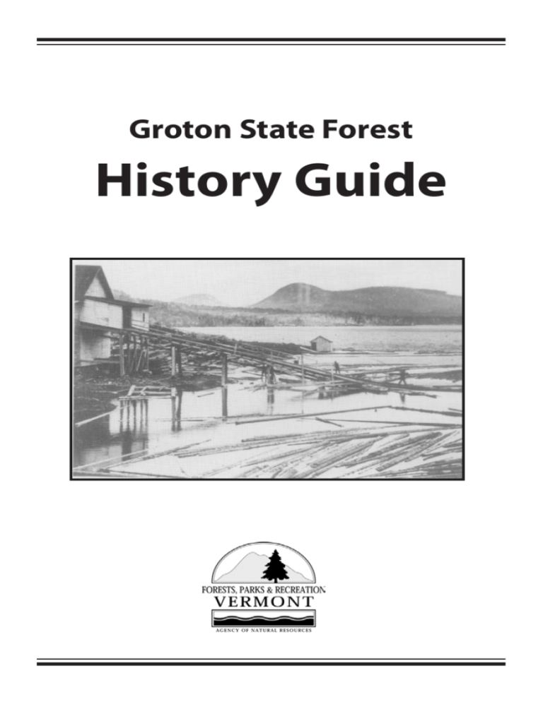
Groton State Forest History Guide GROTON STATE FOREST HISTORY GUIDE Special Thanks to Bill Gove for his Groton photographs and research Written by Laura Hollowell and Dave Synderman Wherever you go in Groton State Forest, people were here before you. Perhaps an Indian passed through the woodlands around you. The Abenaki are known to have camped and hunted here, although there is little record of their presence. Soldiers and explorers (often with Indian guides) also passed this way, using Groton as portage area between the Winooski and Connecticut Rivers. When this spot was in a grove of towering trees, it was probably logged by early settlers. Maybe a poor immigrant tried and failed to to farm the rocky soil beneath your feet. In the last century, Groton saw the dramatic rise and fall of railroad and the logging towns. But the tradition of camping along the ponds, begun in prehistoric times, has endured. Today, signs of the past are evident throughout the forest. This guide takes you to some notable historic sites, but there are clues everywhere, a story for each visitor to unravel. Following is a brief history, a guide to historic sites, and suggested tours by foot and by bike. A map is located in the center of guide During the French and Indian Wars, Groton was visited by hunting bands of Indians and raiding parties of both English and French. As early as 1704, the area’s network of ponds, brooks and rivers was the route the French and Indians used to carry over 100 captives from Deerfield, Massachusetts north to Canada. Groton was a rugged wilderness then. Mountain lions, timber wolves and lynx roamed the hills. Recalling these early times, General A. Harleigh Hall wrote in 1877: Here solitude reigned supreme, broken only by the hungry cry of some wild animal. The Indians roamed over the trackless forests or glided swiftly over the placid water of the pond in their light canoes. There were no permanent settlers in Groton until after the American Revolution. Veterans of the war, along with many ambitious youths from lower New England, moved north to Vermont. These pioneers sought water and trails for transportation, land suitable for farming and available resources for building. Groton was settled early, being accessible to the Connecticut and Wells Rivers. Captain Edmund Morse, one of the first settlers in Groton, arrived in 1783. Morse built the town’s first saw and grist mill on the outlet of what is now called Ricker Pond. A sawmill was in operation on this same site until the early 1960’s. Captain Morse also built the first frame house and was the town’s first blacksmith and military captain. The land outside the village was left as “wild land,” being too rocky to farm. This region was heavily forested with spruce, hemlock, beech, birch, maple and white pine. Local farmers cut the tree-covered hillsides for fuel, lumber and the making of potash. Through the years, the main industry was logging. Sawmills operated at about twelve different sites in the town of Groton. These include Goslant Chartered in 1789, Groton received its name because many of its settlers were from Groton, Massachusetts. The Massachusetts town had been named after Governor John Winthrop’s mansion in England. This pattern of naming villages was prevalent in colonial times. Mill at Lanesboro, Ricker’s Mill on Ricker Pond, the Miller and Ayers Mill on Groton Pond, Peabody’s Mill Stillwater and Darling’s Mill at Seyon Pond. The mills frequently changed owners, but these are the names by which they are remembered. The Montpelier and Wells River Railroad, completed in November of 1873, gave Groton’s sawmills easy access to a wood-hungry market. Within a few years, new mills sprang up and old ones were enlarged to meet the demand for lumber. The railroad, a connection between the Central Vermont Railroad and the Boston and Maine system, was for many years the only access to the ponds. The railroad opened the area to another kind of settler – the seasonal camper. The earliest camps along the shores of Groton Pond date to 1894. Within the next ten years it was an established practice for local Vermonters to spend July 4 to Labor Day by the pond. Camps were opened again in late fall for hunting. Disembarking at either Lakeside Station or the Rocky Point Flag Stop, the campers would take a boat to their cabins on distant shores. Then, as now, swimming, boating, hiking, fishing and berry-picking were the main forms of recreation. From the diary of Mrs. Charles Lord, August 22, 1908: We have been here 3 weeks. Have had a fine time. Quite a quantity of fish and berries of all kinds – raspberries, blueberries and blackberries. The logs were all away here the first of August. The steamer only made a few trips while we were here… The screeching of a wildcat has been heard several times and Ralph saw it once and shot at it. The boys have gone to the foot of the pond…to fish and to get their father who is coming on the 4 o’clock train. There is very little “virgin” forest left. Groton was extensively logged for timber and to supply the wood-burning trains. The area was devastated by several forest fires (the largest were in 1876, 1883 and 1908) and hit by a hurricane in 1938. The State of Vermont bought its first tract of land here in 1919 and has continued to enlarge its holdings. Today, the state forest is approximately 26,000 acres. The Civilian Conservation Corps. (CCC), a government work program during the Great Depression of the 1930’s was instrumental in park and campground development in Groton State Forest. The main forest road (Route 232) was started by the CCC. The Corps also planted trees and built hiking trails, picnic shelters and stone fireplaces. Groton is now managed by the Vermont Department of Forests, Parks and Recreation for year round recreation, forestry and wildlife habitat. Groton is the second largest state lands holding administered by the Vermont Agency of Natural Resources. Its size and diversity has enabled the conservation of a large landscape with its natural, cultural, and recreation resources for the public to enjoy. The following pages describe the sites located on the center map. Look for these as you travel through the forest. Suggested tours of Groton by foot and bike are given at the end of the guide. A CCC Crew working on road construction GROTON STATE FOREST VERMONT 232 Points of Historical Interest Peacham Pond Morse Mtn New Discovery SP North 13 8 11 Osmore Picnic Area 7 9 Osmore Pond Devils Hill 2038 ft Martins Pond 10 Spice Mtn 12 Sti llw ate t on M Kettle Pond 14 Big Deer Mtn 1992 ft Little Deer Mtn 1760 ft Owls Head 1958 ft rB Peacham Bog Groton Nature Center & Self Guiding Trail Big Deer SP .& roo k sR ell W rR ive 15 ail il Tra 6 Boulder Beach SP Stillwater SP 17 16 Silver Ledge 1838 ft Lake Groton Beaver Brook 3 Little Spruce Mtn 2515 ft 2 Dep 5 Ricker Pond ot B roo k Ricker Pond SP 4 18 Noyes Pond VERMONT 232 sR ell W r ive Seyon Lodge State Park ephelps-rev. 04/08 1 S Branch Wells River 0 0.5 1 mi 302 POINTS OF HISTORICAL INTEREST 1. The Montpelier and Wells River Railroad The railroad bed is now a multi-use trail (part of the Cross Vermont Trail) paralleling the main forest road. Completed in 1873, the rail line closed in 1956. Old railroad ties, now covered with moss, can still be seen scattered over the embankment. In the early 1900’s, the lumber industry was at its zenith, and the train made two trips daily from Montpelier to Wells River transporting lumber and passengers . An enormous amount of wood cut from the surrounding forest fueled the steam engines. Sparks from the engines were an ever-present fire hazard. 2. Lakeside Station This was the main train station for most campers. Lakeside was beside Depot Brook at the south end of Lake Groton. All that remains now is a cellar hole. From the station, the walk was long, but level, down to the docks on the lake. 3. Rocky Point Flag Stop Midway on the western side of Lake Groton, the flag stop was an old railway coach with one side removed. The seats on the ends and one side were retained. The site is now marked by a large pile of boulders.Although it was only a short distance from the water, the campers, laden with provisions, had a tough time on the steep, rocky slope. Rocky Point Flag Stop 4. Ricker Mill (private land) 5. The Miller and Ayers Mill (private land) From the time when Captain Morse first constructed a mill on this site, a sawmill was in operation here until 1963. The mill was bought by Amaziah H. Ricker in 1857. Ricker ran the mill for nearly 50 years, increasing his property from 100 acres to 2000 acres. Ricker Mill remained in the Ricker family until it closed, making it one of the longest continuously operating sawmills in the United States. Originally the Groton Pond Lumber Company sawmill, this mill changed hands several times. It was rebuilt in 1904 after burning when a boiler exploded. The explosion killed one man and is said to have sent a boiler flying across the lake. The mill’s sawdust pile is still evident. Portugese, French and Yankee workers at Miller’s Mill 6. Peabody’s Mill The site of this large steam-powered mill is just north of the Stillwater Road. Located adjacent to the newly constructed railroad, the mill was in a favorable position to market its lumber. The train stopped here for campers at an informal flag stop known as the “Tin Pan Flag Stop.” Peabody’s Mill 7. Lanesboro (private land) In the heart of the forest, though not in state ownership, is the abandoned lumber mill community of Lanesboro. The Lane sawmill was later bought by Mitchel Goslant. On the hillside was a large lumber camp with a boarding house, blacksmith shop, general store and stables. 8. Goslant’s Pond Now named Spice Pond, this small pond used to be on the property of Mitchel Goslant. Goslant owned thousands of acres in the Lanesboro area. 9. Kettle Pond According to one story, Kettle Pond received its name when Aaron Hosmer, a hunter and adventurer who roamed the woods of Groton in the mid1700’s dropped his camp kettle while crossing the pond on a log. Another story tells of “Bristol Bill,” a renowned counterfeiter and bankrobber in the U.S. and Europe in the mid-1800’s. Some say Bill buried a kettle full of counterfeit bills beside what is now Kettle Pond. Captured in the Village of Groton, he was brought to trial in Danville. There, before a stunned crowd, he stabbed the prosecuting attorney with a case knife. 10. Coldwater Brook Up Coldwater Brook is the stone foundation of a old waterwheelpowered mill. This was a small “up-and-down” sawmill that operated before the Civil War. 11. Osmore Pond This pond received its name from Aaron Hosmer, a hunter who camped here before any permanent settlements. 12. Owl’s Head Owl’s Head is easily reached by road and a short foot trail to the top. It offers excellent views of Groton State Forest and surrounding area. Several ponds are visible and the old railroad bed can be seen as a straight line running through the forest. The road up the Owl’s Head, the picnic shelter, the trail to the summit and the stone lookout were built by the Civilian Conservation Corps. 13. Civilian Conservation Corps (CCC) Camp In the 1930’s the Corps had two camps in Groton, one near Osmore Pond and the other by Ricker Pond. Most of the Corps men here were from Rhode Island and New York. The men worked for $30 a month, $25 of which was sent home. Stone chimneys from the Osmore Pond camp can still be seen. 14. Devil’s Hill The story goes that a Peacham man was heading home over the ridge one evening and saw a large, dark bird over this hill. He swore it was the devil and ever since this has been Devil’s Hill. 15. The Log Pile North of Boulder Beach was “The Log Pile.” Logs cut in winter and skidded down the mountains on oxen-drawn sleds were stored here until spring. When the lake ice melted, a Miller and Ayers steamer towed the logs to the mill at the foot of the lake. 16. Lake Groton This lake has had several names. One of the earliest was Big Lund, after Silas Lund who owned a large amount of land. It changed to Long Pond, then Wells River Pond. Now, it is known locally as Groton Pond, or just the Pond. 17. Jerry Lund Hill (private land) Silas Lund’s son Jeremiah, cleared land and farmed at the summit of this hill. The stone foundation of his home and evidence of farming are visible still. 18. Noyes Pond At the headwaters of the south branch of the Wells River, this pond was a privately-owned brook trout fishery for many years. The pond was created in the 1890’s by J.R. Darling who operated a mill on the site. The pond changed owners many times until Harry K. Noyes of Boston bought it in 1939. Naming his holding the Seyon Trout Ranch, Noyes built a guest house and converted the Darling sawmill to a waterwheel for generating electricity. In 1967, the State purchased almost 5,000 acres including Seyon Ranch, from Arland Robitzer. The State continued to operate Seyon, first seasonally, then starting in 2002, year round. The house was moved from its original foundation in 1991-92 to a new foundation and spacious basement. It was further renovated in 2000-01. Today Seyon Lodge is popular for fly fishing, cross-country skiing, snowshoeing, meetings, conferences and weddings. SUGGESTED HISTORY TOURS WALKING TOUR This tour is a moderate 4.7 mile loop with some rocky sections. The walk takes from three to four hours. At the Groton Nature Center, take Little Loop Trail to the junction of Peacham Bog/Coldwater Brook Trail (.4 mi.). Look for huge white pine stumps remaining from logging in the late 1800’s. Turn left, and continue up Coldwater Brook Trail to Map Site 10 (1.1 mi.) This was a Civil War-era, water-powered sawmill. Veer left and continue to the junction with Osmore Pond-Big Deer Mtn. Trail (1.9 mi.). Turn left, continue to the junction of Osmore Pond Hiking Loop (2.3 mi.)and Hosmer Brook Trail. To extend your hike two miles, turn right onto the Osmore Pond loop trail (Site 11). You can see remains of camps from the 1900’s as you continue straight. Pass the south end of the pond and turn left onto Little Deer Mtn. Trail (2.4 miles). From the top, are excellent views of Lake Groton and many historic sites on the map in this booklet. Return to Osmore Pond via the same trail. Turn right onto the Hosmer Brook Trail. End at the Nature Center (4.7 mi). BIKING TOUR This is a 7.5. mile one-way tour along the old railroad bed. Mileage given is from the beginning of the tour. Begin at the Ricker Pond State Park entrance (south end of the forest on VT Route 232). Turn onto the Montpelier and Wells River Railroad bed/Cross Vermont Trail (Site 1), located between the recycling station and dumpster, near the park entrance. As you travel along the old railroad line, imagine this area before roads, campgrounds, or other developments. Until the CCC built the forest road, the train was the only transportation. Continue straight to Depot Brook (1.0 mile) and the location of the Lakeside Station (Site 2). At 1.5 miles is a huge boulder pile on your left, Site 3,the former Rocky Point Flag Stop. Note the railroad ties over the bank and the steep descent to Lake Groton. At 2.6 miles the railroad bed crosses the paved Boulder Beach Road leading to Lake Groton. Here is where Peabody’s Mill and the Tin Pan Flag Stop were located (Site 6). Continue straight across the paved road. At 3.6 miles is a good view of the Owl’s Head cliff. Joining VT Rt. 232 (4.4 miles), turn right, then right again onto the Owl’s Head Road (5.0 miles). From the parking lot at the top of the road take the short walking trail on the left side to the summit. Note the CCC constructions, picnic shelter, stone steps, and watch tower. At the top of Owl’s Head (Site 12) is an excellent view of the Groton area and many of the historic sites on the map. Return to VT Rt. 232 (7.0 miles), cross it to a dirt road leading to a four-way intersection (7.5 miles). This is the Lanesboro area (Site 7). As some of the land here is still privately owned, please do not trespass. The railroad bed continues to the left (leading back to VT Rt. 232) and to the right. Hope you’ve enjoyed your trip! 103 S Main St, Bldg 10 South Waterbury, VT 05671 (802)241-3655 www.vtstateparks.com This document is available upon request in large print, Braille, and audio cassette. VT TDD Relay 1-800-253-0191 Printed on recycled paper 04/08-ERP-2000

