Absorbers, Microwave
Partner Search
Description of Partner Search:
Title of Partner Search
SEa Monitoring and Identification System (SEMIS)
Thematic Priority Area
IST Food Safety & Quality Energy/Environment
Other , specify: SPACE
Type of project (if known)
(select only one option)
IP NoE STREP
Marketing co-operation CRAFT /Co-operative research
Other , specify:
Status
Refers to call
Planned for submission Already running
1 st call 2 nd call 3 rd call 4 th call envisaged envisaged
Main research area
Abstract
Please provide a brief description of your project and Partner
Search specifying what type of partners you are looking for.
GMES (Security)
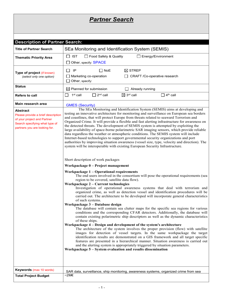
The SEa Monitoring and Identification System (SEMIS) aims at developing and testing an innovative architecture for monitoring and surveillance on European sea borders and coastlines, that will protect Europe from threats related to seaward Terrorism and
Organized Crime. It will provide a flexible and fast alerting infrastructure for awareness on the detected threats. The development of SEMIS system is attempted by exploiting the large availability of space-borne polarimetric SAR imaging sensors, which provide reliable data regardless the weather or atmospheric conditions. The SEMIS system will include
Internet-based technologies to support governmental security organizations and port authorities by improving situation awareness (vessel size, type, velocity and direction). The system will be interoperable with existing European Security Infrastructure.
Short description of work packages
Workpackage 0 – Project management
Workpackage 1 – Operational requirements
The end users involved in the consortium will pose the operational requirements (sea region to be covered, satellite data flow).
Workpackage 2 – Current technologies
Investigation of operational awareness systems that deal with terrorism and organized crime, as well as detection vessel and identification procedures will be carried out. The architecture to be developed will incorporate general characteristics of such systems.
Workpackage 3 – Database design
The database will contain sea clutter maps for the specific sea regions for various conditions and the corresponding CFAR detectors. Additionally, the database will contain existing polarimetric ship descriptors as well as the dynamic characteristics of these ships.
Workpackage 4 – Design and development of the system's architecture
The architecture of the system involves the proper provision (flow) with satellite images for detection of vessel targets. In the same workpackage the target identification results are demonstrated on a GIS framework and all target specific features are presented in a hierarchical manner. Situation awareness is carried out and the alerting system is appropriately triggered by situation parameters.
Workpackage 5 – System evaluation and results dissemination
Keywords (max 10 words)
Total Project Budget
SAR data, surveillance, ship monitoring, awareness systems, organized crime from sea
~2M€
- 1 -
Type of Partner sought:
Specific Expertise required:
Technology development Research Training
Dissemination Demonstration
A partner with links with GMES and experience in SAR data analysis and exploitation
A partner with experience on database design and management
Expiration Date: (latest date of response): 31/06/2005
Contact info:
Vassilis Anastassopoulos
Professor
Department of Physics
University of Patras, Greece
Email: Vassilis@physics.upatras.gr
Tel: + 30 2610 996147
- 2 -


