Chapter C1 Natural Hazards
advertisement

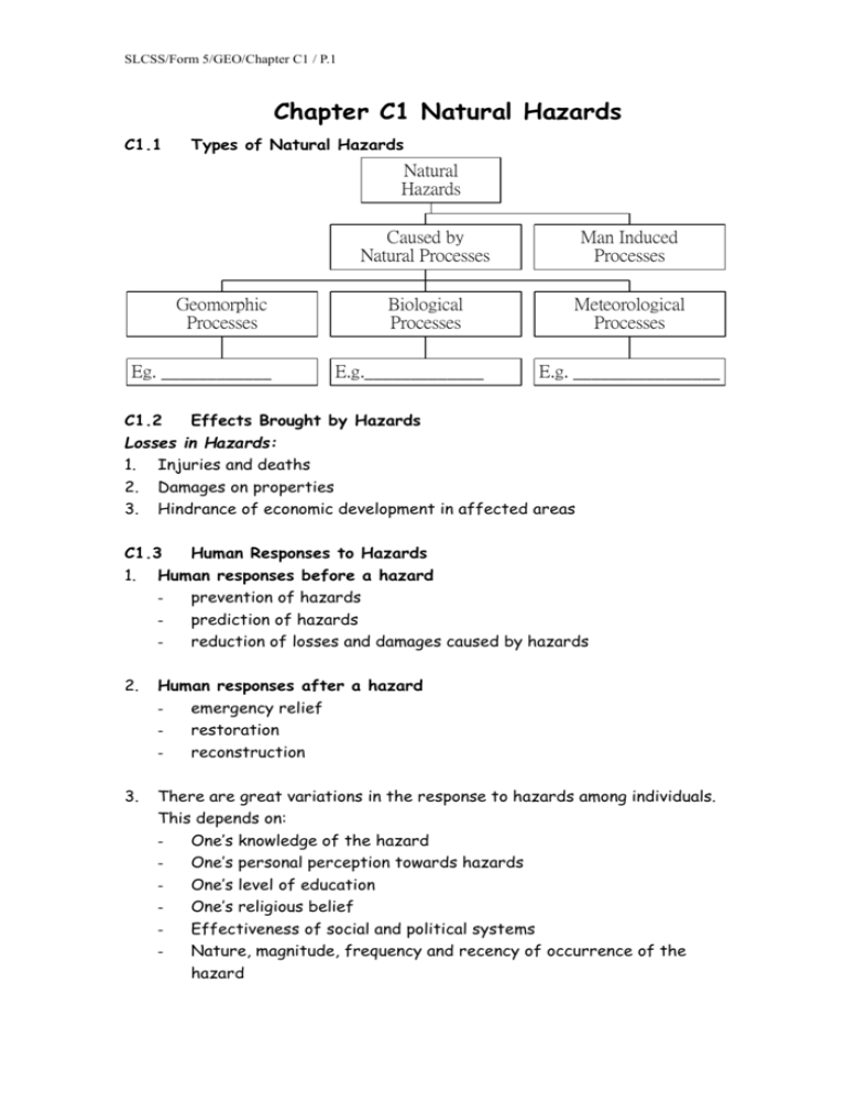
SLCSS/Form 5/GEO/Chapter C1 / P.1 Chapter C1 Natural Hazards C1.1 Types of Natural Hazards Natural Hazards Geomorphic Processes Eg. ____________ Caused by Natural Processes Man Induced Processes Biological Processes Meteorological Processes E.g._____________ E.g. ________________ C1.2 Effects Brought by Hazards Losses in Hazards: 1. 2. 3. Injuries and deaths Damages on properties Hindrance of economic development in affected areas C1.3 Human Responses to Hazards 1. Human responses before a hazard prevention of hazards prediction of hazards reduction of losses and damages caused by hazards 2. Human responses after a hazard emergency relief restoration reconstruction 3. There are great variations in the response to hazards among individuals. This depends on: One’s knowledge of the hazard One’s personal perception towards hazards One’s level of education One’s religious belief Effectiveness of social and political systems Nature, magnitude, frequency and recency of occurrence of the hazard SLCSS/Form 5/GEO/Chapter C1 / P.2 C1.4 Case Study: Huang He Basin (Problems of Floods and Droughts) A. General Cause of Flooding and Drought Floods and droughts are caused by extreme climatic events resulting form ________________________, often of ____________________. Upper course Middle course Lower course Loess Plateau North China Plain Huang He Basin Fig. C1.1 The Huang He Basin B. ~ Floods in the Huang He Basin Causes: 1. Great fluctuation in the amount of rainfall a. In middle Huang He ( i.e. the semi-arid Loess Plateau region), rainfall is highly irregular with occasional periods of prolonged heavy downpours. b. c. In lower Huang He (i.e. the North China Plain region), heavy summer rains are often brought by monsoons. Either of these two causes may lead to a sudden increase in the discharge of the river 2. Sudden change in gradient a. The slope gradient of Huang He decreases abruptly as it runs into the North China Plain from its mountainous middle course. b. At the point of sudden gradient change, the river’s velocity decreases SLCSS/Form 5/GEO/Chapter C1 / P.3 sharply, hence the river flow is retarded. c. d. Mass deposition of sediment takes place at this point leading to rapid silting onto the river bed. As the river cannot flow smoothly, floods often occur. 3. High silt content a. Huang He obtains most of its sediment when it flows through the Loess Plateau. b. Soil erosion is extremely serious in the Loess Plateau because: (1) The plateau is made up of very fine but unconsolidated soil materials (2) c. d. The land surface is lack of dense vegetation cover due to the semi-arid climate (3) Poor farming practices (4) Widespread deforestation for fuel wood The large amounts of sediment that enter Huang He cause widespread deposition on the river bed Floods then occur readily whenever the discharge is high. 4. Absence of large lakes a. Along the whole course of Huang He there is no large lake which can help to: b. (1) Regulate the discharge (2) Retain the large amount of silt Therefore the lower Huang He which always receives excessive discharge and sediment is exposed to the threat of floods from time to time. 5. Silting in flat lower course a. Rapid deposition takes place on the river bed b. As the river bed is raised, the capacity of the river reduces resulting in floods. ~ Effects of Flood a. b. c. d. e. f. g. loss of life loss of properties damages to crops local famine resulted from crop failure spread of diseases destruction of communication lines obstruction to navigation as a result of fluctuating water levels SLCSS/Form 5/GEO/Chapter C1 / P.4 C. Droughts in the Huang He Basin ~ Causes of Drought in the Huang He Basin Droughts are greatest in the semi-arid areas of the middle Huang He (i.e. Loess Plateau). 1. Low and variable rainfall a. the Losses Plateau experiences a typical semi-arid climate b. The mean annual rainfall is low and highly variable. 2. High rate of evaporation In summer, the rate of evaporation often exceeds the amount of precipitation, resulting in water deficits in the soil. ~ 1. 2. 3. 4. 5. Effects of Drought Shortage of water for cultivation and domestic uses crop failures local famine obstruction of hydro-electric power generation loss of habitats (e.g. wetlands) for wildlife 6. retardation of economic development SLCSS/Form 5/GEO/Chapter C1 / P.5 D. Human responses to Floods and Drought in the Huang He Basin Beijing B C A Major dam Irrigated area Minor dam Soil conservation and afforestated area Fig C1.2 Water Project in China Name two important cities A, B and C. A is ____________________________. B is ____________________________. Name three dams X, Y and Z. X is ____________________________. Y is ____________________________. Z is ____________________________. *** The Chinese government has launched a series of projects at both national level and local level. SLCSS/Form 5/GEO/Chapter C1 / P.6 National Level: In the 1950s, a large-scale multi-purpose water scheme, the Huang He Project, was carried out. Aims Projects 1. To control floods in the middle 1. 46 dams are constructed along and lower courses of Huang He the river course to regulate stream flow e.g. the Longyang Gorge Dam ( 龍 陽 峽 ) , the Sanmen Gorge Dam (三門峽) and the Liujia Gorge Dam 2. Flood retention reservoirs are built behind the dams to retain flood water. 3. Desilting basins are dredged on both sides of Huang He to reduce the amount of sediment carried downstream. 2. To reduce the effects of drought Networks of canals are constructed by providing water for irrigation to lead water from the fold retention reservoirs to the neighboring farms. 3. To improve rural electrification Taking full advantage of the huge dams, hydro-electric power is generated. 4. To provide cheap water transport 1. Channel flow is regulated and in lower and middle Huang He controlled by dams and sluice gates. 2. The river bed is constantly dredged to provide a deep enough waterway. Local Level: 1. Soil conservation Implement various local soil conservation projects to reduce soil erosion and minimize the amount of sediment that may enter Huang He. a. Afforestation b. Hillslopes are terraced to reduce water erosion c. Wind breaks are planted d. Gully erosion is controlled by filling the gullies with soil e. Silt collected in the desilting basins is dredged out and used to replenish the land surface where soil erosions is serious. SLCSS/Form 5/GEO/Chapter C1 / P.7 2. In the lower course, many flood-prevention measures are put into practice: a. Dykes are built to strengthen the natural levees. b. River meanders are straightened to quicken the steam flow. c. The river bed and river mouth are dredged to increase the channel capacity. What are the Pros and Cons of building Multi-purpose Water Scheme (like Huanghe Water Project, Three Gorges Project in Changjiang)? Pros Cons C1.5 Earthquakes A. Definition: Earthquake refers to the sudden trembling of the rocks in the earth crust. B. Introduction: 1. When an earthquake occurs, seismic waves are transmitted from the origin onto the surface through the crust. 2. Several features of an earthquake can be identified: a. Focus It is the source of an earthquake where seismic waves are generated. b. c. d. Epicentre It is the point on the ground surface vertically above the focus. Body waves These are seismic waves which travel through the crust. Surface waves These are seismic waves moving along the surface of the earth 3. A seismograph is used to record the strength, duration and location of an earthquake. SLCSS/Form 5/GEO/Chapter C1 / P.8 4. Magnitude a. The magnitude of an earthquake is an indication of the amount of energy released at the focus. b. It is commonly measured on the Richter Scale which ranges earthquakes on a scale from 0 to 9. 5. Intensity (measured by Modified Mercalli Scale) (source: http://www.weather.gov.hk/gts/equake/mms_e.htm) a. This is a qualitative measure of earthquake effects based primarily upon the extent of damages, loss of life and the physical feeling of people. b. Earthquake intensity depends on: (1) ______________________________________________ (2) ______________________________________________ (3) ______________________________________________ i.e. the weaker the crustal materials, the higher the intensity 6. Frequency a. More than a million earthquakes shake the earth each year. b. In general, earthquakes of lower magnitude tend to occur in higher frequency. 7. Duration a. Most earthquakes occur in short duration. b. They usually last for no more than one minute. C. Major Earthquake Zones The world’s major earthquakes coincide with plate boundaries / plate margins. a. The Circum-Pacific Zone This zone includes the west coast of the Americas and the island groups of Asia. - - Colliding plates give rise to young fold mountain belts. Plate compression and oceanic plate subduction causes friction, both triggering off earthquakes. Sliding plates also trigger off earthquakes. b. The Alpine-Mediterranean-trans-Asiatic Zone This belt runs through North Africa, Spain , Italy, Greece, Turkey, Iran , North India and Burma. Colliding plates give rise to young fold mountain belt and folding SLCSS/Form 5/GEO/Chapter C1 / P.9 triggers off earthquakes. c. Minor earthquakes belts diverging plates in mid-Atlantic belt diverging plates beneath East African Rift Valley Fig C1.3World distribution of earthquake zones D. 1. a. b. c. --- Causes of Earthquakes Tectonic movements Tectonic movements produce most of the world’s major earthquakes. Therefore plate boundaries are regions of highest frequency of earthquake occurrence. Earthquakes of greater magnitude occur Destructive boundary Transform fault d. Earthquakes of low magnitude occur along constructive boundaries 2. a. b. c. Man’s Action The collapse of large, deeply dredged underground mines Underground nuclear explosion Careless siting of reservoirs in weak zones SLCSS/Form 5/GEO/Chapter C1 / P.10 E. Effects of Earthquakes 1. a. b. c. d. 2. The degree of destruction of an earthquake is largely determined by: ____________________________________________ ____________________________________________ ____________________________________________ ____________________________________________ Earthquakes cause direct shakings, but they also cause secondary hazards which may bring even more widespread and catastrophic damages , for example, landslides, tsunamis and fires F. Human Responses to Earthquakes 1. Prediction Earthquakes can be predicted through installing earthquake detecting systems. 2. Reduction the damages brought about by earthquake a. ___________________________________________________ b. ___________________________________________________ c. d. e. ___________________________________________________ ___________________________________________________ ___________________________________________________


