Get Outside With GPS: GMHS
Name of Team or Individual: ________________
Description: Get outside with your GPS receiver
with activities focused on geography, science, and
mathematics, while thinking about coordinate
systems, landscapes, land use, and other topics.
Activity: Turn on your GPS receiver and go
outside.
1) How many satellites are visible to your GPS
receiver when it says “ready to navigate? _______.
2) What does the outer circle symbolize on the
satellite view screen? ____________________.
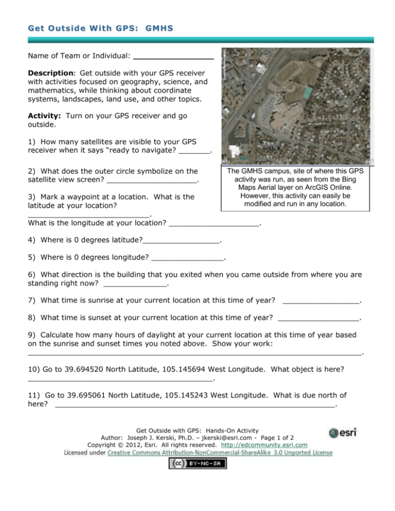
The GMHS campus, site of where this GPS
activity was run, as seen from the Bing
Maps Aerial layer on ArcGIS Online.
However, this activity can easily be
modified and run in any location.
3) Mark a waypoint at a location. What is the
latitude at your location?
___________________________.
What is the longitude at your location? ____________________.
4) Where is 0 degrees latitude?_________________.
5) Where is 0 degrees longitude? ________________.
6) What direction is the building that you exited when you came outside from where you are
standing right now? ______________.
7) What time is sunrise at your current location at this time of year?
_________________.
8) What time is sunset at your current location at this time of year? __________________.
9) Calculate how many hours of daylight at your current location at this time of year based
on the sunrise and sunset times you noted above. Show your work:
__________________________________________________________________________.
10) Go to 39.694520 North Latitude, 105.145694 West Longitude. What object is here?
_________________________________________.
11) Go to 39.695061 North Latitude, 105.145243 West Longitude. What is due north of
here? ______________________________________________________________.
Get Outside with GPS: Hands-On Activity
Author: Joseph J. Kerski, Ph.D. – jkerski@esri.com - Page 1 of 2
Copyright © 2012, Esri. All rights reserved. http://edcommunity.esri.com
12) What is your average speed at which you walk? _______________.
13) What is the maximum speed at which you can run? ______________.
14) Change to the map screen and zoom in as far as you can. Draw the first letter of your
first name by tracing it on the ground as you walk, noting the letter’s shape on your GPS
screen. What letter did you draw? ______. What are the challenges of drawing this letter
accurately? _______________________________________________________________.
15) Mark a waypoint and change the latitude of this waypoint to 51 Degrees North and
change the longitude to 0 Degrees East. This is the approximate location of the Royal
Observatory in Greenwich, England. Save the point and use the Go To function. How far is it
to the Royal Observatory from where you are now? Include the units: _________________.
16) If you were to walk at your average walking speed all the way to the Royal Observatory,
how long would it take you to get there? Show your work:____________________________
__________________________________________________________________________.
17) Examine the following data and fill in the blanks:
100 km
= 1 degree of latitude
10 km
= .1 degree
1 km
= _________ degree
1000 m
= .01 degree (because 1 km = 1000 m)
100 m
= .001 degree
10 m
= _________ degree
1m
= .00001 degree
18) Verify as you walk due north or south that for every meter you walk, the latitude
numbers increase or decrease by .00001. Is this the case? Circle your answer: Yes | No.
19) If geometry tells us that it is 360 degrees around the Earth, and 1 degree is 100 km
distance, what is the distance (the circumference) all the way around the Earth? Show your
work: ____________________________________________________________________.
20) At the average walking speed noted above, how long would it take you to walk around
the Earth? Show your work: __________________________________________________.
21) At your top running speed noted above, how long would it take you to run around the
Earth? Show your work: ______________________________________________________
__________________________________________________________________________.
22) If you could run all the way around the Earth, at what date would you be back here on
campus at the starting point? Show your work: __________________________________.
Get Outside with GPS: Hands-On Activity
Author: Joseph J. Kerski, Ph.D. – jkerski@esri.com - Page 2 of 2
Copyright © 2012, Esri. All rights reserved. http://edcommunity.esri.com

