Grant Proposal
advertisement
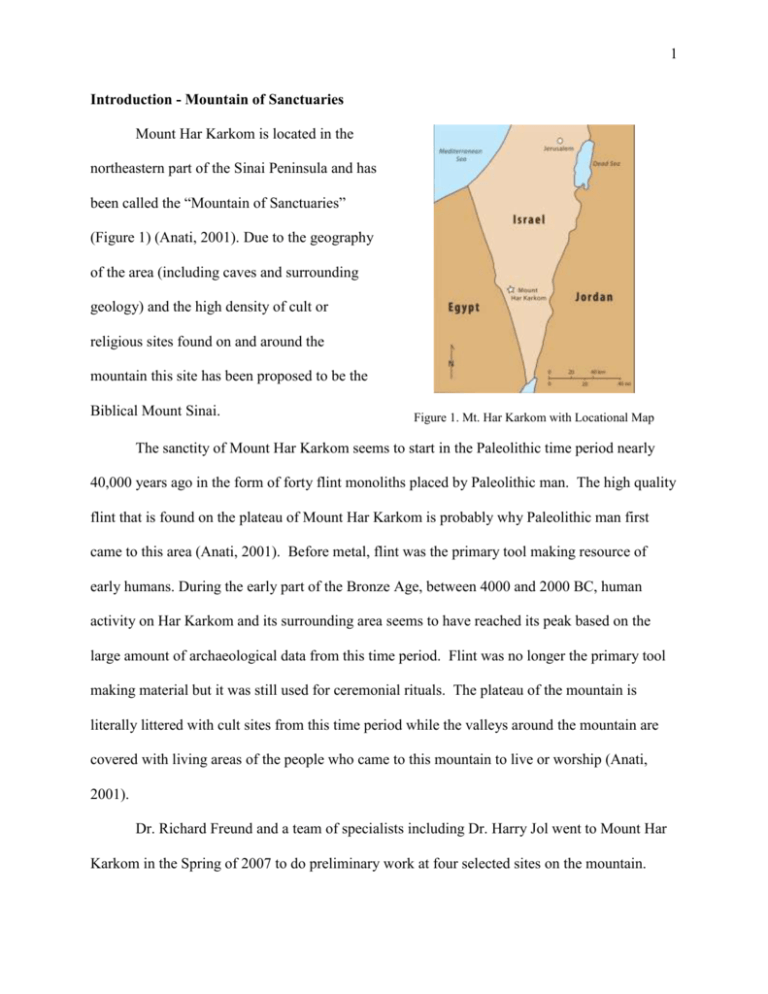
1 Introduction - Mountain of Sanctuaries Mount Har Karkom is located in the northeastern part of the Sinai Peninsula and has been called the “Mountain of Sanctuaries” (Figure 1) (Anati, 2001). Due to the geography of the area (including caves and surrounding geology) and the high density of cult or religious sites found on and around the mountain this site has been proposed to be the Biblical Mount Sinai. Figure 1. Mt. Har Karkom with Locational Map The sanctity of Mount Har Karkom seems to start in the Paleolithic time period nearly 40,000 years ago in the form of forty flint monoliths placed by Paleolithic man. The high quality flint that is found on the plateau of Mount Har Karkom is probably why Paleolithic man first came to this area (Anati, 2001). Before metal, flint was the primary tool making resource of early humans. During the early part of the Bronze Age, between 4000 and 2000 BC, human activity on Har Karkom and its surrounding area seems to have reached its peak based on the large amount of archaeological data from this time period. Flint was no longer the primary tool making material but it was still used for ceremonial rituals. The plateau of the mountain is literally littered with cult sites from this time period while the valleys around the mountain are covered with living areas of the people who came to this mountain to live or worship (Anati, 2001). Dr. Richard Freund and a team of specialists including Dr. Harry Jol went to Mount Har Karkom in the Spring of 2007 to do preliminary work at four selected sites on the mountain. 2 Findings of this expedition included Bronze Age pottery, hundreds of sacrificial altars, as well as 40,000 rock art pieces including one series that may illustrate the tablet that held the Ten Commandments (Dresner, 2007). Objectives To produce schematic diagrams of four archaeological sites at Mount Har Karkom, Israel including: HK/221B, HK/361, HK/52, and a Water Source pond (Anati 2001). To collate and process topographical surveys of the selected sites. To process, topographically correct, and plot collected ground penetrating radar (GPR) data (2D and 3D) from the four sites at Har Karkom. To analyze the datasets so that an interpretation can be provided to better understand the subsurface layering of these four sites and provide possible location(s) for future archaeological excavations. To prepare and present the processed, analyzed, and interpreted field data for conference and community presentations. Project Description Archeological excavations are expensive and time consuming and permits are often hard to obtain. In order to save time and money and be the least the destructive, archaeologists are increasingly turning to geophysical techniques, such as GPR, to image subsurface features (Rapp, 1998). GPR is based on the propagation of high frequency electromagnetic (EM) waves, which are emitted into the ground and are reflected back to the surface in response to the different dielectric properties of the material the waves travel through. An image (similar to a 2D 3 x-ray of the ground) is then produced using the travel time of the waves. The post-acquisition analysis involves processing and plotting the information using pulseEKKO software and interpreting the data sets based upon the principles of radar stratigraphic analysis (Jol and Bristow, 2003). Support for this proposal will allow for processing, plotting, analysis and interpretation of the data collected at four sites, HK/221B (Limestone plateau with Altar), HK/361, HK/52 (Twelve pillars site), and a Water Source pond. The resulting data will provide subsurface information on the four sites that may result in further excavations at this proposed Biblical mountain. Significance of the Proposed Project Mount Sinai is a very important site for not only Judaism but also Christianity and Islam. This Biblical mountain, to date, has never been discovered with any archaeological evidence. The geophysical survey done by Dr. Jol was one of the first to be done on Mount Har Karkom. The results of the project will aid in better understanding the history of this sacred mountain. The data collected will be processed, plotted and interpreted, by myself, with the results being shared with the lead project archaeologists. The data provided will greatly assist them in deciding if and where to spend their time and money excavating in the future and could possibly lead to further discoveries at the proposed Biblical Mount Sinai. Nature and Extent of Student Involvement I wrote the grant proposal and was directly involved in the editing process. The GPR data that was collected, Spring 2007, will require a significant amount of processing, plotting and interpretation to provide the necessary and valuable information. I will be carrying out all 4 components of this proposed research project. My collaborating professor is Dr. Harry Jol of the Department of Geography and Anthropology who has extensive knowledge in the field of GPR. Plan for Disseminating Results Dissemination of interpretations/results to project archaeologists of the Har Karkom expedition. Presentation at the annual UWEC Student Research Day (April 2008) Presentation at the Association of American Geographers 2008 in Boston (April 15-19, 2008) A comprehensive project website (including dataset examples) Community and UWEC Foundation presentations upon request (I have already been asked to be interviewed by WEAU-13 and Eau Claire Community Television) History of Prior Funding This project has not had any prior funding. References Anati, E., 2001. The Riddle of Mount Sinai: Archaeological Discoveries at Har Karkom. Edizoni Centro. Vol.21, pp. 192. Dresner, S., 2007. ISO ‘the real Mount Sinai’ UHa professor says he found the real thing. Jewish Ledger, April 24. Jol, H.M. and Bristow, C.S., 2003. GPR in sediments: advice on data collection, basic processing and interpretation, a good practice guide. In: Bristow, C.S. and Jol, H.M. (eds.), GPR in Sediments, Geological Society of London, Special Publication 211, 9-27. Rapp, G. Jr., Hill, C.L., 1998. Geoarchaeology. Yale University Press, pp. 279.
