Chippewa Moraine Ice Age National Scientific Reserve
advertisement
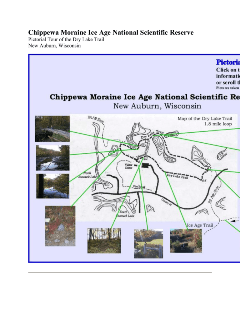
Chippewa Moraine Ice Age National Scientific Reserve Pictorial Tour of the Dry Lake Trail New Auburn, Wisconsin This lake is a glacial kettle with the elevated land around its perimeter being called hummocks. Their formation is described below. The lake in the first picture (same as the background here) has a water level that is much higher than the water levels in the surrounding lakes. This placard indicates it is a perched lake and above the water table of the area. Bridge and hiking path following the hummock beside a lake. Austin and Rachel getting their first break in our approximate three mile hike. This is the location where the Ice Age Circle trail (which connects to the main Ice Age Trail) crosses County Highway M A sign that designates the pathway for the Ice Age Trail. The total trail is about 1,000 miles long. This ridge is part of an Ice-Walled-Lake Plain. It is a unique glacial landform and its development is described below. Entrance to the Ice Age Visitor Center. The next three pictures are taken from just outside the center. Picture overlooking some of the Chippewa Moraine landscape. This picture is looking Southeast. Actual picture of the Barnes Ice Cap on Baffin Island, Canada. It has several features that were similar to the glacier that created the Chippewa Moraine. Map showing the extent of the Wisconsinan Glacier. It also shows the different lobes of this glacier. A 3-D topographical map showing the hills and lakes in the area. The visitors center's location is indicated in the upper left. It is a region with a high density of glacial lakes. The rocks in the pictures are glacial erratics and are described below. More glacial erratics showing up near the hiking trail. One of the many shallow lakes. As indicated in the placard below, these lakes don't have rivers feeding into them. They are also shallow. This causes the lake to have no fish. It is prime habitat for frogs and salamanders. My kids taking their last break on a small wooden bridge that crosses a low-lying area.


