Mining
advertisement
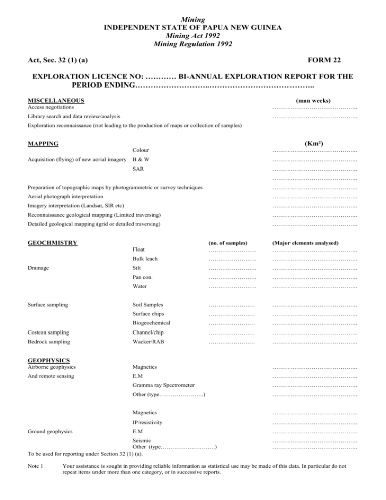
Mining INDEPENDENT STATE OF PAPUA NEW GUINEA Mining Act 1992 Mining Regulation 1992 Act, Sec. 32 (1) (a) FORM 22 EXPLORATION LICENCE NO: ………… BI-ANNUAL EXPLORATION REPORT FOR THE PERIOD ENDING………………………..………………………………….. MISCELLANEOUS (man weeks) Access negotiations …………………………………….. Library search and data review/analysis …………………………………….. Exploration reconnaissance (not leading to the production of maps or collection of samples) (Km²) MAPPING Acquisition (flying) of new aerial imagery Colour …………………………………….. B&W …………………………………….. SAR …………………………………….. …………………………………….. Preparation of topographic maps by photogrammetric or survey techniques …………………………………….. Aerial photograph interpretation …………………………………….. Imagery interpretation (Landsat, SIR etc) …………………………………….. Reconnaissance geological mapping (Limited traversing) …………………………………….. Detailed geological mapping (grid or detailed traversing) …………………………………….. GEOCHMISTRY Float (no. of samples) ……………………. (Major elements analysed) …………………………………….. Bulk leach ……………………. …………………………………….. Silt ……………………. …………………………………….. Pan con. ……………………. …………………………………….. Water ……………………. …………………………………….. Soil Samples …………………… …………………………………….. Surface chips …………………… …………………………………….. Biogeochemical …………………… …………………………………….. Costean sampling Channel/chip …………………… …………………………………….. Bedrock sampling Wacker/RAB …………………… …………………………………….. Drainage Surface sampling GEOPHYSICS Airborne geophysics Magnetics …………………………………….. And remote sensing E.M …………………………………….. Gramma ray Spectrometer …………………………………….. Other (type…………………..) …………………………………….. Magnetics …………………………………….. IP/resistivity …………………………………….. E.M …………………………………….. Ground geophysics Seismic Other (type……………………….) To be used for reporting under Section 32 (1) (a). Note 1 …………………………………….. …………………………………….. Your assistance is sought in providing reliable information as statistical use may be made of this data. In particular do not repeat items under more than one category, or in successive reports. Form 22 2 Mining ACCESS AND EXCAVATION (Km) ………………………………… ………………………………… (metres) ………………………………… ………………………………… Line cutting and gridding Key road and track development Trenching and consteaning Airstrip DRILLING Corred and part cored holes (incl All R.C. except alluvial drilling) Alluvial drilling (no. of holes) ……………… ……………… ……………… BULK SAMPLING (type) (no. of samples) …………. …………………. (Pits, adits etc) metres …………… …………… …………… elements analysed ………………………………… ………………………………… ………………………………… (total weight/vol. in tonnes/m³) …………………………………………………………… SPECIALIST GEOLOGICAL STUDIES (no. of samples) ………………………………… ………………………………… ………………………………… ………………………………… ………………………………… ………………………………… Petrology Whole rock analyses Age determinations Isotope geochemistry Fluid inclusions Other (type…………………….) PRE-FEASIBILITY/FEASIBILITY STUDIES (man weeks) ………………………………… ………………………………… ………………………………… ………………………………… ………………………………… ………………………………… ………………………………… Ore reserve calculations Financial evaluation Metallurgical investigation Geotechnical investigation Environmental investigation Land tenure investigation Engineering studies DESCRIPTION Brief description of significant results obtained with diagrams and maps (preferably A4 size) appended where appropriate. Note problems and restrictions. ………………………………….(holder’s or agent’s signature) …………………………………..(date)
