MS Word - Land Surface Hydrology Research Group
advertisement
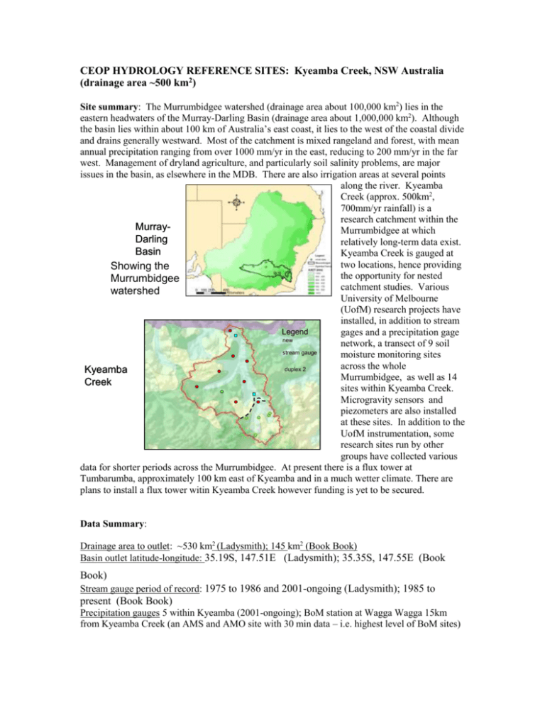
CEOP HYDROLOGY REFERENCE SITES: Kyeamba Creek, NSW Australia (drainage area ~500 km2) Site summary: The Murrumbidgee watershed (drainage area about 100,000 km2) lies in the eastern headwaters of the Murray-Darling Basin (drainage area about 1,000,000 km2). Although the basin lies within about 100 km of Australia’s east coast, it lies to the west of the coastal divide and drains generally westward. Most of the catchment is mixed rangeland and forest, with mean annual precipitation ranging from over 1000 mm/yr in the east, reducing to 200 mm/yr in the far west. Management of dryland agriculture, and particularly soil salinity problems, are major issues in the basin, as elsewhere in the MDB. There are also irrigation areas at several points along the river. Kyeamba Creek (approx. 500km2, 700mm/yr rainfall) is a research catchment within the MurrayMurrumbidgee at which Darling relatively long-term data exist. Basin Kyeamba Creek is gauged at two locations, hence providing Showing the the opportunity for nested Murrumbidgee catchment studies. Various watershed University of Melbourne (UofM) research projects have installed, in addition to stream Legend gages and a precipitation gage new network, a transect of 9 soil stream gauge moisture monitoring sites across the whole duplex 2 Kyeamba Murrumbidgee, as well as 14 Creek sites within Kyeamba Creek. Microgravity sensors and piezometers are also installed at these sites. In addition to the UofM instrumentation, some research sites run by other groups have collected various data for shorter periods across the Murrumbidgee. At present there is a flux tower at Tumbarumba, approximately 100 km east of Kyeamba and in a much wetter climate. There are plans to install a flux tower witin Kyeamba Creek however funding is yet to be secured. Data Summary: Drainage area to outlet: ~530 km2 (Ladysmith); 145 km2 (Book Book) Basin outlet latitude-longitude: 35.19S, 147.51E (Ladysmith); 35.35S, 147.55E (Book Book) Stream gauge period of record: 1975 to 1986 and 2001-ongoing (Ladysmith); 1985 to present (Book Book) Precipitation gauges 5 within Kyeamba (2001-ongoing); BoM station at Wagga Wagga 15km from Kyeamba Creek (an AMS and AMO site with 30 min data – i.e. highest level of BoM sites) 30 min. data since late 1990s and daily data from ~1900. There are many other daily rain stations in the area. Micrometeorological data: from Wagga Wagga – incoming shortwave, screen temp., specific humidity, wind speed and direction, sunshine hours, cloud cover. From these data 30 min forcing data for rainfall, incoming shortwave, incoming longwave, temp, specific humidity and wind speed have been derived from Jan 2001-present (see report below). Turbulent flux measurements: None at present, flux tower planned for 2004, subject to funding Other measurements: In situ TDR at 9 sites along transect across the whole Murrumbidgee; 14 sites within the Kyeamba Ck., mobile TDR measurements for various dates over parts of the Kyeamba catchment and ~10km transects at 3 of the other locations within the broader Murrumbidgee network. References: Richter, H., Western, A.W. and Chiew, F.H.S. (2003) Comparisons of soil moisture simulations from the VB95 land surface model against observations. Proceedings of the International Congress on Modelling and Simulation (MODSIM 2003), Townsville, July 2003, (ISBN 1-74052-098-X), Volume 1, pp. 160-165. Siriwardena, L., Chiew, F., Richter, H. and A.W. Western. 2003. Preparation of a climate data set for the Murrumbidgee River catchment for land surface modelling experiments. CRCCH working document 03/1, 50pp Walker, J, Grayson, R. B., Rodell, M; Ellet, K., 2003. Gravity changes, soil moisture and data assimilation. EGS - AGU - EUG Joint Assembly, Nice, France, April 2003, CDROM Western, A.W., Richter, H., Chiew, F.H.S., Young, R.I., Mills, G., Grayson, R.B., Manton, M.and T.A. McMahon, 2002. Testing the Australian Bureau of Meteorology’s Land Surface Scheme using Soil Moisture Observations from the Murrumbidgee Catchment. Hydrology and Water Resources Symposium, July, 2002. .
