RAM_kortllykill_2006_05_med_gildum_enska
advertisement
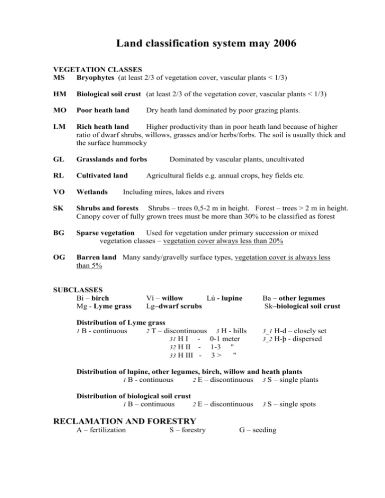
Land classification system may 2006 VEGETATION CLASSES MS Bryophytes (at least 2/3 of vegetation cover, vascular plants < 1/3) HM Biological soil crust (at least 2/3 of the vegetation cover, vascular plants < 1/3) MO Poor heath land LM Rich heath land Higher productivity than in poor heath land because of higher ratio of dwarf shrubs, willows, grasses and/or herbs/forbs. The soil is usually thick and the surface hummocky GL Grasslands and forbs RL Cultivated land VO Wetlands SK Shrubs and forests Shrubs – trees 0,5-2 m in height. Forest – trees > 2 m in height. Canopy cover of fully grown trees must be more than 30% to be classified as forest BG Sparse vegetation Used for vegetation under primary succession or mixed vegetation classes – vegetation cover always less than 20% OG Barren land Many sandy/gravelly surface types, vegetation cover is always less than 5% Dry heath land dominated by poor grazing plants. Dominated by vascular plants, uncultivated Agricultural fields e.g. annual crops, hey fields etc. Including mires, lakes and rivers SUBCLASSES Bi – birch Mg - Lyme grass Ví – willow Lú - lupine Lg–dwarf scrubs Distribution of Lyme grass 1 B - continuous 2 T – discontinuous 3 H - hills 31 H I 0-1 meter 32 H II 1-3 " 33 H III 3> " Ba – other legumes Sk–biological soil crust 3_1 3_2 H-d – closely set H-þ - dispersed Distribution of lupine, other legumes, birch, willow and heath plants 1 B - continuous 2 E – discontinuous 3 S – single plants Distribution of biological soil crust 1 B – continuous 2 E – discontinuous 3S – single spots RECLAMATION AND FORESTRY A – fertilization S – forestry G – seeding VEGETATION COVER 1 2 3 4 5 Fully vegetated Mostly vegetated Half vegetated Sparsely vegetated Very sparse or no vegetation 91-100% cover 67-90% " 34-66% " 11-33% " 0-10% " ROCK OUTCROP 0 1 2 3 4 5 No rock outcrop on surface Very little rock outcrop on surface Some rock outcrop on surface Considerable rock outcrop on surface A lot of rock outcrop on surface Mostly rock outcrop on surface 0 1 - 10 % 11 - 33 % 34 - 66 % 67 - 90 % 91 - 100 % - rock outcrop is defined as rock > 10-20 cm in diameter SAND / TEPHRA ON SURFACE 0 1 2 3 4 5 No sand on surface Very little sand on surface Some sand on surface Considerable sand on surface A lot of sand on surface Mostly sand on surface 0% 1 - 10 % 11 - 33 % 34 - 66 % 67 - 90 % 91 - 100 % - sand / tephra is defined as erodible particles (aeolian transport) SURFACE TYPE S - sand M – gravel H – lava V – tephra C – scree U – rocks/boulders A – dry riverbed B – moist riverbed V – dry lake O – brown soil remnants K – rocks formations RECLAMATION POTENTIAL A - fertilization F – seeding necessary SOIL EROSION CLASSES A – encroaching sand D – erosion spots O – brown soil remnants M – gravel SH– sandy lava B – rofabards / erosion escarpments J – erosion spots on slope / solifluction V – gullies / water erosion K – landslides S – sand and pumice SM – sandy gravel C - scree H – lava EROSION GRADE 0 1 2 3 4 5 No erosion Little erosion Slight erosion Considerable erosion Severe erosion Extremely severe erosion

