Invasive Species Mapping Report Form
advertisement
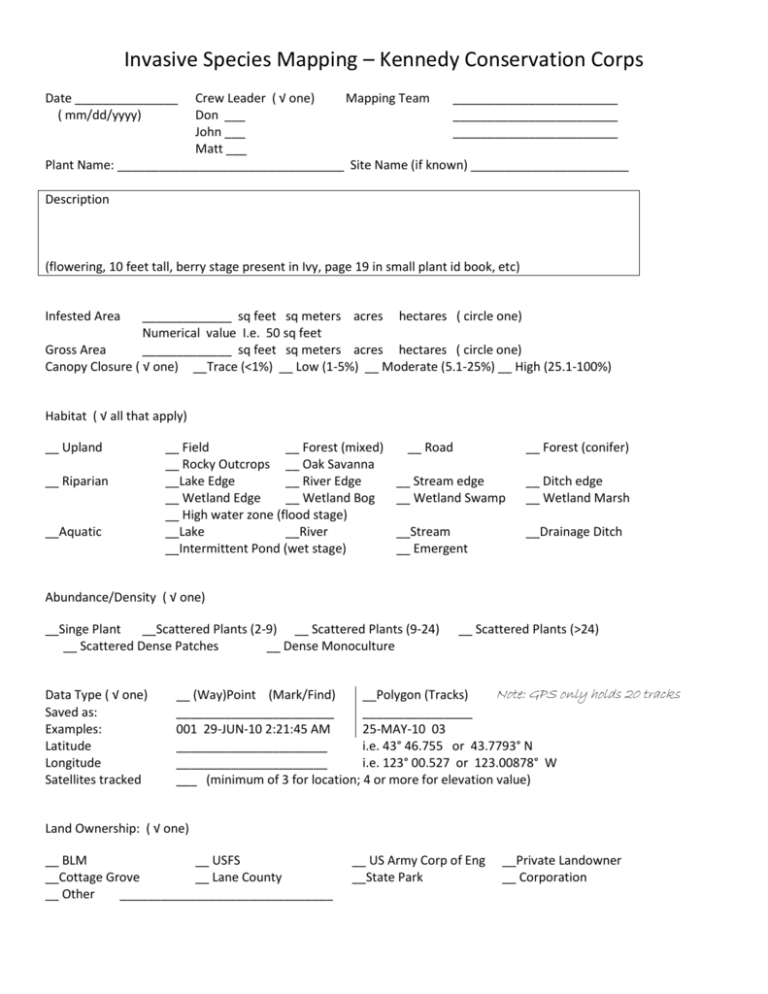
Invasive Species Mapping – Kennedy Conservation Corps Date _______________ ( mm/dd/yyyy) Crew Leader ( √ one) Mapping Team ________________________ Don ___ ________________________ John ___ ________________________ Matt ___ Plant Name: _________________________________ Site Name (if known) _______________________ Description (flowering, 10 feet tall, berry stage present in Ivy, page 19 in small plant id book, etc) Infested Area _____________ sq feet sq meters acres hectares ( circle one) Numerical value I.e. 50 sq feet Gross Area _____________ sq feet sq meters acres hectares ( circle one) Canopy Closure ( √ one) __Trace (<1%) __ Low (1-5%) __ Moderate (5.1-25%) __ High (25.1-100%) Habitat ( √ all that apply) __ Upland __ Riparian __Aquatic __ Field __ Forest (mixed) __ Rocky Outcrops __ Oak Savanna __Lake Edge __ River Edge __ Wetland Edge __ Wetland Bog __ High water zone (flood stage) __Lake __River __Intermittent Pond (wet stage) __ Road __ Forest (conifer) __ Stream edge __ Wetland Swamp __ Ditch edge __ Wetland Marsh __Stream __ Emergent __Drainage Ditch Abundance/Density ( √ one) __Singe Plant __Scattered Plants (2-9) __ Scattered Plants (9-24) __ Scattered Dense Patches __ Dense Monoculture Data Type ( √ one) Saved as: Examples: Latitude Longitude Satellites tracked __ Scattered Plants (>24) Note: GPS only holds 20 tracks __ (Way)Point (Mark/Find) __Polygon (Tracks) _______________________ ________________ 001 29-JUN-10 2:21:45 AM 25-MAY-10 03 ______________________ i.e. 43° 46.755 or 43.7793° N ______________________ i.e. 123° 00.527 or 123.00878° W ___ (minimum of 3 for location; 4 or more for elevation value) Land Ownership: ( √ one) __ BLM __ USFS __Cottage Grove __ Lane County __ Other _______________________________ __ US Army Corp of Eng __State Park __Private Landowner __ Corporation
