Homework Assignment #6 - Brandywine School District
advertisement
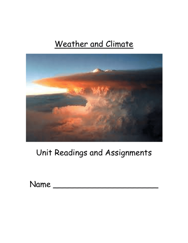
Weather and Climate Unit Readings and Assignments Name _____________________ Table of Contents Part 1: Intro. to Weather and Climate Pages 2-10 Homework Assignment 1 Page 6 Homework Assignment 2 Page 10 Part 2: Interpreting the Weather Pages 11-25 Homework Assignment 3 Page 15 Homework Assignment 4 Page 17 Homework Assignment 5 Page 20 Homework Assignment 6 Page 23 Homework Assignment 7 Page 25 Part 3: Predicting the Weather Homework Assignment 8 Pages 26-28 Page 28 1 Part 1: Introduction to Weather and Climate ENERGY FROM THE SUN The amount of radiation the Earth receives from the Sun is balanced by the energy that returns to space. If the incoming radiation equals the outgoing radiation, our environment would be stable. If incoming and outgoing radiation is not equal, the Earth and its atmosphere would continuously heat up or cool down. Incoming solar energy is balanced by outgoing energy. Even though there is a balance between incoming and outgoing radiation, heat energy still collects in different amounts around the surface of the Earth. The tropical latitudes receive a surplus of heat energy and the polar region experiences a deficit of heat energy. Notice in the NASA picture that the equatorial regions receive more net radiation than the polar region. Climate is the average weather over a long period of time whereas weather is the day to day change in the atmosphere at a specific location. In the next few sections you will find the major factors that influence a locations weather and climate. 2 LATITUDE Variations in climate are due to many factors, such as latitude. Latitude is a measure of the distance north or south of the equator. The equator is located at 0 ° latitude. The greatest amount of solar radiation is received by regions close to the equator. The tropics are regions between the latitudes of 23.5 ° N and 23.5 ° S. Generally, locations on Earth that are close to the equator are often very hot and humid. The temperate zone is located between the tropics and the polar zones (23.5 ° to 66.5 ° N and S latitude). Most of the United States is in the temperate zone and the temperatures are moderate. Generally, locations in the temperate zone are not as hot as at the equator, nor as cold as at the poles. The polar zone extends from 66.5 ° N and S to the poles. The solar radiation reaches the polar zone at a very low angle, spreading the solar energy over a very large area. The Polar Regions receive little to no solar radiation in the winter and temperatures are never warm. Generally, locations in the polar zone are cold and dry. OCEAN CURRENTS Given that the equatorial regions receive more radiation than the poles, why are the poles not as cold as they could be and why is the equatorial region not as hot as it could be? The answer is in ocean currents and global winds. The ocean is divided into two layers; the surface layer and the deep water layer. The surface layer of the ocean is a layer at the top that is mixed by waves, tides, rain and other weather events such as storms. The surface layer is less dense than the deep, colder waters. Movement of the surface waters takes place in the form of currents which 3 move water along the ocean’s surface. These surface ocean currents are mainly driven by the wind. The location of land masses and the rotation of the Earth also influence the movement and direction of ocean currents. Surface waters are cold and dense at the poles and warm and less dense at the equator. Just like with air, this creates areas of high and low pressure in the surface water. Cold polar waters flow towards areas of low pressure at the equator. As the Earth rotates beneath the oceans, the water is turned to the right as it flows. The circulation of water by ocean currents helps to distribute energy from the Sun. The water warmed by the Sun at the equator is transported to higher latitudes. Since 97% of Earth’s water is in the oceans, it is no wonder that the oceans have a huge effect on weather and climate. The oceans and seas supply the majority of the water that evaporates and falls as rain in the water cycle. Delaware’s climate and weather are influenced by a warm current that moves northward from the Gulf of Mexico called the Gulf Stream and a cold current that moves southward from the polar waters called the Labrador Current. When the Gulf Stream is close to Delaware’s shores, the waters keep the temperatures warmer in the winter and cooler in the summer. 4 WIND CURRENTS Different parts of the land and sea heat at different rates around the world. This results in high and low pressure areas and leads to movement of air masses around the world. Due to the tilt of the Earth, the majority of the heat energy falls upon the middle of the world (equator) and less towards the ice caps at the poles. As warm air is rising near the equator, cold air is pulled in from the ice caps. Air rises in warm regions where the pressure is low (near the tropics) and descends where the pressure is high (cold areas near the poles). This spreads warmth across the Earth and results in moving air patterns. The energy from the Sun strikes the ocean near the equator and warms the surface water causing evaporation. The water vapor rises into the atmosphere and moves away from the equator and cools, condenses and falls as precipitation. The less dense air near the equator creates a low pressure zone, whereas the denser, sinking air to the north and south of the equator create high pressure zones. A high and low pressure zone together makes up a weather cell. These weather cells act like a heat pump, driven by solar radiation and the evaporation of sea water. When water vapor in the atmosphere condenses, the stored heat required for evaporation is released and warms the air above the higher latitudes. Weather cells redistribute two thirds of the equatorial solar radiation to the rest of the Earth and the remaining third is redistributed by ocean currents. 5 Homework Assignment #1 Pick a point on the maps above (the same point, mark it with an ”X”). Tell me what kind of climate you would expect to find there. Explain your reasoning. __________________________________________________________________ __________________________________________________________________ __________________________________________________________________ __________________________________________________________________ __________________________________________________________________ __________________________________________________________________ 6 ENERGY IN STORMS Everyday, storms occur on Earth and help transfer energy around the globe. The energy needed to start these storms comes from the Sun and these storms help redistribute this energy. Tornadoes, hurricanes and thunderstorms are the most common powerful storms in the United States. In Delaware, we may experience all of these types of storm systems. Each storm system has some common characteristics with the other systems. Much of the energy in extra tropical cyclones (winds around a low pressure system) is created by the unequal heating of the Earth’s surfaces. When warm and cold air masses meet, the cold air forces the warm air up into the atmosphere. This occurs because the cold air mass is denser than the warm air mass. When warm air rises it cools, water vapor turns back into liquid water, and energy is then released. The more energy that is released by the process of condensation, the larger the resulting storm. The greater the difference between air pressures around any particular storm, the stronger the winds. THUNDERSTORMS Thunderstorms form from strong convection currents that extend high into the troposphere. Thunderstorms may last less than an hour but also may persist with thunder, lightning, and rain for many hours. Thunderstorms occur anywhere that warm, moist air has absorbed enough heat energy to make the air less dense than the surrounding air. This often occurs along cold fronts, but may occur in other places such as where daytime heating forms hot air near the surface of the Earth. As warm, moist air rises, it cools and 7 water begins to condense into tiny droplets in the clouds. When the water condenses, the heat energy is released which adds heat energy to the rising air. This rising air, called updrafts, may build clouds to heights up to 4 miles! Hail and lightning may be seen with thunderstorms. Thunderstorms can occur nearly everywhere. The areas that see the most thunderstorms in the USA are located where warm, moist air moves northward from the Gulf of Mexico. TORNADOES Tornadoes are funnel shaped clouds associated with thunderstorms. Tornadoes affect a much smaller area than hurricanes, but may have higher wind speeds (up to 300 mph). A tornado forms in a severe thunderstorm when upper level winds are blowing faster than lower level winds. The diameters of tornadoes are relatively small compared to hurricanes (maximum of about 1 mile). Tornadoes are short lived storms that may cut a path on the ground from 2 miles in length to 150 feet in width. The intensity of a tornado is classified by the Fujita scale. This scale ranges from one to five. An F1 is a weak tornado and an F5 is a violent tornado. Tornadoes are most common during the spring and summer months and often occur with cold fronts moving across the United States from west to east. 8 HURRICANES A tropical thunderstorm can grow into a massive hurricane under certain conditions. Sometimes several thunderstorms start rotating around a central area of low pressure. This is called a tropical depression. If the depression strengthens so that winds reach at least 39 mph, it is called a tropical storm. If wind speeds increase to more than 74 mph, it is called a tropical cyclone or hurricane. Once formed, hurricanes take energy from the warm ocean water to become stronger. A storm will strengthen if there is a supply of warm, moist air to feed it. Warm, moist air is found above warm, tropical ocean waters. While a hurricane is over warm water it will continue to grow. A hurricane dies when it moves away from the tropics. When a hurricane moves into areas with cooler ocean water, it weakens. It will also weaken if it travels over land. 9 Homework Assignment #2 Answer the questions associated with the thunderstorm development pictures below. 1. Why does the air in the final stage of thunderstorm development stop rising? _________________________________________________________________________ _________________________________________________________________________ 2. How does the difference between the temperature and dew point (where clouds form) of air change as it is pushed up? _________________________________________________________________ _________________________________________________________________ 3. When air condenses it releases heat energy. What part of this picture shows the behavior of air heated by condensation? _________________________________________________________________ _________________________________________________________________ 10 Part 2: Interpreting the Weather The Atmosphere The Earth’s atmosphere is mostly composed of the gases Nitrogen and Oxygen. Several other gases are also present in the atmosphere. The most important to the study of weather is the gas called water vapor. Water vapor, like the other gases that make up the atmosphere, cannot be seen. The atmosphere helps to support life by absorbing energy from the Sun and cycling water (water cycle). The Earth’s atmosphere is broken down into several layers, each having unique characteristics. The troposphere is the layer of the Earth’s atmosphere that starts at the Earth’s surface and extends to about 4-12 miles (620 km) high. The gases in the troposphere decrease as height increases and the air becomes thinner. For this reason, the temperature decreases with height in the troposphere. The troposphere is where all the Earth’s weather takes place. 11 Tools to Measure the State of the Atmosphere There are many ways to check the local weather conditions. You may go outside and observe the clouds in the sky, read weather instruments or use computer technology to obtain this information. Meteorologists use a variety of tools to monitor current weather conditions and use this information to predict future weather. Many of the tools they use are probably already familiar to you, but the following section discusses each tool in more detail. Temperature Temperature is measured with a thermometer. The liquid in a thermometer expands and rises in the tube when the temperature increases, and contracts and drops when the temperature decreases. Digital thermometers operate similarly. They work because the flow of electricity in the device is affected by the temperature of the metal sensor. Temperature is commonly measure in degrees Fahrenheit. In the USA, most people use the Fahrenheit scale. Scientists generally use the Celsius scale. Barometer Air pressure is measured with a barometer. The barometer has a liquid that moves up and down according to the atmospheric pressure. Barometric pressure is measured in inches or millibars. Barometric pressure seldom goes above 31 inches or drops below 29 inches. Normal sea-level pressure is 29.92 inches or 1013.25 millibars. Pressure is one of the most significant indicators of weather. 12 Anemometer An anemometer measures wind speed. A wind vane records wind direction. Hygrometers and Sling Psychrometers Humidity is measured with a sling psychrometer. A sling psychrometer has two thermometers (a dry bulb and wet bulb) mounted side by side. It has a handle at one end and you whirl the instrument to get the readings. A hygrometer also is used to measure relative humidity. Clouds Clouds are classified by height and form. Height can be broken down into high, middle and low clouds. High clouds are generally above 20,000 feet in elevation and are made of ice crystals. Medium clouds are found from about 6500 – 20,000 feet and are made of both ice crystals and water droplets. Low clouds have bases below 6500 feet and are made from water droplets. Fog is a ground touching cloud. Some clouds span multi levels such as the towering cumulonimbus (thunderstorm) cloud. High clouds such as Cirrus, Cirrocumulus and Cirrostratus are wispy clouds and often associated with approaching weather changes or storms. Cirrocumulus clouds are high, wavelike clouds that generally indicate quiet weather. Cirrostratus clouds are high, blanket like clouds that often form a ring around the Sun and Moon and indicate rain or snow within 24 hours. 13 Middle clouds such as altocumulus and altostratus are associated with possible rain or snow. An altostratus cloud generally indicates rain or snow within 6-8 hours. Nimbostratus clouds indicate widespread and continuous rain or snow. Low clouds include cumulus, stratocumulus, stratus and fog. Cumulus clouds are usually puffy and may precede a storm in the morning or follow a storm in the afternoon. Stratocumulus clouds are fairly flat clouds that follow a storm. These clouds give an overcast sky. Stratus clouds are usually the lowest clouds. Drizzle is often associated with this type of cloud. Fog is considered a low stratus cloud. 14 Homework Assignment #3 Station Models A station model is used by meteorologists to record collected weather data on a map using a combination of symbols. The station models show weather conditions at certain locations on the Earth’s surface. This information is used to help forecast weather. Use a newspaper, website, phone, or anything else to create a station model for today’s weather. You will have to also find a website that shows you what symbols to use (HINT: type “weather station symbols” into Google!) My Station Model: 15 THE SUN: THE SOURCE OF ENERGY FOR WEATHER It is true that we do not get heat energy from the Sun, only electromagnetic (EM) (light) energy. When the EM energy is absorbed by materials it is then transformed into heat energy. All of the Earth’s land and water are constantly absorbing electromagnetic (EM) energy from the Sun and transforming it into heat energy. They also transform this EM energy into heat energy differently. This unequal heating (and eventual cooling) of surfaces causes certain types of winds. When the air particles come in contact with a hot surface of the parking lot, heat energy is transferred to them by conduction. This air ‘heats up’ and expands. As the density of the gas decreases, the gas begins to rise. If we could see the air, it would be flowing upwards away from the surface of the parking lot. And you would see cooler air from the edges of the parking lot moving in to replace the rising hot air. The air over the parking lot would look like a huge ‘air fountain’, except you wouldn’t see the rising hot air fall back to down, it would keep on rising. Eventually, the air does fall back to the surface of the Earth, but only after it has cooled. The cooled gas cannot push as hard against the surrounding air. As a result, it appears to contract (actually it is being pushed inward by the surrounding gas). The density of the gas increases and it sinks back to the surface of the planet, but usually far from the spot where it was heated. So the heated air does behave like a very big invisible fountain of gas! 16 These ‘fountains’ of air are very common on the surface of our planet. Any surface heated by the Sun will create these updrafts of air, that eventually return back to the surface. The flow of air that results is called a convective current. These convective currents can influence the weather and even the climate of an entire region. It is important to remember that solar energy that is transformed into heat energy at the surface of the Earth is the source of energy that moves huge quantities of air in our atmosphere. Homework Assignment #4 On the picture below, draw arrows to represent a convective current as described in the reading above. It is recommended that you use red for the warmer air and blue for the cooler air (if not, make sure you label which is which). 17 A CLOSER LOOK AT ATMOSPHERIC PRESSURE Air is comprised of many different kinds of particles. Each of these particles has a tiny mass but there are so many particles that make up the air that together, they weigh a lot! Air does have weight. It is hard to imagine something that we cannot see as having weight, but it is true. How much does air weigh? If we took all of the air out of an average classroom and put it on a scale, it would weigh about 450 pounds! Atmospheric pressure is the pressure created by the gas particles that make up the air. These gas particles have kinetic energy, and collide with each other and any surface in contact with the air. The combined effect of huge numbers of these collisions creates atmospheric pressure, also called air pressure. The size of the air’s pressure depends on the same quantities that influence the pressure in any gas; the number of collisions that take place every second and how energetic these collisions are. The density of the air particles strongly affects the number of collisions that take place, and the temperature of the air determines how energetic these collisions are. Even though there are no boundaries or walls in the atmosphere, air usually is separated into very large sections call ‘air masses’. Air masses differ from each other because they have different physical characteristics. If an air mass forms over a large body of water, it will contain more water vapor in than an air mass that forms over dry land. The temperature of the air mass will depend on where it is formed and the temperature of the Earth’s surface beneath the air mass. The two most common air masses are called ‘high pressure’ and ‘low pressure air masses. When air is slowly descending over a very large area, the air pressure is high. The air in a high pressure system is at a higher pressure than the air that surrounds it. The density of the air in these air masses tends to be greater than the density in surrounding air masses. As this air descends towards the ground it warms. This warming 18 effect disrupts the formation of clouds and is the reason that high pressure areas generally produce good weather conditions. When air is slowly rising over a very large area, the pressure is low. Low pressure systems are large bodies of air having lower pressure than the surrounding air. The density of the air in these systems is lower than the density of surrounding of air. As the air rises, it cools and clouds form from the water vapor in the air. This cooling effect, which causes water vapor to condense into droplets, is characteristic of low pressure areas and generally produces bad weather. Air masses move independently and often push on each other. If a high pressure air mass pushes on a low pressure air mass, huge quantities of air will move from the area of high pressure to the area of low pressure. This air flow creates strong winds that can produce stormy weather as the air from the high pressure and low pressure systems mix. High and low pressure systems are very common all year-round. The weather associated with high pressure air masses and low pressure air masses is very predictable. For this reason meteorologists use changes in atmospheric pressure to predict how the weather will change. The weather at the boundary between these two systems is harder to predict, but expect it to be turbulent. Atmospheric pressure is one of the best indicators of changing weather available to meteorologists. On weather maps, the high pressure areas are designated by a (H) and a low pressure area is designated by a (L). Where these areas of high and low pressure are on the map will enable the meteorologist to predict how the weather will change across the country. 19 Homework Assignment #5 In the three nuts below, write three important facts about air pressure and how air pressure influences weather conditions. (Get it…in a nutshell!!) 20 Water in the Atmosphere Water moves on the Earth in a continuous cycle. Since the water cycle is a cycle, there is no beginning or end. Water changes state from liquid, vapor and solid at various locations in the water cycle. These processes have been occurring over and over again for millions of years. Water can cycle on Earth because the Earth has an atmosphere. If we were to visit the Moon, no clouds or weather would occur because the Moon has no real atmosphere. Energy from the Sun causes water to evaporate on Earth, changing it from a liquid state to a gas state called water vapor. As water vapor rises in the atmosphere, heat energy is typically released. This causes the water vapor to condense back into a liquid form. Clouds form when condensation occurs in the atmosphere. The clouds are made of tiny water droplets that form on microscopic dust-sized matter. Eventually, the small water droplets combine together to form larger droplets and ultimately fall to the surface of the Earth in the form of precipitation. This occurs when the atmosphere can no longer keep the droplets suspended in the air. Dew point is the temperature at which water vapor changes from a gas to liquid water droplets. The dew point temperature depends upon the amount of water vapor content in the air. For example, if the air temperature is 80° F and the dew point temperature is 75° F, then this means that the air must cool down by 5° F in order for the water vapor to change into liquid water droplets. The point where the atmosphere is totally filled with water vapor is called saturation. Energy is required for water droplets to change to water vapor. When heat energy is absorbed, the particles of water become more energetic and spread further apart. The 21 particles at the surface of the water may gain enough energy to be released into the atmosphere as water vapor. When heat energy is released, the particles slow down and come closer together and form liquid water droplets again. Think about the air around you in your classroom. There is water vapor in the air. You can not see it, but it is there. If the air in your classroom was holding all the water vapor it could, the air would be completely saturated. However, this is not the case in your classroom. The air is not completely saturated or it would be raining! The air in your classroom is only holding a portion of the water vapor that it could hold at a given temperature. If we could compare the amount of water vapor present in the air to the amount it could hold at that temperature, this would represent the relative humidity. Relative Humidity is the amount of water vapor in the air compared to the amount that it actually could hold. It is expressed as a percent, such as 50% relative humidity. The air does not always have the same amount of water vapor. At warmer temperatures, water vapor particles move faster and do not easily come together. At cooler temperatures, the particles move slower and begin to come together to form water droplets (the process of condensation). If enough water vapor is present in the air for the process of condensation to take place, the air is saturated. If you hear that the relative humidity is 60%, it means the air contains 60 percent of the water 22 needed for the air to be saturated. When saturation is reached, the temperature and dew point are equal, and the relative humidity becomes 100%. Therefore, increases in water vapor, or decreases in temperature, may result in condensation. To increase the relative humidity, more water vapor would need to be added to the air or the temperature would have to decrease. Homework Assignment #6 Write the letter next to the appropriate process in the water cycle. D Evaporation _____ Precipitation _____ Condensation _____ Dew Point _____ 23 CLOUDS AND WEATHER As weather changes from day to day, so do the clouds. Some clouds are puffy and tall, while others are layered and flat. Some clouds are found at high elevations and are made of ice crystals and other clouds are found at low elevations and are made of water droplets. Some clouds are associated with rain and storms while others are associated with good weather. Cloud Formation We often wonder how clouds form in such varied sizes and shapes. Microscopic matter (condensation nuclei) suspended in the air must be present. Water will condense upon this microscopic matter to form clouds. Condensation nuclei come from the ocean, salt, volcanoes, smokestacks, fires and human made pollution. When air cools to the dew point temperature, water vapor turns to liquid water on this matter in the air. This matter in the air acts as a surface on which the water droplets form. When altitude increases, the air temperature and air pressure decreases. The Sun’s energy heats the ground and the air above it. The heated air, which is less dense than the surrounding air, rises. As this air rises into the atmosphere, the higher it rises, the more it cools. As the air cools and condenses, water vapor changes back into liquid water droplets through the process of condensation. If the air cools and reaches the dew point temperature, the water vapor turns back to liquid water and clouds form. Clouds and Frontal Boundaries Air is forced to rise where two air masses with different densities meet. When a cold air mass moves into an area of warm air, the warm air is pushed up over the cold air. This is because the warm air is less dense than cold air. As the warm air rises, it cools and forms clouds. If the warm air rises rapidly, this may lead to heavy showers and thunderstorms. 24 Convection causes the air to rise, cool and condense. Convection is caused by the warming of air, making it less dense and therefore rising. This air cools and condenses as it rises and forms clouds. As the air is cooled, it becomes denser and sinks and the cycle continues. Homework Assignment #7 Take a look at the picture below. In scientific terms, explain what is happening where the clouds are forming. (Air mass, condensation, dew point, and front are good words to start with) ____________________________________________________________ ____________________________________________________________ ____________________________________________________________ ____________________________________________________________ 25 Part 3: Predicting the Weather Fronts and Weather Systems Air Masses Air masses are large bodies of air that take on the characteristics of the area over which they form. Air masses can form over land or over water, over dry areas or over wet areas. Air masses are given names that correspond to where they form. There are four major air masses. cP stands for Continental Polar. This air mass forms over the continents or land in the polar or cold areas. It is a cold, dry air mass. cT stands for Continental Tropical. This air mass forms over the continents or land in tropical areas. It is a dry, warm air mass. mP stands for Maritime Polar. This air mass forms over the maritime or ocean areas in the polar regions. It is a wet, cold air mass. mT stands for Maritime Tropical. This air mass forms in the maritime or ocean areas in tropical regions. It is a wet, warn air mass. Fronts The boundary where two air masses meet is called a front. There are four types of fronts: cold, warm, occluded, and stationary. In this investigation, we will only be looking at warm, cold and stationary fronts. 26 Cold Front: A cold front occurs when a cold air mass (cP continental polar or mP maritime polar) moves towards warmer air and wedges under the warmer air pushing it out of the area. In a cold front, cold, dense air overtakes warm, less dense air. Cold fronts usually bring storms, move fast (2-5 hours), and produce cooler air following the storm. Warm Front: A warm front occurs when a warm air mass overtakes and replaces a cold air mass. This warm air mass is less dense and therefore moves more slowly than a cold front as it overtakes the denser air. The warm air rises vertically. Generally, a warm front brings light, steady rain and showers. Warm fronts are typically slow moving (several days). Stationary Front: A stationary front occurs when a cold front and warm front meet and remain in the same location for a period of time. Stationary fronts may remain in the same place for several days, producing light rain and wind. Stationary fronts are symbolized with alternating red circles and blue triangles pointing in the opposite direction. Stationary fronts have warm front weather and happen when warm and cold air masses meet and do not move. A cold front has a steeper frontal boundary than a warm front so the clouds marking a cold front are thicker and tower to great heights. These are the cumulonimbus storm clouds. A warm front has a gentle slope, often taking days to enter an area. The first sign of an approaching warm front are high cirrus clouds overhead. As the front moves into the area, the clouds become lower and change form. 27 Homework Assignment #8 Use your phone, newspaper, computer, or any other means to look at a weather map of the United States. Draw the weather map. Include the fronts and their symbols along with the areas of high and low pressure. Using your map, what will the weather be like in 12 hours? ____________________________ In 24 hours? ____________________________________ 28
