File
advertisement
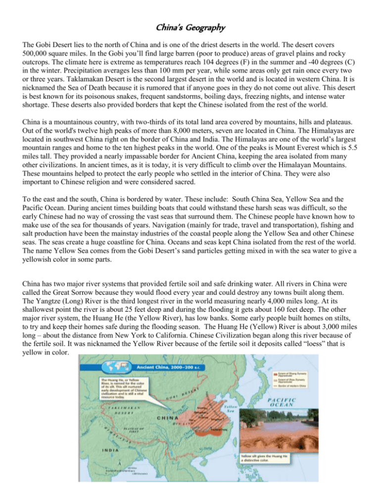
China’s Geography The Gobi Desert lies to the north of China and is one of the driest deserts in the world. The desert covers 500,000 square miles. In the Gobi you’ll find large barren (poor to produce) areas of gravel plains and rocky outcrops. The climate here is extreme as temperatures reach 104 degrees (F) in the summer and -40 degrees (C) in the winter. Precipitation averages less than 100 mm per year, while some areas only get rain once every two or three years. Taklamakan Desert is the second largest desert in the world and is located in western China. It is nicknamed the Sea of Death because it is rumored that if anyone goes in they do not come out alive. This desert is best known for its poisonous snakes, frequent sandstorms, boiling days, freezing nights, and intense water shortage. These deserts also provided borders that kept the Chinese isolated from the rest of the world. China is a mountainous country, with two-thirds of its total land area covered by mountains, hills and plateaus. Out of the world's twelve high peaks of more than 8,000 meters, seven are located in China. The Himalayas are located in southwest China right on the border of China and India. The Himalayas are one of the world’s largest mountain ranges and home to the ten highest peaks in the world. One of the peaks is Mount Everest which is 5.5 miles tall. They provided a nearly impassable border for Ancient China, keeping the area isolated from many other civilizations. In ancient times, as it is today, it is very difficult to climb over the Himalayan Mountains. These mountains helped to protect the early people who settled in the interior of China. They were also important to Chinese religion and were considered sacred. To the east and the south, China is bordered by water. These include: South China Sea, Yellow Sea and the Pacific Ocean. During ancient times building boats that could withstand these harsh seas was difficult, so the early Chinese had no way of crossing the vast seas that surround them. The Chinese people have known how to make use of the sea for thousands of years. Navigation (mainly for trade, travel and transportation), fishing and salt production have been the mainstay industries of the coastal people along the Yellow Sea and other Chinese seas. The seas create a huge coastline for China. Oceans and seas kept China isolated from the rest of the world. The name Yellow Sea comes from the Gobi Desert’s sand particles getting mixed in with the sea water to give a yellowish color in some parts. China has two major river systems that provided fertile soil and safe drinking water. All rivers in China were called the Great Sorrow because they would flood every year and could destroy any towns built along them. The Yangtze (Long) River is the third longest river in the world measuring nearly 4,000 miles long. At its shallowest point the river is about 25 feet deep and during the flooding it gets about 160 feet deep. The other major river system, the Huang He (the Yellow River), has low banks. Some early people built homes on stilts, to try and keep their homes safe during the flooding season. The Huang He (Yellow) River is about 3,000 miles long – about the distance from New York to California. Chinese Civilization began along this river because of the fertile soil. It was nicknamed the Yellow River because of the fertile soil it deposits called “loess” that is yellow in color.
