Continental and Maritime Environments
advertisement
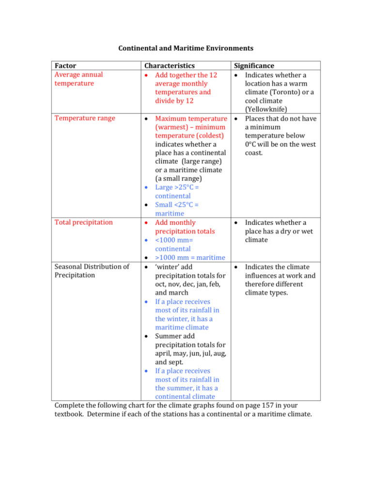
Continental and Maritime Environments Factor Average annual temperature Characteristics Add together the 12 average monthly temperatures and divide by 12 Significance Indicates whether a location has a warm climate (Toronto) or a cool climate (Yellowknife) Temperature range Maximum temperature Places that do not have (warmest) – minimum a minimum temperature (coldest) temperature below indicates whether a 0°C will be on the west place has a continental coast. climate (large range) or a maritime climate (a small range) Large >25°C = continental Small <25°C = maritime Total precipitation Add monthly Indicates whether a precipitation totals place has a dry or wet climate <1000 mm= continental >1000 mm = maritime Seasonal Distribution of ‘winter’ add Indicates the climate Precipitation precipitation totals for influences at work and oct, nov, dec, jan, feb, therefore different and march climate types. If a place receives most of its rainfall in the winter, it has a maritime climate Summer add precipitation totals for april, may, jun, jul, aug, and sept. If a place receives most of its rainfall in the summer, it has a continental climate Complete the following chart for the climate graphs found on page 157 in your textbook. Determine if each of the stations has a continental or a maritime climate.

