Para el 20 de febrero 2013 - Haverford Township School District
advertisement
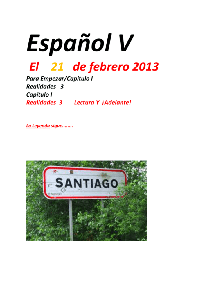
Español V El 21 de febrero 2013 Para Empezar/Capítulo I Realidades 3 Capítulo I Realidades 3 Lectura Y ¡Adelante! La Leyenda sigue........ Español V El 21 de febrero 2013 Para Empezar/Capítulo I Realidades 3 Capítulo I META: Realidades 3 Capítulo I 1. Repaso de LA LEYENDA en español – en Inglés 2. El Camino de Santiago ¡Adelante! Repasos y 3. Repaso de a. La civilización azteca b. La conquista de Mexico c. Periodo colonial - El Porfiriato d. La revolución mexicana y la cultura indígena Correcciones. 3. Página 42 Realidades 3 El IMPERFECTO Realidades 3 Pagina 42 1. era 2. tenía 3. íbamos 4. leía o sacaba 5. leía o sacaba 6. pedían 7. molestaba 8. devolvían 9. enojaba 10. eran El Repaso del IMPERFECTO! The imperfect tense is used to describe actions that happened past. repeatedly in the The imperfect tense is used to describe repeated/habitual actions in the past. -Something that was happening, something that used to happend or something that happend a lot (more than once). Jugar Jugaba Jugabas Jugaba Jugábamos Jugabais Jugaban Hacer Vivir Hacía Hacías Hacía Hacíamos Hacíais Hacían Vivía Vivías Vivía Vivíamos Vivíais Vivían Imperfect Tense Irregular verbs Ir Ser Iba Ibas Iba Íbamos Ibais Iban Era Eras Era Éramos Erais Eran Ver Veía Veías Veía Veíamos Veíais Veían TAREA: Tenochtitlán, the ancient capital of the Aztec Empire, is also known as Temixtitán or Temistitlán. As a powerful city, it had to conquer the surrounding altepetls or Water Mountains with about 500,000 settle man during its peak until 1521, when the Spanish conquers, commanded by Hernán Cortés, got to subjugate it. The city was found as a part of Lacustrine System of the Mexican Basin, into an artificially made islet in the Texcoco Lake with hydraulic work and artificial lands called chinampas, gardens in rectangular plots divided by canals. Basically, Tenochtitlán was ruled by a tlatoani, who was a post held for life and its social structure was classified by social classes; the nobles were the most privileged including the army people, traders and priests; while the low class were the artisans, low-range army, common people, carriers and slaves. During its peak, Tenochtitlán covered about 13 square kilometres at the west of the shallow Lake Texcoco. By the time when the Spanish arrived, they comprised Tenochtitlán and Tlatelolco in what is now Mexico City; but initially, Tenochtitlán was connected by causeways leading north, south and west of the city, and interlaced by canals used either on foot or via canoe. The Dike of Nezahualcoyotl, the most important building, was constructed by the ruler Moctezuma I and designed by Nezahualcoyotl himself. This piece of engineering is estimated in between 12 and 16 kilometres of length, used to keep the spring fresh water in the waters around the city. Through two double aqueducts of about 4kilometres long each, the city of Chapultepec was provided with fresh water used mainly for cleaning and washing, because most of the populations liked to take a bath twice a day, using the root of copalxocotl as soap and the root of maguey as washing soap; furthermore, high-class and pregnant woman delighted to take a bath in temazcalli, or sauna bath, which is still used in some Mesoamerican cultures. Besides, for drinking, the city populations preferred the water from the mountain springs. Geographically, Tenochtitlán was divided in four zones, each divided on 20 districts or calpullis, and each was intersected by streets. The most important streets were three; which according to Bernal Díaz del Castillo, were wide enough for ten horses. Furthermore, the calpullis had a specialty in arts and crafts, being able to compete with some other calpullis; the calpullis were separated by transportation channels and wood bridges which, every night, were removed for security. Additionally, each district had an own tiyanquiztli or marketplace, and also a principal market in Tlatelolco, of which when Cortéz saw it, he described as a twice of size building of the city of Sevilla in Spain, with almost 60,000 people trading and buying daily. Tenochtitlán had about 15 public schools, buildings and temples; and the most important into a walled square, the Ceremonial Center. It included also the Main Temple, the Temple of Quetzalcoatl, the Ball Game Court, the Rack of Skulls or Tzompantli, The Temple of the Sun, The Gladiatorial Sacrifice Platforms, and minor temples. In the outside, there were the Palace of Moctezuma with 100 rooms with its own bath, constructed for ambassadors and lords of either conquered people or allies. In conclusion, the city was distributed in a fabulous symmetry approved by the city planner. Despite of the destruction of the Spanish conquer Cortés all over the city, nowadays is able to see some of the ruins founded in the 1970’s during the construction of the Mexican metro-line. This construction was part of the Main Temple or Templo Mayor. On October 12, 1987 the construction of the Museum of the Main Temple was inaugurated and opened to the public, just three blocks from the Zócalo o Plaza de la Constitución. Here, the ruins are visible walking through the runways surrounding the archaeological complex; however, some parts are covered from the sun in order to protect the mural paintings over some walls. The way to visit the museum is taking the Line 2 in the Mexican Metro Line at the station, and it is open to the public from Tuesday to Saturday from 9am to 5pm for tourists; and Sundays is open with free entrance for Mexican people and residents. History As a capital of the Aztec civilization, Tenochtitlán was formed by Mexica people founded in 1325. According to the Tira de la Peregrinación and the Mexican mythology, the Aztecs leaved Aztlán commanded by its ruler Tenoch, who had the assignment of Huitzilopochtli of found the empire only in the place where an eagle had to be on the top of a cactus eating a serpent. Scale Model of Tenochtitlán The Aztecs found the city over the principal islands of Tenochtitlán and Tlatelolco, as same as over Mixiuhca, Tultenco, Zoquiapan, Temascaltitlan and Iliaca; joining all of them through chinampa systems during the 15th and 16th centuries. Besides of Aztecs, Tenochtitlán was also habituated by a hidden group of mexicas-tlattelolcas, finally conquered in 1473. In 1376, the settlers of this ancient Aztec city, asked for a ruler being Acamapichtli the first ruler, but about years later, the people asked for another one, being Itzcóatl the one who established Tenochtitlán as an independent city. From 1486, the ruler Ahuitzotl, the city was rebuilt into a style that converted Tenochtitlán in one of the greatest ever in Middle America. When the Spanish conquers arrived in Tenochtitlán on November8, 1519 commanded by Hernán Cortés, the city was one of the largest in the world; for some Spaniards the city was the biggest that they had ever seen. Apparently, it is estimate that there were over 200,000 people living on this land of about 13 square kilometres. Finally, Cortés and his man conquered the city on August 13, 1521, after a siege that lasted months in which much of the city was destroyed starting the Fall of Tenochtitlán Mēxihco Tenōchtitlān México-Tenochtitlan 1325–1521 Escudo Capital Tenochtitlan Gobierno Altépetl Período histórico Período Posclásico mesoamericano • Fundación de MéxicoTenochtitlan 1325 • Conquista de México 1521 Gentilicio: Mexica, tenochca México-Tenochtitlan (en náhuatl, MēxíhcoTenochtítlan) fue la capital del imperio Mexica.1 La fundación de la ciudad es un hecho cuya historia se mezcla con la leyenda. La mayoría de las fuentes cita como fecha de fundación de la ciudad el 18 de julio de 1325, de acuerdo con la información proporcionada por los mexicas y que se encuentra registrada en varios documentos. La leyenda de la fundación señala que México-Tenochtitlan fue poblada por un grupo de tribus nahuas migrantes desde Aztlán, lugar cuya ubicación precisa se desconoce. Tras merodear por las inmediaciones del lago de Texcoco, los futuros mexicas se asentaron en diversos puntos de la cuenca de México que estaban sujetos al señorío de Azcapotzalco. La migración concluyó cuando fundaron su ciudad en un islote cercano a la ribera occidental del lago. Las excavaciones arqueológicas apuntan a que el islote de México estuvo habitado desde antes del siglo XIV y que la fundación de Tenochtitlan pudo ser posterior a la de México-Tlatelolco, su "gemela" del norte. México-Tenochtitlan se convirtió en un altépetl independiente tras el establecimiento de una alianza con Texcoco y Tlacopan que derrotó a Azcapotzalco. La capital de los mexicanos se convirtió en una de las mayores ciudades de su época en todo el mundo y fue la cabeza de un poderoso Estado que dominó una gran parte de Mesoamérica. El florecimiento de la ciudad se realizó a costa del tributo pagado por los pueblos sometidos a su poder. Por ello, cuando los españoles llegaron a Mesoamérica, numerosas naciones indígenas se aliaron con ellos con el objetivo de poner fin a la dominación tenochca. Cuauhtémoc —último tlatoani de México-Tenochtitlan— encabezó la resistencia de la ciudad, que cayó el 13 de agosto de 1521 a manos de los españoles y sus aliados indígenas, todos bajo el mando de Hernán Cortés. Cangapol, cacique de los tehuelches, siglo XVIII. Cacique era el que designaba a los jefes de las comunidades taínas de las Antillas. A partir de la expansión colonial española en América, el término fue empleado por los conquistadores para designar a las autoridades políticas indígenas, sin atender a la diversidad de los sistemas políticos de América ni a la nomenclatura autóctona. Son derivados de este término las palabras cacicazgo, caciquismo, cacicato y caciquear. Etimología Algunos historiadores como Charles C. Mann en su obra 1491: New Revelations of the Americas Before Columbus (2005) han objetado el uso del término cacique en lugar de rey para referirse a los monarcas indígenas americanos, aunque sí se utilice para denominar a los caudillos de los llamados pueblos bárbaros de la Historia europea (por ejemplo reyes de los hunos, los francos, y otros.) Uso en castellano Jefes indígenas Kayapó en Brasilia (2005) La utilización en América de la palabra cacique fue activamente promovida por la monarquía española. Una real cédula del 26 de febrero de 1538 insistía en que cualquier autoridad indígena fuera solo llamada "cacique", igualando por esta fórmula desde los más humildes jefes de bandas poco numerosas, hasta los reyes y nobles de los extintos imperios prehispánicos. Se ponía en este documento especial cuidado en prohibir el tratamiento de "señor", que en castellano podía implicar una autoridad efectiva y un trato reverencial, insistiendo al respecto que: "...así convenía a nuestro servicio y preeminencia Real y mandamos a los virreyes y Audiencias que no lo consientan ni permitan y solamente pueden llamarse caciques y principales". Real Cédula de 15381 Pese a que gran cantidad de caciques fueron ejecutados en el fragor de la Conquista, [cita requerida] la institución del cacicazgo, en sus variadas manifestaciones étnicas, sobrevivió durante los siglos coloniales. Y, de hecho, aún subsiste en la actualidad, aunque es más usada, sin embargo, la expresión líder. La figura del cacique no siempre resultaba comprensible para los europeos. Su autoridad era muy relativa en la tradición cultural de algunas etnias. Sus decisiones no eran del todo vinculantes y su autoridad estaba finalmente supeditada a la voluntad de las asambleas indígenas. "... muchas naciones y gentes de indios no sufren reyes ni señores absolutos, sino viven en behetría (...) comunidades, donde se gobiernan por consejo de muchos". Joseph de Acosta2 Existía un método de autogobierno, en que el cacique jugaba un rol conyutural como portavoz, moderador, o tomando decisiones sólo frente a situaciones apremiantes. Esto resultaba especialmente desconcertante para los españoles. España venía saliendo de su propia Guerras de Comuneros, que había finalizado con fuertes ataques oficiales contra toda forma de asambleísmo. Los conquistadores asimilaban la situación de estas tribus a un permanente caos y negligencia del jefe, por lo que entendieron que los caciques, como individualidades, eran prescindibles. Pero pese a todo, dentro del sistema de jerarquías coloniales, la figura del cacique en sí era considerada necesaria. Tanto, de hecho, que existen diversos testimonios que aseguran que durante la Colonia la elección de los caciques de los pueblos de indios fue manipulada por hacendados y curas en numerosas ocasiones. En lo tocante a las elecciones de los caciques y gobernadores de los pueblos de esta Nueva España ha habido y hay grandes confusiones, porque unos suceden en estos cargos por herencia de sus padres y abuelos, y otros por elecciones, y otros porque Moctezuma los ponía por calpisques en los pueblos, y otros ha habido que los encomenderos los ponían y los quitaban a los que venían, y otros nombraban los religiosos (...) Hay otra elección de gobernador en algunos pueblos, que es cargo por sí, diferente del cacique, que tiene cargo del gobierno del pueblo, y éste eligen los indios... Virrey Antonio de Mendoza3 Esta situación ambigua se sumaba a cierto descalabro de las relaciones sociales internas de los grupos indígenas, producto del mestizaje, de la catástrofe demográfica y el desarraigo de las personas que eran enviadas a los nuevos centros de explotación (minas y plantaciones). Como consecuencia de este cuadro, en no pocos casos el cacique fue perdiendo ascendiente sobre su comunidad, que comprendía paulatinamente que la autoridad efectiva era detentada en otras instancias. Cacique mapuche alrededor de 1890. Pasó entonces a ser un concepto aplicado por los españoles a ciertas personalidades de las culturas originarias de América, empleándose con frecuencia de forma equívoca para los hombres que ostentaban mayor poder económico (animales, áreas de cultivo, etc.) y más esposas. El equívoco persistió entre los no especialistas, ya que se suele designar como caciques a los soberanos absolutos de imperios (aztecas, quechuas, taínos, etc.), del mismo modo que a los jefes o líderes de pequeñas poblaciones consideradas 'sin Estado', como por ejemplo los nambikuara. Es así que, vulgarmente, se llama "cacique" a los curacas del Antiguo Perú, a los toki, longko y ülmen de los mapuche, los ruvichá de los guaraníes, etc. [editar] Otros usos En algunos países (por ejemplo Argentina) se usa muchas veces figurativa y peyorativamente la palabra "cacique" para aludir a quienes detentan el poder de "redes clientelares" aunque nada tengan que ver con los pueblos originarios de América. En España se entiende por caciquismo el entramado de relaciones sociales que definían la vida política durante los años de la Restauración borbónica. Como ejemplo digno de consideración tenemos al Conde de Romanones, Presidente del Senado de España, Presidente del Congreso de los Diputados de España, varias veces ministro y tres veces Presidente del Consejo de Ministros bajo el reinado de Alfonso XIII. En Venezuela se usa coloquialmente el refrán "mucho cacique y poco indio" para indicar situaciones en las que varios de los involucrados dan órdenes simultáneamente mientras pocos están dispuestos a acatarlas. En un registro totalmente distinto, en Chile, hoy en día, se utiliza la expresión "caciques" para referirse al equipo de fútbol Colo-Colo. La Leyenda en ESPAÑOL La Leyenda Iztaccíhuatl y Popocatépetl LA LEYENDA 20 febrero 2013 -hoy, 1. al leer y estudiar en español. Al discutir las preguntas de la Página 57 las preguntas. 2. Al leer la versión original Explicaciones e historia del cuentito. Detalles de la historia e comparasiones con la historia y cultura española. 3. ¡Adelante! Página 48ç El Camino de Santiago Al leer y discutir los detalles de la tradición y la cultura en español. Video de El Camino de Santiago Hoy día enla España contemporenea El Iztaccíhuatl y el Popocatépetl La vista que engalana a la ciudad más grande del mundo: la Ciudad de México, está realzada por la majestuosidad de dos de los volcanes más altos del hemisferio, se trata del Popocatépetl y del Iztaccíhuatl. La presencia milenaria de estos enormes volcanes ha sido de gran importancia en las diferentes sociedades que los han admirado y venerado, siendo fuente de inspiración de múltiples leyendas sobre su origen y creación. Entre ellas las más conocidas son dos que a continuación relataremos. Hace ya miles de años, cuando el Imperio Azteca estaba en su esplendor y dominaba el Valle de México, como práctica común sometían a los pueblos vecinos, requiriéndoles un tributo obligatorio. Fue entonces cuando el cacique de los Tlaxcaltecas, acérrimos enemigos de los Aztecas, cansado de esta terrible opresión, decidió luchar por la libertad de su pueblo. El cacique tenía una hija, llamada Iztaccíhuatl, era la princesa más bella y depositó su amor en el joven Popocatépetl, uno de los más apuestos guerreros de su pueblo. Ambos se profesaban un inmenso amor, por lo que antes de partir a la guerra, Popocatépetl pidió al cacique la mano de la princesa Iztaccíhuatl. El padre accedió gustoso y prometió recibirlo con una gran celebración para darle la mano de su hija si regresaba victorioso de la batalla. El valiente guerrero aceptó, se preparó para partir y guardó en su corazón la promesa de que la princesa lo esperaría para consumar su amor. Al poco tiempo, un rival de amores de Popocatépetl, celoso del amor de ambos se profesaban, le dijo a la princesa Iztaccíhuatl que su amado había muerto durante el combate. Abatida por la tristeza y sin saber que todo era mentira, la princesa murió. Tiempo después, Popocatépetl regresó victorioso a su pueblo, con la esperanza de ver a su amada. A su llegada, recibió la terrible noticia sobre el fallecimiento de la princesa Iztaccíhuatl. Entristecido con la noticia, vagó por las calles durante varios días y noches, hasta que decidió hacer algo para honrar su amor y que el recuerdo de la princesa permaneciera en la memoria de los pueblos. Mandó construir una gran tumba ante el Sol, amontonando 10 cerros para formar una enorme montaña. Tomó entre sus brazos el cuerpo de su princesa, lo llevó a la cima y lo recostó inerte sobre la gran montaña. El joven guerrero le dio un beso póstumo, tomó una antorcha humeante y se arrodilló frente a su amada, para velar así, su sueño eterno. Desde aquel entonces permanecen juntos, uno frente a otro. Con el tiempo la nieve cubrió sus cuerpos, convirtiéndose en dos enormes volcanes que seguirán así hasta el final del mundo. La leyenda añade, que cuando el guerrero Popocatépetl se acuerda de su amada, su corazón que guarda el fuego de la pasión eterna, tiembla y su antorcha echa humo. Por ello hasta hoy en día, el volcán Popocatépetl continúa arrojando fumarolas. En cuanto al cobarde tlaxcalteca que mintió a Iztaccíhuatl, presa del arrepentimiento por la tragedia que desencadenó, fue a morir muy cerca de su tierra. También se convirtió en montaña, el Pico de Orizaba, otro de los volcanes de la región, y desde muy lejos, vigila el sueño eterno de los amantes que ya nunca se podrán separar. Esta leyenda ha pasado de generación en generación desde la época del Imperio Azteca, cuyo florecimiento data del siglo XIV, y la importancia que se les daba era evidente ya que desde ese tiempo que les otorgó los nombres que actualmente poseen. Popocatépetl deriva su nombre del verbo náhuatl “popoa” que significa “humo” y del sustantivo “tepetl”, que quiere decir “cerro”, así que su nombre significa literalmente “Cerro que Humea”, debido a que desde esa época emanaba ya, su tan característica fumarola. Popularmente es conocido como “El Popo”, aunque las poblaciones asentadas en sus faldas lo conocen con el cariñoso mote de “Don Goyo”. Iztaccíhuatl, el otro volcán, deriva su nombre de los vocablos nahuátl “iztac”, que significa “blanco” y “cíahuatl” que se interpreta como“mujer”, por lo que su nombre se traduce como “Mujer Blanca”. Actualmente es mejor conocida como la “Mujer Dormida” debido a su característico perfil que asemeja a una mujer recostada con la cara hacia el cielo. El Popocatépetl es un volcán activo con una edad aproximada de 730,000 años. Tiene forma cónica simétrica y una altura máxima de 5,450 metros sobre el nivel del mar, lo que lo coloca como el segundo más alto de México. Está unido en su parte norte con el Iztaccíhuatl, mediante un paso montañoso conocido como Paso de Cortés, nombre que hace referencia a la ruta que siguió Hernán Cortés por ese lugar, antes de llegar a la Gran Tenochtitlán. El Iztaccíhuatl es un volcán extinto ubicado en el centro de México. Es la tercera montaña más alta del país con una altitud de 5,220 metros sobre el nivel del mar y ambas se localizan en los límites territoriales de los estados de México y Puebla. Actualmente ambos volcanes aun son gran inspiración de expresiones artísticas y literarias, que seguramente pasarán a la posteridad como esta gran leyenda. fin Mini-lección 12-15 minutos en casa Home Journal! En el cuaderno en casa. TAREA Tarea esta noche- En Realidades 3 Lean Uds. Para Páginas 54 y 57 el 20 de febrero 2013 Escrito por maquina- Ustedes necesitan presentar una conclusón diferente del cuento del libro o del cuento del sitio de web. Para el viernes. El 22 de febrero 2013. Páginas 54 – 56 ¡ADELANTE! AHORA ¡ Lean Uds. y estudien Uds. ! Realidades 3 Página 48 - Página 49 ¡ADELANTE! El Camino de Santiago página Camino de Santiago Compostela Peregrinación El Camino de Santiago de Compostela es una red de rutas o caminos por toda España y Europa. Desde distintos orígenes, todas las ramas de El Camino de Santiago llegan a Santiago de Compostela, en Galicia, al noroeste de España. El Camino de Santiago tiene su origen en las peregrinaciones medievales hasta la tumba del apóstol Santiago que, según la tradición, se encuentra en la catedral de Santiago de Compostela. En nuestros días, decenas de miles de peregrinos caminan o pedalean El Camino de Santiago cada año en un viaje épico de casi 800 km. Gente de todo el mundo con todo tipo de motivaciones: deporte, cultura, religión, naturaleza, aventura, etc., hacen El Camino de Santiago, o partes de él, en una experiencia única en la vida. El Camino de Santiago ha sido declarado Patrimonio de la Humanidad por la UNESCO y Primer Itinerario Cultural Europeo. Las principales rutas de El Camino de Santiago son: - El Camino de Santiago Francés que va desde el lado francés de los Pirineos a través del interior del norte peninsular (Navarra, La Rioja, Castilla y León y Galicia) hasta Santiago de Compostela. Esta es la ruta más famosa y seguida de El Camino de Santiago. - El Camino de Santiago del Norte o Ruta de la Costa que va desde el País Vasco siguiendo la costa norte española al lado de las montañas de Asturias hasta Santiago de Compostela. Tiene los más impresionantes paisajes y no concentra masas tan grandes como el Camino Francés. - La Vía de la Plata que empieza en Sevilla, en Andalucía, y sigue una antigua calzada romana a través de Extremadura y Castilla-León uniéndose con el Camino Francés en el último tramo. - El Camino de Santiago Primitivo que desde Oviedo cruza los Picos de Asturias occidentales. - El Camino de Santiago Portugués que llega a Santiago de Compostela proveniente de la ciudad portuguesa de Oporto. Este sitio web incluye los aspectos generales para planear la peregrinación a lo largo de El Camino de Santiago y provee información y consejos para los futuros peregrinos. Nos centramos especialmente en El Camino de Santiago francés y también un poco en El Camino de Santiago del norte por ser éstos los más populares pero esperamos añadir más información de las otras rutas de El Camino de Santiago en el futuro. El Camino de Santiago, una larga tradición Durante siglos y siglos, desde los comienzos de la era Cristiana, muchos han sido los peregrinos que han seguido los pasos de Santiago cruzando todo el norte de la península Ibérica hasta Santiago de Compostela y aún continúan haciéndolo. El Camino de Santiago es sinónimo de cultura, deporte, religión, naturaleza, tradición, reto, paz pero sobre todo tiene un significado de libertad. A lo largo de la historia numerosos emperadores como Carlomagno, papas como Calixtus II, reyes como Alfonso II, valerosos caballeros como “El Cid” o los Caballeros Templarios, nobles, miles de monjes, curas, campesinos, vagabundos y pillastres, viajeros, sanos y enfermos, ciegos, cojos, ricos y mendigos; todos ellos han sido peregrinos en el Camino de Santiago y todos ellos recibían los mismos honores porque nadie podía saber si el peregrino sucio, cansado y lleno de ampollas que acababa de llegar al pueblo justo antes del anochecer era un rey, un obispo, o un mendigo. Todo ellos eran, y son, peregrinos siempre buscando nuevos horizontes, siempre aportando nuevas ideas. Así pues, el Camino de Santiago es un camino sin prejuicios. Un día en el Camino de Santiago En El Camino de Santiago los peregrinos siguen el Sol durante el día, de Este a Oeste y La Vía Lactea durante la noche. Parten al amanecer y siguen el Sol hacia el oeste caminando a través de campos dorados o cruzando coloridas y sonoras montañas. El Camino de Santiago es una nueva vida donde se tiene la oportunidad de llegar a ser uno mismo. Es un retorno a lo más básico de la naturaleza humana donde se puede prestar atención a esas cosas pequeñas que siempre despreciamos en nuestras vidas tan ocupadas. Te levantas y admiras el día, te sientes en contacto con la madre Tierra, respiras y te observas, observas tu entorno y la gente a tu alrededor. Entonces comienzas a caminar y puedes pensar. En el Camino de Santiago te encuentras con otros y los escuchas realmente y sientes una conexión con ellos, no son extraños. Te sientes hambriento y piensas cómo y dónde comerás: debajo de un árbol, al lado de un arroyo o en el próximo pueblo que encuentres. Probablemente ya tienes en tu bolsillo algunos higos de una higuera que encontraste al lado del camino o algunas almendras, queso o dulce vino que algún paisano te ofreció sin pedir nada a cambio. A pesar de estar cansado te sientes sano y fuerte porque el Sol te da fuerzas. Continuas disfrutando el día y la Naturaleza y observando todo lo que sucede a tu alrededor. Si desafortunadamente algún coche pasa cerca tuyo te alarmas porque tú ahora estás caminando y puedes ver el mundo a tu ritmo natural y sólo la visión de una máquina tan rápida, ruidosa y contaminante es amenazadora. Entonces piensas: ¿Para qué sirven? Atardece, es la puesta de Sol. Es tiempo para relajarse y disfrutar de una buena cena. En el Camino de Santiago puedes elegir donde dormirás: ¿en el próximo pueblo? ¿en el pequeño albergue disfrutando una cena de platos y vino locales y acompañado de hospitaleros y demás pelegrinos?¿o quizás bajo las estrellas en la cálida noche? (sólo piensa cómo de a menudo tendrías estas posibilidades en tu vida normal). Y el siguiente día el ciclo empieza de nuevo. Elegirás lo lejos que quieres caminar, elegirás tu ruta, elegirás cuando parar para observar lo que te llame la atención, sin prisas. Ésta es la libertad del Camino de Santiago, la oportunidad de ser tú mismo, la oportunidad de prestar atención a las cosas importantes. No hay competición sino una comunión con la Naturaleza y los demás seres. Una vez que te has dejado seducir por el encanto del Camino de Santiago no sabrás si llevas allí solo unos días o varios años. Fin Referencias para LA LEYENDA Teotihuacan Country Mexico Type Cultural Criteria I, II, III, IV, VI Reference 414 UNESCO region North America Inscription history Inscription 1987 (11th Session) The view from the Pyramid of the Sun Teotihuacan (pronounced /ˈtɛɔˌtiwɑˈkɑn/),[1] also written Teotihuacán, is an enormous archaeological site in the Basin of Mexico, 30 miles (48 km) northeast of Mexico City, containing some of the largest pyramidal structures built in the pre-Columbian Americas. The name means "where man met the gods." Apart from the pyramidal structures, Teotihuacan is also known for its large residential complexes, the Avenue of the Dead, and numerous colorful, well-preserved murals. Additionally, Teotihuacan produced a thin orange pottery style that spread through Mesoamerica.[2] The city is thought to have been established around 100 BC and continued to be built until about 250 AD.[3] The city may have lasted until sometime between the 7th and 8th centuries AD. At its zenith, perhaps in the first half of the 1st millennium AD, Teotihuacan was the largest city in the pre-Columbian Americas, with a population of perhaps 125,000 or more,[3][4] placing it among the largest cities of the world in this period.[5] Teotihuacan began as a new religious center in the Mexican Highland around the first century AD. This city came to be the largest and most populated center in the New World. Teotihuacan was even home to multi-floor apartment compounds built to accommodate this large population.[3] The civilization and cultural complex associated with the site is also referred to as Teotihuacan or Teotihuacano. Although it is a subject of debate whether Teotihuacan was the center of a state empire, its influence throughout Mesoamerica is well documented; evidence of Teotihuacano presence can be seen at numerous sites in Veracruz and the Maya region. The Aztecs may have been influenced by this city. The ethnicity of the inhabitants of Teotihuacan is also a subject of debate. Possible candidates are the Nahua, Otomi or Totonac ethnic groups. Scholars have also suggested that Teotihuacan was a multiethnic state. The city and the archaeological site are located in what is now the San Juan Teotihuacán municipality in the State of México, approximately 40 kilometres (25 mi) northeast of Mexico City. The site covers a total surface area of 83 square kilometres (32 sq mi) and was designated a UNESCO World Heritage Site in 1987. It is the most visited archaeological site in Mexico. Name The name Teōtīhuacān was given by the Nahuatl-speaking Aztec centuries after the fall of the city. The term has been glossed as "birthplace of the gods", reflecting Nahua creation myths that were said to occur in Teotihuacan. Teotihuacān is a Nahuatl (Aztec) name meaning "place where gods were born".[6] Nahuatl scholar Thelma D. Sullivan interprets the name as "place of those who have the road of the gods."[7] This is because the Aztecs believed that the gods created the universe at that site. The name is pronounced Nahuatl pronunciation: [te.oːtiːˈwakaːn] in Nahuatl, with the accent on the syllable wa. By normal Nahuatl orthographic conventions, a written accent would not appear in that position. Both this pronunciation and Spanish Spanish pronunciation: [te.otiwaˈkan] are used, and both spellings appear in this article. The original name of the city is unknown, but it appears in hieroglyphic texts from the Maya region as puh, or "Place of Reeds".[8] This suggests that the Maya of the Classic period understood Teotihuacan as a Place of Reeds similar to other Postclassic Central Mexican settlements that took the name Tollan, such as Tula-Hidalgo and Cholula. This naming convention led to much confusion in the early 20th century, as scholars debated whether Teotihuacan or Tula-Hidalgo was the Tollan described by 16th–century chronicles. It now seems clear that Tollan may be understood as a generic Nahua term applied to any large settlement. In the Mesoamerican concept of urbanism, Tollan and other language equivalents serve as a metaphor, linking the bundles of reeds and rushes that formed part of the lacustrine environment of the Valley of Mexico and the large gathering of people in a city.[9] Teotihuacan and other important Classic Era settlements History Origins and foundation The early history of Teotihuacan is quite mysterious, and the origin of its founders is unsure. For many years, archaeologists believed it was built by the Toltec. This belief was based on colonial period texts, such as the Florentine Codex, which attributed the site to the Toltecs. However, the Nahuatl word "Toltec" generally means "craftsman of the highest level" and may not always refer to the Toltec civilization centered at Tula, Hidalgo. Since Toltec civilization flourished centuries after Teotihuacan, the people could not have been the city's founders. In the Late Formative time, a number of urban centers arose in central Mexico. The most prominent of these appears to have been Cuicuilco, on the southern shore of Lake Texcoco. Scholars have speculated that the eruption of the Xitle volcano may have prompted a mass emigration out of the central valley and into the Teotihuacan valley. These settlers may have founded and/or accelerated the growth of Teotihuacan. Other scholars have put forth the Totonac people as the founders of Teotihuacan. There is evidence that at least some of the people living in Teotihuacan immigrated from those areas influenced by the Teotihuacano civilization, including the Zapotec, Mixtec and Maya peoples. The builders of Teotihuacan took advantage of the geography in the Basin of Mexico. From the swampy ground, they constructed raised beds, called chinampas. This allowed for the formation of channels, and subsequently canoe traffic to transport food from farms around the city. The earliest buildings at Teotihuacan date to about 200 BC. The largest pyramid, the Pyramid of the Sun, was completed by 100 AD.] Zenith The city reached its peak in 450 AD, when it was the center of a powerful culture whose influence extended through much of the Mesoamerican region. At its peak, the city covered over 30 km² (over 11½ square miles), and perhaps housed a population of 150,000 people, with one estimate reaching as high as 250,000.[11] Various districts in the city housed people from across the Teotihuacano region of influence, which spread south as far as Guatemala. Notably absent from the city are fortifications and military structures. Platform along the Avenue of the Dead showing the talud-tablero architectural style Restored partion of Teotihucan architecture showing the typical Mesoamerican use of red paint complemented on gold and jade decoration upon marble and granite. The nature of political and cultural interactions between Teotihuacan and the centers of the Maya region (as well as elsewhere in Mesoamerica) has been a long-standing and significant area for debate. Substantial exchange and interaction occurred over the centuries from the Terminal Preclassic to the Mid-Classic period. "Teotihuacan-inspired ideologies" and motifs persisted at Maya centers into the Late Classic, long after Teotihuacan itself had declined.[12] However, scholars debate the extent and degree of Teotihuacano influence. Some believe that it had direct and militaristic dominance; others that adoption of "foreign" traits was part of a selective, conscious and bi-directional cultural diffusion. New discoveries have suggested that Teotihuacan was not much different in its interactions with other centers from the later empires, such as the Toltec and Aztec.[13][14] It is believed that Teotihuacan had a major influence on the Preclassic and Classic Maya, most likely by conquering several Maya centers and regions, including Tikal and the region of Peten, and influencing Maya culture. Architectural styles prominent at Teotihuacan are found widely dispersed at a number of distant Mesoamerican sites, which some researchers have interpreted as evidence for Teotihuacan's far-reaching interactions and political or militaristic dominance.[15] A style particularly associated with Teotihuacan is known as talud-tablero, in which an inwards-sloping external side of a structure (talud) is surmounted by a rectangular panel (tablero). Variants of the generic style are found in a number of Maya region sites, including Tikal, Kaminaljuyu, Copan, Becan, and Oxkintok, and particularly in the Petén Basin and the central Guatemalan highlands.[16] The talud-tablero style pre-dates its earliest appearance at Teotihuacan in the Early Classic period; it appears to have originated in the Tlaxcala-Puebla region during the Preclassic.[17] Analyses have traced the development into local variants of the talud-tablero style at sites such as Tikal, where its use precedes the 5th-century appearance of iconographic motifs shared with Teotihuacan. The talud-tablero style disseminated through Mesoamerica generally from the end of the Preclassic period, and not specifically, or only, via Teotihuacano influence. It is unclear how or from where the style spread into the Maya region.[18] The city was a center of industry, home to many potters, jewelers and craftsmen. Teotihuacan is known for producing a great number of obsidian artifacts. No ancient Teotihuacano non-ideographic texts are known to exist (or known to have existed). Inscriptions from Maya cities show that Teotihuacan nobility traveled to, and perhaps conquered, local rulers as far away as Honduras. Maya inscriptions note an individual nicknamed by scholars as "Spearthrower Owl", apparently ruler of Teotihuacan, who reigned for over 60 years and installed his relatives as rulers of Tikal and Uaxactun in Guatemala. Teotihuacán-style mask, Classical period. Walters Art Museum. Scholars have based interpretations about the culture at Teotihuacan on archaeology, the murals that adorn the site (and others, like the Wagner Murals, found in private collections), and hieroglyphic inscriptions made by the Maya describing their encounters with Teotihuacano conquerors. The creation of murals, perhaps tens of thousands of murals, reached its height between 450 and 650 AD. The painters' artistry was unrivaled in Mesoamerica. It has been compared with those of painters in Renaissance Florence, Italy. Toltec An expressive orange-ware clay vessel in the Toltec style, from the American Museum of Natural History collection. The Toltec culture is an archaeological Mesoamerican culture that dominated a state centered in Tula, in the early post-classic period of Mesoamerican chronology (ca 800-1000 CE). The later Aztec culture saw the Toltecs as their intellectual and cultural predecessors and described Toltec culture emanating from Tōllān ['toːlːaːn] (Nahuatl for Tula) as the epitome of civilization, indeed in the Nahuatl language the word "Tōltēcatl" [toːl'teːkat͡ɬ] (singular) or "Tōltēcah" [toːl'teːkaʔ] (plural) came to take on the meaning "artisan". The Aztec oral and pictographic tradition also described the history of the Toltec empire giving lists of rulers and their exploits. Among modern scholars it is a matter of debate whether the Aztec narratives of Toltec history should be given credence as descriptions of actual historical events. While all scholars acknowledge that there is a large mythological part of the narrative some maintain that by using a critical comparative method some level of historicity can be salvaged from the sources, whereas others maintain that continued analysis of the narratives as sources of actual history is futile and hinders access to actual knowledge of the culture of Tula, Hidalgo. Other controversies relating to the Toltecs include how best to understand the reasons behind the perceived similarities in architecture and iconography between the archaeological site of Tula and the Mayan site of Chichén Itzá. No consensus has yet emerged about the degree or direction of influence between these two sites. Toltec pyramid at Tula, Hidalgo Some archaeologists such as Richard Diehl, argue for the existence of a Toltec archaeological horizon characterized by certain stylistic traits associated with Tula, Hidalgo and extending to other cultures and polities in Mesoamerica. Traits associated with this horizon are: The MixtecaPuebla style of iconography, Tohil plumbate ceramic ware and Silho or X-Fine Orange Ware ceramics.[1] The presence of stylistic traits associated with Tula in Chichén Itzá is also taken as evidence for a Toltec horizon. Especially the nature of interaction between Tula and Chichén Itzá has been controversial with Scholars arguing for either military conquest of Chichén Itzá by Toltecs, Chichén Itzá establishing Tula as a colony or only loose connections between the two. The existence of any meaning of the Mixteca-Puebla art style has also been questioned.[2] A contrary viewpoint is argued in a 2003 study by Michael E. Smith and Lisa Montiel who compare the archaeological record related to Tula Hidalgo to those of the polities centered in Teotihuacan and Tenochtitlan. They conclude that relative to the influence exerted in Mesoamerica by Teotihuacan and Tenochtitlan, Tula's influence on other cultures was negligible and was probably not deserving of being defined as an empire, but more of a kingdom. While Tula does have the urban complexity expected of an imperial capital its influence and dominance was not very far reaching. Evidence for Tula's participance in extensive trade networks has been uncovered, for example the remains of a large obsidian workshop.[3] A map of the layout of the archaeological site of Tula, Hidalgo Stucco relief at Tula, Hidalgo depicting Coyotes, Jaguars and Eagles feasting on human hearts. Carved relief of a Jaguar at Tula, Hidalgo Depiction of an anthropomorphic bird-snake deity, probably Quetzalcoatl at the Temple of Tlahuizcalpantecuhtli at Tula, Hidalgo View of the Columns of the Burned Palace at Tula Hidalgo, the second Ballcourt is in the background Toltec warriors represented by the famous Atlantean figures in Tula. The debate about the nature of the Toltec culture goes back to the late 19th century. Mesoamericanist scholars such as Veitia, Manuel Orozco y Berra, Charles Etienne Brasseur de Bourbourg, Francisco Clavigero all read the Aztec chronicles and believed them to be realistic historic descriptions of pan-Mesoamerican empire based at Tula, Hidalgo. This historicist view was first challenged by Daniel Garrison Brinton who argued that the "Toltecs" as described in the Aztec sources were merely one of several Nahuatl speaking city-states in the postclassic period, and not a particularly influential one at that. He attributed the Aztec view of the Toltecs to the "tendency of the human mind to glorify the good old days", and the confounding of the place of Tollan with the myth of the struggle between Quetzalcoatl and Tezcatlipoca.[4] Désiré Charnay, the first archaeologist to work at Tula, Hidalgo, defended the historicist views based on his impression of the Toltec capital, and was the first to note similarities in architectural styles between Tula and Chichén Itza. This led him to posit the theory that Chichén Itzá had been violently taken over by a Toltec military force under the leadership of Kukulcan.[5][6] Following Charnay the term Toltec has since been associated with the influx of certain Central Mexican cultural traits into the Mayan sphere of dominance that took place in the late classic and early Postclassic periods; the Postclassic Mayan civilizations of Chichén Itzá, Mayapán and the Guatemalan highlands have been referred to as "Toltecized" or "Mexicanized" Mayas. The historicist school of thought persisted well in to the 20th century, represented in the works of scholars such as David Carrasco, Miguel León Portilla, Nigel Davies and H. B. Nicholson which all held the Toltecs to have been an actual ethnic group. This school of thought connected the "Toltecs" to the archaeological site of Tula, which was taken to be the Tollan of Aztec myth.[7] This tradition assumes that much of central Mexico was dominated by a "Toltec empire" between the 10th and 12th century CE. The Aztecs referred to several Mexican citystates as Tollan, "Place of Reeds", such as "Tollan Cholollan". Archaeologist Laurette Sejourné, followed by the historian Enrique Florescano, have argued that the "original" Tollan was probably Teotihuacán. Florescano adds that the Mayan sources refer to Chichén Itzá when talking about the mythical place Zuyua (Tollan). Many historicists such as H. B. Nicholson (2001 (1957)) and Nigel Davies (1977) were fully aware that the Aztec chronicles were a mixture of mythical and historical accounts, this led them to try to separate the two by applying a comparative approach to the varying Aztec narratives. For example they seek to discern between the deity Quetzalcoatl and a Toltec ruler often referred to as Topiltzin Ce Acatl Quetzalcoatl Chichimeca Chichimeca Jonaz. Map of Chichimeca nations around 1550 Chichimeca was the name that the Nahua peoples of Mexico generically applied to a wide range of semi-nomadic peoples who inhabited the north of modern-day Mexico and southwestern United States, and carried the same sense as the European term "barbarian". The name was adopted with a pejorative tone by the Spaniards when referring especially to the semi-nomadic hunter-gatherer peoples of northern Mexico. In modern times only one ethnic group is customarily referred to as Chichimecs, namely the Chichimeca Jonaz, although lately this usage is being changed for simply "Jonáz" or their own name for themselves "Úza". Overview and identity The Chichimeca peoples were in fact many different groups with varying ethnic and linguistic affiliations. As the Spaniards worked towards consolidating the rule of New Spain over the Mexican indigenous peoples during the sixteenth and seventeenth centuries, the "Chichimecan tribes" maintained a resistance. A number of ethnic groups of the region allied against the Spanish, and the following military colonization of northern Mexico has become known as the "Chichimeca Wars Many of the peoples called Chichimeca are virtually unknown today; few descriptions mention them and they seem to have been absorbed into mestizo culture or into other indigenous ethnic groups. For example, virtually nothing is known about the peoples referred to as Guachichiles, Caxcanes, Zacatecos, Tecuexes, or Guamares. Others like the Opata or "Eudeve" are well described but extinct as a people.[full citation needed] Other "Chichimec" peoples maintain a separate identity into the present day, for example the Otomies, Chichimeca Jonaz, Coras, Huicholes, Pames, Yaquis, Mayos, O'odham and the Tepehuánes. Word origin The Nahuatl name Chīchīmēcah (plural, pronounced [tʃiːtʃiːˈmeːkaʔ]; singular Chīchīmēcatl) means "inhabitants of Chichiman"; the placename Chichiman itself means "Area of Milk". It is sometimes said to be related to chichi "dog", but the i's in chichi are short while those in Chīchīmēcah are long, a phonemic distinction in Nahuatl.[1] The word "Chichimeca" was originally used by the Nahua to describe their own prehistory as a nomadic hunter-gatherer people and used in contrast to their later, more urban lifestyle, which they identified with the term Toltecatl.[2] In modern Mexico, the word "Chichimeca" can have pejorative connotations such as "primitive", "savage", "uneducated" and "native". without stopping to recover.[3] While las Casas recognized that the Chichimecan tribes spoke different languages he saw their culture as primarily uniform. In 1590, the Franciscan priest Alonso Ponce commented that the Chichimeca had no religion because they did not even worship idols such as the other peoples – in his eyes another symptom of their barbarous nature. The only somewhat nuanced description of the Chichimeca is found in Bernardino de Sahagún's Historia general de las cosas de Nueva España in which some Chichimec people such as the Otomi were described as knowing agriculture, living in settled communities, and having a religion devoted to the worship of the Moon. The image of the Chichimecas as described by the early sources was typical of the era; the natives were "savages" - accomplished at war and hunting, but with no established society or morals, fighting even amongst themselves. This description became even more prevalent over the course of the Chichimec wars as justification for the war (the Chichimec area was not entirely under Spanish control until 1721).[full citation needed] The first description of a modern objective ethnography of the peoples inhabiting La Gran Chichimeca was done by Norwegian naturalist and explorer Carl Sofus Lumholtz in 1890 when he traveled on muleback through northwestern Mexico, meeting the indigenous peoples on friendly terms. With his descriptions of the rich and different cultures of the various "uncivilized" tribes, the picture of the uniform Chichimec barbarians was changed – although in Mexican Spanish the word "Chichimeca" remains connected to an image of "savagery".
