12.520 Problem Set 6a
advertisement
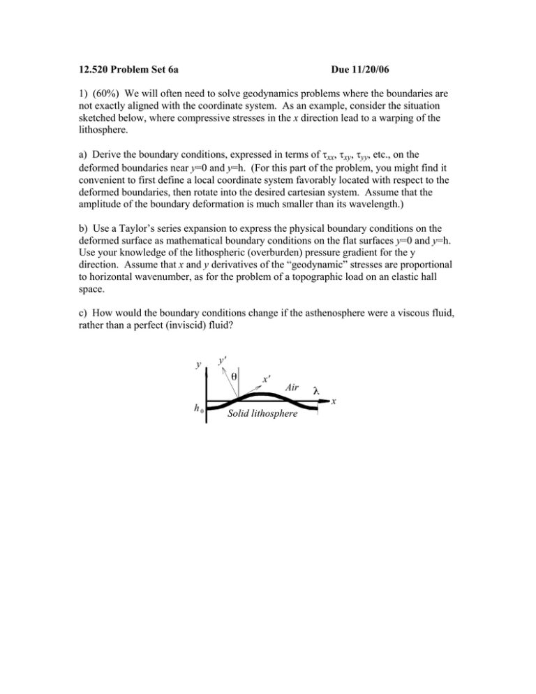
12.520 Problem Set 6a Due 11/20/06 1) (60%) We will often need to solve geodynamics problems where the boundaries are not exactly aligned with the coordinate system. As an example, consider the situation sketched below, where compressive stresses in the x direction lead to a warping of the lithosphere. a) Derive the boundary conditions, expressed in terms of τxx, τxy, τyy, etc., on the deformed boundaries near y=0 and y=h. (For this part of the problem, you might find it convenient to first define a local coordinate system favorably located with respect to the deformed boundaries, then rotate into the desired cartesian system. Assume that the amplitude of the boundary deformation is much smaller than its wavelength.) b) Use a Taylor’s series expansion to express the physical boundary conditions on the deformed surface as mathematical boundary conditions on the flat surfaces y=0 and y=h. Use your knowledge of the lithospheric (overburden) pressure gradient for the y direction. Assume that x and y derivatives of the “geodynamic” stresses are proportional to horizontal wavenumber, as for the problem of a topographic load on an elastic hall space. c) How would the boundary conditions change if the asthenosphere were a viscous fluid, rather than a perfect (inviscid) fluid? y y' x' h0 Air x Solid lithosphere 2) (40%) Consider the problem discussed in lecture, where a surface load due to topography of the form τzz = -ρgh cos (2πx/λ) loads a half space made up of a Poisson solid. h0 h x z topography: h = h0 cos kx h << λ surface load : τ zz = − ρgh = − ρgh0 cos kx a) Calculate the horizontal and vertical displacements at the surface. b) If GPS is capable of measuring displacements to an accuracy of 3 mm, independent of distance, what amplitude of ice sheet thickness variations could cause elastic displacements of the Earth large enough to measure for i) λ=100 km; ii) λ=1,000 km? (Look up or estimate needed parameters.)
