Regulated Land Use Planning
advertisement
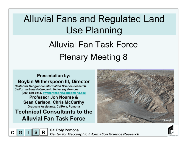
Alluvial Fans and Regulated Land Use Planning Alluvial Fan Task Force Plenary Meeting 8 Presentation by: Boykin Witherspoon III, Director Center for Geographic Information Science Research, California State Polytechnic University Pomona (909) 869-6913, bwitherspoon@csupomona.edu Professor Jon Nourse & Sean Carlson, Chris McCarthy Graduate Assistants, CalPoly, Pomona Technical Consultants to the Alluvial Fan Task Force C G I S R Cal Poly Pomona Center for Geographic Information Science Research Fundamental Issue Why is there a problem? What are these types of ordinances trying to really do? The issue fundamentally comes down to land classification units (LCU’s), the ones that define regulated jurisdictions are different than the ones that define natural processes. Tectonic Elevation Temperature Ecosystem Watershed Sub-basin City County State Country C G I S R Cal Poly Pomona Center for Geographic Information Science Research This is how we Measure hazard This is how we measure Vulnerability, this how most of our ordinances are applied to locations on the ground. Fundamental Issue This is the polygonal geometry we use to assess fan related hazard This is the polygonal and line geometry we use to assess earthquake hazard These are curvilinear land classification units (LCU’s) C G I S R Cal Poly Pomona Center for Geographic Information Science Research Fundamental Issue This is the polygonal geometry we subjectively, self assign as jurisdictions for our ordinances These are rectilinear land classification units (LCU’s) C G I S R Cal Poly Pomona Center for Geographic Information Science Research Fundamental Issue WOW C G I S R Cal Poly Pomona Center for Geographic Information Science Research Fundamental Issue So this LCU pattern is self made by us and represents, well nothing but our collective will. Why do we go with our collective will, against the rules of nature and then mitigate / engineer away a million years of reality? C G I S R And this pattern is created by nature over millions of years and represents the reality of the hazards we face. Cal Poly Pomona Center for Geographic Information Science Research Fundamental Issue What we are suggesting is, “lets change our collective plan view aesthetic of what jurisdictional land class units look like so that that they match reality.” We are working way to hard and spending way to much money engineering and mitigating when we could just be paying more attention to reality. C G I S R Cal Poly Pomona Center for Geographic Information Science Research An Example from Homer Alaska C G I S R Cal Poly Pomona Center for Geographic Information Science Research An Example from Homer Alaska http://www.suitabilitymap.org/ Products and Schedule: This project is scheduled to be completed in August 2008 is divided into three interrelated products: 1. A GIS-based, landscape-level, suitability map will identify core conservation areas to be prioritized for protection, recognize areas highly suitable for development and recognize areas that would benefit from preserving landscape systems in their development. A first rendition to be completed in September 2007. 2. Launch a developer certification program built around the suitability map to train and influence developers (of any size projects) to incorporate landscape systems into their designs. The pilot certification program is tentatively scheduled for June 2008. 3. Identify and incorporate incentives that encourage developers to become certified and reduce the costs associated with best management practice implementation. Ideally, the incentives identified will create situations where the bottom line of any development project will be more profitable. The initial list of possible development guidelines and incentives will be completed in October 2007. C G I S R “Development interests and regulations are built primarily around parcel boundaries, and are therefore not guided by larger landscape patterns. Landscape systems cross parcel boundaries, and as a result, valuable functional and aesthetic qualities are often sacrificed when an individual parcel is developed without regard to these systems. This piecemeal development leads to loss of functional and economic value and creates longterm public expense.” Cal Poly Pomona Center for Geographic Information Science Research An Example from Homer Alaska C G I S R Cal Poly Pomona Center for Geographic Information Science Research AF1 1st we determine the footprint of the fan go halt How do we do that? AF2 AF3 go halt 2nd we determine the location of the fan hazards FH1 5th we use our Geographic Information Science to pull all of the data together and turn it into Land Class Units based on science and reality FH2 FH3 To finish go halt To finish MA1 go 3rd we determine the locations of a bunch of other hazards MH1 Multi MH2 MH3 MH4 MH5 MH6 To finish th 6 we look at what we have done in the past that works and meets multiple objectives and then we use the relationship between reality on the ground and what works to either: Preemptively create a new zoning ordinance To finish MA2 SDT go MB1 To finish MA4 Multi MB2 DC1 MB3 DC2 MB4 Finished Draft model Ordenance MB5 Prelim design and / or draft EIR MB6 4th we find the locations of all the good things about the fan MB7 Eng Mitigati on A. go halt None Multi MA3 finish FM4 ECO1 ECO1 ECO2 B. Or do a design / EIR based on science and reality ECO3 ECO4 ECO4 ECO5 ECO5 ECO6 ECO6 ECO7 ECO7 Draft Feasibility Report C G I S R 7th is to evaluate what we are proposing against protections needed and economic viability. Cal Poly Pomona Center for Geographic Information Science Research May 19, 2000 Raising the Roof, California's Housing Development Projections and Constraints, 1997-2020. MB7 Pro Development model New AFTF tool C G I S R Cal Poly Pomona Center for Geographic Information Science Research Quick look at how the MA1-4 tools work Earthquake shaking potential (California Geological Survey) Map 5.4.1H. Earthquake Hazard Average Raster value score for Shaking Potential PGA C G I S R Cal Poly Pomona Center for Geographic Information Science Research Quick look at how the MA1-4 tools work Map 5.4.1H. Earthquake Hazard Map 5.4.1C. Total/Vulnerable Population Weighted combination Vuln Pop 50% C G I S R Map 5.4.1D. Earthquake Hazard and Total/Vulnerable Population EQ Haz 50% 1 2 3 1 1 2 2 2 2 2 3 3 2 3 3 Cal Poly Pomona Center for Geographic Information Science Research Traditional Minimum Ordinance Administrative Work Flow for Project Review Has the appropriate level of protection been met This workflow represents the minimum method recommended in the draft ordinance beginning with a draft EIR being submitted to the administrator. The AFTF tools are used primarily in a review capacity by a public administrator to create a administrative report to the governing body responsible for approving proposed developments. This line represents the minimum Also part of the 5.1 review C G I S R Cal Poly Pomona Center for Geographic Information Science Research Alluvial Fans and Regulated Land Use Planning Thank You Presentation by: Boykin Witherspoon III, Director Center for Geographic Information Science Research, California State Polytechnic University Pomona (909) 869-6913, bwitherspoon@csupomona.edu Professor Jon Nourse & Sean Carlson, Chris McCarthy Graduate Assistants, CalPoly, Pomona Technical Consultants to the Alluvial Fan Task Force C G I S R Cal Poly Pomona Center for Geographic Information Science Research

