Parts of the water Cycle
advertisement
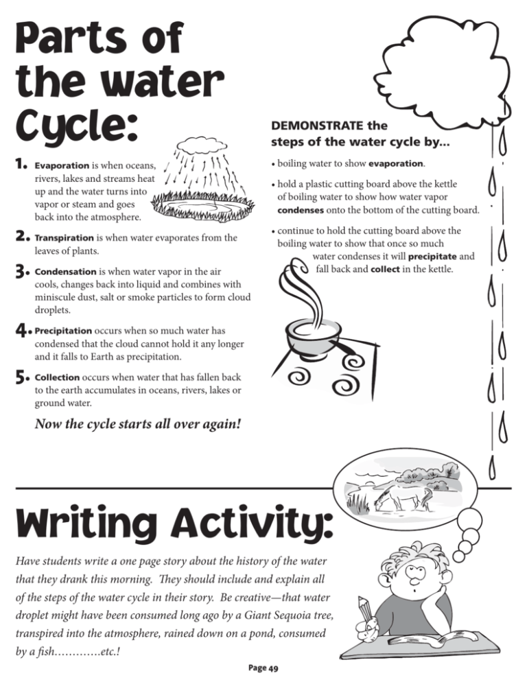
Parts of the water Cycle: DEMONSTRATE the steps of the water cycle by... 1. Evaporation is when oceans, • boiling water to show evaporation. rivers, lakes and streams heat up and the water turns into vapor or steam and goes back into the atmosphere. • hold a plastic cutting board above the kettle of boiling water to show how water vapor condenses onto the bottom of the cutting board. 2. Transpiration is when water evaporates from the • continue to hold the cutting board above the boiling water to show that once so much water condenses it will precipitate and fall back and collect in the kettle. leaves of plants. 3. Condensation is when water vapor in the air cools, changes back into liquid and combines with miniscule dust, salt or smoke particles to form cloud droplets. 4. Precipitation occurs when so much water has condensed that the cloud cannot hold it any longer and it falls to Earth as precipitation. 5. Collection occurs when water that has fallen back to the earth accumulates in oceans, rivers, lakes or ground water. Now the cycle starts all over again! Writing Activity: Have students write a one page story about the history of the water that they drank this morning. They should include and explain all of the steps of the water cycle in their story. Be creative—that water droplet might have been consumed long ago by a Giant Sequoia tree, transpired into the atmosphere, rained down on a pond, consumed by a fish………….etc.! Page 49 Importance of Healthy Forests for California’s Water Supply Forests are very important in the water cycle and to water quality. Trees help hold soil in place and filter out unwanted sediment to keep water clean. They shade creeks and regulate water temperature for the many aquatic species that need clean, cool water. Many different animals live in the forest near water. Otters, beavers, deer, herons, salamanders, snakes, frogs, turtles and many others depend on healthy forest streams and lakes for food, water, homes and protection. Forests are the source of approximately 75% of California’s water supply. For this reason, foresters, hydrologists, geologists, aquatic biologists and many others work together to manage healthy forests and watersheds. and removing accumulated biomass reduces the threat of large, intense wildfires which degrade water quality by decreasing soil permeability, increasing erosion and sediment in streams, and destroying vegetation that shades streams and provides wildlife habitat. 5. Restoration: placement of large woody debris in streams helps to create deep pools needed by fish, improvement of road systems mitigates erosion, keeping sediment out of streams. EXTENSION... • http://ga.water.usgs.gov/edu/ is the USGS Water Science for Schools website. Explore this site as a class by projecting on an LCD display. • Divide the class into small groups and have each group choose a topic from the site to research, for. Example... under the “special topics" link: acid rain, water shortage, ground water quality, etc. What do forest managers do to manage healthy forests and protect water quality and aquatic habitat? 1. 4. Reducing Forest Fuels: harvesting some trees • The groups should create visual aids to present their explanation of the topics to the class. • Invite a forestry professional into your classroom to talk about the relationship between healthy forests and healthy watersheds. Minimize Soil Erosion: while some soil erosion is a natural process, forest managers take precautions and abide by state laws to minimize erosion. Roads and water crossings are engineered by experienced road builders and are maintained and inspected on a regular basis. 2. Buffer Zones: areas of trees/vegetation around water courses are left undisturbed and act to filter out sediment and shade streams to keep them cool for the fish and other organisms living there. Root systems of streamside plants hold soil in place and increase infiltration of water. 3. Monitoring: hydrologists and fisheries biologists monitor water quality and health of aquatic organisms to ensure that management activities are not harming either. A great way to visualize just how much of California’s water for drinking and agriculture originates in forests is by looking up “Shasta Dam” on Google Earth or a topographic map of California. Inspect the topography of the surrounding landscape. How big is the Shasta Lake Watershed? How much of this is forestland? From Shasta Dam, follow the Sacramento River south to its confluence with San Joaquin River. Point out the agricultural fields that are irrigated with water from the river. These two rivers form the Sacramento-San Joaquin Delta which flows into the San Francisco Bay and out into the Pacific Ocean. Nearly two-thirds of Californians (about 20 million people) get their drinking water from the Delta! (USGS) Page 50


![Bulletin Our Forests in the [Water] Balance](http://s2.studylib.net/store/data/011676288_1-61718bc5b5261c9ef3963dd2b2f4c082-300x300.png)