Geology PDF - Southern Upland Way
advertisement
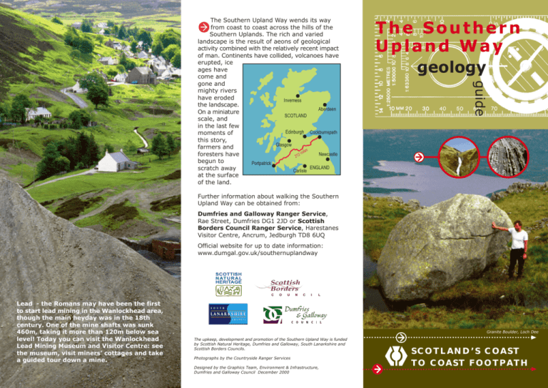
The Southern Upland Way geology guide The Southern Upland Way wends its way from coast to coast across the hills of the Southern Uplands. The rich and varied landscape is the result of aeons of geological activity combined with the relatively recent impact of man. Continents have collided, volcanoes have erupted, ice ages have come and gone and mighty rivers have eroded Inverness the landscape. Aberdeen On a miniature SCOTLAND scale, and in the last few Edinburgh Cockburnspath moments of this story, Glasgow farmers and es mi l Newcastle foresters have 212 begun to Portpatrick ENGLAND scratch away Carlisle at the surface of the land. Further information about walking the Southern Upland Way can be obtained from: Dumfries and Galloway Ranger Service, Rae Street, Dumfries DG1 2JD or Scottish Borders Council Ranger Service, Harestanes Visitor Centre, Ancrum, Jedburgh TD8 6UQ Official website for up to date information: www.dumgal.gov.uk/southernuplandway SCOTTISH N AT U R A L HERITAGE Scottish Borders C Lead - the Romans may have been the first to start lead mining in the Wanlockhead area, though the main heyday was in the 18th century. One of the mine shafts was sunk 460m, taking it more than 120m below sea level! Today you can visit the Wanlockhead Lead Mining Museum and Visitor Centre: see the museum, visit miners’ cottages and take a guided tour down a mine. O U N C I L Granite Boulder, Loch Dee The upkeep, development and promotion of the Southern Upland Way is funded by Scottish Natural Heritage, Dumfries and Galloway, South Lanarkshire and Scottish Borders Councils. Photographs by the Countryside Ranger Services Designed by the Graphics Team, Environment & Infrastructure, Dumfries and Galloway Council December 2000 S C O T L A N D ’ S C OA S T T O C OA S T F O O T PA T H LATER EVENTS THE SOUTHERN UPLANDS The Southern Upland Fault runs from near Ballantrae to Dunbar. Most of the rocks to the south of the fault, as far as the Scottish Border, were formed in the Ordovician period (500-435 million years ago) and the Silurian period (435-405 million years ago). During the Ordovician ‘Scotland’ was near the equator and moving northward. ‘England’ was further south and following ‘Scotland’ northwards. Huge quantities of sediment, eroded from both landmasses, were deposited into the sea between. These eventually metamorphosed into greywacke, a dark-grey hardened sandstone, created by heat and pressure. Some sediment became shale, a dark fine grained and crumbly rock. When the two landmasses came together the bed of the ocean was pushed up to form the Southern Uplands. Vertical faulting, South Scotland Eildon Hills In Southern Scotland, Devonian and Carboniferous rocks are found mostly in the south and east. A typical scene in Devonian times is thought to be that of powerful, fast flowing rivers bringing sediment into lakes. By Carboniferous times Scotland was near the equator and our landscape was one of rainforest and tropical seas. Thick red sandstones show that by Permian times the area had become a desert. In Dumfries and Galloway the main rivers all flow south into the Solway (indeed the watershed marks the region’s northern boundary). In South Lanarkshire, around Daer, rivers flow north to the Clyde. In the Borders they mainly flow north eastwards to the North Sea. THE ICE AGE The last part of the ice age was relatively recent, lasting from about 70,000 to 12,000 years ago. At one stage the whole of Scotland was under a great sheet of ice. Latterly the main ice accumulations in south Scotland were north of Glentrool, and in the Tweedsmuir and Moffat Hills. Examples of glacially eroded valleys can be seen at Glentrool, Loch Dee, Wanlockhead and Moffat Water Valley (especially at Grey Mare’s Tail, slightly off the Way). St Mary’s Loch THE HAND OF MAN After the ice sheets receded much of southern Scotland gradually became covered in woodland, the dominant trees being oak, elm and hazel. About 8000 to 10,000 years ago people began moving into the area and ever since they have gradually changed the surface appearance. Forests have been cut and cleared and regeneration prevented by grazing animals. Latterly the land has been drained to improve the productivity for crops and animal rearing. At first this was just for food production but later, since the 1950s, for planting of commercial woodlands. Grey Mare’s Tail EROSION & PRESENT LANDFORMS VOLCANIC ACTIVITY This has occurred most obviously at Ailsa Craig and the Eildon Hills. Only the remnants and roots of the volcanoes survive today, often as distinctive features because granite is much harder than most of the surrounding sedimentary rocks and has therefore eroded more slowly. When walking the SUW from west to east granite first appears underfoot at Glentrool. Natural lakes were formed at Ochiltree, Loch Trool, Loch Dee and St Mary’s Loch. Many others along the Way are man made eg. at Knockquhassen, Clatteringshaws, Daer and Watch Water. Around 15,000 years ago the ice began to melt. Water that flowed from the glaciers flowed off the hills carrying away boulders, gravel and sand in huge quantities, dumping them in the valley bottoms. Deposits of eroded material (moraines) left behind after the ice has melted can be seen near Cockburnspath. Later, some of these sediments were worn away by smaller rivers to leave eroded terraces and deep cleughs (eg at Pease Dean). Glentrool and the Merrick (843m) KEY FEATURES 1 PORTPATRICK CLIFFS Here you can see excellent exposures of the typical greywackes of southern Scotland. Those at Portpatrick contain about 15% quartz grains whereas Glenwhargen formation greywackes (found further east near Polskeoch) contains about 65%. 2 AILSA CRAIG An eroded root of an extinct volcano can be seen towering out of the Firth of Clyde from a few points along the west of the Way, (especially from Mulloch Hill above Knockquhassen Reservoir). Its granite contains the rare bluish-grey mineral riebeckite that has allowed geologists to trace the movements of glaciers into the Irish Sea. 3 LOCH RYAN From late Devonian times, faulting around Loch Ryan allowed a basin to develop that was filled with sediment. The Permian sandstone that formed is much softer than the surrounding greywackes and the loch (and the land southwards to Luce Bay) was gouged out by ice that followed the course of the Firth of Clyde out into the Irish Sea. 4 GALLOWAY HILLS From Loch Dee northwards to Loch Doon many of the hills are formed from a granite intrusion now a light coloured rock. Around the fringes, much greyer tonalite occurs, as does norite a darkcoloured medium-coarse grained rock. Loch Trool was cut out by ice flowing down from the higher ground that also created the hanging valley down which the Gairland Burn falls. 5 CAIRNSMORE OF CARSPHAIRN The high hills seen north of the Way from Manquhill are part of another large granite intrusion, the surrounding softer rocks having been worn away more rapidly. 6 SANQUHAR 12 EILDON HILLS Tropical conditions in Carboniferous times (around 350 million years ago) led to the formation of extensive coal deposits around Sanquhar, particularly eastwards to Kirkconnel and New Cumnock. Coal has been mined here for at least 700 years but is now extracted only by the open cast method. The remains of a complex volcanic system. The three prominent hills are made of hard igneous rock that has weathered much less than the surrounding sandstones and greywackes. Most of the molten lava never reached the surface and cooled underground to form sills. Later eruptions threw ash and blocks of rock high into the air that can still be seen in layers on the hill sides. Nearby Black Hill was formed in a similar way. 7 WANLOCKHEAD and LEADHILLS Galena (lead sulphide) has been mined at Wanlockhead since Roman times; zinc-blende (zinc sulphide) since 1880. Prior to 17th century silver was probably the main product of the galena mining. From 1880, zinc-blend from which zinc is extracted has been the main target. The largest piece of gold found here was nearly 200gms in weight! Gold panning is still carried out by a few enthusiasts. 8 LOWTHER HILL The highest point of the Way (725m). This hill and the other gently rounded hills in the vicinity are composed of greywacke but there are few rock exposures. 9 MOFFAT WATER VALLEY This is a classic glaciated valley with a wide valley bottom and steep sides. From the Way, it is best seen at the start of the long climb to Ettrick Head, east of Moffat. Here and there among the gently rounded hills the underlying rocks are exposed, particularly at Craigmichan Scar, beside the Way. 10 DOBB’S LINN A world famous geological site (4kms west of the Way). Here Charles Lapworth, a Galashiels schoolteacher, provided geologists with the key to unlocking the mysteries of the Southern Uplands. He studied the fossil remains of tiny sea creatures called graptolites found in black shales and published his findings in The Moffat Series (1878). 11 ST MARY’S LOCH & LOCH OF THE LOWES Glaciers spilling over from the Moffat and Megget hills carved out the basin for these lochs before travelling on to Yarrow. Once a single loch, it has since been divided by the alluvial deposits brought in by the Crosscleuch and Ox Cleuch Burns. Alluvial gold has been extracted from Glengaber Burn, near Megget Reservoir. 13 LAMMERMUIR Granite under these hills is mainly concealed but reaches the surface at Cockburn Law (4km off the Way). 14 DIRRINGTON LAWS These volcanic intrusions south of Longformacus are composed of felsite (and associated rocks) among conglomerates and sandstone of Upper Old Red Sandstone age. 15 SICCAR POINT – ‘HUTTON’S UNCONFORMITY’ A world famous geological site (2.5 kms from the Way). Here, in 1788 James Hutton studied steeply inclined beds of greywacke and shale which were overlain by gently inclined beds of Old Red Sandstone. He understood the vast amount of time it would have taken for this to happen. From his observations Hutton compiled his Theory of the Earth (1795) – the foundation of modern geology. 16 COVE HARBOUR Access to the sandy shore is by a 50m tunnel cut through the red sandstone in the 1750s. Folded rock strata at the entrance to the harbour can be clearly seen from the Way on the cliff top. 17 BASS ROCK (26km north west of the Way) A dramatic 95m high volcanic plug composed of trachyte. 17 2 Southern Upland Way and key features Wenlock Llandovery Ashgill,Caradoc & Arenig SEDIMENTARY ROCKS NORTH SEA EDINBURGH Silurian 16 15 Cockburnspath Ordovician St Abb's Head Triassic IGNEOUS ROCKS Permian Old Red Sandstone Lower d 14 rT we e T H Peebles Galashiels U L ot Kelso 3 Ayr SO H UT E A PL N D 12 Dobbs Linn 10 8 7 St Mary's Loch Hart Fell Moffat 9 Sanquhar ve Ri sk River E Ailsa Craig 4 Girvan Selkirk 11 RN Wanlockhead 6 2 oo o rf Intrusive Igneous Rocks U FIRTH OF CLYDE M A Upper Permian Carboniferous Lower Old Red Sandstone Ordovician 4 3 2 1 F Carboniferous s ill 5 2 2 Hawick t io ev T r H C River Annan ve Ri 1 rN Merrick ith 1 er ee Cr R. 3 Cairnsmore of Fleet Stranraer of Ke n e o ls t CO T S Canonbie E N G L D A N D Annan 0 Criffel Wigtown Portpatrick N LA Lockerbie 3 Dumfries W at h vi il N Thornhill 4 Ri ve Upper Lower Berwick upon Tweed 13 Extrusive Igneous Rocks Carlisle 0 10 miles 20 km Kirkcudbright 1 SOLWAY FIRTH Geological Sketch Map Burrow Head Mull of Galloway of the South of Scotland


