Image Interpretation
advertisement
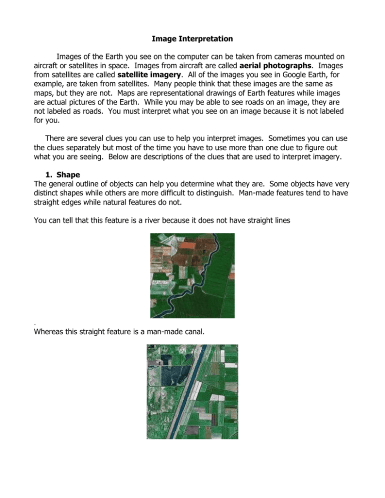
Image Interpretation Images of the Earth you see on the computer can be taken from cameras mounted on aircraft or satellites in space. Images from aircraft are called aerial photographs. Images from satellites are called satellite imagery. All of the images you see in Google Earth, for example, are taken from satellites. Many people think that these images are the same as maps, but they are not. Maps are representational drawings of Earth features while images are actual pictures of the Earth. While you may be able to see roads on an image, they are not labeled as roads. You must interpret what you see on an image because it is not labeled for you. There are several clues you can use to help you interpret images. Sometimes you can use the clues separately but most of the time you have to use more than one clue to figure out what you are seeing. Below are descriptions of the clues that are used to interpret imagery. 1. Shape The general outline of objects can help you determine what they are. Some objects have very distinct shapes while others are more difficult to distinguish. Man-made features tend to have straight edges while natural features do not. You can tell that this feature is a river because it does not have straight lines . Whereas this straight feature is a man-made canal. 2. Size The size of an object can help you interpret what it is. In this example, there is a middle school located next to houses. Can you tell which is the school complex and which are the houses? 3. Pattern Certain objects have a distinct pattern. Man-made features, such as cities tend to have very regular patterns, while natural features do not have regular patterns. This is a picture of the regular street pattern in San Francisco. Whereas, this picture shows the irregular drainage patterns in the mountains. 4. Tone/Color The brightness and variation of color of an object can help you identify it. For example in this image, this image shows many different types of crops in agricultural fields. You can see this from the many different shades of green. 5. Shadow Shadows can provide information about an object’s height and shape. This is an image of buildings in downtown San Francisco. Shorter buildings have smaller shadows while taller buildings have longer shadows. 6. Association Sometimes you can identify an object by what is surrounding it, or what it is associated with. In the pictures below, can you tell which image is a mountain lake and one is a high desert lake? What are the features around the lake that helped you make that decision? Spatial Resolution The other term you need to know when working with satellite imagery on a computer is spatial resolution. This refers to how much detail you can see on the ground. For example, when you are zoomed out in Google Earth (looking at large areas with less detail), you are looking at Landsat Thematic Mapper satellite imagery that has a spatial resolution of 30 meters. 30 meters is about the size of a baseball diamond. As you zoom in to Google Maps, the satellite imagery changes to a very high spatial resolution imagery of about 1 meter, sometimes less. Google acquires these images from different sources. Note that not all areas in Google maps have high spatial resolution imagery. Interpreting imagery of the Sacramento Delta Using a browser on the computer, go to Google.com and then click on Maps in the upper left corner. Once you are in Google Maps, Type “San Francisco Bay” into the Search Maps box. Right now, you are probably looking at a map of the area. We want to look at the satellite image so click on Satellite in the upper right of the map. You may want to click off “Show labels” so you can see the image clearer. Move the image to the left so you can see as much of the Delta as possible. Zoomed out at this resolution, the first thing you probably notice are the large water bodies and the rivers that lead into them. The water is blue, but as you may notice it is different shades of blue. The different shades of blue often represent the amount of sediment in the water and/or the depth of the water. Water with sediment in it will look lighter. The deeper the water, the darker it usually is. If you look at the pictures of the lakes above, the water looks almost black. That is because these are very deep, clear lakes. The next things you may notice are the brown and green areas. What do you think the green areas represent? Notice that there are different shades of green. This can either represent the amount of water the vegetation is receiving or the type of vegetation. You have to use your clues to determine what the vegetation might be. The brown areas usually represent dry vegetation. Based on what you know about California vegetation, what time of year do you think this image was acquired? Lastly, you probably notice the blue/grey blobs in the image. These are the urban areas. In this image, you can clearly see the pattern of urban growth in the bay and delta. As you zoom in, you will see more and more details emerge.


