Due: Friday, December 9, 2011
advertisement
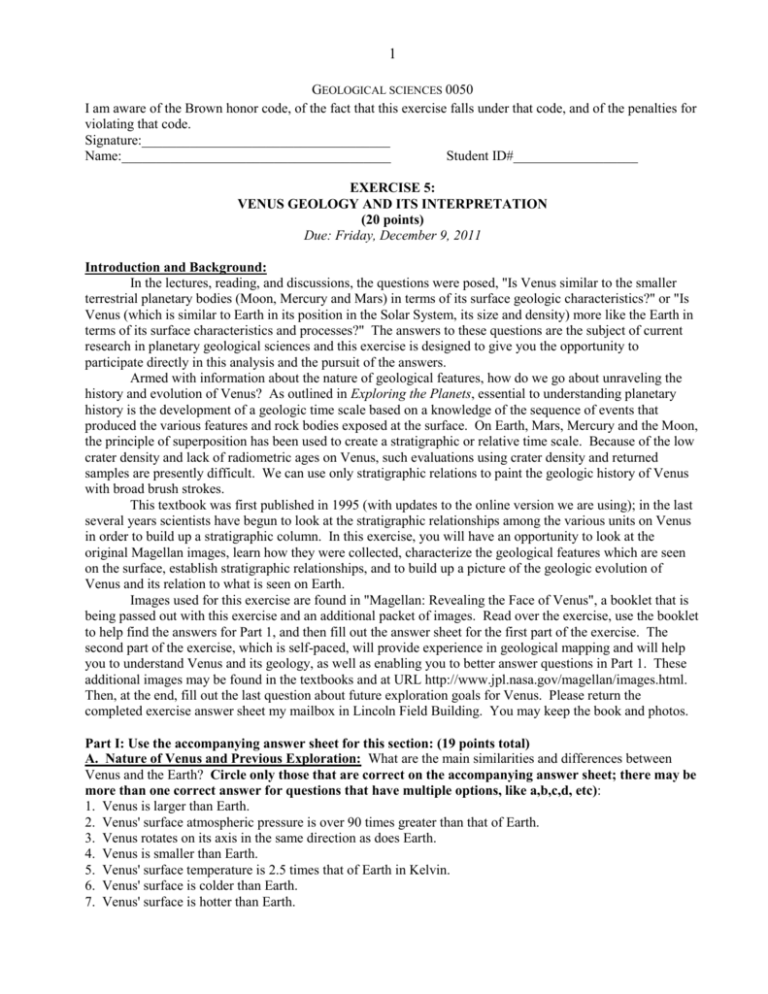
1 GEOLOGICAL SCIENCES 0050 I am aware of the Brown honor code, of the fact that this exercise falls under that code, and of the penalties for violating that code. Signature:____________________________________ Name:_______________________________________ Student ID#__________________ EXERCISE 5: VENUS GEOLOGY AND ITS INTERPRETATION (20 points) Due: Friday, December 9, 2011 Introduction and Background: In the lectures, reading, and discussions, the questions were posed, "Is Venus similar to the smaller terrestrial planetary bodies (Moon, Mercury and Mars) in terms of its surface geologic characteristics?" or "Is Venus (which is similar to Earth in its position in the Solar System, its size and density) more like the Earth in terms of its surface characteristics and processes?" The answers to these questions are the subject of current research in planetary geological sciences and this exercise is designed to give you the opportunity to participate directly in this analysis and the pursuit of the answers. Armed with information about the nature of geological features, how do we go about unraveling the history and evolution of Venus? As outlined in Exploring the Planets, essential to understanding planetary history is the development of a geologic time scale based on a knowledge of the sequence of events that produced the various features and rock bodies exposed at the surface. On Earth, Mars, Mercury and the Moon, the principle of superposition has been used to create a stratigraphic or relative time scale. Because of the low crater density and lack of radiometric ages on Venus, such evaluations using crater density and returned samples are presently difficult. We can use only stratigraphic relations to paint the geologic history of Venus with broad brush strokes. This textbook was first published in 1995 (with updates to the online version we are using); in the last several years scientists have begun to look at the stratigraphic relationships among the various units on Venus in order to build up a stratigraphic column. In this exercise, you will have an opportunity to look at the original Magellan images, learn how they were collected, characterize the geological features which are seen on the surface, establish stratigraphic relationships, and to build up a picture of the geologic evolution of Venus and its relation to what is seen on Earth. Images used for this exercise are found in "Magellan: Revealing the Face of Venus", a booklet that is being passed out with this exercise and an additional packet of images. Read over the exercise, use the booklet to help find the answers for Part 1, and then fill out the answer sheet for the first part of the exercise. The second part of the exercise, which is self-paced, will provide experience in geological mapping and will help you to understand Venus and its geology, as well as enabling you to better answer questions in Part 1. These additional images may be found in the textbooks and at URL http://www.jpl.nasa.gov/magellan/images.html. Then, at the end, fill out the last question about future exploration goals for Venus. Please return the completed exercise answer sheet my mailbox in Lincoln Field Building. You may keep the book and photos. Part I: Use the accompanying answer sheet for this section: (19 points total) A. Nature of Venus and Previous Exploration: What are the main similarities and differences between Venus and the Earth? Circle only those that are correct on the accompanying answer sheet; there may be more than one correct answer for questions that have multiple options, like a,b,c,d, etc): 1. Venus is larger than Earth. 2. Venus' surface atmospheric pressure is over 90 times greater than that of Earth. 3. Venus rotates on its axis in the same direction as does Earth. 4. Venus is smaller than Earth. 5. Venus' surface temperature is 2.5 times that of Earth in Kelvin. 6. Venus' surface is colder than Earth. 7. Venus' surface is hotter than Earth. 2 8. Venus is less dense than Earth. 9. Venus is denser than Earth. 10. Venus' atmosphere has carbon dioxide in the same abundance as Earth's. 11. Venus' surface atmospheric pressure is less than that of Earth. 12. Venus' surface atmospheric pressure is greater than that of Earth. 13. Venus' rotation period is much longer than that of Earth. 14. Venus' orbit is ~42 x 106 km closer to the Sun than Earth's, but Earth's orbit is closer to Venus' than to Mars' orbit. 15. The Magellan spacecraft was launched from the Space Shuttle Atlantis. 16. In order to cool the Magellan spacecraft down: a. The ground crew periodically stopped and had a tall, cold one. b. Solar panels were used to radiate excess heat. c. The spacecraft antenna was periodically turned toward the Sun. d. Liquid nitrogen periodically was pumped into the spacecraft.The Magellan mission provided: 17. The Magellan Mission provided: a. Near-global high-resolution imaging. b. Near-global topography. c. Near-global radiometry data. d. Near-global gravity data. e. Near-global atmospheric composition measurements. f. Near-global atmospheric wind circulation measurements at several levels. 18. The ground receiving stations t o which Magellan beamed its data are located in: a. Cape Canaveral, Florida b. Munich, Bavaria c. Kamloops, British Columbia. d. Canberra, Australia. e. Madrid, Spain. f. Pawtucket, Rhode Island. g. Goldstone, California. 19. Magellan was launched in 1989 and went into orbit around Venus in 1990. 20. Magellan returned to Earth a larger amount of digital data than all previous United States planetary missions combined. B. Making Observations and Establishing Regional Stratigraphic Relationships: 21. Magellan images revealed that the % of the surface occupied by volcanic rock was: a) <25%. b) ~33.3% c) ~45% d) ~65% e) >85%. 22. This volcanic rock is mostly in the form of: a. Billions of Hawaii-like shield volcanoes. b. Oceanic crust with a morphology similar to Earth's. c. Flat-lying carbonates. d. Lava flows forming plains. 23. The surfaces not covered by volcanic rock are composed of: a. Structures exactly like continents on Earth. b. Volcanic edifices that have been destroyed by tectonic activity. c. Mountainous areas that have been deformed repeatedly. 3 d. Sandstone and limestone. e. Large depressions that appear to be subduction holes. 24. Alpha Regio (p. 4-5) is a highland region consisting of complex terrain of intersecting ridges, troughs, and flat-floored valleys. The dark volcanic plains are: a. Younger than Alpha Regio. b. Older than Alpha Regio. c. Of the same age as Alpha Regio. 25. Venus is characterized by a lot of erosion because it is so hot that the rocks bake, crack in the heat, explode and fall apart. 26. Coronae on Venus: a. Are not widely distributed on the surface. b. Are usually between 1000 and 1200 km in diameter. c. May reflect deep interior mantle processes that uplift and deform the surface. d. Are generally several hundred km wide, but the largest, Artemis Corona, is 2100 km in diameter. e. Are similar to circular to ovoid features with outwardly extending fractures, called arachnoids. f. Commonly contain evidence of both tectonism and volcanism, as in the case of Bahet and Onatah. g. Are most like hot spots on Earth. h. Are characterized by a deformed annulus. 27. Volcanic activity on Venus is characterized by: a. Large lava flows that extend many hundreds of kilometers. b. Pancake-like domes over 20 km in diameter and up to 750 m high. c. One deposit, covering over 100,000 km2, from the volcanic source Ammavaru. d. Dark surfaces, indicating very rough, and bright, indicating smooth surfaces. e. Large plinian eruption columns. f. Some volcanoes that may still be active. g. Lava flows which emerge from volcanoes, cracks in the crust and depressions. h. Long narrow sinuous channels, one of which is 7000 km long, that may be due to thermal erosion. i. Some very fluid eruptions and/or very high eruption rates. j. No signs of pyroclastic explosive eruptions because of the high pressure. k. Sapas Mons, in Atla Regio, which has a height only one two-hundredth of its width. l. Maat Mons, only about 2 km high, is much smaller than the Hawaiian volcano Mauna Loa. m. A few hundred small shield volcanoes less than about 15 km diameter. 28. Venus topography is characterized by: a. Northern lowlands and southern highlands similar to Mars. b. A trimodal frequency distribution in contrast to that of the bimodal Earth. c. No real evidence for topography like that of folded mountain belts on Earth. d. About the same range as Earth but the distribution is different. e. The highest point on the planet, the 11 km high summit of Maxwell Montes. f. Several large highland areas including Beta Regio, Atla Regio, Alpha Regio, Aphrodite Terra, and Ishtar Terra. g. Steep trenches such as Diana and Dali Chasma, located in Aphrodite Terra. 29. Impact cratering on Venus is characterized by: a. Some dark haloes caused by intense atmospheric shock waves. b. Few small craters because they are apparently broken up by the atmosphere. c. Clusters of craters showing that projectiles break up in the dense atmosphere. d. One 72 km diameter crater which has flows that travelled up to 300 km from the crater walls. e. Giant dark parabolas caused by interaction of the expanding ejecta plume with the upper atmosphere. 4 f. Few craters less than about 15 km in diameter. g. Mead crater, the largest impact crater on Venus, about 100 km in diameter. h. Over 2000 impact craters distributed mostly in the ancient tessera terrain. i. Craters which mostly have not been significantly altered by erosion. j. Large ancient multi-ringed basins like those on the Moon, Mars and Mercury. 30. Eolian activity on Venus is characterized by: a. Dunes that are hundreds of meters in width. b. Features that show that the winds are blowing from the equator to the poles. c. Providing evidence for the distribution of Venus' global wind patterns. d. Sources of sediment that are most commonly from impact craters. e. Wind streaks that are commonly located near topographic barriers. f. Being located near sources of sediment. g. Only a few meters of movement because the wind can't blow very hard. h. Blizzard-like conditions with snow deposition in topographic lows. 31. Synthetic aperture radar images: a. Appear bright when surfaces are smooth or tilted away from the spacecraft. b. Often show very bright areas at an elevation above about 2.5 km, that may be due to the presence of metallic minerals such as magnetite or pyrite. c. Can be generated at night or through clouds. d. Are shown in shades of gray, where bright is smooth and dark is rough. e. Can be enhanced using color estimates of the surface. 32. Gravity data from Magellan: a. The best gravity data is collected when the spacecraft is highest above Venus. b. Can detect density differences caused by hot downwelling and cool upwelling material. c. Will help us in studying the planet's interior. d. Is collected solely by using Magellan-Earth direct radio communications. e. Show that convective rising and sinking are less closely related to interior processes on Venus than on Earth. 33. Tectonic activity on Venus is characterized by: a. Some areas, named tessera, that are very complexly deformed, and stratigraphically old. b. Tessera terrain, named by the Armenians for the English word for tile. c. Major amounts of strike-slip faulting with offset like the San Andreas fault. d. Large mountain ranges formed in a manner similar to those on the Moon. e. Sinuous ridges similar to the wrinkle ridges observed in the lunar maria. f. Graben-like features indicating that forces of compression are widespread. Part II. GEOLOGICAL RELATIONSHIPS AND HISTORY ANALYSIS: Review the images on the web and use this as a study guide: At the end, fill out the final question on outstanding questions for Venus. A. Establishing Regional Stratigraphic Relationships: For each of the following examples, study the image and then pay particular attention to the points indicated in italics. 1. Aine Corona with Pancake Domes: (http://www.jpl.nasa.gov/magellan/image15.html) This image shows coronae and their relationship to regional plains with wrinkle ridges, small shields, and steep-sided pancake domes. When the caption for this image was written in 1991 during the Magellan mission, the emphasis was on the description of the range of features, not necessarily on their relative age. Some of these features are described in the caption as follows: "The large circular structure near the center of the image is a corona, 5 approximately 200 kilometers in diameter. Just north of Aine Corona is one of the flat-topped volcanic constructs known as "pancake" domes for their shape and flap-jack appearance. This pancake dome is about 35 kilometer in diameter and is thought to have formed by the eruption of an extremely viscous lava. Another pancake dome is located inside the western part of the annulus of the corona fractures. Other volcanic features associated with Aine Corona include a set of small domes, each less than 10 kilometers across, located along the southern portion of the annulus of fractures, and a smooth, flat region in the center of the corona, probably a relatively young lava flow. The range of volcanic features associated with coronae suggests that volcanism plays a significant role in the formation of coronae." We can try to use the observed relationships to build up a stratigraphic column. a) Corona: The corona is characterized by a high-standing ring of folded and fractured crust. The ring is incomplete, however, being prominent only to the west and northeast. On the basis of embayment and crosscutting relationships, the fractured ring of the corona appears older than the wrinkle-ridged plains surrounding it. b) Small shield volcanoes: A series of small shield volcanoes, each a few km across, is visible just inside the annulus in the southern part of the corona. The age of these relative to the corona ring (look at the more prominent single example in the southwest part of the corona) appears younger. c) Pancake domes: What is the age of the pancake domes? There are four pancake domes in this image. The largest one lies just outside the corona rim and the smaller three are inside. The large pancake dome appears younger than the deformed corona annulus. The other pancake domes appear older than the regional plains with wrinkle ridges (e.g., think about the shape of the northernmost one inside the corona). d) Wrinkle-ridged plains: The wrinkle ridges are deformational features that have modified the regional plains on which they form; thus they postdate the emplacement of the regional plains. What is the age of the wrinkle-ridged plains relative to the small shield volcanoes? Although they stick up above the plains, this does not necessarily mean that they are superposed as they can be surrounded by younger lava and still stick up. Look for evidence of small volcanoes that might be partially buried by later units; if you see such evidence, it would suggest an older age for the small shields. In fact, the wrinkle-ridged plains appear younger than the small shield volcanoes e) Regional Fractures: A series of narrow curving bright lines extend from north to south across the image. Some unit(s) are NOT cut by these fractures in a manner that indicates that these units are younger than the fractures. f) Stratigraphic Sequence: Place these stratigraphic units and features (small shield volcanoes, regional fractures, pancake domes, corona rim, wrinkle ridged plains) in stratigraphic order in a stratigraphic column, and then check your results with those of other mappers indicated below: Youngest: -wrinkle ridged plains -regional fractures -pancake domes/small shield volcanoes -corona rim Oldest: Think through and jot down a brief summary of the geologic history of this region of Venus. 2. Impact Craters: (http://www.jpl.nasa.gov/magellan/image7.html) Relationship to regional plains. Three impact craters are displayed in this three-dimensional perspective view of the surface of Venus. The center of the image is located at approximately 27 degrees south latitude, 339 degrees east longitude in the 6 northwestern portion of Lavinia Planitia. The viewpoint is located southwest of Howe Crater, which appears centered in the lower portion of the image. Howe is a crater with a diameter of 37.3 kilometers. Danilova, a crater with a diameter of 47.6 kilometers, appears above and to the left of Howe in the image. Aglaonice (diameter 62.7 kilometers), is shown to the right of Danilova. The background plains in this image are largely composed of plains with wrinkle ridges. The craters shown here are very typical of the relationships of the vast majority of craters on Venus. Do these plains embay the craters, or are the impact craters superposed on the plains, and thus younger? Examination of the images shows that the craters are superposed. 3. The Volcano Sapas Mons: (http://www.jpl.nasa.gov/magellan/image28.html) Large shield volcanoes and their relationships to regional plains with wrinkle ridges. The volcano Sapas Mons (400 kilometers across and 1.5-2.0 kilometer high) is typical of large shield volcanoes with surrounding lobate lava flows, both in terms of morphology and stratigraphic relationships. It is located in the broad equatorial rise known as Atla Regio. The peak of Sapas sits at an elevation of 4.5 kilometers above the planet's mean elevation. The flanks of the volcano are composed of numerous overlapping lava flows. Background plains surround Sapas Mons. A major question is 'Do the background plains embay Sapas Mons, or is Sapas Mons superposed on the regional wrinkle ridged plains?' Examination of the image shows that the Sapas deposits are superposed on background plains. A six foot wide blowup of this image is also located on the third floor landing of Lincoln Field Building. 4. Regional Rift Zones: (http://www.jpl.nasa.gov/magellan/image17.html) Relationship of rifting to impact cratering. This remarkable "half crater" is located in the rift zone between Rhea and Theia Montes in Beta Regio. Radar illumination is from the left. The crater is 37 kilometers in diameter and is located at latitude 29.91 degrees north, longitude 282.9 degrees east. It has been cut by many fractures or faults since it was formed by the impact of a large asteroid. The eastern half of the crater has been completely destroyed during the formation of a fault-valley that is up to 20 kilometers wide and apparently quite deep. A north-south profile through the very center of this crater is visible as a result of the downdropping and removal of the eastern half of the crater. This "profile view" gives a third dimension to the crater. This relationship is typical of those seen in rift zones and indicates that rifting took place after the emplacement of this and most other impact craters. 5. Plains with Wrinkle Ridges: (http://www.jpl.nasa.gov/magellan/image19.html) Nature and Emplacement Style. This full resolution radar mosaic from Magellan at 49 degrees south latitude, 273 degrees east longitude of an area with dimensions of 130 by 190 kilometers, shows a 200 kilometer segment of a sinuous channel on Venus. The channel is approximately 2 kilometers wide. These channel-like features are common on the wrinkle-ridged plains of Venus. In some places they appear to have been formed by lava which may have melted or thermally eroded a path over the plains' surface. Most are 1 to 3 kilometers wide. They resemble terrestrial rivers in some respects, with meanders, cutoff oxbows, and abandoned channel segments. However, Venus channels are not as tightly sinuous as terrestrial rivers. A few have vast radar-dark plains units associated with them, suggesting large flow volumes. These channels appear to be older than other channel types on Venus, as they are crossed by fractures and wrinkle ridges, and are often buried by other volcanic materials. In addition, they appear to run both upslope and downslope, suggesting that the plains were warped by regional tectonism after channel formation. What type of volcanic activity and style would you say characterizes this feature and unit and how does it differ from that seen in the smaller shield volcanoes and the larger ones like Sapas Mons? The style seems to be most comparable to large outflows of lava, flood basalt volcanism, or to volcanism like that associated with lunar sinuous rilles. This differs from the small shield volcanoes in that they represent many small-volume eruptions spread over a wide area, and from the large shield volcanoes in that they represent multiple flows from a single source building up a large shield in one place, not distributing lavas over a vast plain from a single or small number of sources. 6. Festoons: (http://www.jpl.nasa.gov/magellan/gif/p39916.gif) This unusual Venusian volcano is located on the plains between Artemis Chasma and Imdr Regio at 37.5 degrees south latitude and 164.5 degrees east longitude. The dome structure with lava channels radiating 7 from the volcanic center is about 100 km across. Measurements show that the thickness of the lobe of lava at the left-center edges of the image is variable but typically about 540 meters. The fan-shaped lava flow in the lower left is about 120 meters thick near its edge. Lava scarps on the east side of the complex are about 90 meters high. These data strongly suggest that this feature and its associated flows are composed of a very viscous magma (maybe andesite, dacite or rhyolite) and that it represents more silicic lavas on Venus. What is the relative age of this deposit? Is it older than the surrounding regional plains with wrinkle ridges or younger than them? Detailed examination of superposition relationships suggests that they are younger. 7. Tessera Terrain: (http://www.jpl.nasa.gov/magellan/gif/p42392.gif) Relationship to regional plains with wrinkle ridges. Ovda Regio covers an area 6,300 kilometers by 2,100 kilometers, rises over 3 kilometers above the surrounding plains, and is made up of complex ridged terrain (tessera). At the bottom right of this scene, along the northern edge of the highland, is a series of east-west trending ridges that are interpreted to have formed by NW/SE oriented compression, part of the tessera deformation. The relationship between the tessera shown here and the adjacent regional lava plains with wrinkle ridges is very typical for Venus. What is the relationship between the linear ridges in the tessera and the dark lava deposits (regional plains with wrinkle ridges) in the lower left part of this image? Are the dark volcanic plains older, or younger than the tessera? Superposition relationships show that they are younger. B. Global Stratigraphic Correlations and Geologic History: Assuming that the relationships that you have established in each area are typical of other areas on Venus, think about these relationships and how you might compile a global stratigraphic column including the units and structures that you have observed (e.g., small shield volcanoes, regional fractures, pancake domes, corona rim, wrinkle-ridged plains, festoons, impact craters, large shield volcanoes, tessera, rift zones and any other features that you think are important). Then compare your column to that (reproduced below) of other scientists here at Brown and in Russia. Youngest: -rift zones -regional fractures -impact craters -large shield volcanoes -festoons -wrinkle-ridged plains -pancake domes -small shield volcanoes -corona rims -tessera Oldest: C. Outstanding Questions and Recommended Next Steps: (1 point): Using your geological history and information from the course about the nature of the other terrestrial planetary bodies, think about your ideas to explain and interpret the nature of Venus and its geologic history and to understand why Venus is so unusual relative to the other terrestrial planets. What do you think are the most significant outstanding questions about Venus that remain to be addressed? What measurements, experiments and missions would you propose to NASA to address these questions? 8 I am aware of the Brown honor code, of the fact that this exercise falls under that code, and of the penalties for violating that code. Signature:____________________________________ Name:_______________________________________ Student ID#__________________ GEOLOGICAL SCIENCES 0050 - EXERCISE 5: VENUS GEOLOGY AND ITS INTERPRETATION ANSWER SHEET (20 Points Total) Due: Friday, December 9, 2011 Circle only those that are correct on the answer sheet; more than one may apply for each: 1. 2. 3. 4. 5. 6. 7. 8. 9. 10. 11. 15. 16. a. b. c. d. 17. a. b. c. d. 18. a. b. c. d. e. f. g. 19. 20. 21. a. b. c. d. e. 22. a. b. c. d. 23. a. b. c. d. e. 24. a. b. c. 26. a. b. c. d. e. f. g. h. 27. a. b. c. d. e. f. g. h. i. j. 28. a. b. c. d. e. f. g. 29. a. b. c. d. e. f. g. h. i. j. 30. a. b. c. d. e. f. g. h. 31. a. b. c. d. e. 32. a. b. c. d. e. 33. a. b. c. d. e. 12. 13. e. 14. f. 25. k. l. m. f. C. Outstanding Questions and Recommended Next Steps: (1 point): What do you think are the most significant outstanding questions about Venus that remain to be addressed? What measurements, experiments and missions would you propose to NASA to address these questions?

