Generic burn plan
advertisement
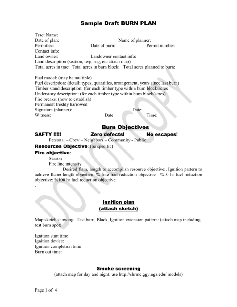
Sample Draft BURN PLAN Tract Name: Date of plan: Name of planner: Permittee: Date of burn: Permit number: Contact info: Land owner: Landowner contact info: Land description (section, twp, rng, etc attach map) Total acres in tract Total acres in burn block: Total acres planned to burn: Fuel model: (may be multiple) Fuel description: (detail: types, quantities, arrangement, years since last burn) Timber stand description: (for each timber type within burn block/acres Understory description: (for each timber type within burn block/acres) Fire breaks: (how to establish) Permanent freshly harrowed Signature (planner): Date: Witness: Date: Time: Burn Objectives SAFTY !!!!! Zero defects! No escapes! Personal – Crew – Neighbors – Community - Public Resources Objective: (be specific) Fire objective: Season Fire line intensity Desired flam, length to accomplish resource objective:, Ignition pattern to achieve flame length objective: % fine fuel reduction objective: %10 hr fuel reduction objective: %100 hr fuel reduction objective: , Ignition plan (attach sketch) Map sketch showing: Test burn, Black, Ignition extension pattern: (attach map including test burn spot) Ignition start time Ignition device: Ignition completion time Burn out time: Smoke screening (attach map for day and night: use http://shrmc.ggy.uga.edu/ models) Page 1 of 4 Day time SSA: list Night time SSA: list Neighbors (include plat showing property location) Contact info: Name: Authorities Contact info 911 PX # Sheriff AFC County Supervisor Volunteer Fire Dept 1 Volunteer FD 2 Weather (provide extra forms for during and after fire observations) Planned (desired) Forecast Temperature Relative humidity Surface wind speed Surface wind direction Transport wind speed Transport wind direction Ventilation factor Dispersion Index Fine fuel moisture KBDI Probability of ignition Atmospheric stability Cloud cover LVORI/dew point Extended forecast Equipment (check list format) (Include map with pre-ignition staging location) Ability to hold &/or suppress fire: Ignition: Communications: Page 2 of 4 Actual (measure/observed on site – use multiple forms or back for repeat observations Personal protective gear: Water: Water source: Weather monitoring: Sling psychrometer, Anemometer, Recording note book ATV 1, ATV 2 Crew (names) Burn manager (fire boss, incident commander): Weather recorder: Sector boss 1:, Sector boss 2:, Sector boss 3: Equipment operator 1:, Equipment operator 2: Mop-up: Contingencies (anything that might go wrong) Wind shift: Wind speed increase: Relative humidity below acceptable level: Smoke on a road: Escape: Non-attainment of NAQQS: Other: Evaluation Tail gate safety session: (immediately following burn out and mop-up) PM smoke check (post burn): AM smoke check (post burn): Photo points: Post burn scorch estimation (following week?): Summer pine beetle check: Mortality check: Resource objective accomplishment: Pre-burn check list (pre-burn crew meeting) YES NO Page 3 of 4 Questions Forecast weather in line with prescribed weather? On site weather observation, temp., RH%, wind direction okay? Are ALL smoke management specifications met? Maps attached for day & night? Are all planned operations personnel and equipment on site, available, and operational? Crew list? Equipment list? Are communication systems working with charged/fresh batteries? Terminology reviewed? Radio checks complete? Has the availability of ALL contingency resources been checked, and are they available? Authorities notified? AFC county manager? Sheriff? Volunteer fire department? Have ALL personnel been briefed on the project objectives, their assignments, safety hazards, escape routes, and safety zones? Are ALL permits and clearances obtained? Burn permit? Fire lines checked? IN YOUR OPINION CAN THE BURN BE CARRIED OUT ACCORDING TO THE BURN PLAN AND WILL IT MEET THE PLANNED OBJECTIVES: SAFETY, FIRE, RESOURCES? ARE THE ELEMENTS WITNIN PRESCRITION? Date______________ Page 4 of 4 Signature_____________________________
