flash floods: causes, consequences and its management in
advertisement
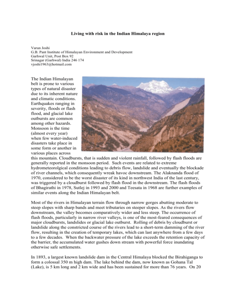
Living with risk in the Indian Himalaya region Varun Joshi G.B. Pant Institute of Himalayan Environment and Development Garhwal Unit, Post Box 92 Srinagar (Garhwal) India 246 174 vjoshi1963@hotmail.com The Indian Himalayan belt is prone to various types of natural disaster due to its inherent nature and climatic conditions. Earthquakes ranging in severity, floods or flash flood, and glacial lake outbursts are common among other hazards. Monsoon is the time (almost every year) when few water-induced disasters take place in some form or another in various places across this mountain. Cloudbursts, that is sudden and violent rainfall, followed by flash floods are generally reported in the monsoon period. Such events are related to extreme hydrometeorolgical conditions leading to debris flow, landslide and eventually the blockade of river channels, which consequently wreak havoc downstream. The Alaknanda flood of 1970, considered to be the worst disaster of its kind in northwest India of the last century, was triggered by a cloudburst followed by flash flood in the downstream. The flash floods of Bhagirathi in 1978, Sutlej in 1993 and 2000 and Teesata in 1968 are further examples of similar events along the Indian Himalayan belt. Most of the rivers in Himalayan terrain flow through narrow gorges abutting moderate to steep slopes with sharp bands and meet tributaries on steeper slopes. As the rivers flow downstream, the valley becomes comparatively wider and less steep. The occurrence of flash floods, particularly in narrow river valleys, is one of the most-feared consequences of major cloudbursts, landslides or glacial lake outburst. Rolling of debris by cloudburst or landslide along the constricted course of the rivers lead to a short-term damming of the river flow, resulting in the creation of temporary lakes, which can last anywhere from a few days to a few decades. When the backwater pressure of the lake exceeds the retention capacity of the barrier, the accumulated water gushes down stream with powerful force inundating otherwise safe settlements. In 1893, a largest known landslide dam in the Central Himalaya blocked the Birahiganga to form a colossal 350 m high dam. The lake behind the dam, now known as Gohana Tal (Lake), is 5 km long and 2 km wide and has been sustained for more than 76 years. On 20 June 1970, this lake busted again due to a new cloudburst cloud burst and the sudden surge of water sent a tidal wave down the valley raising the level of the river by 50 m at Srinagar, a town almost 110 km away. The entire town was washed away. Two days later, when the water reached Hardwar, at the junction with the Ganges, another 125 km away, the floodwater raised the level of the Ganges by nearly four meters. Such flooding has an immense impact on the economy of the region and the safety of the local population. On 8 July 1993, a rock fall in the Nathpa area stopped the flow of Sutlej River for 30 minutes, creating a 6 kilometre long temporary lake. The raised river level allowed some water to enter the hydroelectric power installation of the Nathpa Jhakri power plant, halting it for three months and resulting in a revenue loss of millions of dollars. The cost of the removal of the dumped rock fall mass and the treatment of hill slope also ran into the millions. More than 200 people were killed, and many bridge buildings and road suffered damage. The majority of the settlements in this area located on the middle slopes. However, in the areas where fluvial terraces exist, people prefer to exploit such flat areas such as those adjacent to the rivers. These areas are considered to be the most fertile locations by Central Himalayan standards, but at the same time are most vulnerable to floods caused by the breaching of landside-induced dams. Evidence of past damming in different river basins of the Indian Himalayas suggest that the river was blocked many times, particularly at the confluence with tributaries. A combination of factors appears to contribute to flash flood and cloudburst. The fragile geology and torrential rains play a significant role in destabilizing the Himalayan terrain. The entire Himalayan belt is, both tectonically and seismically, a very sensitive domain with strong tectonised rocks and fragile mountain slopes vulnerable to the onslaughts of rains. The cumulative effects of past earthquakes in such a zone aggravate these phenomena. The studies from Nepal and Pakistan show that the extreme rainfall events have increased in last few years in these countries. A long-term study predicting the incidence of cloudbursts is necessary. Even a cursory examination of the severity of different natural disasters occurring in the Himalayan region indicates that the dwellers of this region are living with the risk. Yet a mechanism for coping with these risks in the field has yet to be developed.
