SPATIAL THINKING
advertisement
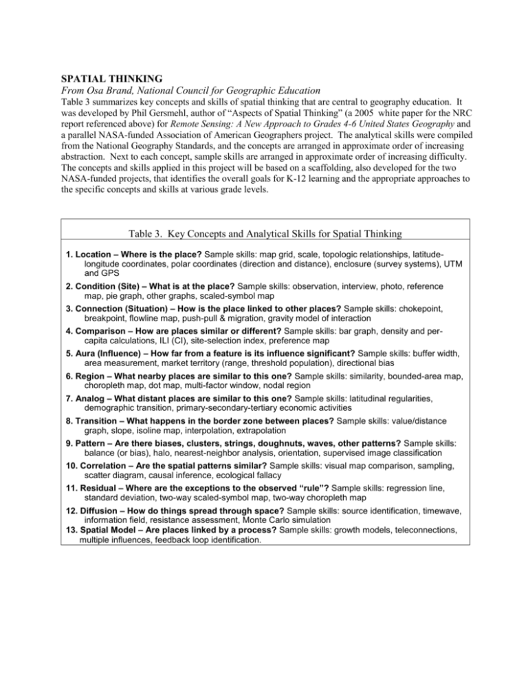
SPATIAL THINKING From Osa Brand, National Council for Geographic Education Table 3 summarizes key concepts and skills of spatial thinking that are central to geography education. It was developed by Phil Gersmehl, author of “Aspects of Spatial Thinking” (a 2005 white paper for the NRC report referenced above) for Remote Sensing: A New Approach to Grades 4-6 United States Geography and a parallel NASA-funded Association of American Geographers project. The analytical skills were compiled from the National Geography Standards, and the concepts are arranged in approximate order of increasing abstraction. Next to each concept, sample skills are arranged in approximate order of increasing difficulty. The concepts and skills applied in this project will be based on a scaffolding, also developed for the two NASA-funded projects, that identifies the overall goals for K-12 learning and the appropriate approaches to the specific concepts and skills at various grade levels. Table 3. Key Concepts and Analytical Skills for Spatial Thinking 1. Location – Where is the place? Sample skills: map grid, scale, topologic relationships, latitudelongitude coordinates, polar coordinates (direction and distance), enclosure (survey systems), UTM and GPS 2. Condition (Site) – What is at the place? Sample skills: observation, interview, photo, reference map, pie graph, other graphs, scaled-symbol map 3. Connection (Situation) – How is the place linked to other places? Sample skills: chokepoint, breakpoint, flowline map, push-pull & migration, gravity model of interaction 4. Comparison – How are places similar or different? Sample skills: bar graph, density and percapita calculations, ILI (CI), site-selection index, preference map 5. Aura (Influence) – How far from a feature is its influence significant? Sample skills: buffer width, area measurement, market territory (range, threshold population), directional bias 6. Region – What nearby places are similar to this one? Sample skills: similarity, bounded-area map, choropleth map, dot map, multi-factor window, nodal region 7. Analog – What distant places are similar to this one? Sample skills: latitudinal regularities, demographic transition, primary-secondary-tertiary economic activities 8. Transition – What happens in the border zone between places? Sample skills: value/distance graph, slope, isoline map, interpolation, extrapolation 9. Pattern – Are there biases, clusters, strings, doughnuts, waves, other patterns? Sample skills: balance (or bias), halo, nearest-neighbor analysis, orientation, supervised image classification 10. Correlation – Are the spatial patterns similar? Sample skills: visual map comparison, sampling, scatter diagram, causal inference, ecological fallacy 11. Residual – Where are the exceptions to the observed “rule”? Sample skills: regression line, standard deviation, two-way scaled-symbol map, two-way choropleth map 12. Diffusion – How do things spread through space? Sample skills: source identification, timewave, information field, resistance assessment, Monte Carlo simulation 13. Spatial Model – Are places linked by a process? Sample skills: growth models, teleconnections, multiple influences, feedback loop identification.


