Groningen
advertisement
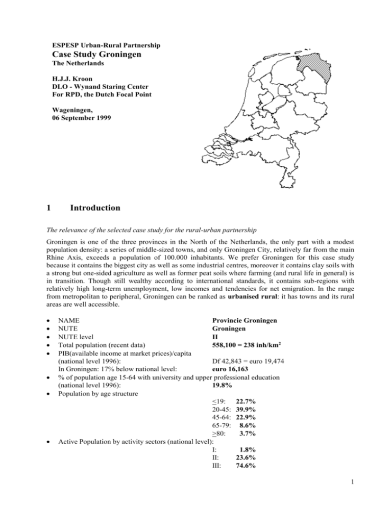
ESPESP Urban-Rural Partnership Case Study Groningen The Netherlands H.J.J. Kroon DLO - Wynand Staring Center For RPD, the Dutch Focal Point Wageningen, 06 September 1999 1 Introduction The relevance of the selected case study for the rural-urban partnership Groningen is one of the three provinces in the North of the Netherlands, the only part with a modest population density: a series of middle-sized towns, and only Groningen City, relatively far from the main Rhine Axis, exceeds a population of 100.000 inhabitants. We prefer Groningen for this case study because it contains the biggest city as well as some industrial centres, moreover it contains clay soils with a strong but one-sided agriculture as well as former peat soils where farming (and rural life in general) is in transition. Though still wealthy according to international standards, it contains sub-regions with relatively high long-term unemployment, low incomes and tendencies for net emigration. In the range from metropolitan to peripheral, Groningen can be ranked as urbanised rural: it has towns and its rural areas are well accessible. NAME Provincie Groningen NUTE Groningen NUTE level II Total population (recent data) 558,100 = 238 inh/km2 PIB(available income at market prices)/capita (national level 1996): Df 42,843 = euro 19,474 In Groningen: 17% below national level: euro 16,163 % of population age 15-64 with university and upper professional education (national level 1996): 19.8% Population by age structure <19: 22.7% 20-45: 39.9% 45-64: 22.9% 65-79: 8.6% >80: 3.7% Active Population by activity sectors (national level): I: 1.8% II: 23.6% III: 74.6% 1 Number of cars /1000 inhabitants CO2 emissions/inhabitant. The regional level may be lower. 362 2.13 (national level 1995) (national level 1996) Indication of spatial planning relevance The spatial planning for the northern provinces has a strong tradition in trying to develop their regions economically and culturally. They try to use their potentials of rest, nature and landscape to bind and attract inhabitants and especially to attract industry and interregional services, including tourism. They claim support from national agencies because of the contribution of natural gas exploitation, concentrated in Groningen, to the national energy supply, exportation and taxes. In this province, specifically, plans are being developed to create nature and tourism opportunities in sub-marginal agricultural lands. There are also opportunities to attract cattle breeding from sandy regions elsewhere with environmental problems of manure exceeds. Third, new communication technologies may compensate for the relative distance from major foci of professional services. Regional functionality/productive specialisation Apart from some import/export, the province has mainly been based on agriculture, fishing and peat digging, with related industries (shipbuilding, potato-flour).. In recent decades, the gas drilling is adding to the economy. The city of Groningen is the major centre of trade and services Type of political-administration and main powers The Netherlands has a strong central government, but provinces, municipalities and some specific authorities (e.g. water boards) have limited self-government and some autonomy. Identification of the main actors on the process of development In the Netherlands, entrepreneurs make their own decisions about localisation of their activities (farming, industry, construction etc.) within limits of laws and bylaws, and influenced by market demands, cost structure, agreements on subsidies, impositions, concessions etc. Governments at all levels promote participation of the public and its interest groups for spatial planning and other policies. Development model The Netherlands have destination plans of municipalities for both built-up areas and countryside, limited by regional plans of provinces. The central government set out base lines and has power to intervene. A series of territorial projects can influence and implement changes in spatial plans by contracts between government agencies and private partners (entrepreneurs and non-governmental organisations), including agreements on subsidies, impositions, concessions etc. Conditions and instruments of success The success lies in the balance between local and regional initiatives, the provincial support and cooperation with bordering provinces, and the claims on national agencies. The main challenges are how to use effectively the potentials of natural and historical resources, and how to maintain (services in and transportation lines to) small villages. 2 Innovations When preparing the regional plan of 1994, the provincial government was already aware of risks facing arable farming with crops under the EU regulations. It was especially concerned about the arable fields in the central and eastern part of the province, and their relations with other activities, possibly adding to older problems in that specific region. Farmers should be flexible enough to change their production system, choosing new techniques or crops. They were encouraged to be involved in ‘management contracts’ or otherwise combine agriculture with nature management, though not especially in this region. Here, the province would explicitly welcome the establishment of dairy farms. But even then, it was not expected that agricultural lands could hold up their function everywhere. The province aims at using parts of those lands for nature, recreation or forest. Some first steps have been 2 taken for nature development (‘Middle Groningen’) and combination of the three functions and housing as well, in the ‘Blue City’ near Winschoten. The introduction of small-scale industry and service, and improved connections with towns, should also contribute to ‘a modern countryside’, in order to prevent depopulation. In the nature development project of ‘Middle Groningen’, agricultural land would be developed into nature areas in a strip from Hoogezand (not far from the city) to Delfzijl and Appingedam, including a lake and current nature areas. Farmers were not be expropriated but the province expected that they would be bought out to a high degree. The land use changes here were apparently considered sufficient to start the process. In fact, the strip of nature areas was considered to be the ‘natural axis’, paralleled by a strip of villages, called the ‘cultural axis’. This may complete the general idea of combining ecology and economy into sustainable development. The ‘Blue City’, north of Winschoten, is now a circle of villages along a few low but natural heights in an otherwise flat landscape. Agriculture prevails to the west, north and east, and the extreme openness of its landscape is to be protected. The motor-road from the city to Germany goes along the south, bundled with canal and (rapid) train. The corridor here contains Winschoten and a larger village, both with industrial areas, and separated from each other by agriculture with intermediate openness. East of the planning area, there are starting points, apparently considered to be good enough: a natural marsh and a combination of forests and recreation zones. The western part of the planning area itself now contains two nature areas and a recreation area, and the province already planned new nature areas to expand and combine the two blocks. The main part of the planning area, however, consists mainly of agricultural areas (with intermediate openness) and the regional plan did not yet indicate land use changes here. Moreover, new residential areas were not indicated at all. The province announced a further process to work out plans for this project. In the meantime, some more radical ideas were launched, including the development of a series of wetlands by stopping drainage. New dikes could be built to isolate a series of drained areas and to guarantee parts to remain dry. Further, layers of clay could be dug to form relatively deep waters, and used for industry or for artificial hills. After stopping drainage, a series of marshes, open waters, islands and peninsulas would come about, aided by pumping water in, if necessary. Nature would develop, either spontaneously or helped by planting trees and shrubs or by introducing plants and animals. Land plots on islands or near the many coastal lines could be sold or rented for marinas, camping grounds or bungalows. Although experiments with stopping drainage and pumping water in into polders were implemented before, this plan and the provincial politician who launched it became well known. It was no former lake that was to be given back to the water, small and relatively expensive to drain, to be used for public recreation of nearby townspeople. A whole region, cultivated since centuries, would be given up, and planners claimed an exploitation that would be return investments. There were serious doubts, of course. Would the qualities and soils provide starting conditions to provide nature qualities? Would the farmers inside readily sell their lands or to participate in the project? Would the rise of water level influence the surrounding lands and villages? Would tourists and immigrants come in to buy or rent accommodations and services in sufficient numbers to make the project economically successful? There is no official project going on right now, but in the meantime, similar ideas have been launched in other parts of the country as well. And perhaps the discussions gave more credits too less radical plans like ‘Middle Groningen’ or the ‘Blue City’. 3 3 Main Issues 3.1 Settlement structure and accessibility to infrastructures City and surrounding countries An interrupted series of dunes divide the North Sea proper from tidal areas in the Wadden Sea, and its branches: Eems-Dollard, still a shipping route, and the former Lauwerszee, now a polder. The Wadden Sea and its branches were important barriers for land traffic, like the moors near what is now the German border. The Wadden Islands were especially isolated, while most of them belong to the province of Frisia. Along many parts of the Wadden coast, clay sediments has been delivered and after building dikes and some drainage, the polders there lie relatively high and are suited for arable fields. The cultivation started from natural heights and artificially enlarged hills (’terpen’) that were protected against floods until the dikes were built. The centre of the province lies relatively low, so here more intensive drainage is needed for cultivation, except for some higher and sandy soils in the west. The peat in the moors of the south-east was extensively dug, and remaining soils are drained and used as arable fields. The city of Groningen developed where several brooks flow together into the major lowland stream that ends in the former Lauwerszee and eventually into the Wadden Sea. Lacking important shipping routes, land connections are important. The pretty flat country permitted the city to spread its influence, coasts and moors could protected it against competitors from north and east, but there are hardly barriers to south and west to keep other cities out. Nevertheless, the domination of ‘The City’ spread from government to trade and services, and it became the major town, both for the province and for parts of the bordering provinces of Frisia and Drenthe. There have been some secondary industrial towns (Hoogezand, Veendam, Winschoten) based on ship building, potato flour and some diversification later, including gas drilling. The Eems-Dollard shipping route is used to develop the harbours of Delfzijl and Eemshaven, including metals. In general, the Netherlands shows a polynuclear settlement structure with two extremes. The Randstad forms an ‘edge city’ around a ‘green heart’. The northern provinces, on the other hand, form a ‘green belt’ around a ‘heart city’, or ‘a jewel of state in golden frame’ as the provincial hymn for Groningen puts it. There are some pearls in the frame, to be accurate. Eastern and southern provinces show a less regular settlement structure. There were periods of immigration, especially from northern Germany, but emigration to the city or farther away have dominated. Parts of the province are notorious because of long-standing unemployment and low-waged jobs. The mean income is well below the national level. In spite of emigration, especially of young people, the province’s population has grown till now, but some regions may seriously become grey and small villages may even face depopulation to a certain extent. The evaluation of the effects of rapid transport routes on the siting of different activities The location near the coast and the lack of important international harbours restricted the development of important bundles of infrastructure. Secondary railroads, major canals and some highways go the east (Eemshaven, Delfzijl, Germany) and west (Leeuwarden). Minor railways have been improved and enlarged to connect the harbours of Delfzijl and Eemshaven. The main connections, however, are to the south (Assen - Zwolle) and via the Veluwe region to the southern and western provinces, including the Randstad. A long dam transformed the former Zuiderzee into IJsselmeer, replacing a shipping line from Frisia to North Holland, but did not as yet develop into a major east-west route. A shortcut of railway and motor-road from Zwolle to Amsterdam is being developed, stressing again the southbound traffic from Groningen. The regional airport is close to the city, but connections to Amsterdam (Schiphol) dominate, too. The first rapid train from the Netherlands to Germany will cross Gelderland. There are plans to open a second one directly to Hamburg and Bremen that will cross Groningen. It will certainly stop in the city but not in other places in the province. It is expected that this line will influence the attraction of the whole region, not just the city. 4 The role of middle size urban centres Since they were dominated by the city of Groningen with 170.000 inhabitants now, regional centres had difficulties to grow into cities of more than 50,000 inhabitants. Nevertheless, several villages grew into towns with important regional functions of industry, trade and services. Only a few subregions, including the northern coastal strip, lack centres with more than 10,000 inhabitants within 20 km. The spread of housing and its consequences on the transport movements of the population The growing concentration of population in the city and some middle-sized towns has the advantage of restricting traffic for work, schools and jobs within urban limits. The remaining rural population may survive by owning and using private cars, since public transport is limited. This may cause some environmental problems, especially if regional centres are relatively far away. Listing the costs of sub-urbanisation There is only a limited sub-urbanisation around some middle-sizes towns. More commuters live around the city, of course, that lost part of its well-to-do families. The traffic axis from Groningen to Assen may be further developed as a corridor for firms as well as for housing and tourism. It is promoted as ‘the golden line’. Many commuters live in Haren along this line, just south of the city, but in recent decades, other villages in a circle around the city have also profited of sub-urbanisation. 3.2.Diversification of the economy in a wider rural-urban context Relocation of the industrial system The national government invested in the exploration and exploitation of gas in Groningen and related exploitations elsewhere. It returned part of its yield to the diversification of the three northern provinces, where the eastern half of the province got special attention. Part of the strategy was to subsidise Dutch firms if they opened a branch in the region and to order national public services to move there. In most middle-sized town, industrial areas have been developed, including the harbours of Delfzijl and Eemshaven. Services complementary between city and countryside For the three northern provinces, the city of Groningen serves as an excellent centre for specialised facilities. Smaller towns add their weekly services on a regional scale, but have to compete with the major city, especially if they are close to it. Many villages have their day-to-day services but the very small ones have difficulties to maintain that level. Diversification of the productive system Diversification of the economy was largely focussed on gas digging, harbours, and industrial centres. The city and medium-sized towns profited from the national and provincial policy, but rural areas had difficulties to do so. The Wadden Islands and a few lakes have attracted tourists, and some villages are somewhat popular for weekends and second homes. Most parts of the province have intensive agricultural use and the landscape, though interesting in itself, is less attractive than the big lakes in Frisia or the forests and heather in Drenthe. The pressure on arable fields is a threat as such, but can also invoke new opportunities, including expansion of the dairy system. Plans are also being discussed to turn parts of the arable fields into lakes for water recreation, saving islands and peninsulas for marinas, camping and bungalow parks, second homes etc. 5 New opportunities on communication technologies If delivery systems remain adequate, new communication technologies may help relatively remote regions like the province of Groningen to hold and attract high-tech and other specialised firms. 3.3. Territorial impacts of agricultural change Marginalisation versus increasing profitability of agriculture and forestry Agriculture in Groningen has grown, both for deliveries within its own region, including the city and towns, and for exportation to major urbanising regions, not too far from it. New polders along the Wadden coast, and soils of former peat diggings have been cultivated. Improvement of soils and water systems, seeds and manure, weed and pest control, resistant races, generally led to high productivity. Because of mechanisation, less labour per hectare was demanded and small farms could grow, while the number of farms decreased somewhat. Industrial processing of agricultural products, including potato flour, has profited from agricultural growth. Restricted mobility has limited, however, the exportation of vegetables, flowers and meat. Thus, exportation was focussed on bulk goods like cereals and potato flour. Globalising economy strengthens the competition, especially for bulk goods, from other regions in the European and elsewhere. Products under EU regulations face risks now the Common Agriculural Policy is changing. There is a tendency among farmers to sell arable fields to cattle breeders from elsewhere or to learn the dairy system themselves. Greenhouses or breeding stables seem to offer less, though concentrations of greenhouses are planned in the province. Intensification versus extensification of land use Past and present of agriculture in Groningen have mainly been a process of intensification of land use, at least in terms of improvements of soils, water systems and races (capital), as well as seeds and manure, weed and pers control (exploitation). As prices remained high, the population somewhat growing, and transportation costs acceptable, it was worthwhile to intensify land use. It was, however, only intensification of arable fields and meadows; greenhouses and breeding stables were not developed to a large extent. Diversification (pluriactivity) versus specialisation Although some regions maintained a mixture of meadows and arable fields, specialisation started quite early in the case study area. Now, there is some tendency to change arable fields into meadows for dairy production or into small forest lots for timber. Except for a small minority of farms, non-agricultural activities have not been developed very much. The landscape and the farm holdings within it should change very much to attract sufficient numbers of holidays and day trips in order to promote farm-based recreation. If such changes are to be realised, it is expected that many farmers will move or give up their farming to a very large degree. Only after a period of transition, remaining farms can profit from tourism, if successfully realised in their region. Non-agricultural services other than tourism will be restricted to immediate surroundings of the city and some towns. 3.4 Natural heritage: conservation and development Prevention of land use conflicts on areas with natural heritage potentials Except for new residential areas near cities and towns, urbanisation gives little direct conflicts. It is the industry and mining which causes discussions about environmental conditions for nature. There have been many other discussions about impacts, especially on the Wadden Sea, recognised as a nature area of international importance for migratory birds especially, and the seals as the critical mammal species. The 6 potato flour industry, trying to control its pollution by concentrating it in a single ‘grease pipe’, had to handle conflicts with environment and nature organisations, as the metal industry of Delfzijl and Eemshaven later. Gas drilling caused some soil contraction under the main land, and this may also be expected for the Wadden Sea. The drilling itself may cause some pollution, as well as leaking pipes from the Wadden Islands. Non-industrial uses are under attack too, for instance military manoeuvres with noisy airplanes, cultivation of the last polders along the Wadden coast, fishing in the Wadden Sea itself. Even hiking during low tide and recreational boating are followed critically. Preservation of strategic river basins for water supply The river Ems from Germany feeds the Eems-Dollard along the provincial and national border. Its water is mainly used for shipping and (metal) industry and seems to fulfil the quality standards for that, though not for the nature values in the Wadden Sea. A series of small brooks, mainly from Drenthe feed the lowland streams and canals in the province. Most of them are canalised for shipping and water control, ending in the Wadden Sea through barrages. The pollution by potato flour industries, and by sewage water, major sources of pollution, seems pretty well under control by now, leaving agriculture as a further source. Especially the middle valley of the Drenthse Aa is increasingly protected as a nature area, in spite of continuing agricultural use upstreams adding nutrients and some pollution. As such processes continue, it becomes worthwhile taking next steps to clean the lowland streams and canals. The concern till now about the water system is mainly for nature in the Wadden Sea. The quality levels of lowland streams and canals, if necessary in addition to ground water, seem to be adequate for agriculture and water recreation. Ground water supplies most of the potable water, but the general lowering of ground water levels in the Netherlands may invoke a discussion, also in Groningen, about switching to open waters. A further cleaning of lowland streams seems to be a prerequisite for that. One saving basin is planned in the western part of the province. Renewable energy production The energy supply of Groningen depends largely on oil, gas and coal, and there is much gas production in the province. Intensification of land use since the building of dikes caused deforestation of the country, if tidal influences had given much space to woodlands. Timber is largely important from abroad, and from other parts of the Netherlands. There is a tendency, however, to change parts of the arable fields into small forest plots. In spite of limited sunshine in our climate, experiments with solar energy are going on with some succes. More important may be the development of windmills, especially along the Eems-Dollard near Delfzijl and Eemshaven. Take advantage from natural spaces for local economy diversification The sea dunes on most of the Wadden Islands are used for timber supply and intensively for outdoor recreation (including the beaches of course) as well as for nature values as such. Nearby hotels, campings, restaurants and kiosks profit from tourist spending. The larger islands belong to other provinces, however. The few lakes have similar, though restricted impacts on the local and regional economy. If new lakes will be developed, this may add significantly to tourism and related activities. Fight against erosion (climate and anthropic) Apart for the coasts, there are no major erosion problems in Groningen. Soil contraction may be considered to be a form of erosion, however, causing some limited inconveniences. Coastal planning There has been a fight against erosion and sedimentation along the Wadden Islands, changing the form and position of the islands, in the long run threatening villages and farms. Experiments are announced for 7 the virtually uninhabited smaller islands in the province of Groningen to stop the fight, accepting the spontaneous processes more and more. Along many parts of the Wadden coast, clay has been sedimented and after building dikes and some drainage, the polders there lie relatively high and are suited for arable fields. This process is still going on, but suggestions are made to stop new cultivation, leaving the ecological process to produce nature areas. 3.5 Cultural heritage: culture in economic development strategies Close articulation between “culture” and “nature” The countryside of Groningen is deeply influenced by dikes, drainage, peat digging, cultivation and the developments of infrastructure, towns and villages. This started with the pre-historic ‘wierden’: natural hills that were artificially enlarged. In as far as this landscape can be called ‘nature’ it has very close relationships with ‘culture’, including the few lakes. Even the Wadden Island dunes, and their valleys, have been greatly influenced by man. Only the North Sea, Wadden Sea and Eems-Dollard can be called ‘wilderness’ to a certain degree. On the other hand, even towns have been developed under the ‘natural’ circumstances of their surroundings. Defining a new approach of rural landscape In contrast to cities, rural areas have been defined for agriculture, excavations etc. that can hardly be realised in built-up areas. In due time, the countryside have got more functions than primary production of food, peat, clay etc. for urban and rural populations. People working in towns try to stay in villages or try to move there as yet, if they prefer living and recreation opportunities in the countryside of those in towns. If they are willing or forced to live in urban conditions, most of them will spend periods of their free time in the countryside. Even if they don’t do that regularly, they want to be reassured that there is nature out there. Rural people on the other hand, may work in towns or visit them for shopping, services or outings. Progressively, both the towns and the countryside became part of the living environment of both urban and rural people. From this point of view, the cultural heritage in the countryside should not be conserved for the local people alone, but for a much wider population. Moreover, conservation is not only the protection of monuments inherited from former generations but also the development of new assets for the use of generations to come. We should try to conserve potential assets from recent periods, and put the best of our own rural culture in the countryside. This may be particularly important for metropolitan regions, but it also has more general implications. Reinforcement of network of small and medium rural cities Even if strengthened by industry, all medium-sized towns have functions as regional centres. Since their regions are rural by definition and their populations don’t exceed 50,000 inhabitants, the centres have some rural character as well, though not specifically agricultural. It is even doubtful if the towns would survive without strong surrounding series of villages. On the other hand, most of the towns have grown quite recently from larger villages, more or less as an outpost of the city of Groningen. Municipalities and other actors in such towns should co-operate in a network, including towns of Frisia and Drenthe, in order to attract Dutch and foreign visitors who would otherwise be concentrated on the city of Groningen. The role of urban centres The city of Groningen is the cultural capital as well, with a series of monuments from history as well as current cultural centres. The middle-sized centres have limited numbers of old monuments to preserve, 8 and should concentrate on potential assets from recent periods, like harbour installations, factories, public buildings and nice neighbourhoods. And we should try to put the best of our own urban culture in the few areas to be built-up in the next decades. 3.6 Local administration: prospect for co-operation between rural and urban authorities Settlement structure In early Middle-Ages, the city of Groningen was the northernmost town of Drenthe, governed by the prince-bishop of Utrecht, while the surrounding country to the west and north were free communities of Frisian descent. In due time, the town succeeded to dominate most of the communities. By the formation of the Republic of the Seven United Netherlands, ‘City and surrounding countries of Groningen’ was a separate member and still one of the twelve Dutch provinces. The domination of ‘The City’ spread from government to trade and services, and it became the major town, both for the province and for parts of the bordering provinces of Frisia and Drenthe. Groningen came under the influence of the Houses of Bourgundy and Habsburg until the struggle (15681648) against Philip Habsburg, King of Spain and Lord of the Netherlands. A brother of William Nassau, Prince of Orange, was active in this region, and his descendants, the ‘Frisian branch’ became Lieutenants in northern and eastern provinces, and they also took over the other provinces after William’s branch died out. Legal differences between the city and rural communities disappeared, but differences in population levels and prosperity remained. The city has a higher status and more power, as it is bigger and growing, compared to villages who are small regardless of growth, and to smaller towns with mostly lower growth rates. In spite of emigration from rural areas and immigration to the city, village populations also grew. Some annexations took place, but most rural municipalities could maintain their independence, containing several hamlets and only one or a few villages. There are some secondary industrial towns developed later (Hoogezand, Veendam, Winschoten) based on shipbuilding, potato flour and some diversification recently, including gas drilling. An expanded harbour developed Delfzijl. Towns and rural areas depend on each other, and inhabitants seem increasingly aware of that. Nevertheless, most local politicians stick to their independence from other municipalities and only accept the authority of the EU, national and provincial governments. A disadvantage of one dominating city may be that city and surrounding municipalities can suspect each other of influencing provincial policies too much. Moreover, local politicians often concentrate on built-up areas where most of their voters live, at the cost of rural areas within the boundaries of their municipality, important for a somewhat wider public. Urbanisation strengthened some tensions between city and village municipalities. Some provincial and national public services are responsible for important rural interests (agriculture, nature, recreation), while many others concentrate on urban matters (economy, housing). City-rural tensions tend to be duplicated at higher government levels. Moreover, several political parties seem to take part in potential conflicts. In the case of Groningen, sub-urbanisation adds little to such tensions. Planning culture The Dutch population has grown from 12 million in the late fifties to 16 millions now, with high birth rates until about 1970, and resulting in a population density of almost 400 inhabitants per km2. A growing economy, especially between 1955 and 1975, allowed for higher standard for living, working and mobility, demanding more space per inhabitant, while agriculture has long been regarded essential for the national food supply and exportation. The national planning culture in the Netherlands is very much imprinted in the 1960’s because of such developments and prospects. Economical planning was already going on, primarily based on trilateral relationships between employers’ organisations, labour unions and governments. It was aimed at the distribution of income over net wages, income insurance and public services, as well as at productivity 9 growth to earn that income. It was about time, then, to add the planning of land use and public projects. Plans were made for national highways and for developing industrial areas. Planning criteria per household or inhabitant were developed for housing measures, hospital beds, school teachers, theatre seats and so on. Recreation areas near population concentrations should be added to the water areas and to the few forest, heather and dune areas in the country. In addition to such national plans and projects, provinces were asked to develop regional plans, which delimit residential and industrial areas, nature and recreation areas and the like. Municipalities were asked to change from their traditional ‘extension plans’ for new built-up areas, to full-fledged ‘destination plans’ for already built-up areas and for their rural areas as well, within the limits of national projects and provincial plans. Experiments were started with regional authorities, filling the assumed gap between municipalities and provinces, to merge municipalities, or split up provinces. In spite of the wish to concentrate growth in the Randstad, there was concern about ‘underdevelopment’ in the northern provinces and the eastern half of the case study area in particular. As soon as the gas stock was found, the national government invested in its exploration and exploitation and related exploitations elsewhere. It returned part of its yield to the diversification of the three northern provinces, where the eastern half of the province got special attention. Part of the strategy was to subsidise Dutch firms if they opened a branch in the region and to order national public services to move there. A similar strategy was followed for southern Limburg during and after the closing of coal-mines. Local and provincial authorities are confronted with a dilemma. On the one hand, they want to guarantee future jobs for inhabitants and their children who want to live here. This may imply acceptance of growing towns, villages, firm areas and infrastructure, even investments to stimulate all that. On the other hand, the middle-range density of population, the moderate intensity of land use and the modest growth of both have guaranteed the quietness and openness of the region. Those qualities are the main reasons to prefer Groningen above other regions, the Randstad in particular, the very reasons why people want to stay here and the main specific arguments to attract new activities. The national government is inclined to choose for concentration of growth in agglomerations generally, and ‘bundled de-concentration’ of growth in old and new towns of the Randstad, accepting controlled development within ‘corridors’ along main infrastructure axis. For Groningen, this may imply further growth of the city and its surrounding municipalities into an agglomeration, including a ‘corridor’ to Assen. New attempts to develop east-west connections into a major ‘corridor’ deserve discussion, but the further growth of regional centres seems to have priority, even if not in such a ‘corridor’. Co-operation for the conservation and development of the natural heritage Wadden Islands and Sea deserve further conservation, and a proper balance with market values must be found with support of all actors. Improvement of south-western and south-eastern parts of the provinces should continue, which seems to be difficult enough for the former moors. The main challenge however, is to hold up qualities in the northern and central countryside of the case study area, where actual nature values are low and agricultural interests at stake. Radical interventions in land use forms, like agricultural transitions or the development of new lakes, may be needed, indeed. Both farmers’ and conservationists’ organisations should look for sustainable developments here. 10
