Midterm Review - The University of Texas at San Antonio
advertisement
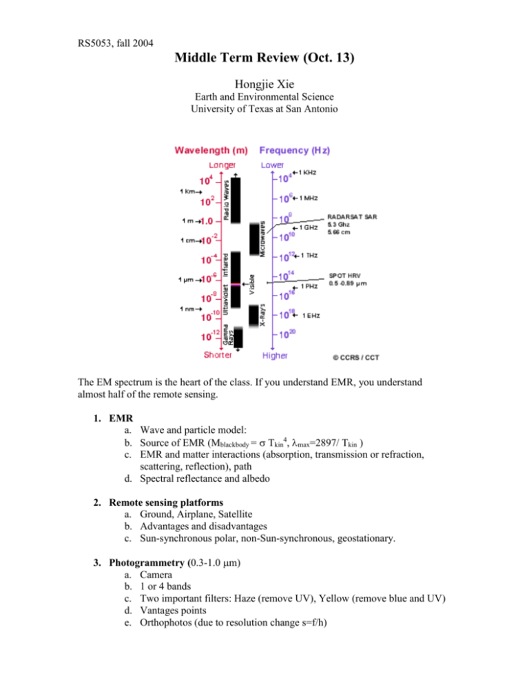
RS5053, fall 2004 Middle Term Review (Oct. 13) Hongjie Xie Earth and Environmental Science University of Texas at San Antonio The EM spectrum is the heart of the class. If you understand EMR, you understand almost half of the remote sensing. 1. EMR a. Wave and particle model: b. Source of EMR (Mblackbody = Tkin4, max=2897/ Tkin ) c. EMR and matter interactions (absorption, transmission or refraction, scattering, reflection), path d. Spectral reflectance and albedo 2. Remote sensing platforms a. Ground, Airplane, Satellite b. Advantages and disadvantages c. Sun-synchronous polar, non-Sun-synchronous, geostationary. 3. Photogrammetry (0.3-1.0 m) a. Camera b. 1 or 4 bands c. Two important filters: Haze (remove UV), Yellow (remove blue and UV) d. Vantages points e. Orthophotos (due to resolution change s=f/h) 4. Detector configurations a. Discrete detectors and scanning mirrors, Linear array, Area array b. Across track and along track c. Dwell time d. FOV and IFOV 5. Resolutions a. Spatial, spectral, radiometrical, temporal 6. Passive remote sensing (Sun, Earth, or atmosphere) a. Multi-spectral (0.4-2.5): Landsat, MODIS, AVHRR b. Hyperspectral (0.4-2.5): AVRISS, Hyperion c. Thermal (3-5, 8-14): (1) all material emit thermal energy (Trad, Tkin, ) (2) remote sensor (TB, T or land surface temperature, Planck equation) d. Microwave (0.75-100cm): Earth emit microwave energy, rain detection 7. Active remote sensing (energy from sensor) a. Radar (0.75-100 cm) (1) Azimuth, look, range, depression angle, polarization (2) Ra, Rr (3) Roughness, penetration ability, shadow, speckle, banding (4) Real Aperture Radar (5) Synthetic Aperture Radar (SAR) (6) InSAR (elevation and surface displacement; one SAR two antennas, one SAR in different times) b. Lidar (0.3-0.4, 0.4-0.7, 0.7-1.1) (1) Ranger finders (elevation) (2) DIAL (gas concentration) (3) Doppler (velocity of a target) (4) Raman (gases species) 8. Image processing related a. Byte, integer, floating b. Image stored as raster c. BSQ, BIP, BIL d. Band math, statistics, link, gray or color image (band composition), spectral curve and spectral library e. Atmospheric correction, radiance, reflectance, NDVI f. Radiance, brightness temperature g. 3D view by draping image and vector overlaying DEM
