Will arrive in Natchez Mississippi in the afternoon and will be staying
advertisement
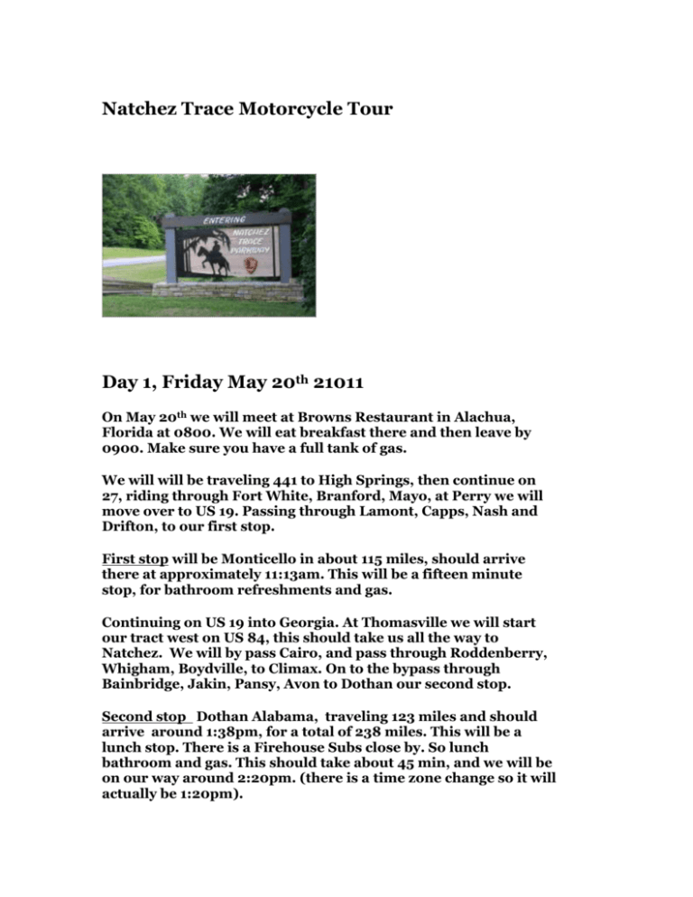
Natchez Trace Motorcycle Tour Day 1, Friday May 20th 21011 On May 20th we will meet at Browns Restaurant in Alachua, Florida at 0800. We will eat breakfast there and then leave by 0900. Make sure you have a full tank of gas. We will will be traveling 441 to High Springs, then continue on 27, riding through Fort White, Branford, Mayo, at Perry we will move over to US 19. Passing through Lamont, Capps, Nash and Drifton, to our first stop. First stop will be Monticello in about 115 miles, should arrive there at approximately 11:13am. This will be a fifteen minute stop, for bathroom refreshments and gas. Continuing on US 19 into Georgia. At Thomasville we will start our tract west on US 84, this should take us all the way to Natchez. We will by pass Cairo, and pass through Roddenberry, Whigham, Boydville, to Climax. On to the bypass through Bainbridge, Jakin, Pansy, Avon to Dothan our second stop. Second stop Dothan Alabama, traveling 123 miles and should arrive around 1:38pm, for a total of 238 miles. This will be a lunch stop. There is a Firehouse Subs close by. So lunch bathroom and gas. This should take about 45 min, and we will be on our way around 2:20pm. (there is a time zone change so it will actually be 1:20pm). Still traveling on US 84, we will pass through Brannon Stand, Level Plains and the bypass through Enterprise, here we will jump on SR 192, to SR 134 to eliminate a few miles. Near Duvall we will get back to KUS 84, passing through Sanford, Andalusia River Falls, Cohassett and Evergreeen and then Monroe here we spend our first night. Third and final stop for the first day. We will be staying in Monroeville Alabama. We should arrive there at around 3:38pm after 127 miles for total of 366 miles for the day. We will stay at the Holiday Inn Express. This hotel is located at 12o hwy 21 South, just off of US 81. Monroeville is a quaint little town which has an interesting history. The town received the designation of “Literary Capital of Alabama” in 1997 by joint proclamation of both the Alabama House and Senate because of its history to produce many famous writers, such as, Nelle Harper Lee, Truman Capote, Mike Stewart, Cynthia Tucker and Mark Childress. The town has an annual production of the play “To Kill a Mockingbird” in both April and May. If we have enough time we can ride by the outdoor stage where they perform the play. Here are several places that have been recommended for supper that night. Davids Catfish House www.davidscatfishhouse.com Radley’s www.radleysfountaingrill.com and the The Mockingbird Cafe Day Two, Saturday May 21 We would like to leave and be on the road by 900am. The hotel has a full breakfast so we will be sure and gas up the night before. Jumping on US 84, we pass through Grove Hill, and to Coffeeville, passing through Silas to our next stop. First Stop Will be in Laurel Mississippi, at around 1056am, and 117miles. Again this will be a gas, bathroom, and refreshment stop and it should take about 20 miles . Back on the road and still on US 84 we will travel about 65 miles. Second Stop At 1226pm and about 65 miles away, we will stop for lunch in Monticello. There are several restaurants to eat at and this should take about an hour. We will top off our tanks before moving on to Natchez. Third stop We will be arriving in Natchez Mississippi at around 247pm and staying at the Eola Hotel downtown Natchez. We will be near restaurants and other types of entertainment. Natchez, the county seat of Adams County, is one of Mississippi's oldest cities. Located along the Mississippi River, Natchez is the southern terminus of the Natchez Trace Parkway. Natchez was founded by French colonists in 1716. The city is famous in American history for its role in the development of the Old Southwest, particularly with respect to its location on the Mississippi River. Natchez is well-known for the numerous antebellum mansions and estates built by its early 19th-century planter society, many of whom owned plantations in Louisiana but chose to locate their homes on the higher ground in Mississippi. Prior to the American Civil War, Natchez had the most millionaires per capita of any city in the United States, making it arguably the wealthiest city in the nation at the time. It was frequented by notables such as Aaron Burr, Henry Clay, Andrew Jackson, Zachary Taylor and Jefferson Davis. Today the city boasts that it has more antebellum homes than anywhere else in the United States, partly due to the fact that during the Civil War Natchez was spared the destruction of many other Southern cities Although the hotel has a restaurant and bar, we can venture down to the river and experience the food and night life. We should have a great time during our stay in Natchez. There plenty of places to eat and relax. This place looks interesting, one of the many places to partake in some cold libations. Other places are Dimples, Biscuits and Blues, The Pig Out Grill and Fat Mama’s Tamales. Also maybe in the morning before we get on the Trace we can try Mammy’s Cupboard on US 61. Day 3, Sunday May 22 First day on the Trace! Even though we might be out late, we need to be ready to roll by 900am, we have a long day on the Trace, but it will be worth it. We will only be covering about 160 miles, but there is a lot to do and see. This includes breakfast as well. We will check out a place to eat before we start out. Our first stop on the Trace will be Mount Locust. MOUNT LOCUST Constructed circa, 1780, this home is one of the oldest structures in Mississippi. It functioned as both a working plantation and as an inn, where travelers on the Natchez Trace could rest for the night. Mount Locust is the only surviving inn of the more than 50 that existed during the period of greatest use of the Old Natchez Trace. We should be here for about 40 minutes then on to our next leg of the trip. From here we double back to Highway 553 to cruise down the Church Hill Loop Church Hill Loop Route The rural community of Church Hill is located at the intersection of Mississippi Highway 553 and Church Hill Road. The area is named after Christ Church which sits atop a terraced hill. Built circa 1790, the building’s design was copied from the old country church buildings of England. Across the intersection is a wooden country store built around 1837. The store bears the name Wagners Grocery on the upper header of the store. The store was closed in the late 1990s, after which it was donated to the Church Hill historic society for preservation. It also functioned as the Church Hill, MS post office. It is the oldest known all-wooden heart pine country store that had a post office in the southeastern United States. Antebellum plantations line both sides of Highway 553. Plantations along this 12 mile stretch of road include Gayoso, Pecan Grove, Logonia, Oak Grove, Cedars, Woodland and Springfield Plantation where Andrew Jackson and Rachel Robards were married in 1791. All of the properties are privately owned and not open to the public. Christ Church and the plantations are all listed on the National Register of Historic Places. The Church Hill Loop is 22 miles long – 12 miles along Mississippi Highway 553 and 10 miles along the Natchez Trace Parkway. This should take us about 30 minutes. Lunch is the next thing on the agenda at the Old Country Store Restaurant. The Old Country Store Restaurant is located in Lorman, Mississippi on US 61 between Port Gibson and Natchez just off the Natchez Trace Parkway (milepost 30 - MS Highway 552 exit). People travel for hours to partake of Mr "D"s 'Heavenly Fried Chicken'. An all-you-can-eat lunch buffet is served from 10 a.m. to 4 p.m. seven days a week. The buffet includes fried chicken and other meats (sometimes catfish and ribs), tossed salad, cucumber/tomato salad, potato salad, coleslaw, mac & cheese, corn on the cob, green beans, turnip greens, dirty rice, field peas, sweet potatoes, dressing and cornbread. All for $9.95. And owner Arthur Davis (Mr. "D") entertains guests by singing a song about his Grand Mama's cornbread. After a great lunch we will be heading to The Windsor Manor Loop People from all over the world travel to see Windsor Ruins. Built just before the Civil War, Windsor was one of the largest plantations in the area. Unfortunately, in 1890 a house guest left a lighted cigar on the upper balcony and Windsor burned to the ground. Everything was destroyed except 23 of the columns, balustrades and iron stairs. The Windsor Ruins Loop is 32 miles long - 20 miles along Mississippi Highway 552/Rodney Road, 7 miles along the Natchez Trace Parkway from milepost 30 to 37 and 5 miles through the town of Port Gibson and back to the Trace. Canemount Plantation: About a mile north of Alcorn sits Canemount Plantation on the east side of the road. Canemount was established in the early 19th century with several buildings dating back to 1826 still standing. The centerpiece is the Italianate Revival built in 1855. Today, Canemount is a private residence but through recent years the property has been a retreat and a bed and breakfast. Bethel Church: A mile north of Canemount Plantation and two and a half miles south of Windsor Ruins sits historic Bethel Church. The original congregation of the Bethel Presbyterian Church organized in 1826 under the direction of Dr. Jeremiah Chamberlain. The building, that still stands today, was built in the mid 1840s. During Grant’s campaign to take Vicksburg, he landed his troops east of the Mississippi River just a few miles from here at Bruinsburg. His troops passed Bethel Church on April 30th, 1863 moving to Port Gibson on the Rodney Road. Windsor Ruins: Legend says that from a roof observatory, Mark Twain watched the Mississippi River in the distance. Leading up to the Battle of Port Gibson in the spring of 1863, confederate troops used the roof observatory as a lookout as Grant's army crossed the Mississippi River. After the battle the mansion was used as a Union hospital and observation post, thus sparing it from being burned by Union troops. A.K. Shaifer House: The first shot of The Battle of Port Gibson was fired at the Shaifer House on May 1, 1863. Grant's army, after marching past Bethel Church and Windsor Ruins first encountered confederate troops on the way to Port Gibson at the Shaifer House. This leg of the trip should take about an hour to see. By 2:20pm we should be headed to Port Gibson. Port Gibson, Mississippi: Chartered as a town on March 12, 1803, Port Gibson is Mississippi's third oldest settlement, being occupied in 1729. Most of Port Gibson's historic buildings survived the Civil War because Grant believed the city "too beautiful to burn". Historic Church Street through the middle of town is lined with antebellum homes and church buildings. From Port Gibson we will take a side trip to Grand Gulf Military Park. In May of 1962, the Grand Gulf Military Monument Park was officially opened, dedicated to preserving the memory of both the town and the battle in which occurred there. Located eight miles northwest of Port Gibson, Mississippi off Highway 61, this 400 acre landmark is listed on the National Register of Historic Places and includes Fort Cobun and Fort Wade, the Grand Gulf Cemetery, a museum, picnic areas, hiking trails, an observation tower, and several restored buildings dating back to Gulf Grands hey day. Next stop is the Rocky Springs The Town of Rocky Springs. At the end of this trail is evidence of a once thriving community. First settled in the late 1790s, the town grew from a watering place along the Natchez Trace, and took its name from the source of that water - the rocky springs. In 1860, a total of 2,616 people lived in this area covering about 25 square miles. The population of the town proper included three merchants, four physicians, four teachers, three clergy and 13 artisans; while the surrounding farming community included 54 planters, 28 overseers and over 2,000 slaves who nurtured the crop that made the town possible - cotton. Civil War, Yellow Fever, destructive crop insects and poor land management brought an end to this once prosperous rural community. Only thing left there is the safes that could not be carried away. On to Clinton Mississippi, this will end our first day on the Trace. Day four, Monday Leaving Clinton, we will be heading north on the Trace. The Ross Barnett Reservior is the next thing we will be seeing. Named for the 52nd governor of the State of Mississippi, the Ross R. Barnett Reservoir was created by impounding the Pearl River between Madison and Rankin Counties. Completed in 1965, it has 105 miles of shoreline and is bounded on the north by the historic Natchez Trace. The lake has a width of approximately 3 1/2 miles at its widest point and is some 45 miles long. There are 33,000 acres of surface area and at the summer pool level, the average depth is 12 feet. The reservoir creates a haven for many outdoor adventures. Boating, sailing, water sports, camping, fishing, picnicking or bird watching offer endless hours of pleasure. Visitors have the opportunity to view and participate in national and regional fishing tournaments, weekend regattas as well as the many festivals held at the reservoir. River Bend, on the reservoir is a good place to stop, it is beautiful, and quite historical, it is located on the Natchez Trace Parkway at milepost 122.6. If time permits we can make a quick stop for pictures In 1698, the French Explorer, Pierre LeMoyne Sieur d'Iberville, sailed into the mouth of this river and found pearls. He named it 'River of Pearls'. The Natchez Trace, 100 years later, avoided the marshy lowlands by following the ridge between the Pearl River and the Big Black River for 150 miles. The last 75 miles of the river course have served since 1812 as a boundary between Mississippi and Louisiana We will be passing by Kosciusko Kosciusko, the county seat of Attala County, is located 65 miles northeast of Jackson and less than one mile from the Natchez Trace Parkway. Kosciusko is named for the Polish general Tadeusz Kościuszko, who assisted United States military efforts during the American Revolution. However the anglicized name omits the "z". Kosciusko was originally named Red Bud Springs for one of three natural springs that were present in the city. Locally the town name is pronounced Kah-zee-ESS-ko. Kosciusko is the home of Magnolia Bible College and the birthplace of Oprah Winfrey. French Camp will be our next stop French Camp Historic District sits alongside the Natchez Trace. They have a small historical village that show how early American life used to be in this quaint log cabin village. The Huffman Cabin Gift Shop and the French Camp Log House Museum, are interesting places to visit, included is the Council House Café where we can get a bite to eat for lunch. Interesting fact Lewis LeFleur first traded with the Choctaw Indians at a bluff now part of Jackson, Mississippi. About 1812, he established his stand 900 feet to the northeast on the Natchez Trace. Because of the storekeeper's nationality the area was often called "French Camp", a name retained by the present village. LeFleur married a Choctaw woman. Their famous son who changed his name to Greenwood Leflore, became a Choctaw chief and a Mississippi State Senator. For him are named the city of Greenwood and the county of Leflore. A stone memorial marks a stage of the Natchez Trace at French Camp. The first highway opened through the lower south by the treaty of Dancing Rabbit Creek in 1830 between the American government and the Choctaw Indians. The surrounding country became a part of the state of Mississippi. Here Andrew Jackson's Tennessee and Kentucky commands rested on their way to join him in his coast campaign in the War of 1812. Next is Tupelo, Mississippi So much to see and do!!! European-American settlers had first named the town Gum Pond prior to the American Civil War, supposedly due to the high number of tupelo trees, locally known as blackgum, that grew in the area. The city still hosts the annual Gumtree Arts Festival. The Southern expression, Possum Up A Gum Tree came from this area. [2] During the war, the local Battle of Tupelo was named after the trees in the area. In the post-Civil War era, Tupelo became the northern Mississippi site for the crossing of a railroad, which encouraged industry in the town. Once the town began to grow, it changed its name to Tupelo, in honor of the battle. Tupelo was incorporated in 1870 with a population of 618. Famous prohibition-era gangster Machine Gun Kelly's last known bank robbery occurred on November 30, 1932 at the Citizen’s State Bank in Tupelo netting his gang $38,000. After the robbery the bank’s chief teller would say of Kelly, “He was the kind of guy that, if you looked at him, you would never thought he was a bank robber.”[3] In 1934 Tupelo and its region gained electricity from the new Tennessee Valley Authority. In 1935, President Franklin D. Roosevelt visited this "First TVA City". We will visit the Elvis Presley birthplace. 306 Elvis Presley Drive And then back track to the famous hardware store where Elvis’s mother brought his first guitar. 114 W Main St Tupelo, Ms Here is the story: Elvis Presleys First Guitar As the story is recorded in Forrest L. Bobo’s letter dated October 2, 1979, Gladys Presley brought her son Elvis to Tupelo Hardware in January 1945 to buy him a birthday present. According to Mr. Bobo, Elvis would have preferred a rifle, but his mother succeeded in buying a guitar instead. The boy strummed the new guitar for a while, before his mother paid $7.75 and a 2% sales tax. The rest is history! After this it most likely will be time for supper and some rest, so we will retire to our lodging for the night. Day 5 Tuesday May 24, 2011 We will start the day visiting the Tupelo Automobile Museum. 1 Otis Blvd, Tupelo, Ms Featuring 120,000 square feet of automobile displays and open viewing restoration bays. Over 100 antique, classic and collectible automobiles, chronologically displayed, illustrate the progress of over 100 years of automobile design and engineering. Your self-guided tour begins with an 1886 Benz, representing the birth of the automobile, and culminates with a never-driven 1994 Dodge Viper. The collection, valued at over $6 million, includes a rare Tucker, a Lincoln previously owned by Elvis Presley, other movie and celebrity vehicles, Hispano Suizas, a Duesenberg, and many more rare brands and American favorites. From here we will head back to the Natchez Trace. And we will be crossing over the Tenn Tom waterway The Tenn-Tom Waterway was started in 1972 and completed in 1985. The waterway provides shallow draft boats and barges operating in some 16,000 miles of other navigable inland waterways with access to the Gulf of Mexico at Mobile, Alabama 412 river miles to the south of the Bay Springs Lock and Dam. The junction of the waterway at the Tennessee River is 47 miles north of lock and dam. The lock on the waterway is standard dimension, 110 feet wide and 600 feet long. From here we will follow the Trace to Foster Harley Davidson in Tuscumbia Alabama.. Tuscumbia, the county seat of Colbert County, is located in northwest Alabama about 20 miles east of the Natchez Trace Parkway. Tuscumbia was first settled in the 1700s and was named in honor of a Chickasaw Indian chief. Also this is the birthplace of Helen Keller, of course we all know her history and that of her teacher Anne Sullivan. The Alabama Music Hall of Fame, located on Highway 72 in Tuscumbia, showcases the musical accomplishments of Alabama natives. I think we will be passing by here as we go the the Harley Shop. Muscle Shoals is rapidly becoming a popular tourist destination in the United States with thousands visiting each year, enjoying the many attractions and events offered. Muscle Shoals is conveniently located in Colbert County, the gateway to Northwest Alabama. Muscle Shoals is less than a days drive from anywhere in the mid-South and the lower mid-West. Colbert Ferry Colbert's Stand - George Colbert operated a ferry across the Tennessee River from 1800 to 1819. His stand, or inn, offered travelers a warm meal and shelter during their journey on the Old Trace. Colbert looked after his own well being and once charged Andrew Jackson $75,000 to ferry his Tennessee Army across the river.The site of his stand is a short 50 yards up the path from the parking area. An additional 20 minute stroll will take you along the Old Trace to the bluff overlook and back. After a venison supper, one guest at Colbert's Stand spent the night in an outbuilding (Wilderness Haven) with "not less than 50 Indians, many of them drunk." Here and about 20 other stands along the Trace, Kaintuck riverboatmen, money-laden businessmen, Indians and outlaws shared a spot of fellowship on a long hazardous road. The .8 mile-long John Coffee Memorial Bridge carries the Natchez Trace Parkway across the Tennessee River. Pickwick Landing Dam, a few miles downstream, widens the river at this crossing. The bridge is named after General John Coffee who was under Andrew Jackson's command at the Battle of New Orleans in 1815. Alabama Tennessee Line . In 1663 King Charles II of England granted the colony of Carolina all land between 31 and 36 degrees north latitude from the Atlantic Ocean west in a direct line as far as the South Seas. The separation of North and South Carolina fixed the boundary between them at 35 degrees in 1735. North Carolina's release of land claims west of the Appalachian Mountains permitted establishment of the state of Tennessee with the same southern boundary. John Coffee, one of Andrew Jackson's generals at the Battle of New Orleans, supervised the surveys of the line between 1817 and 1822. After a brief stop at the state line we will be on our way to the Meriwether Lewis Park and Monument Meriwether Lewis - 1774 to 1809. Beneath the monument erected under the legislative act by the State of Tennessee A.D. 1848, reposes the dust of Meriwether Lewis, captain in The United States Army, Private Secretary to President Jefferson, senior Commander of the Lewis and Clark Expedition and Governor of the Territory of Louisiana. In the Grinder House, the ruins of which are still discernible 230 yards south of this spot, his life of romantic endeavor and lasting achievement came tragically and mysteriously to its close on the night of October 11, 1809. The report of the committee appointed to carry out the provisions of the Monument Act contained these significant statements: "Great care was taken to identify the grave. George Nixon, Esq., an old surveyor, had become very early acquainted with the locality." He pointed out the place; but to make assurance doubly sure the grave was reopened and the upper portion of his skeleton examined and such evidence found as to leave no doubt this was the place of interment.
