A seawall is a structure built to protect bluffs by separating land from
advertisement
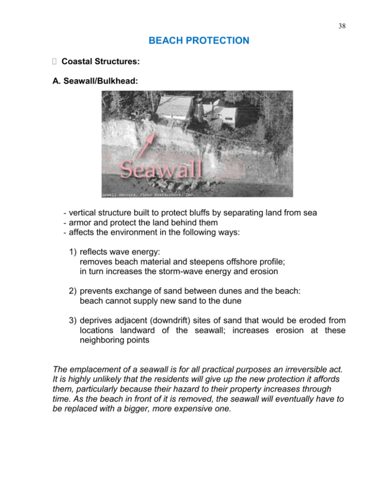
38 BEACH PROTECTION Coastal Structures: A. Seawall/Bulkhead: - vertical structure built to protect bluffs by separating land from sea - armor and protect the land behind them - affects the environment in the following ways: 1) reflects wave energy: removes beach material and steepens offshore profile; in turn increases the storm-wave energy and erosion 2) prevents exchange of sand between dunes and the beach: beach cannot supply new sand to the dune 3) deprives adjacent (downdrift) sites of sand that would be eroded from locations landward of the seawall; increases erosion at these neighboring points The emplacement of a seawall is for all practical purposes an irreversible act. It is highly unlikely that the residents will give up the new protection it affords them, particularly because their hazard to their property increases through time. As the beach in front of it is removed, the seawall will eventually have to be replaced with a bigger, more expensive one. 39 Figure: Curved-face seawall. 40 Figure: Stepped-face seawall. 41 B. Breakwaters (rubble mound): - structure placed offshore to dissipate energy of incoming waves - generally beyond the resources of individual property owners - placed one to three hundred feet offshore in relatively shallow water - designed to protect a gently sloping beach - allows drift material to be deposited behind the breakwater - accretion protects the shore and may also extend the beach - amount of deposition depends on the site characteristics and the design of the breakwater 42 43 C. Groins (Groynes/Spurs)/Jetties: - fingerlike structures that extend from the shore ‘Jetties’ are groins placed along sides of an inlet usually constructed in groups called groin fields primary purpose is to trap and retain sand interrupt the longshore transport of littoral drift most effective where longshore transport is predominantly in one direction - may cause unacceptable erosion of the downdrift shore 44 D. Embankments (Dikes)/Polder: - protect people and land from storm surge protect land from salt water intrusion help agriculture constructed mostly from local materials E. Revetments: - structures placed on banks or bluffs to absorb wave energy - usually preserve existing uses of the shoreline and slope - armor and protect the land behind them 45 - may be watertight or porous - most revetments do not significantly interfere with longshore transport - do not redirect wave energy to vulnerable unprotected areas; however, beaches in front of steep revetments are prone to erosion 46 F. Other Coastal Structures: - Caissons - Sheet Piles - Artificial reefs 47 Backfill Sand bags Mixture of gravel/boulder and quick-setting cement concrete Geo-bags Wooden pile Gravel pack Concrete blocks Figure: Wooden-pile supported geo-bags and concrete blocks. 48 Non-structural Measures: A. Beach Fill (Nourishment): - first line of defense against erosion damage - promotes shoreline recreational activities - often both economical and effective - addition of fill increases the width of the backshore - fill should resemble the original beach material(coarser fill will erode more slowly) - slope of the filled beach should also match the natural slope as closely as possible - initial cost is low if local materials can be used - refilling constitutes a regular maintenance cost - can be designed to act together with a breakwater or retaining structure 49 B. Vegetation: - effective and inexpensive way to stabilize dunes and protect marshes - provides additional resistance against surges - helps improve ecosystem - natural protection of the land (roots and stems tend to trap fine sand and soil particles, forming an erosion-resistant layer) - enhances natural beauty of the landscape 50 Estuary Controls: Passive Control: defense against an undesirable situation, for example: - bank erosion - local conditions In many situations solutions to local problems may not be cost effective or may prove to be dangerous. Active Control: solutions by bringing about a change of regime, for example: replacement of a meandering channel with a deeper, stable channel. Immediate objectives may be achieved at a reasonable cost, but long-term consequences in the estuary may be difficult to predict. Methods of Active Control: - Control of the watercourse - revetments - bank training - spurs/groynes - Control of transverse circulation - Control of solids flux - bed load (dams, barrages) - suspended load (removal of flocs) - Control of solids flux by dredging - Control of tidal propagation by dredging or training works 51 LAND RECLAMATION The main objective is to increase the area of ground available for agriculture, homestead or commercial use It is more economical to reclaim a large area at one time rather than reclaiming small areas one at a time The area to be reclaimed is enclosed by embankment and then filled up either naturally by slowing down the velocity of suspended solids, or by dredging sediment from outside the area. 52 Conflicts and Controversy - Land reclamation projects often shift ecosystem to a new equilibrium - Because of change in local aquatic habitat (fish, clam, crab, etc.) resistance groups grow against the reclamation project Example: South Korea: depletion of clam and crab population; livelihood of fishermen threatened 53 Land Reclamation Projects: Bangladesh Meghna Cross-dam: 54 55 Land Reclamation Project (LRP): History: 1975: BWDB proposed a technical cooperation project for land reclamation and estuary control 1977: LRP launched Objectives: Long-term planning for land reclamation and estuary control in the SE delta of Bangladesh Accelerate land accretion Ascertain increased agricultural production and settlement of landless people in the reclaimed areas Potential Sites: 56


