Ocean color satellites
advertisement
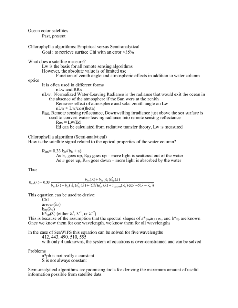
Ocean color satellites Past, present Chlorophyll a algorithms: Empirical versus Semi-analytical Goal : to retrieve surface Chl with an error <35% What does a satellite measure? Lw is the basis for all remote sensing algorithms However, the absolute value is of limited use Function of zenith angle and atmospheric effects in addition to water column optics It is often used in different forms nLw and RRs nLw, Normalized Water-Leaving Radiance is the radiance that would exit the ocean in the absence of the atmosphere if the Sun were at the zenith Removes effect of atmosphere and solar zenith angle on Lw nLw ≈ Lw/cos(theta) RRS, Remote sensing reflectance, Downwelling irradiance just above the sea surface is used to convert water-leaving radiance into remote sensing reflectance RRS = Lw/Ed Ed can be calculated from radiative transfer theory, Lw is measured Chlorophyll a algorithm (Semi-analytical) How is the satellite signal related to the optical properties of the water column? RRS= 0.33 bb/(bb + a) As bb goes up, RRS goes up – more light is scattered out of the water As a goes up, RRS goes down – more light is absorbed by the water Thus bbw ( ) bbp ( 0 )bbp ( ) RRS ( ) 0.33 * bbw ( ) bbp ( 0 )bbp ( ) (Chl)a*ph ( ) aCDO M ( 0 ) exp( S( 0 )) * This equation can be used to derive: Chl aCDOM(0) bbp(0) b*bp() (either 0, -1, or –2) This is because of the assumption that the spectral shapes of a*ph,aCDOM, and b*bp are known Once we know them for one wavelength, we know them for all wavelengths In the case of SeaWiFS this equation can be solved for five wavelengths 412, 443, 490, 510, 555 with only 4 unknowns, the system of equations is over-constrained and can be solved Problems a*ph is not really a constant S is not always constant Semi-analytical algorithms are promising tools for deriving the maximum amount of useful information possible from satellite data However, they still are not quite as good as empirical algorithms for determining Chl from space Chlorophyll a algorithm (Empirical) Pre-launch algorithm Not much data Worked OK globally Often worked Not-OK locally Had to be checked before remote sensing data could be used regionally The need for a Calibration/Validation program There are a number of possible levels of cal/val In-flight lunar calibration Monitor instrument integrity and stability Cal/val of remote sensing reflectance retrievals MOBY permanent platform in Hawaii monitors RRs continuously for comparison with SeaWiFS and MODIS RRS Ships of opportunity Cal/val of pigment retrievals Ships of opportunity Provided most of the data for the global SeaWiFS algorithm SIMBIOS Project Sensor inter-comparison project Provided lots of data for the global SeaWiFS algorithm SeaWiFS uses: log(Chl – 0.071) = 0.319 – 2.336(RRS490/RRS555) + 0.879(RRS490/RRS555)2 – 0.135(RRS490/RRS555)3 Problem The RRS signals used to estimate Chl are affected by lots of things not accounted for in the global empirical algorithm If a particular location differs bio-optically from the global mean state, errors will result.
