F. Earth`s crustal jigsaw
advertisement
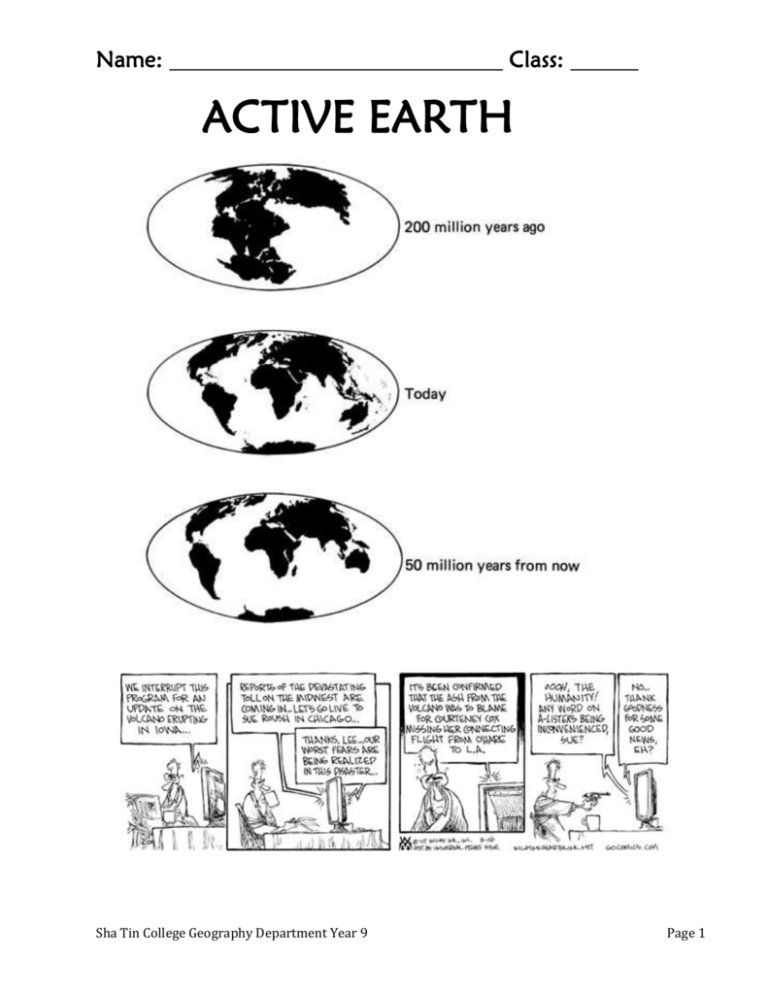
Name: Class: ACTIVE EARTH Sha Tin College Geography Department Year 9 Page 1 A. Introduction and terminology: There are no active volcanoes in Hong Kong today, although we do experience occasional small earthquakes. In other countries, some quite close to HK, the natural hazards of volcanoes and earthquakes regularly affect millions of people. First, let’s find out what you already know about earthquakes and volcanoes and what would you like to learn during this unit? 1. What I know already What I would like to know 2. Compare your lists with others in the class. Maybe you could add some questions? In this topic we will find the answers to these questions: Where do earthquakes and volcanoes occur and why do they happen? What is the link between earthquakes and volcanoes? What can be done to reduce their effects? Apart from your text book, many web sites have excellent material. Some of the better ones are: http://volcano.und.edu/ http://volcanoes.usgs.gov/ http://earthquake.usgs.gov/bytopic/ http://geology.about.com/science/geology/cs/volcanoes/index.htm http://geology.about.com/science/geology/cs/earthquakes/index.htm http://geohazards.cr.usgs.gov/html_files/gsaslide/Index.html http://www.wwnorton.com/earth/egeo/index/animations.htm 3. There will be a number of new terms in this topic. Watch the Powerpoint “Glossary” and see whether you can complete the crossword on the following page. You could also see: http://volcanoes.usgs.gov/Products/Pglossary/pglossary.html which is a photo glossary. Sha Tin College Geography Department Year 9 Page 2 1 3 2 4 5 6 7 8 9 10 11 EclipseCrossword.com Across 1. 3. 6. 7. 8. 10. 11. What happens when 2 plates meet and one goes under the other. (10) The place on the ground directly above the focus of an earthquake. (9) A flow of hot ash, gas and lava. (11) The point under the ground where the earthquake starts. (5) An instrument which measures the strength of earthquakes. (11) Molten rock above the surface of the Earth. (4) Molten rock below the surface of the Earth. (5) Down 2. 3. 4. 5. 6. 9. The solid outer layer of the Earth. (5) The shaking of the Earth's crust caused by an earthquake (12) The movements of plates, forming the Earth's major features. (9) Energy from hot rocks under the ground. (10) A large piece of the Earth's crust. (5) The layer of the Earth beneath the crust. (6) Sha Tin College Geography Department Year 9 Page 3 B. Volcanoes: 1. Study the terms and definitions below. Match them with an arrow, like the one that is done for you. Lava bombs small volcano on the side of the main one Lava flow cloud of ash thrown out of the volcano Magma chamber store of magma beneath the volcano Vent lumps of solid lava thrown into the air Ash cloud the circular opening at the top of the volcano Secondary cone liquid rock on the surface Crater the tube up which the magma escapes to the surface 2. When you have checked them, write the terms (not meanings) onto diagram A next to a number: Sha Tin College Geography Department Year 9 Page 4 3. Diagram B shows the development of a volcano. Use the sketches to describe what is happening and to explain how the typical cone-shaped volcano is formed over a long period of time. _________________________________________________________________________________ _________________________________________________________________________________ _________________________________________________________________________________ _________________________________________________________________________________ _________________________________________________________________________________ _________________________________________________________________________________ C. Sha Tin College Geography Department Year 9 Page 5 1. Using the previous diagram, read through this passage and cross out the words which are incorrect: The Earth is made up of four / five main layers. The outer layer is the core / crust. This layer is broken into pieces called magma / plates. The main land masses are made of oceanic / continental crust. This part of the crust is an average of 5 / 35 km thick. The ocean floor is made of oceanic crust which is much thinner / thicker than the continental crust. It is covered by a thin layer of sediments / lava. 2 a) How thick is the oceanic crust? b) Where is the crust thickest? c) Which layer does the magma that feeds volcanoes come from? 3 a) Which is the hottest part of the Earth? b) How hot is the mantle? c) Why is the upper part of the mantle described as plastic? D. The eruption of Mount Pinatubo, 1991: (Read pp18 and 19 in the textbook) http://volcano.und.nodak.edu/vwdocs/volc_images/southeast_asia/philippines/pinatubo.html http://vulcan.wr.usgs.gov/Volcanoes/Philippines/Pinatubo/framework.html 1. Describe the location of Mount Pinatubo: 2. Answer question 2 from p19: _______________________________________ __________________________________________ ________________________________________________ Sha Tin College Geography Department Year 9 _________________________________ Page 6 3. Read question 3, p19 and think of your answer. You may then watch a video of the actual situation. http://en.wikipedia.org/wiki/Pinatubo 4. Read p 20 and discuss the answers to questions 1a, b and c with your neighbour. Read p21 and answer questions 2 and 3. 2a. The ash travelled _____________ . 2b. The ash covered an area of approximately ________ km². 1. Effects on local people Effects on the environment 5. Extension: Pinatubo sheet on the next page. Sha Tin College Geography Department Year 9 Page 7 Sha Tin College Geography Department Year 9 Page 8 E. Where do we find Volcanoes? We locate places on the Earth’s surface using latitude and longitude. Lines of latitude are drawn parallel to the equator and tell us how far north or south a place is. Lines of longitude all pass through the North and South Pole and tell us how far east or west of the Greenwich Meridian a place is. 1. Read p22 and answer question 1b: 57°N 152°W = _____________ , 6°S 105°E = ______________ , 4°S 152°E = ________________ . 2. Using map A give the latitude and longitude of: i. Mauna Loa ______________ iii. Mt St Helens ______________ Sha Tin College Geography Department Year 9 ii. Cotopaxi ______________ iv. Fuji ______________ Page 9 Sha Tin College Geography Department Year 9 Page 10 (Sheet 2.3 tasks) 2. 3. 4. After discussions with your teacher, and maybe watching some videos, you should now be able to say where volcanoes occur and why? http://pubs.usgs.gov/publications/text/understanding.html may help? 5. Read p23 and answer questions 3, 4 and 5. Extension: Use web sites to find more about types of volcanoes, eruptions or geothermal energy. Sha Tin College Geography Department Year 9 Page 11 F. Earth’s crustal jigsaw 1. Read p24 and answer question 1. For a) look at Iceland, between Europe and North America. a. The b. The c. The d. Earthquakes 2. Have a look at some of these if you can: http://earthquake.usgs.gov/eqcenter/ = recent quakes http://www.wwnorton.com/college/geo/egeo/index/animations.htm = animations of boundaries http://earthquake.usgs.gov/bytopic/ = how earthquakes happen http://news.bbc.co.uk/go/em/fr/-/1/hi/sci/tech/4126809.stm = why does the earth move? A guide to the origin of earthquakes. Sha Tin College Geography Department Year 9 Page 12 3. a. Study diagrams A-D and then match the correct halves of these sentences: Ocean ridges form where Fold mountains form where Transform faults cause When oceanic crust melts magma rises to form volcanoes. earthquakes when plates suddenly move sideways. two plates move apart. two continents collide. b. Add the name of an actual place where each type of plate boundary is found onto the relevant diagram. Sha Tin College Geography Department Year 9 Page 13 G. Earthquakes: Measuring the effect of an earthquake (see next page): 1 Cartoon B = Cartoon C = 2. The Alaskan earthquake was about 2 2. Below: on the Mercalli Scale. 3. The proper name for Question 5 is an extra task that your teacher may ask you to do as an actual letter. Sha Tin College Geography Department Year 9 Page 14 Sha Tin College Geography Department Year 9 Page 15 Read p25 and answer questions 2-4: 2 a) Bombay = km Bangalore = km b) The earthquake 3 4 Sha Tin College Geography Department Year 9 Page 16 How many earthquakes occur globally? Sha Tin College Geography Department Year 9 Page 17 Description Magnitude Frequency per year Great 8.0+ 1 Major 7.0-7.9 18 Large (destructive) 6.0-6.9 120 Moderate (damaging) 5.0-5.9 1,000 Minor (damage slight) 4.0-4.0 6,000 Generally felt 3.0-3.9 49,000 Potentially perceptible 2.0-2.9 300,000 Imperceptible less than 2.0 600,000+ H. Surviving an earthquake: 1. Read pp26 & 27. 2. Brainstorm responses to these questions in a group: a. What is it about the earthquake itself that makes some earthquakes more dangerous than others? b. What is it about the location that makes some earthquakes more dangerous than others? c. What are the hazards faced by people in an earthquake? d. What can be done to reduce the risks? 3. Imagine that Hong Kong is an active earthquake zone. Your group has been asked to produce an Earthquake Response Plan for the government. Your plan should include: A risk assessment map, showing which urban centres in HK you think would suffer high, medium or low damage in an earthquake. You should explain how you made these judgements. A list of recommended items for an Earthquake Emergency Kit for each HK home to have. Some items could be essential and some optional? A poster or leaflet giving advice on what to do before, during and after an earthquake. Make this as clear, informative and attractive as possible. Any others ideas or proposals that you think would be helpful in reducing the threat of an earthquake. Remember that your plan should relate specifically to Hong Kong as much as possible. Sha Tin College Geography Department Year 9 Page 18 Sha Tin College Geography Department Year 9 Page 19 Sha Tin College Geography Department Year 9 Page 20 T H M O U N T K E N Y A E A N T E S K S E T K I L I M A N J A R O W M E N T R U P Y V O L C A N O E S A S R A E A M A B C O T O P A X I O N G N T S U T T H K E E M P O S T F A M O E U R N N S I N A R T H E O W O R L D L T E O N A O E F T E T H E M C A R E E F O Y M U L N E D O S U H E K L A R H R O A U B N O D L I A F P A R I C U T I N M N G O T A H E E P U A C I F I S C E O C E A L N I N P A B J E L K A T M A I P T C A I L L E T D T I H E P N A C I F V E S U V I U S N I C R I V U L C A N O N G T O F F I R U E A L I O S T O F T H E K I L A U E A O S E T M T R I S T A N D A C U N H A E M N I S a. Find these 20 volcanoes in the word search above: EREBUS KRAKATOA MAYON FUJI KATMAI VULCANO MOUNT ST HELENS MONT PELEE TRISTAN DA CUNHA MAUNA LOA HEKLA KILAUEA VESUVIUS KILIMANJARO MOUNT KENYA POPOCATEPETL COTOPAXI ETNA STROMBOLI PARICUTIN b. The remaining letters spell out a message. Write and complete the message. EXTRAS: Volcano model Sheets 2.4 and 2.7 Produce a game based on this topic, eg snakes and ladders? Make your own list of facts etc on earthquakes and volcanoes HOMEWORK: Revise for end of unit test. You will need to: Be familiar with the terminology used in the topic Be able to use latitude and longitude to locate places Know why earthquakes and volcanoes occur where they do Know the different types of plate boundaries and the processes and features associated with them Sha Tin College Geography Department Year 9 Page 21 BBC NEWS, ASIA_PACIFIC Friday, 23 May 2008 Sha Tin College Geography Department Year 9 Page 22 Sha Tin College Geography Department Year 9 Page 23

