Word Format, 158 kb - Ministère de l`Énergie et des Ressources
advertisement
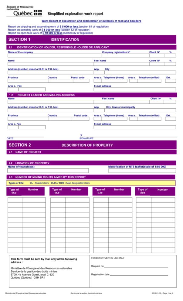
Simplified exploration work report Work Report of exploration and examination of outcrops of rock and boulders Report on stripping and excavating work of $ 5 000 or less.(section 81 of regulation) Report on sampling work of $ 5 000 or less (section 82 of regulation) Report on open face work of $ 10 000 or less (section 82 of regulation) SECTION 1 1.1 IDENTIFICATION IDENTIFICATION OF HOLDER, RESPONSIBLE HOLDER OR APPLICANT Company registration No Name of the company Name First name Address (number, street or R.R. or P.O. box) App. Province Country Postal code 1.2 % Client No % City Area c. Telephone (home) Area c. Fax Client No Area c. Telephone (office) Ext. E-mail address PROJECT LEADER AND MAILING ADDRESS Name First name Address (number, street or R.R. or P.O. box) Province App. Country Postal code % City, town or municipality Area c. Telephone (home) Area c. Fax Client No Area c. Telephone (office) Ext. E-mail address TRAVAUX DE RECHERCHE ET D’EXAMEN D’AFFLEUREMENTS ROCHEUX X DATE SIGNATURE SECTION 2 2.1 DESCRIPTION OF PROPERTY NAME OF PROJECT 2.2 LOCATION OF PROPERTY Name of township(s) 2.3 Identification of NTS leaflet(scale of 1:50 000) NUMBER OF MINING RIGHTS AIMED BY THIS REPORT Types of title: Type of title CL : Staked claim CLD or CDC : Map designated claim Number Type of title Number This form must be sent by mail only at the following address : Ministère de l’Énergie et des Ressources naturelles Service de la gestion des droits miniers 5700, 4e Avenue Ouest, local C-320 Québec (Québec) G1H 6R1 Ministère de l’Énergie et des Ressources naturelles Type of title Number Type of title Number FOR DEPARTMENTAL USE ONLY Request no: Registration date: Service de la gestion des droits miniers 2016-01-12 – Page 1 de 6 SECTION 3 OBJECTIVE OF WORK PERFORMED 3.1 SUBSTANCES SOUGHT 3.2 GEOLOGICAL SETTING OF EXPLORED AREA Highlight the favourable elements that may lead up to the discovery of mineral substances sought after . 3.3 Yes NEW DISCOVERY (showing) No Ministère de l’Énergie et des Ressources naturelles Service de la gestion des droits miniers 2016-01-12– Page 2 de 6 Exploration and examination of rock outcrops and erratic boulders Simplified report — Annexe A A.1 DATE OF WORK CARRYING OUT Start of work program Year End of work program Month Day Year Month Day A.2 LAND PARCEL SUBJECT TO MINING WORK Total distance covered in kilometers : Total surface area covered in square kilometers: A.3 ROCK TYPE(S) A.4 DESCRIPTION OF PRINCIPAL MINERALIZATIONS A.5 BEEP MAT PROSPECTING A Yes No A.6 ANALYTICAL RESULTS If the analyses have been performed by a laboratory, write the significant results A.7 IDENTIFICATION OF QUALIFIED PROFESSIONAL WHO SUPERVISED THE WORK PROGRAM The report shall be signed by a qualified professional when the amount spent for all the work, declared and reported during a given term, exceeds $5,000 per mining right. (section 73 of regulation) Name First name Address (number, street, R.R. or P.O. box) Province App. Country Postal code Area c. Fax City, town or municipality Area c. Telephone (home) Area c. Telephone (office) Ext. E-mail address I hereby declare that the work program consisting in the exploration and examination of rock outcrops and erratic boulders as reported in this form has been carried out under my supervision. X DATE SIGNATURE OF QUALIFIED PROFESSIONNAL A.8 DOCUMENTS TO ATTACH A map showing the location of rock outcrops, mineralizations, anomalies, conductors and, where applicable, analyzed samples. The four corners should be identified using geographic coordinates (latitude, longitude) or UTM coordinates (Universel Transverse Mercator), as well as the mode (NAD83) in accordance with the National Topographic System of Canada (NTS) The analyses certificates listing the complete results obtained for each sample with sample numbers corresponding to the numbers indicated on the map. The analyses certificates must be dated and signed by the laboratory supervisor where the analyses have been performed. A map of mining rights at a scale of 1:50,000 showing the mining property and the perimeter of the work program. Ministère de l’Énergie et des Ressources naturelles Service de la gestion des droits miniers 2016-01-12– Page 3 de 6 Stripping and excavating work Simplified report — Annexe B Report on stripping and excavating work of $ 5 000 or less.(section 81 of regulation) B.1 DATE OF WORK CARRYING OUT Start of work program Year Month End of work program Day Year Month Day B.2 WORK PERFORMED Number of stripped outcrops : Total stripped surface area in square meters (m2) : Number of trenches : Trench stripping/ number UTM Coordinates (Nad 83) or geographical Length (m) Width (m) Depth (trench) (m) B.3 GEOLOGICAL DATA OBSERVED IN EACH TRENCH AND EACH STRIPPED OUTCROP Rock type, structure, alterations and mineralizations B.4 ANALYTICAL RESULTS If analyses have been performed by a laboratory, write the significant results. B.4.1 Collected chosen samples B.4.2 Channel samples B.5 DOCUMENTS TO ATTACH A map and, where applicable, plans drawn at a scale showing the location of stripped areas and trenches and identifying the geological features and analyzed samples. The map and plans should be identified, at the four corners using geographic coordinates (latitude, longitude) or UTM coordinates (Universel Transverse de Mercator), as well as the mode (NAD83) in accordance with the National Topographic System of Canada (NTS). The analyses certificates listing the complete results obtained for each sample with sample numbers corresponding to the numbers indicated on the map and sketches. The analyses certificates must be dated and signed by the laboratory supervisor where the analyses have been performed. A map of mining rights at a scale of 1:50 000 showing the mining property and the perimeter of the work program. Ministère de l’Énergie et des Ressources naturelles Service de la gestion des droits miniers 2016-01-12– Page 4 de 6 Sampling Simplified report— Annexe C Report on sampling work of $ 5 000 or less (section 82 of regulation) Use Annexe C to report the following : bulk sampling , surface sampling and sampling in short drill-holes (5 meters or less into bedrock). Channel sampling work must be reported in Annexe B. Prospecting of dimension stone and block sampling work to open a mine face must be reported in Annexe D. C.1 DATE OF WORK CARRYING OUT PERFORMED Start of work program Year C.2 Month Day End of work program Year Month Day SAMPLED MATERIALS Type of materials Number of samples Quantities Rock Soil Streams sediment Heavy minerals Other (specify) C.3 SIGNIFICANT ANALYTICAL RESULTS C.4 DOCUMENTS TO ATTACH A map drawn at appropriate scale showing the locatation of the collected samples The the four corners should be identified, using geographic coordinates (latitude, longitude) or UTM coordinates (Universel Transverse de Mercator), as well as the mode (NAD83) in accordance with the National Topographic System of Canada (NTS). The analysis certificates listing the complete results obtained for each sample with sample numbers corresponding to the numbers indicated on the map. The analysis certificates must be dated and signed by the laboratory supervisor where the analyses have been performed. A map of mining rights at a scale of 1:50,000 showing the mining property and the perimeter of the work program. Ministère de l’Énergie et des Ressources naturelles Service de la gestion des droits miniers 2016-01-12– Page 5 de 6 Work to open face Search for dimension stone Simplified report — Annexe D Report on open face work of $ 10 000 or less (section 82 of regulation) D.1 DATE OF WORK CARRYING OUT Start of work program Year D.2 Month End of work program Day Year Month Day DIMENSIONS Size of collected blocks AND/OR Dimensions of open face Nº Length Width (m) (m) D.3 Height (m) PHYSICAL AND ESTHETIC CHARACTERISTICS OF THE ROCK Rock type : Color and depth alteration of the rock: Color on fresh or polished surface: Grain size: Spacing of joints : Percentage of enclaves: Mineral agglomerates (%) : Presence of veins or dykes (%) : D.4 OTHER GEOLOGICAL DATA OBSERVED D.5 ANALYTICAL RESULTS AND ASTM TESTS (where applicable) D.6 DOCUMENTS TO ATTACH A map and, where applicable, plans drawn at a scale showing the location of mine front and block sampling site and identifying the geological features and analyzed samples. The four corners of the map and plans should be identified, using geographical coordinates (latitude, longitude) or UTM coordinates (Universel Transverse de Mercator), as well as the mode (NAD83) in accordance with the National Topographic System of Canada (NTS). A map of mining rights at a scale of 1:50,000 showing the mining property and the perimeter of the work program. Ministère de l’Énergie et des Ressources naturelles Service de la gestion des droits miniers 2016-01-12– Page 6 de 6
