Fairweather, D., Myvett, G. 2014
advertisement
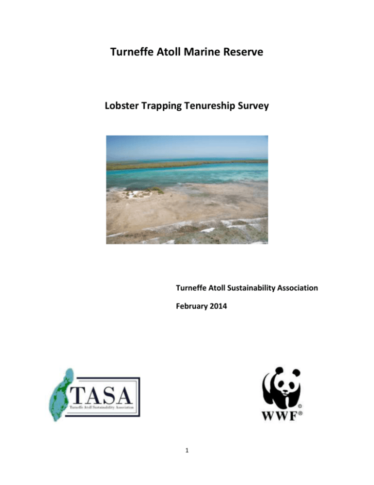
Turneffe Atoll Marine Reserve Lobster Trapping Tenureship Survey Turneffe Atoll Sustainability Association February 2014 1 Table of Content 1.0 Introduction 1–4 1.1 Background 1–3 1.2 Project Purpose 3–3 1.3 Project Rationale and Justification 3–4 2.0 Methodology 4–5 2.1 Geographic Coverage 4–4 2.2 Survey Design 4–5 2.3 Project Activities 5–5 3.0 Results and Discussion 5 – 17 3.1 Observations 5–6 3.2 Discussion 6 – 17 4.0 Conclusions 18 5.0 Recommendations 18 – 19 References 20 Appendix I Survey Questionnaire 21 Appendix II Cumulative Survey Narrative and Maps 22 – 87 List of Figures Figure 1. Geomorphology of Turneffe Atoll Figure 2. Ecosystems of Turneffe 2 Figure 3A. Location of Fishing Camps in 2010 Figure 3B. Location of Fishing Camps in 2014 Figure 3C. Fishing Zones of Overlap Figure 4. Turneffe Atoll Marine Reserve Map List of Tables Table 1. Passive Gear Fishing Method Census Table 2. Analysis of Tenureship on the Atoll Table 3. Summary Survey Synthesis 3 1.0 Introduction 1.1 Background 1.1.1 The Turneffe Atoll was declared a Marine Reserve in November 2012. 1.1.2 The salient feature of Marine Reserves that set them apart from other Marine Protected Areas is the multiple-use concept. Many other MPA categories in Belize do not make allowances for economic development activities, especially those related to extractive uses. Marine Reserves in general are Fisheries Management Tools that embody a healthy mix of sustainable extractive and non-extractive economic and conservation activities. 1.1.3 The primary economic activities on Turneffe Atoll are tourism and commercial fishing. Much of the tourism activity is based on sports fishing and scuba diving, while commercial fishing activities are based on the harvesting of a wide range of marine macro-invertebrate and vertebrate species but focusing on Spiny Lobster (Panulirus argus) and Queen Conch (Strombus gigas). 1.1.4 The Turneffe Atoll is a collection of over 150 mangrove islands and sand cayes interspersed by an array of lagoons, mud flats, sea grass beds and coral reef formations, The Marine Reserve also encompasses the deep open ocean environment surrounding the atoll. (See Figs. 1 & 2). The range of intertidal and sub-tidal ecosystems provide habitats for a broad range of fin-fish species, macroinvertebrate, marine mammals and aquatic reptiles that are the basis of the recreational tourism industry and commercial fishing enterprises. 1.1.5 Species of interest to the commercial fishing industry include the macro-invertebrate Spiny Lobster (Panulirus argus) and Queen Conch (Strombus gigas), as well as fin-fish species such as the yellow-tail snapper (Ocyurus chrysurus), Red Snapper (Lutjanus purpurpeus), Black Grouper (Mycteroperca bonaci), White Grunt (Haemulon plumieri) and the Crevalle Jack (Caranx hippos). 1.1.6 The financial worth of the tourism industry in 2010 on Turneffe was estimated at Bz$47 million per annum with a substantial portion coming from Sports Fishing, while the Commercial Fishing Industry has been estimated at Bz$6 Million per annum. 1.1.7 The direct employment associated with the tourism industry in 2010 was estimated at 55 while that attributable to commercial fishing was estimated at 180 – 200 fishermen. The latter is comprised mainly of small scale artisanal fishers whom are divided between semi-resident ‘camp fishermen’ and ‘transient sailboat fishers’. The majority of fishers are the semi-resident camp fishers who hail mainly from Belize City and its immediate suburban environs .Most of the sailboat fishers are from the northern villages of Chunox, Sarteneja and Copper Bank. 1.1.8 The most valuable and important commercial fisheries of the Turneffe Atoll are the lobster and conch stocks. The target habitats for these species include the various patch reef systems on the atoll, as 4 well as shallow fore-reef and lagoonal systems (See Fig. 1). The latter habitat is especially important to the lobster fishery. 1.1.9 The lobster and conch fisheries have been historically heavily targeted nationally and are said to be ‘mature fisheries’. In the case of the Turneffe Fishery for these species data available from the Fisheries Department in 2009 shows that these stocks are in varying state of decline. In the case of the lobster fishery at Turneffe, there was a decline in annual sales from 20.4 % of national deliveries in 2004 to 6.2% in 2009 – in the case of the conch fishery, the decline was estimated at approximately 60% over said timeframe. 1.1.10 Apart from over-harvesting and the poaching of under-sized lobster and conch, the decline of these fisheries has also been attributed to habitat destruction and degradation. The latter has been linked to both developmental activities on the atoll and the global phenomena of Climate Change and Climate Variability. 1.1.11 Recognition of the need to improve the management of developmental activities to conserve the biodiversity of Turneffe Atoll derives from both the Private Sector/NGO Community and the Public Sector. In the case of the Private Sector/NGO Community, Turneffe Atoll Trust (TAT) has dedicated considerable financial resources, time and effort to highlight the perils of unsustainable development and the need to effectively steward the resources and developmental activities on the atoll. The functional efforts of TAT have translated into a sustained effort to monitor and engage pertinent GOB regulatory agencies in regards to unauthorized dredging, illegal mangrove clearing and destructive construction activities. The programmatic efforts of TAT have extended to monitoring and reporting upon illegal fishing activities: This has entailed coordination and material support for the Fisheries Department enforcement activities. 1.1.12 The Public Sector initiative to improve the sustainable stewardship of Turneffe derives from two (2) sources. These include the Coastal Zone Management Authority Coastal Planning Area Initiative, and the Fisheries Department, which assisted efforts to declare the entire atoll as a Marine Reserve. In relation to the CZMA planning initiative, the Turneffe Atoll was identified as one (1) of nine (9) Planning Zones covering the coastal seas of Belize. 1.1.13 The zoning scheme associated with Marine Reserves (See Fig. 4), makes allowance for the full suite of development activities on the atoll, and the need to balance these activities with the conservation of biodiversity of the area. Thus, it can be seen from the zonation scheme that there are conservation and preservation zones (See Fig. 4) in which no extractive activities such as dredging or commercial fishing are permitted. Conversely it may also be seen that there is a substantive general use zone (See Fig. 4) where pre-declaration extractive activities will be allowed to continue, all-be-it in a more supervised and closely monitored manner. The special management areas (See Fig. 4) do make allowances for specific and limited fishing activities. 1.1.24 The commitment to enhance management outcomes for the Turneffe Atoll Marine Reserve is most aptly embodied by two (2) of its management objectives, which reads as follows: 5 - Maintain and improve healthy, resilient, biodiverse reefs of the Atoll at or above the 2010 HRI status of ‘Fair’ up to and beyond 2022 - By 2016, reverse the decline in commercial production demonstrated at the Atoll over the last five years by 50% 1.1.25 Subsequent to the declaration of the Turneffe Atoll as a Marine Reserve in November 2012, a co-management agreement was signed with the Turneffe Atoll Sustainability Association (TASA) in November 2013. This was a prerequisite for installing a substantive and sustained management presence on the atoll. The most definitive output to date has been the hiring and deployment of rangers to patrol the marine reserve. This, however, has only been recently initiated. Stakeholders are in general most anxious to see a roll-out of the full suite of management activities that would accompany the proper running of the marine reserve. This would include perhaps most significantly beneficiaries such as the fishermen of the atoll. 1.2 Project Purpose 1.2.1 To determine the location of fishing camps in Turneffe and to assess the zones utilized by fishers to set their lobster traps and ‘shades’ or ‘sumbras’. 1.2.2 This project is, by inference, focused exclusively on the portion of the lobster fishery that utilizes passive gear. It needs to be borne in mind that using traps and ‘shades’ is not the only methods used for lobster harvesting: Free diving is also one of the significant methods of capture for the species. Capture methods other than traps and shades were not evaluated in this survey. 1.2.3 This survey also yields information on whether or not there have been any changes in regard to the number and location of fishing camps on the atoll in recent times. Much of the information related to this issue was reported upon in 2010 and since then there may well have been some changes. 1.2.4 Given the fairly recent declaration of the Atoll as a Marine Reserve, gauging the attitude of fishers to the relevance of the MPA is also a logical output of the survey. 1.3 Project Rationale and Justification 1.3.1 If the lobster stocks of the Atoll are to be spared the ravages of overharvesting, as well as habitat destruction and degradation, then management intervention for the fishery will need to focus on the geographic spread of fishing activities and the quantum of production over time. Management interventions will also need to be focused on the fishing methods being deployed and the returns on effort - or catch per unit effort (CPUE). 1.3.2 Determination of the geographic locations of fishing activities, and indeed CPUE and annual production data, are not only relevant to the assessment of stock size , but may also identify potential conflicts between user groups, such as fishers vs. tourism, or among fishers themselves The geographic 6 location of fishing activities is also relevant in providing a baseline for other management interventions such as managed access initiatives which are to be rolled out nationally throughout all of the Marine Reserves, including the Turneffe Marine Reserve 2.0 Methodology 2.1 Geographic Coverage 2.1.1 The current survey is relevant to those fishers whom have a significant presence and/or impact on the resources of the Turneffe Atoll. Given the definitive focus of the survey on the deployment of passive or ‘set gear’ to harvest lobster, the survey efforts are limited to the shallow-water habitat of the atoll. This especially entails the waters of Southern and Central Lagoons of the Atoll (See ‘shallow water lagoon’ Fig. 1), as well as Vincent’s Lagoon (See Zone III Fig. 4). The effort also documented fishing activities in the large open area North of Vincent’s Lagoon as well as the barrier lagoon circumnavigating the Atoll between the reef flat and the line of cayes (See ‘shallow lagoon’ Fig. 1). 2.1.2 The fore-reef slope and seaward deeper water habitat of the Atoll (See ‘Caribbean Open Sea’ Fig. 2) were excluded from the survey. This is due to the fact that these areas are not pertinent to trap setting activities for lobster. 2.1.3 The conservation Zones I, IIA, IV, V & VI (See Fig. 4) were also excluded from the survey given the fact that these areas are off-limits for any lobster harvesting activities. The Special Management Area IIB and the Preservation Zone VII (See Fig. 4) are also excluded from the survey given the nonextractive strictures on these areas. 2.2 Survey Design 2.2.1 The survey exclusively targeted semi-resident and resident Camp-Fishers who utilize Turneffe for lobster fishing using passive gears. These include lobster traps and ‘lobster shades’ or ‘sumbras’. The latter are in effect Fish Aggregating Devices (FADs) which primarily attracts lobsters. 2.2.2 Apart from the classical palmetto slot lobster traps, ‘drum’ which are deployed by some fishers are also considered as traps for the purpose of this survey. These ‘drum’ are for the most part 55 gallon galvanized drums previously used as containers for gasoline and other petroleum products. 2.2.3 The survey is a census of issues related to land and seafloor usage on the atoll. Corollary issues such as the status of lobster resources, critical challenges to the fishery and attitudes to the concept of the area being declared as a Marine Reserve were also included in the survey (See Appendix I). 2.2.4 The sail-boat lobster fishers and day-trippers were excluded from the survey given the transient nature of their fishing activities and the lack of any land or seafloor tenure as they fish the entire atoll primarily by diving and do not fish with set fishing apparatus such as traps or shades. 7 2.2.5 The survey was in the form of a questionnaire (See Appendix I). Great care was taken in ensuring that the questions were succinct and clear and that the response required brief verbiage. Great care was also exercised in ensuring that the individual carrying out the survey was trusted and respected by the fishers since this could greatly affect the accuracy and quality of the response garnered. 2.2.6 The individual selected to carry out the survey was Mr. Dale Fairweather. Mr. Fairweather has been a Camp Fisher on Turneffe for the past twenty-five (25) years. He has excellent rapport with the Fishers and is extremely knowledgeable about the lobster fishery on the atoll. Mr. Fairweather is well respected by the Fishing Community nationally and in this regard is a member of the Managing Committee of the Belize Fishers Federation (BFF). 2.3 Project Activities 2.3.1 The Customary Lobster Tenureship Survey has been divided into three (3) main phases, viz: Problem analysis and survey design On-site field survey Data analysis and report synthesis 2.3.2 The overall exercise has taken seven (7) weeks: Two (2) weeks were dedicated to the problem analysis and survey design aspect of the exercise, while three (3) weeks were dedicated to the on-site field survey – the data analysis and report synthesis took two (2) weeks. 2.3.3 The importance of ensuring that the interviewees were on site is that there was the need for fishermen to specifically pin-point the location of their camps and the full extent of their trap-setting zones. 2.3.4 The field survey entailed the interviewer presenting the survey form to the interviewee and ensuring that they specifically answered all, or as many of the questions as possible. There were no financial incentives or inducements otherwise to recruit responders to the survey. 3.0 Observations, Results and Discussion 3.1 Observations 3.1.1 Thirty-three (33) out of a possible thirty-four (34) persons responded to the survey – this represented a ninety-seven percent (97%) response rate. The only person that did not participate in the survey pointedly stated that he did not wish to be involved in the exercise. All responders to the survey did so willingly and for the most part enthusiastically. The survey was conducted during the fishing season for lobster to ensure that most of the potential responders would be on-site. 8 3.2 Results and Discussion 3.2.1 There were thirty-one (31) Fishing Camps identified in the survey. This was an increase over the twenty-five (25) camps identified by Cawich in a 2010 survey (See Figs 3A & 3B). 3.2.2 Most of the Fishing Camps were located around the periphery of Southern and Central Lagoons of the atoll (See Fig. 3B). These camps are located within the General use Zone of the Marine Reserve (See Fig. 4). There were also a few camps on the seaward margins of the lands surrounding Southern Lagoon and Central Lagoons (See Fig. 3B and Appendix III). 3.2.3 Twenty-one (21) of the thirty-three (33) fishers chose to volunteer information on their preference for fishing gear deployed in the lobster fishery at Turneffe. There was a functional split on those fishers using ‘Lobster Shades’ or ‘Sumbras’ vs. those using ‘Lobster Shades’ in combination with Lobster Traps – none of the fishers used Lobster Traps alone (See Table 1). Our supposition is that this is a function of the efficiency of the ‘Sumbras’ to attract lobsters, their relatively low construction/acquisition costs, and the need to optimize opportunities for capture of the target species using multiple harvesting strategies. 3.2.4 Seventy-eight percent (78%) of the fishers were long-term residents of the atoll (See Table 2) these are individuals with more than eleven (11) years in the area (See Appendix I). The longest term resident has fished at Turneffe for fifty (50) years (See Table 2). There are a significant number of residents with tenureship of over thirty (30) years on the atoll (See Table 2). The average mean time of tenureship was 22.5 years, while the median was 20 years and the mode was also 20 years (See Table 2). 3.2.5 The medium and short-term Camp Fishers on the Atoll were evenly split at eleven percent (See Table 3). The short-term residents were those individuals with a presence of 1 to 3 years, while mediumterm residents had tenure of 4 to 10 years (See Table 3). 3.2.6 Fishers with ‘free-hold’ or ‘private’ ownership of their land parcels were in the minority – they made up only 23% of the respondents (See Table 3). The Lease Holders were a total of 29%. The majority of responders were classified in the ‘Other’ Category of the survey – these fishers made up 48% of those polled (See Table 3). This included for the most part fishers that had some form of ‘Tennant’ arrangement with the primary owners of the camp. It also included individuals who were working for the primary camp owners and those individuals who had no declared arrangement with the owner who were in effect ‘squatting’. In one instance an individual had relocated temporarily from his camp with the authorization of the primary owner because his camp had recently burned down. 3.2.7 The seafloor usage was extensive and took up most of the shallow water habitat of the atoll. In the case of the internal lagoons, viz: Northern Lagoon or Vincent’s Lagoon, the Southern Lagoon and the Central Lagoon, 90 – 100% of the seafloor is being utilized.(See Appendix II). The extreme northern waters of the atoll had an appreciable quantum of space that was not utilized for trap setting by fishers. These areas are open sea/reef lagoonal areas that are richly invested with patch reef that were generally turbid and not fisher-friendly in terms of locating lobster traps and ‘sumbras’. These areas are primarily targeted by sail-boat fishers utilizing free-diving methods of capture. 9 3.2.8 There is an appreciable amount of overlap in terms of seafloor customary usage. A number of individuals identified similar zones that were not necessarily mirror images of each other but were reflective of considerable overlap. One instance of major overlap was in regard to different individuals operating from the same camp but working independently. This was seen in ‘Fishing Area III’ with Daniel Palacio, Nicholas Diego and Frank Andrews (See FA. III, Fig. 3C). Daniel Palacio or ‘Cappy’ is the primary owner of the Camp and Frank Andrews and Nicholas Diego were camping there. These individuals fish a sizable area of the lower central and south-eastern reaches of Southern Lagoon (See Appendix II). 3.2.9 The more common cases of the overlap of seafloor usage are related to individuals located at adjacent camps and fishing areas with major overlap. This was seen in Vincent’s Lagoon with Dale Fairweather, Kent Gillette, Leavan Aldana and Eric Young (See FA. I, Fig. 3C and Appendix II). Other cases of major overlap were also seen in the Central Lagoon: This entailed Fishing Areas II, III, IV and V (See Fig. 3C). The greatest overlap was in Fishing Area III and involved Angel Marin, Alan Bevans Green, Dale Fairweather, Kent Gillett, Anthony Allen, Wayne Jones and George Marin (See FA. III, Fig. 3C and Appendix II). 3.2.10 Another case of major overlap in the Central Lagoon entailed Fishing Area V with Hopeton Westby Jr, Octivio Flores, Joseph Tasher, David Flores, Roy Bowden and Daniel Palacio (See FA. V, Fig. 3C and Appendix II). 3.2.11 The other area of significant overlap was a ‘tributary’ or ‘bogue’ off the southeastern portion of the Central Lagoon known as Soldiers Bight and Small Fishing Bogue (See Fig. 3 B and Appendix II): This area is labelled Fishing Area VII on Fig. 3C. The relevant fishers in this instance were Melvin Young, Leopold Young and Hopeton Westby Jr. 3.2.12 There was also some instances of overlap in the extreme southwestern portion abutting the Southern Lagoon immediately northwest of Caye Bokel (See Fig. 3 B and Appendix II): This area has been labelled as Fishing Area VI on Fig. 3 C. The relevant fishers were Hopeton Westby Jr., Jason Young and William Johnson (See Fig. 3 C). 3.2.13 It was also apparent from the survey that a number of utilized fishing grounds throughout the Atoll – This includeds Hopeton Westby Jr., Dale Fairweather and Kent Gillett (See Fig. 3 C). 3.2.14 It was not clear what arrangement(s) are in place to deal with the potential conflicts arising among fishers with overlapping fishing areas; however, it was pointed out by an informed fisher that the operation of this system was predicated on the marking of ‘Set Lines’ or demarcation paths to identify the lobster traps and ‘Sumbras’ set in a particular area. It should be kept in mind that these traps and ‘Sumbras’ are neither registered nor licensed, thus there is no information on the number of traps and/or ‘Sumbras’ deployed in the fishery in any public record. 3.2.15 Most of the fishers feel that the status of the fishery resources and the prospects of fishing are ‘fair’ (See Table 3). Those who feel that the prospects of fishing are either ‘poor’ or ‘good’ was split at 18% (See Table 3). 10 3.2.16 The overwhelming majority of Camp Fishers (84%) feel that the most critical need for the fishery on the Atoll is ‘more enforcement patrols’ (See Table 3). Fishers feel that the second-most critical need for the fishery (11%) is to contain ‘fishing during the closed season’ (See Table 3). 3.2.17 Most of the Camp Fishers (68%) feel that the most ‘damaging aspect to the lobster fishery’ is the ‘catching of undersized lobsters (See Table 3). They feel that the second most damaging aspect to the fishery (24%) is pirating traps and shades’ (See Table 3). 3.2.18 The overwhelming majority of fishers (85%) supported the concept of the Marine Reserve (See Table 3). Only 3% do not support the concept of the reserve (See Table 3). 3.2.19 A major ‘concern is that ‘the rangers display the highest standard of professionalism (See Table 3) .This was the sentiment echoed by 16% (See Table 3). The other concern, also evenly split at 16%, is for ‘the various zones of the Marine Reserve to be demarcated to ensure that the areas open for fishing is readily identifiable’ (See Table 3). The majority of Camp Fishers (41%) do not have any concerns about the Marine Reserve (See Table 3). 3.2.20 The vast majority of Camp Fishers (79%) do not feel that the concept of the Marine Reserve had been adequately explained to them (See Table 3). 3.2.21 The overwhelming majority of Camp Fishers (85%) feel that the Marine Reserve will bode well for their operations (See Table 3). 11 Fig. 1: Geomorphology of Turneffe Atoll 12 Fig. 2: Ecosystems of Turneffe Atoll 13 Fig. 3A: Location of Fishing Camps in 2010 14 Fig. 3B: Location of Fishing Camps 2014 15 Key to Fig. 3B & 3C Number on Map Name of Fisher Occupying Camp 1 2 3 4 5 6 7 8 9 10 11 12 13 14 15 16 17 18 19 20 21 22 23 24 25 26 27 28 29 30 31 32 33 Jeffrey Murillo Angel Marin Melvin Young Leopold Young Hopeton Westby Jr & Jermaine Cain David Young Ismael Moreno Fabian Johnson Greg Dillon Octivio Flores Joseph Tasher David Flores Eligio Tzul Roy Bowden Allan Bevans Green Mounthcreef Flowers Dale Fairweather Alfred Barrow Isaac Lambey Kent Gillett Anthony Allen Leavan Aldana Wayne Jones Michael Welch Eric Young Alburn Plunkett Dionicio Edwards Daniel Palacio Nicholas Diego Frank Andrews Jason Young William Johnson George Marin 16 17 Fig. 4: Turneffe Atoll Marine Reserve Zonation Scheme 18 Table 1: Passive gear fishing method census Number of Fishers Fishing Method Percentage 0 Lobster Trap - 10 Lobster Shade 48% 11 Lobster Trap & Lobster Shade 52% Table 2: Analysis of tenureship on the atoll Length of Tenureship (years) 32, 4, 34, 30, 29, 20, 27, 26, 14 12, 50, 20, 45, 20, 35, 45, 25, 20 20, 23, 3, 4, 1, 45, 5, 5, 11, 11, 20 1 19 Averages Mean (years) Median (years) Mode (years) 22.5 yrs 20 yrs 20 yrs Table 3: Summary survey synthesis Variable History Land and Seafloor Tenureship Land Ownership Fishing Viability Critical Need Most Damaging aspect to lobster fishery Support for Marine Reserve Concerns for Marine ReserThereTherve Specific Qualifiers Quantitative Response (No. Persons) Long-Term ( ≥ 11 yrs) 21 Medium-Term (4 – 10 yrs) 3 Short-Term (1 – 3 yrs) 3 Private Ownership 7 Lease 9 Other 15 Poor 6 Fair 21 Good 6 More enforcement patrols 31 Too much sailboat 2 Fishing during Closed Season 4 Pirating traps and shades 9 Catching under-sized 26 lobsters Hurricanes 1 Too many fishers 1 Dredging 1 Yes 28 No 1 Maybe 4 Little or no info available 4 Professionalism of Rangers 5 Corruption of Enforcement 2 Officers No Concern 13 Demarcation of zones open 5 to fishing No management activities 3 taking place Yes 7 No 27 Concept and specific of Marine Reserve explained Will Marine Yes Reserve help? No 29 5 20 Percentage Distribution 78% 11% 11% 23% 29% 48% 18% 64% 18% 84% 5% 11% 24% 68% 3% 3% 3% 85% 3% 12% 13 16% 5% 41% 16% 9% 21% 79% 85% 15% 4.0 Conclusions 4.1.1 Turneffe is important as a destination for the production of lobster in Belize. This may be seen from the high degree of usage of the lagoonal floor of the atoll for the setting of lobster traps and shades. 4.1.2 Turneffe Atoll Fishers have a long history of utilizing the atoll. The longest recorded tenure was 50 years, with an arithmetic mean of 22.5 years. 4.1.2 Fishers are very supportive of the Marine Reserve and they link their livelihood with the benefits of a properly functioning Marine Reserve. 4.1.3 Although fishers generally supported the concept of a Marine Reserve, Fisher does not feel that the operational details of the reserve have been adequately explained to them. 4.1.4 The overlap of fishing zones is significant, especially in Vincent’s Lagoon, the Southern Lagoon and the Central (Main) Lagoon. 4.1.5 Because of the overlap in fishing areas, the potential for conflict among fishers utilizing the lagoonal floor for lobster trapping activities appears high. 4.1.6 The information collected in this survey will be helpful in informing fisheries management going forward. This will be particularly pertinent to the Managed Access initiative being implemented across Marine Reserves nationally. 4.1.7 Fishers felt that the most important challenge to the atoll was the lack of enforcement. 5.0 Recommendations 5.1.1 Demarcation of the areas of the seafloor used by particular fishers will likely need to be more specifically defined before definitive Fisheries Management Interventions, such as Managed Access, are instituted. 5.1.2 Given the fact that use of the seafloor by fishers has been a source of social tension and intense rivalry at times leading to violent confrontation and even death, there is the need to critically examine the prospects for legal tenure of the seafloor by fishers. There is also the need to embark on initiatives to invest fishers with the requisite ‘conflict resolution’ capabilities that would mitigate and avert negative consequences. 5.1.3 Input of fishers on the need to strengthen enforcement in the Marine Reserve emphasizes the need for the Turneffe Atoll Marine Reserve to develop a fully operational enforcement program as rapidly as possible. Rangers for the Marine Reserve should be meaningfully deployed, especially during the upcoming lobster season, to effectively prevent illegal fishing activities. The goal of enforcement 21 should be to stop the illegal harvesting of lobsters and conch during the closed seasons as well as the taking of undersized lobster and conch. 5.1.4 Effective demarcation of the various zones of the Marine Reserves should be instituted so that fishers and the general public are aware of no-take zones. This, along with a fully functional enforcement system, would build confidence and support among fishers for the broader concepts of the Marine Reserves. 22 BIBLIOGRAPHY Coastal Zone Management Authority and Institute (2003). Turneffe Islands Development Guidelines, Draft. Coastal Zone Management Authority and Institute (2011). Turneffe Atoll Coastal Zone Management Guidelines, Draft. Fedler A. J. and C. Hayes (2008). Economic Impact of Recreational Fishing for Bonefish, Permit and Tarpon in Belize for 2007. Fedler A. J. (2011). The Economic Value of Turneffe Atoll. Turneffe Atoll Trust. Neal D. and K. M. Toure’ (2011). Identifying Needs for measuring Fisheries Capacity at Turneffe Atoll. Final Draft Report to Nature Conservancy. Neal D. (2011). Survey of Fisher’s Perception of a Turneffe Atoll Marine Reserve. Report to Turneffe Atoll Trust. Turneffe Atoll Trust and Fisheries Department (2012). Turneffe Atoll Management Plan: 2012 – 2017. 23 Appendix I Turneffe Marine Reserve Lobster Trap Zone Survey January 2014 1.0 How long have you had your fish camp? _______ Years 2.0 Do you own or lease the land where your camp sits? Own ______, Lease ______, Other _____ 3.0 How do you rate the current lobster fishing at Turneffe? Poor ___, Fair ___, Good ___, Excellent ____. 4.0 What is the most important need for Turneffe’s fishery? 5.0 What things are damaging the lobster fishery at Turneffe? 6.0 Do you support the new Marine Reserve? Yes_____ No _____ Maybe ______. 7.0 What is your biggest concern about the Marine Reserve? 8.0 Do you feel that the Marine Reserve has been adequately explained to you? 9.0 Do you believe that the Marine Reserve will help your fishing operation? Yes _____, No ______ 24 SAMPLE SURVEY AND MAP Appendix II Cumulative Survey Narrative and Maps 25 26
