readme
advertisement
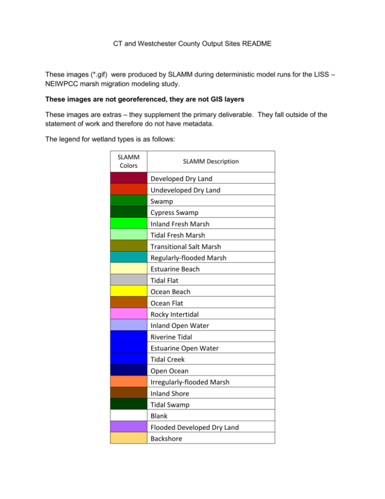
CT and Westchester County Output Sites README These images (*.gif) were produced by SLAMM during deterministic model runs for the LISS – NEIWPCC marsh migration modeling study. These images are not georeferenced, they are not GIS layers These images are extras – they supplement the primary deliverable. They fall outside of the statement of work and therefore do not have metadata. The legend for wetland types is as follows: SLAMM Colors Developed Dry Land Undeveloped Dry Land Swamp Cypress Swamp Inland Fresh Marsh Tidal Fresh Marsh Transitional Salt Marsh Regularly-flooded Marsh Estuarine Beach Tidal Flat Ocean Beach Ocean Flat Rocky Intertidal Inland Open Water Riverine Tidal Estuarine Open Water Tidal Creek Open Ocean Irregularly-flooded Marsh Inland Shore Tidal Blank Flooded Dev Backshore SLAMM Description Developed Dry Land Undeveloped Dry Land Swamp Cypress Swamp Inland Fresh Marsh Tidal Fresh Marsh Transitional Salt Marsh Regularly-flooded Marsh Estuarine Beach Tidal Flat Ocean Beach Ocean Flat Rocky Intertidal Inland Open Water Riverine Tidal Estuarine Open Water Tidal Creek Open Ocean Irregularly-flooded Marsh Inland Shore Tidal Swamp Blank Flooded Developed Dry Land Backshore
