4th grade SS Week 4
advertisement
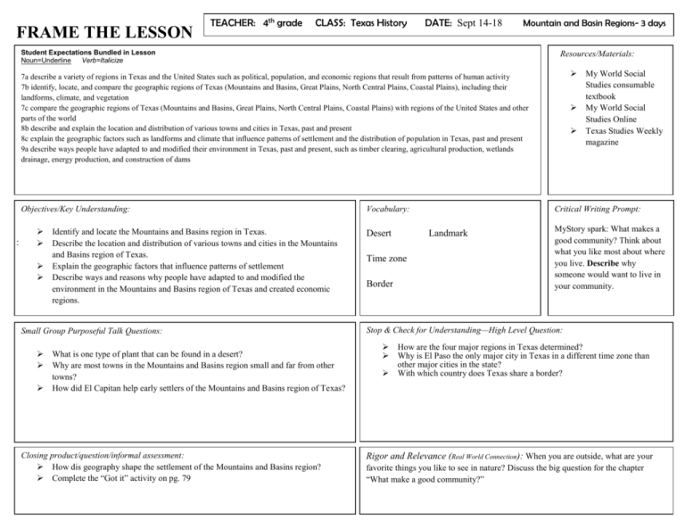
FRAME THE LESSON TEACHER: 4th grade CLASS: Texas History DATE: Sept 14-18 Mountain and Basin Regions- 3 days Student Expectations Bundled in Lesson Noun=Underline Verb=Italicize Resources/Materials: 7a describe a variety of regions in Texas and the United States such as political, population, and economic regions that result from patterns of human activity 7b identify, locate, and compare the geographic regions of Texas (Mountains and Basins, Great Plains, North Central Plains, Coastal Plains), including their landforms, climate, and vegetation 7c compare the geographic regions of Texas (Mountains and Basins, Great Plains, North Central Plains, Coastal Plains) with regions of the United States and other parts of the world 8b describe and explain the location and distribution of various towns and cities in Texas, past and present 8c explain the geographic factors such as landforms and climate that influence patterns of settlement and the distribution of population in Texas, past and present 9a describe ways people have adapted to and modified their environment in Texas, past and present, such as timber clearing, agricultural production, wetlands drainage, energy production, and construction of dams Objectives/Key Understanding: : Identify and locate the Mountains and Basins region in Texas. Describe the location and distribution of various towns and cities in the Mountains and Basins region of Texas. Explain the geographic factors that influence patterns of settlement Describe ways and reasons why people have adapted to and modified the environment in the Mountains and Basins region of Texas and created economic regions. Small Group Purposeful Talk Questions: What is one type of plant that can be found in a desert? Why are most towns in the Mountains and Basins region small and far from other towns? How did El Capitan help early settlers of the Mountains and Basins region of Texas? Closing product/question/informal assessment: How dis geography shape the settlement of the Mountains and Basins region? Complete the “Got it” activity on pg. 79 Vocabulary: Desert Border Critical Writing Prompt: Landmark Time zone My World Social Studies consumable textbook My World Social Studies Online Texas Studies Weekly magazine MyStory spark: What makes a good community? Think about what you like most about where you live. Describe why someone would want to live in your community. Stop & Check for Understanding—High Level Question: How are the four major regions in Texas determined? Why is El Paso the only major city in Texas in a different time zone than other major cities in the state? With which country does Texas share a border? Rigor and Relevance (Real World Connection): When you are outside, what are your favorite things you like to see in nature? Discuss the big question for the chapter “What make a good community?” Teaching points and activities: Engage: Explore: Introduce the key idea “I will know about the geography of the Mountains and Basin region” and lesson vocabulary words. Have students read the big question for Chapter 2 “What makes a good community?”. Ask students to think about the things they like most about their community and where they live. Do the big question activity in the online resources. Complete the “My Story Spark” on pg. 72 Complete the words to know worksheet found in the online resources. Watch the My Story video for the beginning of chapter 2 in the online resources. Read the chapter 2 introductory story “Texas: A Varied State” and discuss with students. Give students the Reading skills illustration and worksheet from the online resources. Where are some of the largest ranches in Texas located? Why might someone want to visit Dinosaur Valley State Park? What generalizations did the boy make? What other generalizations can be made based on the illustration? Explain: Subtopics to be covered: “The Land” pgs. 76-77: Texas can be divided into four major geographic regions. These regions are determined by their major landforms. Why would the climate of this region be very dry? Why is the Mountains and Basins region a poor location for farming? How has human activity in the Mountains and Basins region created an economic region? In which mountain range is Texas’s tallest peak found? Elaborate: “Compare Geographic Regions” pg. 78: Texas is not the only part of North America to have mountains and basins. Why are there few larger cities in the Basin and Range Province? Which four different deserts make up a part of the Basin and Range Province? “Major Cities” pg. 78: Most towns in the Mountains and Basins regions are small. El Paso is the exception. It is the firth-largest city in Texas. How did El Paso get its name? What is a time zone? “A Natural Landmark” pg. 79: A landmark is an object, such as a mountain, that stands out from the area around it. Based on the plant life in the image, what type of weather would you expect at El Capitan during the summer? Evaluate: Assess learning with the “Got it?” activity on pg. 79. ONLINE RESOURCES EXPLAINATION: My World Social Studies online: offers online activities and review. Big question activity is to introduce the key concept for the chapter and to get students thinking about what they will learn the next few days. MyStory video introduces the reading selection at the beginning of the chapter Target reading skill illustration and worksheet gives the student practice on their reading skills over the reading selection at the beginning of the chapter. Words to know worksheet gives targeted vocabulary practice for the chapter. Interactive digital lesson for pg. 77 Interactive digital lesson for pg. 79 FRAME THE LESSON TEACHER: 4th grade CLASS: Texas History LESSON DATE: Sept 14-18 The Great Plains Region- 2 days Teaching Points & Activities Resources/Materials: Student Expectations Bundled in Lesson Noun=Underline Verb=Italicize Resources: 7a describe a variety of regions in Texas and the United States such as political, population, and economic regions that result from patterns of human activity 7b identify, locate, and compare the geographic regions of Texas (Mountains and Basins, Great Plains, North Central Plains, Coastal Plains), including their landforms, climate, and vegetation 7c compare the geographic regions of Texas (Mountains and Basins, Great Plains, North Central Plains, Coastal Plains) with regions of the United States and other parts of the world 8b describe and explain the location and distribution of various towns and cities in Texas, past and present 9a describe ways people have adapted to and modified their environment in Texas, past and present, such as timber clearing, agricultural production, wetlands drainage, energy production, and construction of dams 9b identify reasons why people have adapted to and modified their environment in Texas, past and present, such as the use of natural resources to meet basic needs, facilitate transportation, and enhance recreational activities Objectives/ Key Understanding: Identify and locate the Great Plains region in Texas. Describe the location and distribution of various towns and cities in the Great Plains region. Explain the geographic factors that influence patterns of settlement and distribution of population in the Great Plains region. Describe ways and resources why people have adapted to and modified the environment in the Great Plains region. Small Group Purposeful Talk Questions: How does Edwards Plateau differ from other plateaus? Why do you think Amarillo has a museum that honors the American Quarter Horse? Closing Product/Question/Informal Assessment: Why is the Great Plains region of Texas an ideal place for cattle ranching? Complete the “Got it?” activity on pg. 83. Vocabulary: My World Social Studies consumable textbook My World Social Studies online Texas Studies Weekly magazine Critical Writing Prompt: Mohair Helium Tourism Stop & Check for Understanding—High Level Questions: Infer what life is like for people living in the Great Plains region. What led to Amarillo’s cattle boom in the 1880s? Why was the Palo Duro Canyon made into a state park? Rigor and Relevance (Real World Connection) We live in a global society, it’s important that students grasp the geographical and societal peculiarities to a particular region so that they can relate to the people around them. Discuss the question big question for the chapter “What makes a good community”. Teaching points and activities: Engage: Introduce the key idea “I will know about the geography of the Great Plains region” and lesson vocabulary words. Subjects to be covered: Explore: “The Land” pg. 80: The Great Plains region has four sections. Which four sections make up the Great Plains region of Texas? In which direction would you travel when going from the Mountains and Basins region to the Great Plains region? What type of weather would you expect to find in higher elevations when compared to lower elevations? Explain: “Compare Geographic Regions” pg. 81: The Great Plains stretch from the Rio Grande northward, across the center of the United States and up into Canada. What similarities do the Great Plains in the United States and Pampas in South America share? Which river borders the Llano Basin to the north? “Major Cities” pg. 82: Lubbock, Amarillo, Midland, and Odessa are important cities in the Great Plains region. Which large university is found in Lubbock, TX? What service does the tourism industry provide? What major industry is found in the cities of Midland and Odessa? Elaborate: “A Natural Landmark” pg. 83: Palo Duro Canyon is about 120 miles long, 20 miles wide, and as great as 800 feet deep. What river formed the Palo Duro Canyon? Which canyon in the United States is the only one bigger than the Palo Duro Canyon? Assess with “Got it?” activity on pg. 83 Evaluate: ONLINE RESOURCES EXPLANATION: My World Social Studies online: offers online activities and review. - Interactive digital activity for pg. 81 - Interactive lesson for “Got it” activity on pg. 83
