urban floodplain
advertisement
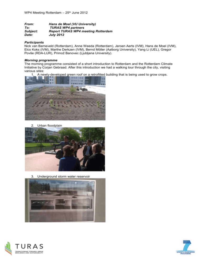
WP4 Meeting Rotterdam – 25th June 2012 From: To: Subject: Date: Hans de Moel (VU University) TURAS WP4 partners Report TURAS WP4 meeting Rotterdam July 2012 Participants Nick van Barneveld (Rotterdam), Anne Weeda (Rotterdam), Jeroen Aerts (IVM), Hans de Moel (IVM), Elco Koks (IVM), Marthe Derkzen (IVM), Bernd Möller (Aalborg University), Yang Li (UEL), Gregor Povše (RDA-LUR), Primož Banovec (Ljubljana University). Morning programme The morning programme consisted of a short introduction to Rotterdam and the Rotterdam Climate Initiative by Corjan Gebraad. After this introduction we had a walking tour through the city, visiting various sites: 1. A newly-developed green roof on a retrofitted building that is being used to grow crops. 2. Urban floodplain 3. Underground storm water reservoir WP4 Meeting Rotterdam – 25th June 2012 4. Embankment in the middle of the city 5. Tour through the harbour by boat (floating pavilion on photo) 6. Arriving at the SS Rotterdam (old Atlantic lineship) for lunch and the afternoon programme WP4 Meeting Rotterdam – 25th June 2012 Afternoon programme In the afternoon we discussed the different case studies with their planned activities and the overall conceptual framework. London: Dr. Yang Li explained the spatial analyses UEL intends to perform related to green roofs. The objective is to map the potential of green roofs in London, starting from high resolution elevation (LIDAR) data and possibly other information on construction type, ownership and building year. Questions from the partners relate to the possibility to link the potential of green roofs with a hydrological model to estimate the effect of these potential green roofs on storm water attenuation. Furthermore, it is asked whether scenarios and/or possible retrofitting schemes will be used in the analysis. Dr. Yang touches upon a link between social deprivation and flooding, which is picked up by the other partners as an interesting subject in their cities as well. Rotterdam: Hans de Moel goes into the ongoing and planned activities in Rotterdam, related to flood risks and urban planning. Ongoing activities focus in flood risk assessments and the effectiveness of building-scale measures to reduce flood risks (as opposed to embankments). Possible future activities on flood risk include the risk of harbour industry, indirect effects of flooding (business interruption and supply-chain effects) and energy infrastructure. The urban planning track is just starting up, but is currently envisaged to address the demand and supply of blue and green urban services to optimize the urban living environment now and in the future. Aalborg: Dr. Möller introduces the Aalborg case study, in which strategic energy planning will be addressed by means of high resolution geospatial and temporal data. He explains how Aalborg, and Denmark as a whole, has a lot of district heating and adaptation and energy strategies. For long-term strategic energy planning, saving energy is crucial. This can be done at various levels: building level (demand), city level (plants) and national level (infrastructure). The heat atlas method will be used to map energy demand and supply, in order to identify possibilities for energy saving and cost-effective extension of district heating. Ljubljana: Gregor Povše explains the adjusted plan of RDA-LUR concerning transport. Their plan is to create a GIS public transport web portal. Such a portal could improve micro-communication between stakeholders and enable discussion between decision-makers and end-users. This way, the accessibility of the transport system and the modal split can be improved. Dr. Banovec then proceeded to address the flood issues in the Ljubljana region. The region has been hit by floods events in 1991, 2007 and 2010. The research will address the use of retention areas to mitigate flood risks. Especially the effect of multiple reservoirs on flood risks will be investigated (as opposed to assessments made for a single reservoir as is usually the case). WP4 Meeting Rotterdam – 25th June 2012 Wrap-up and conceptual model After the case study presentations we brainstorm on how to bring things together, also in preparation of our milestone report in month 36 of the TURAS project. It is recognized that while the studies have different themes, there are various similarities. In essence, we all build upon various types of data. In many cases LIDAR data and public registry data have been found to be important, and should thus become available to support strategic urban planning. Building on this data, various modeling tools are developed and applied in the case studies, related to different themes. Using these tools, enables us to assess the current situation, possible future situations, and evaluate the effect of certain measures related to urban planning. In many cases, results are spatially differentiated in the form of maps. Such maps can display flood risks, potential for green roofs, potential for energy savings, bottlenecks of infrastructure etc. Theoretically, if all methods would be used in one city, such maps could be overlaid in order to identify synergies and conflicts and support strategic urban planning. This common framework will most probably become the skeleton of our final report and has been illustrated very well by Primož in the following diagram. As can be seen, there are various crosscutting common issues which can be used to make generalized recommendations in our final report, building upon the experience of the individual case studies.
