JPL_iono_product_description
GPS Ionosphere-Based Tsunami Early Warning Product
Attila Komjathy, Yu-Ming Yang, Xing Meng and Olga Verkhoglyadova
JPL Natural Hazards Ionospheric Imaging Research Group
Email: Attila.Komjathy@jpl.nasa.gov
Phone: 818-726-2817
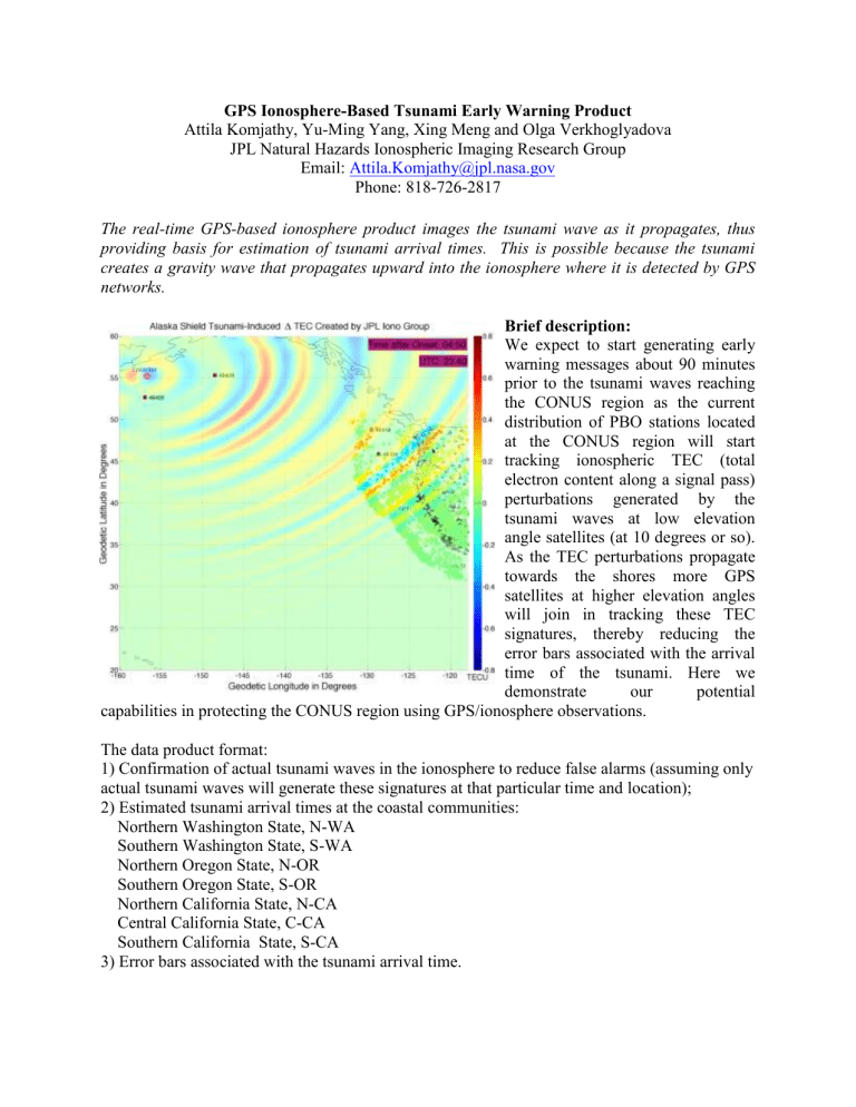
The real-time GPS-based ionosphere product images the tsunami wave as it propagates, thus providing basis for estimation of tsunami arrival times. This is possible because the tsunami creates a gravity wave that propagates upward into the ionosphere where it is detected by GPS networks.
Brief description:
We expect to start generating early warning messages about 90 minutes prior to the tsunami waves reaching the CONUS region as the current distribution of PBO stations located at the CONUS region will start tracking ionospheric TEC (total electron content along a signal pass) perturbations generated by the tsunami waves at low elevation angle satellites (at 10 degrees or so).
As the TEC perturbations propagate towards the shores more GPS satellites at higher elevation angles will join in tracking these TEC signatures, thereby reducing the error bars associated with the arrival time of the tsunami. Here we demonstrate our potential capabilities in protecting the CONUS region using GPS/ionosphere observations.
The data product format:
1) Confirmation of actual tsunami waves in the ionosphere to reduce false alarms (assuming only actual tsunami waves will generate these signatures at that particular time and location);
2) Estimated tsunami arrival times at the coastal communities:
Northern Washington State, N-WA
Southern Washington State, S-WA
Northern Oregon State, N-OR
Southern Oregon State, S-OR
Northern California State, N-CA
Central California State, C-CA
Southern California State, S-CA
3) Error bars associated with the tsunami arrival time.


