Near Source Tsunami Model
advertisement
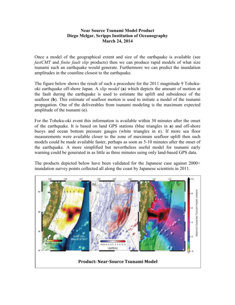
Near Source Tsunami Model Product Diego Melgar, Scripps Institution of Oceanography March 24, 2014 Once a model of the geographical extent and size of the earthquake is available (see fastCMT and finite fault slip products) then we can produce rapid models of what size tsunami such an earthquake would generate. Furthermore we can predict the inundation amplitudes in the coastline closest to the earthquake. The figure below shows the result of such a procedure for the 2011 magnitude 9 Tohokuoki earthquake off-shore Japan. A slip model (a) which depicts the amount of motion at the fault during the earthquake is used to estimate the uplift and subsidence of the seafloor (b). This estimate of seafloor motion is used to initiate a model of the tsunami propagation. One of the deliverables from tsunami modeling is the maximum expected amplitude of the tsunami (c). For the Tohoku-oki event this information is available within 30 minutes after the onset of the earthquake. It is based on land GPS stations (blue triangles in a) and off-shore buoys and ocean bottom pressure gauges (white triangles in c). If more sea floor measurements were available closer to the zone of maximum seafloor uplift then such models could be made available faster, perhaps as soon as 5-10 minutes after the onset of the earthquake. A more simplified but nevertheless useful model for tsunami early warning could be generated in as little as three minutes using only land-based GPS data. The products depicted below have been validated for the Japanese case against 2000+ inundation survey points collected all along the coast by Japanese scientists in 2011. Product: Near-Source Tsunami Model

