Concepts and Skills - Brockton Public Schools
advertisement
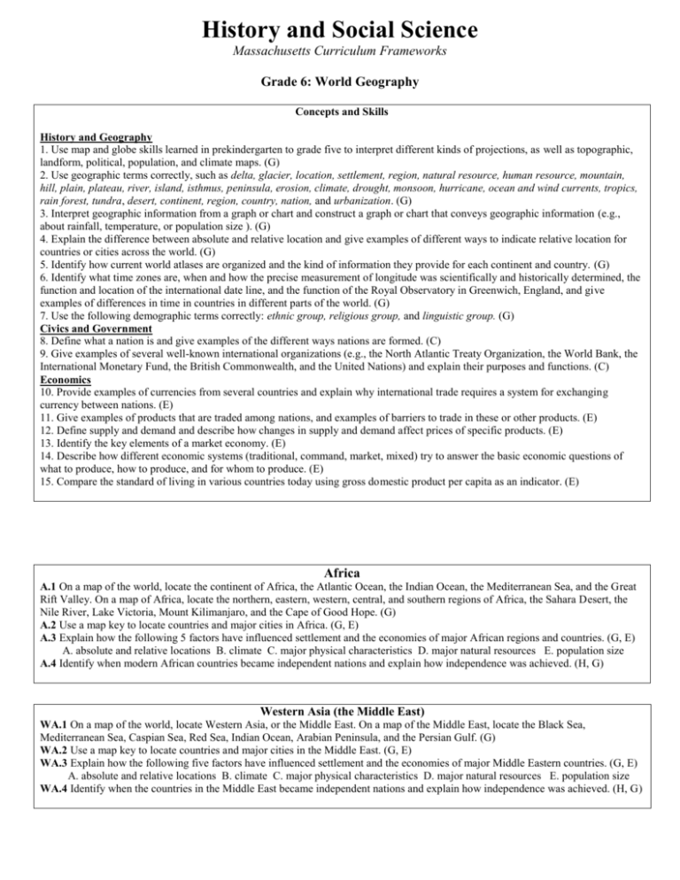
History and Social Science Massachusetts Curriculum Frameworks Grade 6: World Geography Concepts and Skills History and Geography 1. Use map and globe skills learned in prekindergarten to grade five to interpret different kinds of projections, as well as topographic, landform, political, population, and climate maps. (G) 2. Use geographic terms correctly, such as delta, glacier, location, settlement, region, natural resource, human resource, mountain, hill, plain, plateau, river, island, isthmus, peninsula, erosion, climate, drought, monsoon, hurricane, ocean and wind currents, tropics, rain forest, tundra, desert, continent, region, country, nation, and urbanization. (G) 3. Interpret geographic information from a graph or chart and construct a graph or chart that conveys geographic information (e.g., about rainfall, temperature, or population size ). (G) 4. Explain the difference between absolute and relative location and give examples of different ways to indicate relative location for countries or cities across the world. (G) 5. Identify how current world atlases are organized and the kind of information they provide for each continent and country. (G) 6. Identify what time zones are, when and how the precise measurement of longitude was scientifically and historically determined, the function and location of the international date line, and the function of the Royal Observatory in Greenwich, England, and give examples of differences in time in countries in different parts of the world. (G) 7. Use the following demographic terms correctly: ethnic group, religious group, and linguistic group. (G) Civics and Government 8. Define what a nation is and give examples of the different ways nations are formed. (C) 9. Give examples of several well-known international organizations (e.g., the North Atlantic Treaty Organization, the World Bank, the International Monetary Fund, the British Commonwealth, and the United Nations) and explain their purposes and functions. (C) Economics 10. Provide examples of currencies from several countries and explain why international trade requires a system for exchanging currency between nations. (E) 11. Give examples of products that are traded among nations, and examples of barriers to trade in these or other products. (E) 12. Define supply and demand and describe how changes in supply and demand affect prices of specific products. (E) 13. Identify the key elements of a market economy. (E) 14. Describe how different economic systems (traditional, command, market, mixed) try to answer the basic economic questions of what to produce, how to produce, and for whom to produce. (E) 15. Compare the standard of living in various countries today using gross domestic product per capita as an indicator. (E) Africa A.1 On a map of the world, locate the continent of Africa, the Atlantic Ocean, the Indian Ocean, the Mediterranean Sea, and the Great Rift Valley. On a map of Africa, locate the northern, eastern, western, central, and southern regions of Africa, the Sahara Desert, the Nile River, Lake Victoria, Mount Kilimanjaro, and the Cape of Good Hope. (G) A.2 Use a map key to locate countries and major cities in Africa. (G, E) A.3 Explain how the following 5 factors have influenced settlement and the economies of major African regions and countries. (G, E) A. absolute and relative locations B. climate C. major physical characteristics D. major natural resources E. population size A.4 Identify when modern African countries became independent nations and explain how independence was achieved. (H, G) Western Asia (the Middle East) WA.1 On a map of the world, locate Western Asia, or the Middle East. On a map of the Middle East, locate the Black Sea, Mediterranean Sea, Caspian Sea, Red Sea, Indian Ocean, Arabian Peninsula, and the Persian Gulf. (G) WA.2 Use a map key to locate countries and major cities in the Middle East. (G, E) WA.3 Explain how the following five factors have influenced settlement and the economies of major Middle Eastern countries. (G, E) A. absolute and relative locations B. climate C. major physical characteristics D. major natural resources E. population size WA.4 Identify when the countries in the Middle East became independent nations and explain how independence was achieved. (H, G) Central and South Asia CSA.1 On a map of the world, locate Central and South Asia. On a map of Central and South Asia, locate the Indian Ocean, the Arabian Sea, the Bay of Bengal, the Ganges River, the Indo-Gangetic Plain, the Northern Mountains, the Deccan Plateau, the Himalayan Mountains, and the Steppes. (G) CSA.2 Use a map key to locate the countries and major cities in Central and South Asia. (G, E) CSA.3 Explain how the following five factors have influenced settlement and the economies of major Central and South Asian countries. (G, E) A. absolute and relative locations B. climate C. major physical characteristics D. major natural resources E. population size CSA.4 Identify when India, Pakistan, Bhutan, Nepal, Bangladesh, Sri Lanka, and the Central Asian republics first became independent countries and explain how independence was achieved. Explain the relationship of the Central Asian republics to the former Soviet Union. (H, G) North and East Asia NEA.1 On a map of the world, locate North and East Asia, the Pacific Ocean, and the Arctic Ocean. On a map of East Asia, locate the Sea of Japan, the Yellow Sea, the East China Sea, the Gobi Desert, the Himalayas, and the Huang He (Yellow) and Chang Jiang (Yantgtze) Rivers. On a map of North Asia, locate Siberia and the Yenisey, Lena, and Kolyma rivers. (G) NEA.2 Use a map key to locate the countries and major cities in the various regions of East Asia. (G, E) NEA.3 Explain how the following five factors have influenced settlement and the economies of major East Asian countries. (G, E) A. absolute and relative locations B. climate C. major physical characteristics D. major natural resources E. population size NEA.4 Identify when North Korea, South Korea, and Mongolia became independent countries and describe how independence was achieved. (G, H) South America SAM.1 On a map of the world, locate South America and the Atlantic and Pacific Oceans. On a map of South America, locate the Amazon, the Andes Mountains, Cape Horn, and the southern, northern, eastern, and western regions of South America. (G) SAM.2 Use a map key to locate the countries and major cities of South America. (G, E) SAM.3 Explain how the following 5 factors have influenced settlement and the economies of major South American countries. (G, E) A. absolute and relative locations B. climate C. major physical characteristics D. major natural resources E. population size SAM.4 Identify when South American countries became independent nations and explain how independence was achieved. (H, G). Europe E.1 On a map of the world, locate the continent of Europe. On a map of Europe, locate the Atlantic Ocean, Arctic Ocean, Norwegian Sea, and Barents Sea. Locate the Volga, Danube, Ural, Rhine, Elbe, Seine, Po, and Thames Rivers. Locate the Alps, Pyrenees, and Balkan Mountains. Locate the countries in the northern, southern, central, eastern, and western regions of Europe. E.2 Use a map key to locate countries and major cities in Europe. (G) E.3 Explain how the following five factors have influenced settlement and the economies of major European countries. (G, E) A. absolute and relative locations B. climate C. major physical characteristics D. major natural resources E. population size Southeast Asia and Oceania SEAO.1 On a map of the world, locate Southeast Asia, the Indian Ocean, Australia, New Zealand, Antarctica, the major Pacific Islands, the Pacific Ocean, and the Coral Sea. On a map of Southeast Asia and Oceania, locate the Bay of Bengal, the South China Sea, the Great Victoria Desert, and the Great Barrier Reef. (G) SEAO.2 Use a map key to locate countries and major cities in the various regions of Southeast Asia, Australia, and the major Pacific Islands. (G, E) SEAO.3 Explain how the following five factors have influenced settlement and the economies of major countries of Southeast Asia and Oceania. (G, E) A. absolute and relative locations B. climate C. major physical characteristics D. major natural resources E. population size SEAO.4 Identify when countries in Southeast Asia and Oceania became independent countries and describe how independence was achieved. (G, H)
