Geographic Luck Supporting Arguments
advertisement
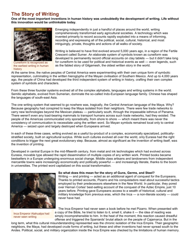
The Story of Writing One of the most important inventions in human history was undoubtedly the development of writing. Life without this innovation would be unthinkable today. Emerging independently in just a handful of places around the world, writing comprehensively transformed early agricultural societies. A technology which was invented primarily to record accounts rapidly exploded into a means of informing, recording and expressing all of the political, social, cultural, historical, and most intriguingly, private, thoughts and actions of all walks of society. Cuneiform is recognized as the earliest writing in human history Writing is believed to have first evolved around 5,000 years ago, in a region of the Fertile Crescent called Sumer. An elaborate system of symbols known as cuneiform was developed to permanently record official accounts on clay tablets — but it didn't take long for cuneiform to be used for political and historical events as well — even legends, such as the fabled story of Gilgamesh, the oldest written story in the world. At the same time, the native peoples of Central America were experimenting with their own unique form of symbolic representation, culminating in the written hieroglyphs of the Mayan civilisation of Southern Mexico. And up to 4,000 years ago, the people of China had developed the third independent system of writing in history, crafting their own complex system of symbols and characters. From these three founder systems evolved all of the complex alphabets, languages and writing systems in the world. Semitic alphabets, evolved from Sumerian, dominate the so-called Indo-European language family. Chinese has shaped the languages of south-east Asia. The one writing system that seemed to go nowhere was, tragically, the Central American language of the Maya. Why? Because geography had conspired to keep the Maya isolated from their neighbors. There were few trade networks to carry new technologies beyond the Mexican plateau — particularly south, through the impassable isthmus of Panama. There weren't even any load-bearing mammals to transport humans across such trade networks, had they existed. The people of the Americas communicated only sporadically, from shore to shore — which meant there was never the consistency of communication to necessitate using the written word. So Mayan symbols remained local only to central America — seized upon and largely destroyed when Europeans arrived. In each of these three cases, writing evolved as a useful by-product of a complex, economically specialized, politicallystratified society, built on agricultural surplus. While such cultures evolved all over the world, only Eurasia had the right conditions to trigger the next great evolutionary step. Because, almost as significant as the invention of writing itself, was the invention of printing. Developed in central Europe in the mid-fifteenth century, from metal and ink technologies which had evolved across Eurasia, movable type allowed the rapid dissemination of multiple copies of any written work. Printed books became bestsellers in a Europe undergoing enormous social change. Middle class artisans and landowners from independent mercantile towns were increasingly economically and politically powerful — and increasingly literate, thanks to the boom in universities. The printed word capitalized on this social transformation. So what does this mean for the story of Guns, Germs, and Steel? Writing — and printing — acted as an additional agent of conquest for the Europeans. Thanks to printed accounts, Pizarro and his conquistadors read about successful tactics employed by their predecessors elsewhere in the New World. In particular, they pored over Hernan Cortes' best-selling account of the conquest of the Aztec Empire, just 10 years before. Printing gave Europeans access to a wealth of historical, cultural and military knowledge from previous eras, which the Inca — a non-literate society — could never have had. The Inca Emperor had never seen a book before he met Pizarro. When presented with a copy of the Bible, he tried to listen to it, smell it, shake it — the idea of reading was Inca Emperor Atahualpa had simply incomprehensible to him. In the heat of the moment, this reaction caused dreadful never seen writing offense and triggered the Spaniards' brutal attack on the people of Cajamarca. But in the long term, what this cultural misunderstanding represented was the chronic isolation of the Inca Empire. Their geographic neighbors, the Maya, had developed crude forms of writing, but these and other inventions had never spread south to the Andes. Political, social, and military organization inside the Inca Empire was checked by the limitations of human memory. Throughout human history whenever literate societies clashed with non-literate societies, the victors were usually the ones capable of later recording their great achievements for posterity. To the victor goes the recording of history. The Story of Latitude and Climate Daily life on our planet is governed by fundamental universal forces, far beyond our control. A chance product of our distance from the Sun, and the physical properties of the earth itself, factors like latitude and climate have played a central part in the grandest patterns of human history. But how do they work? Latitude expresses any distance north or south of the Equator, in degrees between 0 and 90, and measured from a point of origin at the center of the earth. Lines of latitude are significant not just for global navigation – but, more fundamentally, because they reflect the changing angle of the sun in respect to the earth. This alone determines day length, seasonality, and to a large extent, climate. Latitide expresses distance north or south For example, a person standing anywhere between 23.25 degrees north, and 23.25 degrees south of the Equator will – at some point during the year – be standing directly perpendicular to the rays of the Sun. In this region there is hardly any fluctuation in day length or seasonality, apart from a tendency towards cooler, drier weather when the earth tilts away from the sun (wintertime), and hotter, wetter weather when the earth tilts towards the sun (summertime). As we move north or south of the tropics, and farther away from the Equator, the difference between hours of daylight, compared to hours of nighttime, will start to increase. At forty degrees, for example, with the earth tilting away from the sun, the day will be much shorter than the night (wintertime). If the earth is tilting towards the sun, the day will last much longer than the night (summertime). Winter and summer in these parts of the world cycle between much broader climatic extremes than at the Equator – winters are very cold, dark, and often wet; summers are very hot, bright, and often dry. And in these latitudes there are also transitional phases, or seasons, known as autumn and spring, where the hours of nighttime and daytime reach momentary equilibrium. In these so-called temperate zones, seasonality has a major impact on which plants, animals, and even diseases can thrive. Beyond 66 degrees north or south of the Equator, in the so-called arctic regions, the seasons reach their most dramatic extremes. In the summer, the sun never sets, whilst in the winter, the sun never rises. The temperature here remains cold all year round and in such inhospitable conditions very few plants or creatures can thrive. Any two points east or west of one another, which share the same latitude, will also share the same day length, and therefore – by and large – the same climate. Plants and animals which thrive at a given latitude, will tend to thrive at the same latitude anywhere else on the planet – either north or south of the Equator. So, if there is an easy east/west overland migration route for those crops or animals, they will tend to successfully export themselves beyond their point of origin. However, it is very unusual for plants and animals which thrive at one latitude, to be able to survive at dramatically different latitudes. Successful migration north or south is extremely rare, because moving through different latitude zones means moving through dramatically different climates, day lengths, and environmental conditions. In this context, latitude has had massive implications for the grandest patterns of history, seen most clearly in the differing fortunes of Eurasia, Africa and the Americas. The Shapes of the Continents One of the most surprising revelations of history revolves around simple, basic geography: the shape of the continents themselves. The product of millions of years of geological flux, continental shape may have had a fundamental impact on the progress of human societies. Continents that are spread out in an east-west direction, such as Eurasia, had a developmental advantage because of the ease with which crops, animals, ideas and technologies could spread between areas of similar latitude. Continents that spread out in a north-south direction, such as the Americas, had an inherent climatic disadvantage. Any crops, animals, ideas and technologies had to travel through dramatically changing climatic conditions to spread from one extreme to the other. Europe was destined to be a cultural melting pot Technologies such as gunpowder were able to migrate 6,500 thousand miles from China, where they originated, to Western Europe, where they reached their apogee, in a matter of centuries. The wheel, on the other hand, developed in southern Mexico, never even managed the 500-mile journey south to the Andes. But the influence of continental formation runs even deeper than this. Some have argued that coastlines, mountains and valleys may help us understand something as fundamental as the differing historical paths taken by Europe and China. This is a puzzle which has occupied historians for generations. Given that Chinese civilization had evolved for almost as long as the civilizations of the Fertile Crescent, and by extension, Europe; given that China had even developed a phenomenal navy capable of trans-Pacific exploration nearly 100 years before Columbus set sail for the Indies, how come Europeans were the ones who took over the world – and not the Chinese? Can geographical phenomena explain these differing paths? Chinese civilization was founded on the domestication of irrigation-dependent crops. Rice grows in the wild along riverbanks and in swampy regions where the grasses enjoy year-round partial submersion. In order to replicate this environment, the earliest Chinese farmers had to construct fairly complex systems of irrigation, supplied by the Yangtze and Yellow rivers. This, it is argued, influenced the development of two social phenomena. First, the establishment of a central social organization and hierarchy, founded upon the construction and maintenance of irrigation networks. Second, because of the geographic distribution of the Yellow and Yangtze rivers – flowing almost parallel to one another, from central China to the pacific coast – Chinese civilization grew organically outwards, from one central-east heartland – a heartland which controlled the mechanics of irrigation. European civilization, on the other hand, was founded upon the domestication of rainfall-dependent crops – wheat and barley, which will grow anywhere, as long as it rains for part of the year. This, experts argue, allowed farming communities, villages, towns and eventually cities to emerge autonomously, all across Europe. There was never any need for a central authority to control irrigation across the continent. Instead, from its very inception, European society was destined to become fragmented – independent, autonomous and competitive. So what about the shape of the continents? China is essentially a fertile basin, enclosed by a ring of insurmountable geographic obstacles – ocean to the east, desert to the north, mountains to the south and an enormous, man-made wall to the west. This centrally-organized culture, which could expand rapidly for thousands of miles right up to its natural borders, could exist quite happily in isolation providing irrigation agriculture was maintained. It had no need to compete with neighboring states. In fact, the basin of China was so vast, there were few neighboring states, and for thousands of years the Chinese empire progressed along its own isolated path. Europe, on the other hand, with its four mountain ranges, five peninsulas, dozens of rivers, islands, and proximity to the coast of North Africa, was geographically destined to become a cultural melting pot. Independent, organically grown states emerged cheek by jowl, and were separated by distinct, but not insurmountable, geographical barriers. In 1492, rejected by the King of Portugal for lack of funds, Christopher Columbus simply travelled to Portugal's neighbor and rival, Castile, and instead pitched for exploration funds there. Fuelled by the desire to compete, patrons and princes throughout Europe were prepared to invest in outlandish ventures, and provided Columbus with the necessary capital to explore new lands. In China, the greatest navy that the world had ever seen was disbanded one day, on the whim of an Emperor. Unlike Columbus, the Admiral of the Imperial fleet had no rival princes on whom he could call. There was little incentive for China to seek its fortune outside of its heartland – the Empire had everything it needed, right in its own backyard. And in such a vast nation ruled by the will of one man, there was simply no choice but to obey. Simply put, the ramifications of basic geography could be profound: Spain claimed the Americas instead of China, and Europe soon conquered the world. The Story of Horses Domesticated in central Asia around five thousand years ago, the horse was instrumental to the development of Eurasian civilization. Unlike most other large mammals, it was not farmed for its meat, milk or hides. Instead, the horse was harnessed solely for its incredible strength – to pull plows, vehicles, and most significantly, to carry humans themselves. Without horses, the evolution of complex European economies and trading networks would have been unthinkable. Most significantly, the horse transformed the art of war. From the earliest horse-drawn chariots of the Hittite empire, to the bareback cavalrymen of Attila the Hun, the warhorse has become synonymous with Eurasian military success. Spanish horses were instrumental in the conquest of the New World. Neither the Aztec nor the Inca had ever seen humans riding animals before; the psychological impact of mounted troops was tremendous. Hernan De Soto, comrade of Pizarro, famously rode his horse right into the Inca Emperor's throne room. Eyewitnesses later recalled: "The captain advanced so close that the horse's nostrils stirred the fringe on the Inca's forehead. But the Inca remained still, he never moved." European civilization ascended to power on the backs of horses Spanish conquistadors like de Soto were inheritors of some of the finest riding techniques in the whole of Eurasia. The jineta riding style, unique to Spanish cattle-ranchers, emphasized spontaneity, speed, balance in the saddle and maneuverability. Bull-fighting, a pastime which grew out of Spanish ranching, also helped riders and their horses improve their techniques of forceful advance and swift retreat. The conquistadors who sailed to the New World had grown up on ranches and farms. They had ridden horses since their youth, and brought their finest animals with them. The consequences for the peoples of the New World were catastrophic. On the morning of November 16, 1532, a surprise charge of just 37 Spanish horses, concealed in the Inca town of Cajamarca, unleashed an orgy of bloodshed. Europeans had known for centuries that foot soldiers stood a good chance against cavalry if they stood firm and repelled the outnumbered mounted troops. But the Inca had no experience of this, nor could they have read about others' experiences, since they were geographically isolated and had no written records from which to learn. The Conquistadors mastery of the horse allowed Instead, they panicked and tried to flee, allowing the outnumbered for a swift defeat of the Inca empire conquistadors to run through them with great speed and efficiency. But the great irony of the conquistadors' victory was that, until about 10,000 years ago, the horse's wild ancestor had flourished throughout the Americas. The plains of North America had in fact been the natural homeland of the Equus species, some of which migrated across a narrow land passage to the plains of central Asia. Then, between 10,000 and 8,000 years ago, the species vanished from the Americas – it is believed, through a combination of over-hunting and climatic change. The submersion of the Bering Strait meant no subsequent, reverse migration could occur from central Asia, and the horse remained absent from the Americas until its reintroduction by Europeans. The Story of Llamas The only large mammals ever domesticated within the Ancient Americas, Llamas and alpacas are evolutionary cousins of the camel – although they lack the camel's signature hump. Like camels, llamas are intelligent and gregarious herbivores, but when aggravated, over-burdened or other-wise annoyed, they tend to hiss, spit, kick, and refuse to move, often lying down in protest. The llama was central to the success of the Inca empire Domesticated by Native Americans more than 5,000 years ago, llamas average around 4 feet tall at the shoulder. Primarily kept for their wool, they are also used for their meat, dung and hides. Llamas are kept in paddocks and never brought indoors; nor are they milked for human consumption. This has meant that very few diseases have ever jumped species from llama to man, compared to the host of diseases which Europeans inherited from living in close proximity to their livestock. The llama’s high tolerance for thirst, and appetite for a broad range of plants, made it key to Native American transport and communication throughout the Andes. Although llamas can average between fifteen and twenty miles a day, llamas lack the strength of oxen, camels and horses,so they’re unable to carry adult humans or pull any kind of machinery. Even if the Inca had discovered the wheel, no llama could ever have pulled a cart larger than a wheelbarrow. At the time of the Spanish conquest of the Americas, llamas were used in great numbers to transport silver ore from the Inca mining network. One Spanish observer guessed that as many as 300,000 llama were used to export the produce of one particular mine (Potosi, in modern Bolivia), alone. But geography had ensured that the continent's only load-bearing mammal remained isolated, known only to the indigenous peoples of the Andes. The inhospitable jungles of The Llama, central to the the Panamanian isthmus and the deserts of South America ensured that no llamas – and success of the Inca empire no Inca – had ever reached the Aztecs, or beyond.

