Sermilik
advertisement
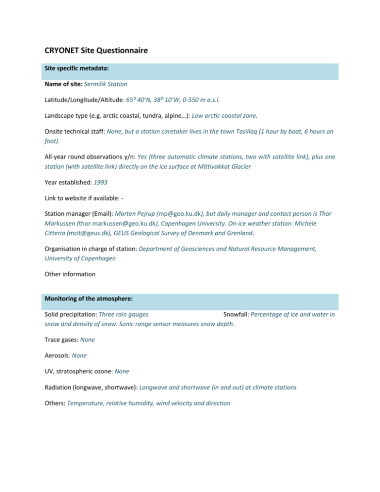
CRYONET Site Questionnaire Site specific metadata: Name of site: Sermilik Station Latitude/Longitude/Altitude: 65⁰ 40’N, 38⁰ 10’W, 0-550 m a.s.l. Landscape type (e.g. arctic coastal, tundra, alpine…): Low arctic coastal zone. Onsite technical staff: None, but a station caretaker lives in the town Tasiilaq (1 hour by boat, 6 hours on foot). All-year round observations y/n: Yes (three automatic climate stations, two with satellite link), plus one station (with satellite link) directly on the ice surface at Mittivakkat Glacier Year established: 1993 Link to website if available: Station manager (Email): Morten Pejrup (mp@geo.ku.dk), but daily manager and contact person is Thor Markussen (thor.markussen@geo.ku.dk), Copenhagen University. On-ice weather station: Michele Citterio (mcit@geus.dk), GEUS Geological Survey of Denmark and Grenland. Organisation in charge of station: Department of Geosciences and Natural Resource Management, University of Copenhagen Other information Monitoring of the atmosphere: Solid precipitation: Three rain gauges Snowfall: Percentage of ice and water in snow and density of snow. Sonic range sensor measures snow depth. Trace gases: None Aerosols: None UV, stratospheric ozone: None Radiation (longwave, shortwave): Longwave and shortwave (in and out) at climate stations Others: Temperature, relative humidity, wind velocity and direction Snow cover Physical parameters: snow depth from sonic ranger on the glacier Chemical parameters: None Others: Glaciers and ice caps Mass balance (measured parameters): Winter and summer mass balance measured each year, ice ablation at the station on the glacier (using GEUS ablation sensor) Ice flow (measured parameters): Surface velocity of the glacier, all year GPS position at the station on the glacier. Basal water pressure (measured parameters): No Others: Glacier front measurements by dGPS every year; Comparing with available satellite images and aerial photographs; Annual situation photos from fixed points. Complete surface energy balance at the automatic station on the glacier. Realtime climate data from the glacier station are contributed to and freely available from the PROMICE Programme for Monitoring of the Greenland Ice Sheet database (promice.dk) Sea ice Mass balance (measured parameters): None Meteorology: radiation, air temperature, humidity, wind speed and direction, air pressure (measured parameters): None Snow on ice (measured parameters): None Ice chemistry (measured parameters): None Others: Permafrost Borehole measurements (measured parameters): Not on a regular basis Meteorology: radiation, air temperature, humidity, wind speed and direction, air pressure (measured parameters): No Snow on ground (measured parameters): No Active layer thickness (measured parameters): No GST: Others: Ice sheet Mass balance (measured parameters): Ice sheet is not in the area Meteorology: radiation, air temperature, humidity, wind speed and direction, air pressure (measured parameters): No Snow on ice (measured parameters): No Ice chemistry (measured parameters): No Others: Other measurements (hydrological, ecological, oceanographic, etc) Hydrology (measured parameters): River discharge in the proglacial valley; sediment load in the river (three sites); water levels (Q-h relationships); conductivity; dissolved substances (not on a regular basis) Ecology (measured parameters): Not on a regular basis Oceanography (measured parameters): Only during intensified field campaigns Other thematic linkages: Morphological development of an arctic delta using dGPS Linkages to satellite data (describe validation programs, applications of satellite data, etc.) Several high resolution satellite scenes gathered for the area including QuickBird, SPOT, Landsat a.o.; 3D elevation models Participation in international monitoring programmes such as GAW, GTN-G, GTN-P, …. Networks and start of contribution: International Network of Terrestrial Research and Monitoring in the Arctic (INTERACT), Sediment budgets in cold environments (SEDIBUD)
