Aviation: The Distance Formula
advertisement
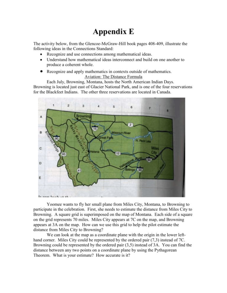
Appendix E The activity below, from the Glencoe-McGraw-Hill book pages 408-409, illustrate the following ideas in the Connections Standard: Recognize and use connections among mathematical ideas. Understand how mathematical ideas interconnect and build on one another to produce a coherent whole. Recognize and apply mathematics in contexts outside of mathematics. Aviation: The Distance Formula Each July, Browning, Montana, hosts the North American Indian Days. Browning is located just east of Glacier National Park, and is one of the four reservations for the Blackfeet Indians. The other three reservations are located in Canada. Yoomee wants to fly her small plane from Miles City, Montana, to Browning to participate in the celebration. First, she needs to estimate the distance from Miles City to Browning. A square grid is superimposed on the map of Montana. Each side of a square on the grid represents 70 miles. Miles City appears at 7C on the map, and Browning appears at 3A on the map. How can we use this grid to help the pilot estimate the distance from Miles City to Browning? We can look at the map as a coordinate plane with the origin in the lower lefthand corner. Miles City could be represented by the ordered pair (7,3) instead of 7C. Browning could be represented by the ordered pair (3,5) instead of 3A. You can find the distance between any two points on a coordinate plane by using the Pythagorean Theorem. What is your estimate? How accurate is it?
