Urban Processes & Patterns: Perth & NYC Geography Worksheet
advertisement
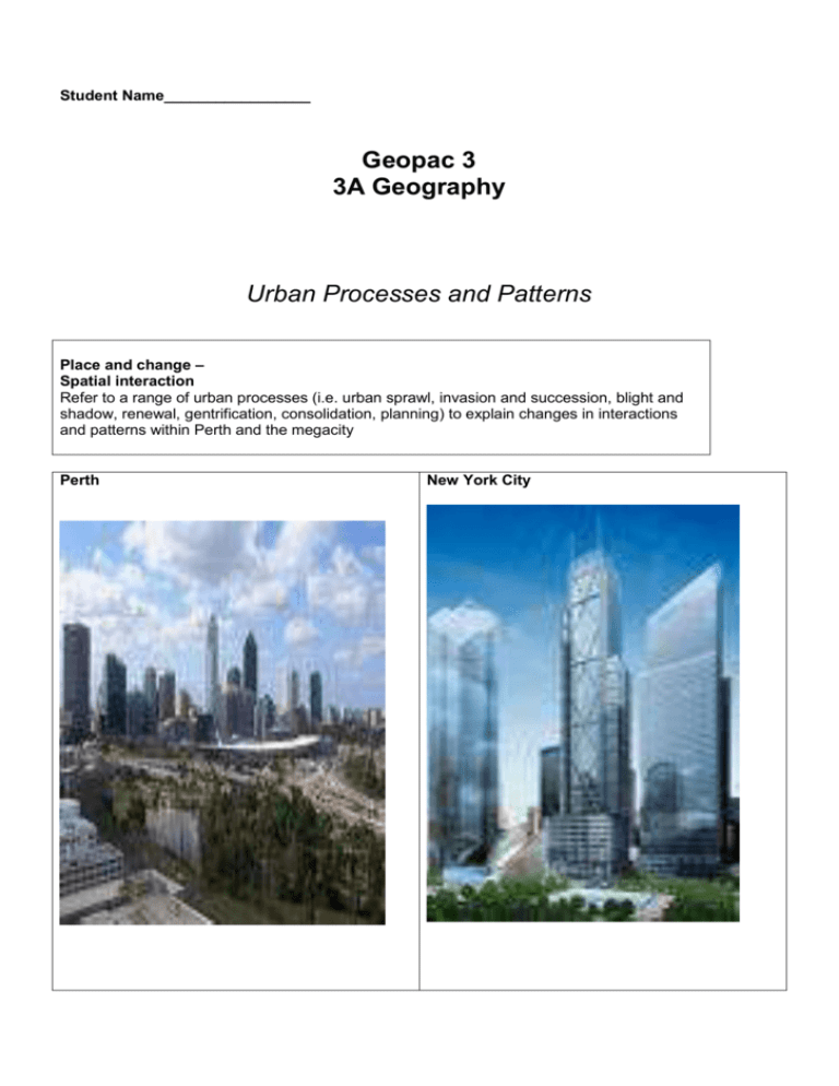
Student Name_________________ Geopac 3 3A Geography Urban Processes and Patterns Place and change – Spatial interaction Refer to a range of urban processes (i.e. urban sprawl, invasion and succession, blight and shadow, renewal, gentrification, consolidation, planning) to explain changes in interactions and patterns within Perth and the megacity Perth New York City Review: Perth’s Functional Zones (Source – Landscapes and Land Uses, Atkinson et al) Internal morphology is the layout of land uses and urban functions within a city. The term urban function refers to the purpose or role of an urban area and therefore to the economic and social activities carried out by city dwellers in that area. As in any city, the internal morphology of Perth contains a large number of urban functions aimed at meeting the requirements of the residents as well as the population of the hinterland. As a result of the changing living conditions, the operation of market forces and the gradual development of urban planning, distinct patterns of land use developed and could be classified into areas known as functional zones. Perth’s land use pattern is characterised by a number of functional zones. • central business district • inner mixed zone • residential zone: – established residential zone – newer growth zone • outer business districts • industrial zone • rural–urban fringe • special purpose zones Perth’s central business district The CBD, located on the site of the first settlement, occupies a relatively small area of the inner city and has a very compact form. The initial site was a sandy ridge bounded by swamplands. Consequently, the site had drainage problems that have been overcome by reclamation work over the years. The CBD overlooks a broad stretch of the Swan River between Heirisson Island and Narrows Bridge. It is laid out as a rectangular grid with the main streets—Wellington, Murray, Hay and St Georges Terrace–Adelaide Terrace—running west to east parallel to the Swan River. The main streets running north to south are Milligan, King, William, Barrack, Pier and Victoria. The CBD is the commercial, business and administrative centre for Perth. It is the zone of maximum accessibility and the focus of communication for the whole of Western Australia. The inner mixed zone The inner mixed zone (IMZ) is made up of Perth’s oldest suburbs—West Perth, Leederville, North Perth and East Perth—and is situated beyond the frame of the CBD. The IMZ is made up of a variety of different land uses of a semi-intensive nature, including shops, factories, warehouses, flats, terraces, houses, restaurants and transport links that channel commuter traffic in and out of the CBD. Original buildings from the turn of the nineteenth century are found next to newer commercial buildings creating a landscape of mixed architectural styles. This zone also includes parks, gardens and cultural precincts. This zone is one in which a variety of land uses (heterogeneity) may be found. It is also referred to as a zone in transition, where the mixed pattern of land use is constantly changing as CBD functions encroach on the older residential areas. This inner-city transition zone displays a semi-intensive mixture of land uses, shown by its dissimilar building types. Factories, warehouses, flats, terrace houses, transport terminals, restaurants and other structures house specialist functions. These are found close to one another along transport links. Many functions are carried out in buildings not originally designed to house them—a change of function. A restaurant, for example, may now occupy an old house Residential zone Perth’s residential zone is the most space extensive zone within the city’s boundaries and extends from the IMZ to the rural–urban fringe (discussed below). It consists of a mosaic of dwellings of different ages, sizes, styles and quality, the transport routes that connect them and buildings associated with providing the goods and services needed by residents. This zone has two distinctive parts: the established residential zone (ERZ ), which is on the interior of the zone near the IMZ; and the newer growth zone (NGZ) towards the outskirts, which contains newer and greenfields developments. Beyond the IMZ lies a large region of established suburbs, known as the established residential zone (ERZ). These suburbs formed old city boundaries and have been substantially developed since World War II, though development of some of the inner areas precedes this point in time (e.g. East Perth). Located in areas with good transport networks, they are well served by a range of recreational, cultural, commercial and professional services. Some of these suburbs are found on desirable sites and therefore command higher land values. They have a high population turnover as new families buy into the zone. Examples of suburbs in the ERZ include Willetton to the south of central Perth, Bayswater to the east, Morley to the north and City Beach to the west. Outer business districts Outer business districts (OBD) operate outside the CBD. The smallest types of OBDs are corner stores, which were extremely common before cars became the social norm. These days it is possible for consumers to drive to a larger ‘neighbourhood’ shopping precinct and the result is that corner stores are becoming a thing of the past. The most commonly occurring OBDs are shopping centres and these are dispersed throughout Perth. Industrial zones Industrial zones (IZ), like OBDs, are dispersed throughout Perth. They include areas of light industry, such as that which occurs in the CBD and IMZ and other zones; planned industrial estates, like those in Canning Vale and Wangara; and areas of heavy industry like Kwinana. Light industry (e.g. jewellery making, printing and stationery, small scale food producers, clothing manufacture) are small scale and space intensive. Industrial estates contain more space extensive activities such as panel beating, medium scale manufacturing (often metal workshops), and home fixtures, fabrication and supplies. Heavy industry refers to businesses such as refineries, smelters, steelworks and fertiliser factories and these require more space because of their large scale and complex processing activities Rural–urban fringe The rural–urban fringe (RUF) is located on the outskirts of the city where the built-up area meets the countryside. Because this area is only partly urbanised, it has a lot of rural characteristics and a mixture of land uses. Rural land uses, such as dog kennels, orchards, vineyards, poultry farms, horse studs and nurseries, will often take place next to a NGZ. Space extensive land uses that may require some separation from other urban land uses also occur, such as sewage treatment plants, waste disposal sites, telecommunications areas, prisons, industrial estates, quarrying and water catchment areas. These often take place in the RUF because it is more cost-effective than using valuable urban land and some of these activities can conflict with residential land use. The RUF is also home to a variety of specialised, space-extensive land uses, some of which are relegated to these areas due to their incompatibility with other urban functions. These land uses include industrial estates (such as that in Wangara), prisons (Canning Vale Prison), sewage treatment plants, water catchment areas and quarrying. Increasing numbers of commuters moving into the RUF have caused the older, semi-rural settlements to become more urban in function. Kalamunda, Gooseberry Hill and Mundaring were formerly small country towns along the Darling Scarp. They are now multifunctional urban centres, though they still have a predominantly rural character. The RUF, like the IMZ, is a transitional zone. Intensive farming is the principal rural land use in the wide zone on the outskirts of Perth. Market gardens are found to the north (e.g. in Carabooda) and to the south-west (e.g. in Spearwood), and vineyards are found to the northeast in the Swan Valley area. In the hills area to the east, fat lamb farming and stone fruit production occur. Other rural land uses in this zone include horse studs, dog kennels, poultry farms and nurseries. New housing estates also occur frequently throughout the zone. As in the NGZ, the provision of amenities and services to these estates may lag behind settlement. The rapid encroachment of residential and other urban land uses has resulted in a partially developed urban landscape, which often has an untidy appearance. This has occurred in Merriwa and Butler. This northern region also illustrates the uneven nature of the RUF, with suburban evelopment leaping over undeveloped areas as each individual developer achieves planning approvals for their own piece of land. Special purpose zones Special purpose zones (SPZ) are areas that cannot be classified into one of the recognised land use functions, or that are too few or scattered in their distribution. These areas often are ‘one of a kind’ in Perth and service the entire state. They include railway yards, sewage treatment plants, airports, university campuses. Review Questions: Urban Morphology and land use 1. Define ‘urban morphology’ 2. What is the difference between internal morphology and external morphology? 3. Using examples define each of the following: Dispersed, grid, linear, multi-cellular, nucleated, organic, stallate 4. Describe the external morphology of Perth 5. Draw a sketch map to show the external morphology of Perth – label the CBD and the main road and rail networks. 6. Discus five factors that have influenced the external morphology of Perth. 7. Which of these factors appear to have been most important – why? 8. What are the major urban functions of Perth? 9. Draw a sketch map of Perth to show the: Location of the CBD Inner mixed zone Established residential zone Newer growth zone Outer business district Major industrial areas Rural-urban fringe Special functions 10. Where is the CBD of Perth located? 11. State six characteristics of the CBD 12. Where is the inner mixed zone? 13. State six characteristics of the inner mixed zone. 14, What are the similarities and differences between the inner mixed zone and the CBD? 15. Describe the location of the established residential zone 16. State six characteristics of the established residential zone 17. Describe the location of the newer growth zone 18. State six characteristics of the newer growth zone. 19. What are the similarities and differences between the established residential zone and the newer growth zone? 20. Where are Perth’s outer business districts located? 21. What are the main functions of the outer business districts? 22. How do outer business districts differ from the CBD? 23. Describe the characteristics of Perth’s rural urban fringe 24. List four ways that the rural urban fringe has changed in recent years 25. Identify some of the special function areas of Perth. 26. What factors have influenced the location of these special function areas? The Urban processes and patterns that influence Perth and New York City 1. Processes that produce patterns a) Accessibility The CBD Accessibility This is an important locational quality expressing the ease with which a location can be reached and interacted with from other locations. A highly accessible area would have excellent transport connections and usually means that land prices are higher. As the central business district (CBD) is the most accessible land in Perth, it contains the highest land values, particularly the core area bounded by Hay, William and Barrack Streets and St Georges Terrace. There is keen competition for this limited land, so only business functions that can operate in a small area for high profit can afford to occupy it. With the exception of Supreme Court Gardens and Government House, this zone has the most intensive land use of any zone in the city. Because there is such intensity of land use competition in the CBD, space is created by building upwards. As well as vertical growth, within multistorey buildings there are a variety of functions taking place. This is known as vertical zonation. Some functions, such as retail firms and service activities, need to be at the ground level as they rely on passing trade, while other functions that need less direct contact with customers, such as business firms, tend to locate their offices on higher, less accessible floors of office buildings. The top floors of office blocks on the south side of St Georges Terrace are particularly prestigious business addresses, as they command views overlooking the river. Pedestrian scale is the distance pedestrians are prepared to walk to access services. As the CBD has a pedestrian scale the outwards growth is limited, which further encourages vertical zonation. Because of escalators and connecting arcades between Hay and Murray Streets, the retail core is also zoned vertically. Murray Street is one floor lower than Hay Street, which means pedestrians must use escalators to reach the Hay Street level. These escalators extend another two levels above ground into more shopping areas, such as the Carillion arcade. The Perth Connvention Centre, Claremont Showgrounds, prisons, television stations, rubbish transfer stations, and parks and reserves underground station and adjoining concourse also connects pedestrians with the Murray Street Mall and to the newer retail traders on William Street. New developments on this street are hoping to attract commuters from the new underground station, which will also supplement the traditional retail areas. These developments include Wesley Quarter, the Raine Square redevelopment, and ONE40 William, which is set to be developed by 2010. Each of these developments will be vertically zoned. Horizontal zonation of functions also occurs in the CBD. In the core zone, financial institutions such as banks, insurance firms and finance companies tend to concentrate in the high land-value area of St Georges Terrace. Newer office developments (e.g. the Woodside building) have occurred at the freeway end of the terrace, where the higher land improves the river views. Hay, Murray and, more recently, William Street are given over to retail functions, especially at ground level. Traditionally, the CBD has not been an area of residential development. However, with rising fuel prices and an increase in commute times, there are more people moving to there to live in a high density setting. The residential population growth rate between 2006 and 2007 was 9.1 per cent making the city of Perth one of the fastest growing places in the metropolitan area. The growth is mainly in the luxury apartment market with new developments at the west end of Murray Street and east end of Adelaide Terrace. This growth is supported by the Perth City Council and the Western Australian Planning Commission, as it revitalises the CBD as the shopping and entertainment heart of Perth. Despite this change, the CBD still retains the characteristic pattern of very high day-time population and low night-time population densities, with some 130 000 workers drawn to the city each day. The 2006 census count of the inner city Perth population was merely 1008 people. The CBD is a very dynamic zone because of the competition for the most desirable locations, and while the forces of change tend to dominate the city, this does not mean that all functions will be affected. Perth’s CBD also includes important heritage precincts of a social, cultural and religious nature. The zone contains a number of important religious buildings and these continue to exist among the commercial skyscrapers. The growth of an active heritage movement has also seen the facades of older buildings preserved as a condition of development OBDs OBDs operate to service the nearby suburban areas. They demonstrate a high level of accessibility and are often located at main road intersections and close to public transport hubs. Most importantly, though, there is significant car parking which makes OBDs more attractive to suburban consumers who would not normally drive to the CBD. (p43 textbook) 1. What is meant by ‘accessibility’ and how does it influence land values? 2. According to the concentric model how does distance from the CBD influence land values? 3. What are some of the other factors that have impacted on land values in Perth and New York City? Give examples of how accessibility has influenced land values in Perth and NYC Perth New York City b) Planning (p43 textbook) 1. What role does the planning process play in the distribution of land-use zones? 2. How can planning create accessible sites? 3. What are some of the other factors that have impacted on land values in Perth and New York City? 2. Processes that group functions together a) Agglomeration Agglomeration of industrial zones Processes in industrial zones Light industry is located in the CBD where it can operate on the upper floors of some building through the process of vertical zonation. Heavy industrial zones usually agglomerate around a port, but they tend to separate from residential areas to lessen the effects of industrial pollution Planned industrial estates The impact of industrial functions on other land uses often produces negative effects. Higher environmental standards and stricter planning standards have given rise to the large industrial estates. Within these, the site of different industries is closely considered with a view to creating buffer zones around them and meeting environmental laws. Thus, industries that deal with hazardous materials or have emission problems are sited to minimise their impacts on other industrial activities as well as other land uses. The location of a cement works involves a different set of standards to those for a warehouse function. While the Canning Vale industrial estate illustrates the newer estates, the Bentley Technology Park, situated near Curtin University, is an example of a high technology estate. Here, pharmaceutical companies, computer and electronic equipment producers and biotechnology enterprises engage in quaternary-type industries (a knowledge industry focusing on technological research, design and development). Heavy industry Heavy industries are separated from residential areas by relatively wide buffer zones of natural vegetation or rural land use. The Kwinana heavy industrial area, for example, was built on an unused part of the coastal plain about 40 kilometres south of Perth. The sheltered waters of Cockburn Sound, though shallow, provided the opportunity to construct wharves that could take large tankers and bulk carriers. Early industries included the BP refinery and the BHP steel works. It is also an area in which Western Mining and Alcoa operate refineries. Further south towards Rockingham, the CBH grain silos illustrate another use of the port facilities in Cockburn Sound. (p44 textbook) 1. What is meant by ‘agglomeration’? Describe examples of agglomeration in Perth and NYC Perth New York City b) Aggregation Aggregation in the CBD The process of aggregation of financial, commercial, professional and retail functions allows for close contact between providers and consumers of these types of services. The process of land use competition results in Perth CBD having extremely high land value. It has a high level of accessibility as it is the nodal point for many transport links. Competition for this land creates the extremely high land rent limiting the types of functions operating there. Aggregation and OBD’s Aggregation When similar or compatible land uses come together. Benefits for business include the prestige reputation an area can develop or simply becoming known by consumers as the place to go to purchase certain goods or services. Aggregation is one of the processes that influences the location of OBDs. For example, new and used car yards along the Albany Highway, Shepparton Road and the Scarborough Beach Road are given high exposure throughout the metropolitan area due to their location. Their arrangement also points to the ribbon or linear pattern that occurs with some OBDs (p45 textbook) 1. What is meant by ‘aggregation’? Describe examples of aggregation in Perth and NYC Perth New York City 3. Processes that separate functions a) Segregation (p46 textbook) 1. What is meant by ‘Segregation’? Describe examples of segregation in Perth and NYC Perth New York City Processes that produce changes in location a) Centripetal forces Centripetal forces are forces pulling functions towards the city centre. Some functions are forced to relocate, e.g. accessibility, prestige sites, advertising. (p48 textbook) What is meant by ‘centripetal forces’ Describe examples of centripetal forces in Perth and NYC Perth New York City b) Centrifugal forces Centrifugal forces are forces that tend to push functions away from the city centre. Flinging functions out to the periphery, e.g. traffic congestion, land taxes, parking. (p48 textbook) 1. What is meant by ‘centrifugal forces’? Describe examples of centrifugal forces in Perth and NYC Perth New York City Describe examples of centrifugal sources in Perth and NYC (cont) Perth New York City Copy the diagram from page 49 into the space below Decentralisation (p50 textbook) 1. What is meant by ‘Decentralisation’? Describe examples of decentralisation in Perth and NYC Perth New York City d) Invasion and succession Invasion occurs when one land use invades upon another land use. Succession is when invasion occurs in such an amount that the invading land use becomes the more common land use. Urban sprawl, urban blight and the urban shadow effect are characteristics of this process. Features of urban sprawl include extensive road networks, limited public transport, large homes and few people living in them. Urban blight is the deterioration of older properties because they no longer becomes viable to maintain them due to invasion of other functions. Some parts of the IMZ show visual evidence of deterioration or decay. This decaying process, or urban blight, is attributable in part to the reluctance of property owners to renovate sites that may be worth more if taken over by central business functions. There are also areas of poor quality properties, older high density flats and terrace housing, which also show evidence of gentrification. This process occurs when blighted buildings become upgraded. Similar to the IMZ, the RUF is affected by the deterioration in structures. However, in this zone the process is called the urban shadow effect rather than urban blight which is similar to urban blighting. It occurs on the rural–urban fringe. Farmers may have no incentive to invest and maintain property. Developers or investors may purchase property and leave it idle. This results in property deterioration as the landowners wait to redevelop their rural holdings or sell to housing estate developers. Along with this process, there is also evidence of invasion and succession. Rural land use intensification also occurs when city dwellers purchase rural land to create hobby farms. In this way the original land use is taken over by smaller major intensive land uses. This can be seen in the Swan Valley where although the land use must remain rural due to council restrictions, the types of rural land use have become more intensive. p51 textbook) What is meant by Invasion and succession? (cont) What is meant by Invasion and succession? Describe examples of invasion and succession in Perth and NYC Perth New York City Processes of change a) Urban renewal Urban renewal is the redevelopment of areas of urban blight, usually initiated by government Agencies (p55 textbook) What is meant by urban renewal and urban redevelopment? Describe examples of urban renewal and redevelopment in Perth and NYC Perth New York City Processes that act to limit change a) Inertia Inertia is the term used to describe functions that have held their central position despite the changes that have occurred in the surrounding land use. (p57 Inertia) What is meant by inertia? Describe examples of urban inertia Perth and NYC Perth New York City b) Gentrification and consolidation Within the ERZ new development is relatively minimal, though there may be some new construction in areas where land has been rezoned to allow for higher density construction (consolidation). In addition, the desire to live in some of these established suburbs can also result in small-scale redevelopment (p57 textbook) What is meant by: Gentrification? Consolidation? Describe examples of gentrification in Perth and NYC Perth New York City What are the positive and negative impacts of gentrification Positive Negative
