Designing community-based adaptation actions
advertisement
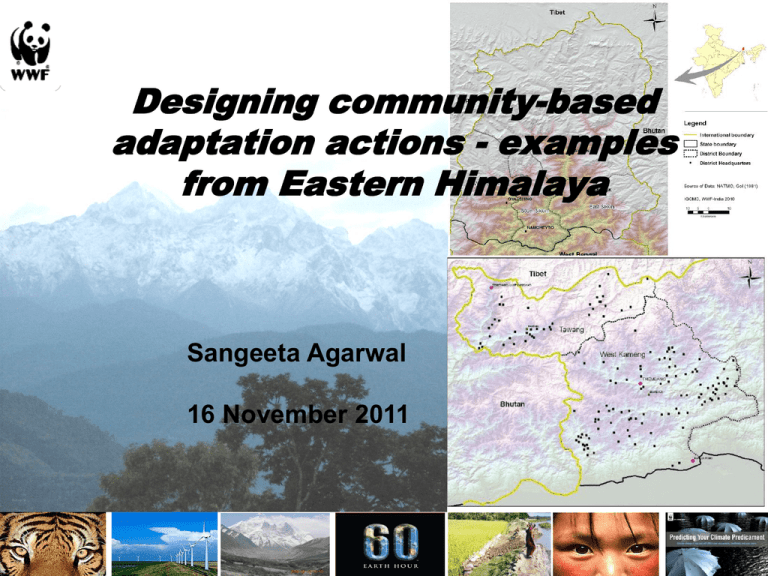
Designing community-based adaptation actions - examples from Eastern Himalaya Sangeeta Agarwal 16 November 2011 Vulnerability Assessment for Adaptation Practices • Vulnerability assessment (VA) involves analysis of exposure, sensitivity and adaptive capacity of a system. • VA act as useful tool for identifying adaptation strategies for specific vulnerable groups and areas. Macro – level Vulnerability Assessment (incl. future projection) Detailed Vulnerability Assessment at field level using PRA Adaptation Pilot Projects Vulnerability Assessment - Sikkim • South Sikkim – most Vulnerable • East Sikkim - High Adaptive Capacity • Climate - data shows fluctuation; only minor increase in temp. & winter rainfall • PRAs – erratic rainfall but heavy in shorter duration • Future climate projections predict larger changes at the end of century (2070 to 2100s) as compared to near future (2040) – - decrease in rainfall; - increase in surface temp. Ecosystem Vulnerability - Sikkim • South Sikkim high on sensitivity index • • Forest quality deteriorating • • • • • specially for space heating. Water sources decline Phenological changes reported • • % of degraded forest increasing. Similar trend observed in Protected areas. Hydropower & road building Firewood still used widely • • • dependence on rainfed agriculture & monsoon dependent water sources (Rhododendron and Prunus sp.) Shift in range of some crops to higher elevation (e.g., Ginger) Decrease in yield/quality of crops • (potato, ginger, chilly) as well as oranges and orchids Ensuring rural water security Springshed Restoration • • • • Spring shed conservation work piloted with State Government support Increased spring discharge; enhanced soil moisture & vegetation cover Spring discharge increase by 100% (Mallagiri dhara, Sumbuk, Melli) to 400% (Nunthaley Dhara, Deythang, Kaluk) Downstream dhara users & upstream land-owners benefitted Learnings • Role of state government in mainstreaming through linking with existing schemes - Scaled up by the government to 500+ springs across the state through the MGNREGA programme • Getting the right technical partners and building local capacity (barefoot engineers) • Importance of identifying the infiltration zones as opposed to simple catchment area treatment Alternate Energy • • Objective: Reduce fuelwood use for water heating Two pilot locations in East Sikkim District, • Gnathang (14,000 ft)and Zaluk (12000 ft) • Proximity to Red Panda habitat (Pangolakha Wildlife Sanctuary) • High dependence on fuel wood and bamboo Solar Water Heaters • 4 community systems installed • 300 lpd (1) & 200 lpd (3) • Domestic use – washing, bathing; women benefit • Frequent bursting of Pipes – technology concern Alternate Energy Space Heating • • Objective: Reduce fuelwood use for space heating Use solar passive architecture concepts and locally available insulation material in building design in East Sikkim District, Sikkim • Retrofitting existing houses, Gnathang village – 14,000 ft • New Prototype construction for FD Ranger’s hut, Kupup village – 13,000 ft • Improvements in the design of local bukharis to enhance efficiency Learnings • Despite some rough edges, solar water heaters can work at high altitudes • Local capacity building and management key to success, for community systems. Women primary beneficiaries • Government identifying Energy as a priority issue esp. in high altitude remote areas; Mainstreaming through State Action Plan on Climate Change Western Arunachal Landscape (WAL) • Includes 2 districts – Tawang and West Kameng • Changes in forest cover (80% land area) impacts local livelihoods • Dense forests declining • Climate - Shift in rainfall patterns and warmer winters • Hydropower & infrastructure development seriously affecting water & forest resources Landuse Projection - Upward Shift in tree line - Decline in grass production In Alpine meadows Community Conserved Areas – enhancing ecological resilience • CCAs are forests owned & managed by local communities • Maintaining these forests can contribute to increased resilience to climate change • Thembang Bapu (312 sq.km) & Pangchen-Lumpo-Muchat (98 sq.km) Community Conserved Areas set up • WWF aims to increase the extent of CCAs as a ‘safety net’ for future climate adaptation Community Conserved Areas - Building Community Resilience Community Based Tourism Alternative Energy Pilots • Solar Water heaters at campsites and home stays in 2 villages – Thembang & Lumpo Muchat • Solar Street Lights (12) • Yak dung – pine leaf briquettes (thermal efficiency of 27%) Learnings • Community ownership of land • Clear linkages between income generation and forest conservation • Long association and local team in place • Political support • Potential of scaling up at a state level to include all community owned areas above 300m Thank you
![[[1]] To G.Bentham Esqre. Darjeeling, April 1st 1849 My dear Sir, I](http://s3.studylib.net/store/data/007625093_2-5386ebbe341ae3f5f176325616c7bb2c-300x300.png)
