Glaciers and Mining, Kaliia Moldogazieva
advertisement
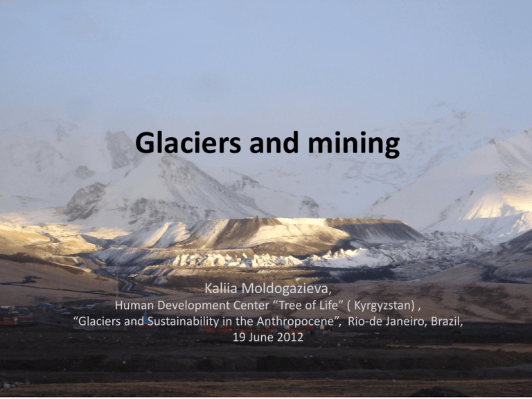
Glaciers and mining Kaliia Moldogazieva, Human Development Center “Tree of Life” ( Kyrgyzstan) , “Glaciers and Sustainability in the Anthropocene”, Rio-de Janeiro, Brazil, 19 June 2012 General information on glaciers in Kyrgyzstan • • • • • • 4.2% of the country’s total area, 6582 registered glaciers, 8047.8 sq. km Glaciers and seasonal snow are unique reservoirs of fresh water: 30-35 per cent of Kyrgyz mountain rivers nourishment Almost 90 percent of the population of Central Asia depend on the water precipitated in the mountains, stored in glaciers and snow cover Water reserve in glaciers volume: approx. 650bln cubic metres Should all the Kyrgyz glaciers melt, every square meter of the country's territory will be covered with 1.26m of water Global climate change severe impact: in 20 years the Kyrgyz glaciers might decrease by 35% Kumtor Gold mine – its impact on glaciers • • • Й • • - Conditions: fragile permafrost, vicinity of glaciers that feed fresh waters into the transboundary Naryn River - The Kumtor open pit gold mine is located in a remote area of the Tian-Shan mountain range in Kyrgyzstan at an altitude of 4000 metres, next to the Sarychat-Ertash reserve and not far from the Issyk-Kul lake, an important regional tourist attraction. - owned by Canadian mining company Centerra Gold Inc., the Kyrgyz Republic owns 33 per cent of Centerra Gold Inc. - the largest gold deposit project managed by a Western company in Central Asia - produced 17,66 tons of gold in 2010, 18,1 in 2011, plans to further expand operations - generates appr. 10 per cent of Kyrgyzstan's GDP, but also significant environmental and social threats Kumtor glaciers • • • • - located in the north-west part of the mountain and glacier system Ak-Shyirak - adjacent are several morphologically diverse and rather big glaciers, and more than a dozen of small ones - The Naryn river originates from the largest valley-type glacier of Tian-Shan – Petrov glacier (ca. 70 km2) - other glaciers of remarkable size: Lysyi (5.5 km2), Davydov (11.6 km2), Sarytor (3,3 km2), Bordoo East (5,9 km2) Bordoo West (7.9 km2) Anthropogenic influence on glacier retreat, Kumtor mine - - • Human intervention is present in almost every landscape object adjacent to the Kumtor gold mine – typical for mining industry Mountain slopes are removed, parts of glaciers were mined to access the ore and waste rock was stored on the glaciers Local pollution of glaciers, glacial meltwater occurs the development of natural environment objects is disturbed several decades will be needed to restore the disturbed natural objects, their natural evolution and development, even after taking land reclamation measures. Image: waste rock and dust on the Davydov Glacier (picture by K. Moldogaziev, 2005) Glaciers in the valley with dust Anthropogenic influence - Kumtor mine - Currently the ice is being removed from the middle part of the Davydov glacier as to mine development plan - New artificial glacier on Davydov glacier tongue is being formed, together with waste rock - manmade rock glacier - Ice removal from the southeast section (SW area) will lead to: 1) the glacier degradation and losing its single mass - broken down into two or three parts; 2) the upper part of the glacier practically loses its support in the form of the Davydov glacier’s tongue; 3) accelerated movement of both upper part and the tongue, which significantly influences the stability of already independent and separate parts of the formerly one-piece glacier; 4) contamination of glacier ice that disrupts ablation and consequently the glacier runoff - geochemical composition of the glacier and glacier meltwater suffers (R. Usubalieyev, 2012, Report of the interdepartmental commission) Davydov glacier recent creep and new concession area plans • • • • • • • • In February 2012, the movement of the Davydov glacier’s speed rapidly accelerated –up to 2 m/day with large cracks and gaps formed The southern pit wall was completely blocked - the glacier and its arm merged together above the pit wall, urgent unloading of ice masses that creeped into the pit were needed, the high-gold-grade site is dangerous and currently blocked for exploration Sergei Yerokhin, Hydrogeologist: ‘the glacier may move abruptly and fill the entire open pit. A research is required if glacier is going to move rapidly or it can be removed step by step’. The glacier volume is about 15-18 mln cubic meters. Size: 500m wide, 60 to 70 m high. Glacier’s speed: 50 mm/hour = more than 1m/day, 30-40 cubic meters a day goes into the pit Company didn’t expect such drift rate in February 2012! Since 2009, the company was removing ice constantly At the same time Kumtor has licenses for a new concession area where new glaciers are located: Sary-Tor, Muzdoo-Su, Bordoo 1 and Bordoo 2, as well as the Sarychat-Ertash natural reserve. InterAgency Government Commission on evaluation of environmental and industrial safety at Kumtor (January 2012) • Set of problems and risks at Kumtor gold mine found: - exeedance of maximum permissible concentration (MPC) and maximum permissible discharge (MPD) of a number of chemical substances in water, instability of pit walls according to the company’s report 2010, risk of outbreak of the Petrov lake natural moraine dam, transfer of land of the specially protected natural areas to the new concession area of Kumtor in violation of the effective laws Recommendation: -to temporarily suspend operations of the Kumtor mine for further examination and addressing all the violations and problems identified; -the transfer of the new concession area for mine exploitation is preliminary and inexpedient due to availability of unexhausted underground ore resources that could be excavated by underground method and potential increase of negative impact of production activity in the new concession area where glaciers Sary-Tor, Muzdoo-Su, and buffer zone of the Sarychat-Ertash natural reserve are located. Recommendations for preservation of Kyrgyz glaciers 1. Kyrgyzstan joining international initiatives aimed at preservation of mountain glaciers, natural ecosystems around mountain rivers. 2. Establishment of “no go zone” on specially protected natural areas to preserve mountain glaciers and (regional) watersheads; 3. To investigate hydrogeological conditions of mountain terrains and estimate the buried ice reserves and water storage capacity of rocks that form valleys. 4. As a consequence of glacier degradation, river floods will shift to spring months. Underground waters will not be able to fully compensate the lack of glacier meltwater during the driest and hottest months of year. Therefore it’s necessary to arrange artificial retaining of snow melt and rain water within mountain valleys or within piedmont parts of piedmont plains by building various type reservoirs. Water storage in these reservoirs will enable us to provide farmers with necessary amount of water in July-August. 5. Develop the construction plan of new reservoirs due to water shortage in the valleys where glacier degradation resulted in significant reduction of river discharge. The plan to be implemented as needed. References • • • • • • • http://www.cawater-info.net/all_about_water/?p=3548 Report of the Interdepartmental government commission on evaluation of environmental and industrial safety at Kumtor mine. December 2011. www/treelife.org.kg Technical Report on the Kumtor gold project for Kyrgyz Republic. Toronto Canada 2011. Kyrgyzstan Kumtor gold mine. http://bankwatch.org/ru/ourwork/projects/zolotonosnyi-rudnik-kumtor-kirgizstan S.A. Yerokhin, Degree of influence of global climate changes on water resources of Kyrgyzstan.http://www.ekois.net/wp/?p=8450 Special project to prevent the consequences of Davydov glacier melting at Kumtor is completed by 35% - ‘Asiarudproekt’ http://www.minerjob.ru/viewnew.php?id=2120 Prospects of ‘green economy’ in Kyrgyz Republic. May 2012. Position of Kyrgyz Government to Rio-20. Public discussion draft. Petrov Lake, Sept.2011 Thank you!
